-- From Denmark to Cosy Corner
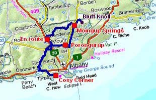
The road tracklog
from Denmark to Cosy Corner
from 25/01/2010 to 31/01/2010
On Monday January 25, I left Cosy Corner Beach to return in Denmark to publish the pages of my website. Alas Telecentre opened only at 10 a.m., in the countryside Australians are not morning. Then I moved towards north to visit two national parks in spite of a rainy weather. On the move I did a detour to see the Werburgh's Chapel built into 1873 which was constantly restored in particular the roof which is now out of corrugated sheets. Inside very elegant wrought iron works with vine leaves.
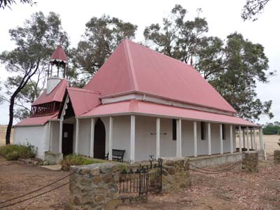
St Werburgh's Chapel
en route
25/01/2010
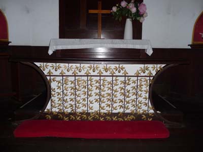
Wrought iron altar
St Werburgh's Chapel
25/01/2010
St Werburgh's Chapel
25/01/2010
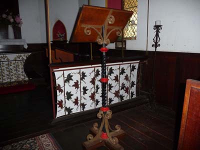
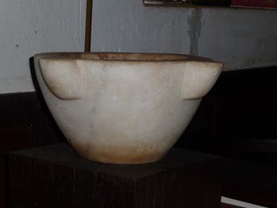
Lutrin
St Werburgh's Chapel
25/01/2010
The town of Mt Barker was built in 1830. The museum is housed by the old police station and old the gaol built by the convicts in 1868. I establish my bivouac in Porongurup Range Tourist Park.
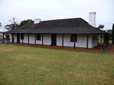
Police Station
Mt Barker
25/01/2010
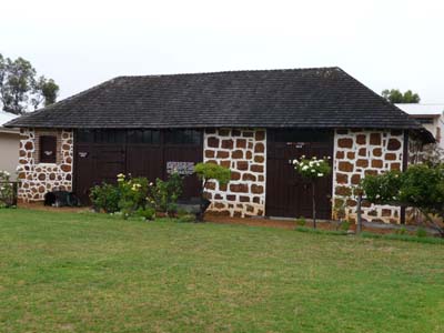
Gaol
Mt Barker
25/01/2010
Porongurup Range – An Island of Karri
Porongurup Range is a granite solid mass of 1,100 million years old emerging above the plain. After a severe fire in 2007 which devastated 90% of the flora and involved the escape of fauna it is under process of natural reconstitution. But it will be necessary several decades so that it finds all its heyday splendour.
In this day of Australia Day, January 26, I visited Porongurup NP. The park is the subject of a particular attention due to the presence of a fungus Phytophthora which destroys plants. Consequently walker must clean his shoes in a box envisaged to this end. In the morning I strolled a 5.5 kilometre loop in a Karri forest with the climbing of Haywards Peak and Nancy Peak. Landscapes are dramatic in spite of a covered weather. The abundant flowers in spring do not profit yet from enough rain to develop. In the same park but with another access, a track leads to extraordinary Balancing Rock, to see the gallery of pictures. In the afternoon I was heading to bivouac in Stirling Range NP.
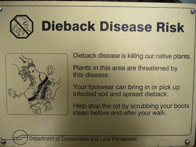
Phytophthora
Porongurup NP
26/01/2010
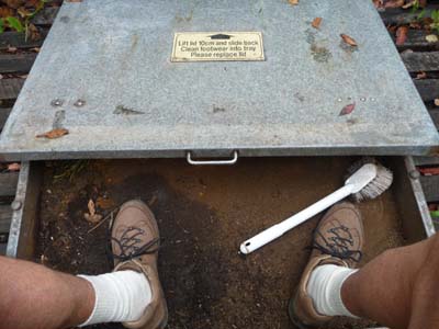
Cleaning shoebox
Porongurup NP
26/01/2010
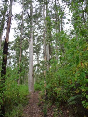
Karri trees
Porongurup NP
26/01/2010
Hayward Peak's climbing
Porongurup NP
26/01/2010
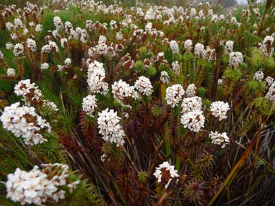
Mountain Bell
Porongurup NP
26/01/2010
Marmabup Rock
Porongurup NP
26/01/2010
The Stirling Range – Mountain Bells
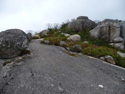
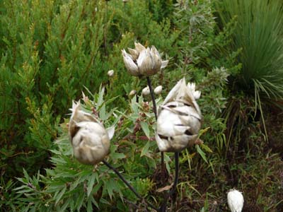
The range was formed more than 1000 million years ago when this area was a shallow sea and sediment was deposited on the granite lowland. After the sea receded, the area of the range sank. The surrounding area gradually eroded back to basic granite and the Range was slowly uplifted, eventually weathering its present form. BLUFF Knoll, the highest peak is 1100 metres high above the sea level. The climate differs from that of the lowland. As a result a great variety of wildflowers thrive here, in particular the mountain bells.
On January 27, starting from the carpark of Bluff Knoll I undertaken the climb of the eponym summit. Documentation gives a distance to the top of 3,1 kilometres for a return walk duration between three to four hours. The weather was frankly gloomy and the top was capped with clouds. The track curves in the forest among stones and rocks. I reached the top, 1090 metres GPS, in one hour and twenty minutes of walk. The visibility was poor. Making way I observed some wildflowers, but the season was not favourable. The return to the carpark took more time. I carried out the loop in 3 hours and eight minutes for a little more than six kilometres and uneven of approximately 600 meters. I had lunch on the carpark before back to the bivouac at Moingup Springs.

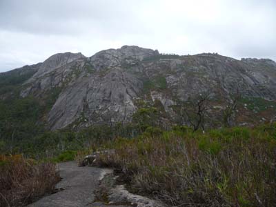
Bluff Knoll
Stirling Range NP
27/01/2010
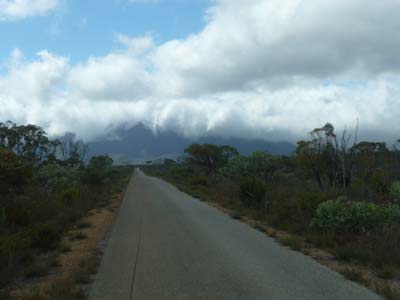
Access road
Bluff Knoll
Stirling Range NP
27/01/2010
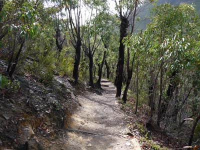
Track
Bluff Knoll
Stirling Range NP
27/01/2010
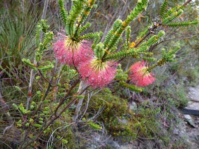
Flore
Bluff Knoll
Stirling Range NP
27/01/2010
Flora
Bluff Knoll
Stirling Range NP
27/01/2010
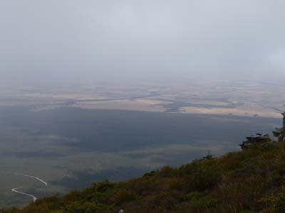
Surrounding lowland
Bluff Knoll
Stirling Range NP
27/01/2010
The following day I crossed Stirling Range NP from east to west by the Stirling Range Drive's gravel road of 42 kilometres lengh. The state of the track was very variable from passable to bad with corrugated sheet. Landscapes are splendid mountains culminating at 800 meters high dominating a stunted vegetation. Sometimes on the track a varan walked on peacefully. I had lunch at the western lookout before joining Albany Road. I bivouacked on the move.
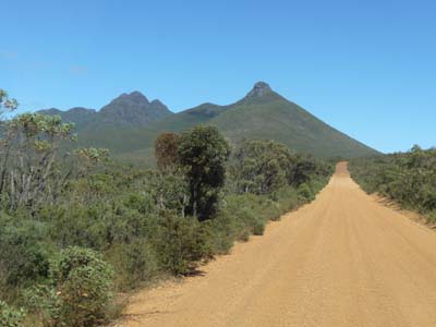
Landscape
Stirling Range Drive
Stirling Range NP
28/01/2010
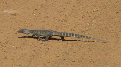
Varan
Stirling Range Drive
Stirling Range NP
28/01/2010
I decided to stay on the rest area to repair the accordion of connection between the cabin and the body. Indeed at the time of the rains some leakage had appeared. In Geralton I had found a shop of products for boats. I bought of black Sikaflex-291. In six working hours without stopping I posed this product on the damaged parts. Fortunately I worked in a pleasant environment, fragrances of eucalyptus under a beautiful sun.
On Saturday 30 and Sunday January 31, I stayed again in Cosy Corner to finish the maintenance of my truck and to have rest.