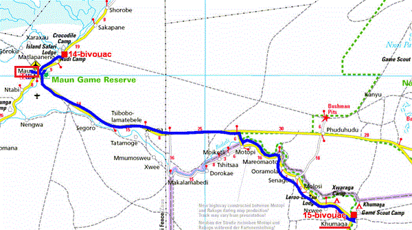
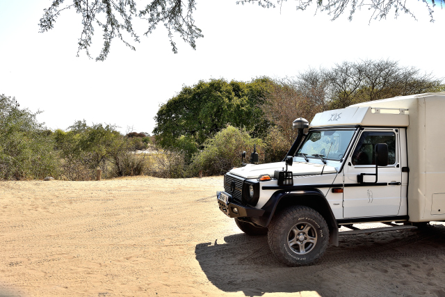
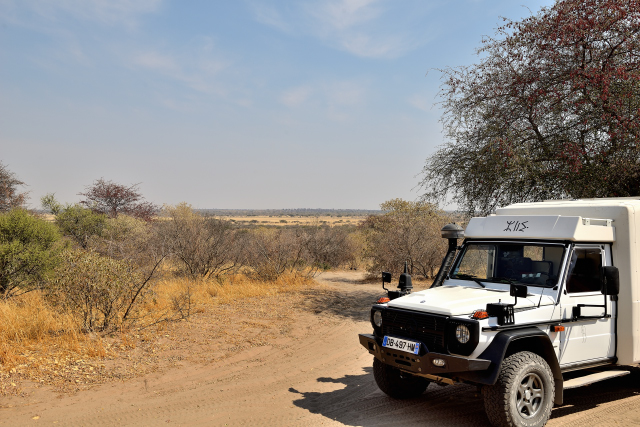
Makgadikgadi National Park
Saturday, August 11 before leaving Maun I made wash the truck at
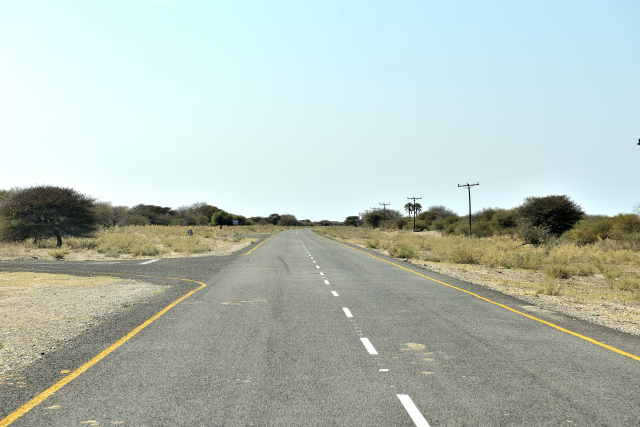
a European price standard Blue Eléphant, in France! The road is
asphalted with sections of deep pot-holed up to the crossroads
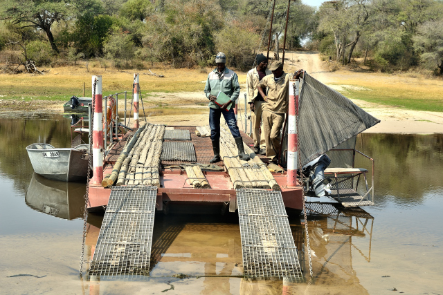
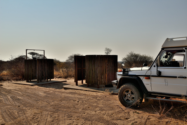
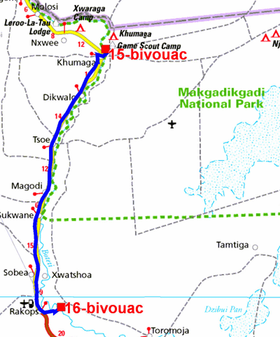
to go to Makgadikgadi N.P. and to bivouac in Khumaga Campsite for
two nights. It is necessary to cross the Boteti River on a small
pontoon, at the exorbitant price of BWP 400 return is
approximately €35. Non-resident tourists are cash cows.
But the worst will be in Tanzania and in Kenya.
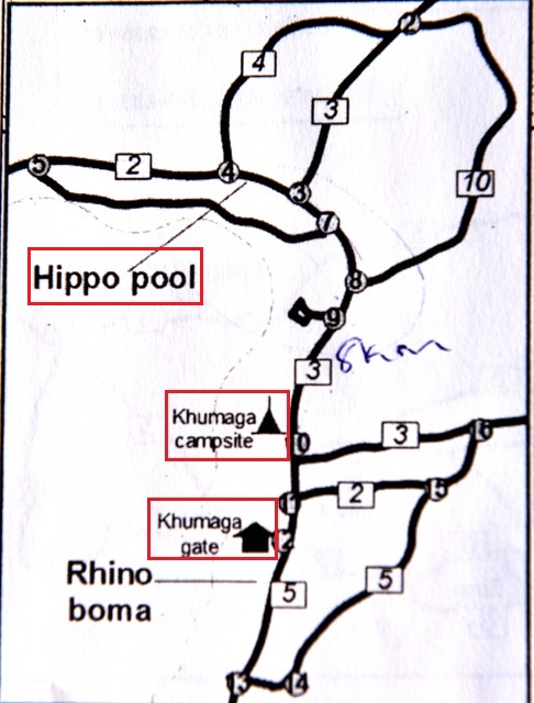
Hippo Loop

The GPS road tracklog
of Hippo Loop
from 2018/08/12 to 2018/08/12
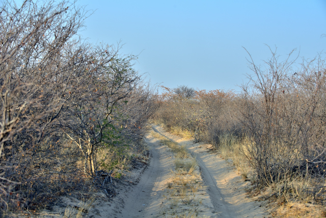
Sunday, August 12 I undertook to traverse Hippo loop along Boteli
River in search of hippopotamuses which I did not meet, perhaps
under water for freshness? Indeed the temperature reached the 37°C
with a moisture of 6%! In the small hour it was at 9,5°C.
click on the pic for opening the gallery
Rakops
The GPS road tracklog
from Khumaga to Rakops
from 2018/08/13 to 2018/08/13
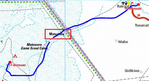
Monday, August 13 I again cross the pontoon at the exorbitant price.
The village of Khumaga is dominated by a pylon of
telecommunications. I stopped at its foot, alas connection was not
possible. Isn't the operator thus Mascom, perhaps Orange or
Bemobile? In Rakops there was also a pylon of telecommunications.
Bingo, it is operated by Mascom with a good transmission speed. I
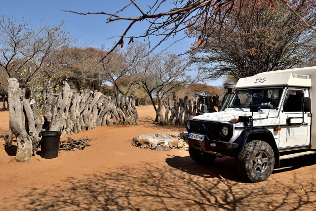
left the pylon to find a bivouac at the edge of Boteli River which
is ace at this place. I went down in the dry river bed to establish
my bivouac. Indeed I had not found a camp-site available for the
13/08 inside the Kalahari. The pylon of telecom emits up to that
point, i.e. its radiation is at least two kilometers. The private
Internet providers settle in profitable villages, to amortize the
investment.
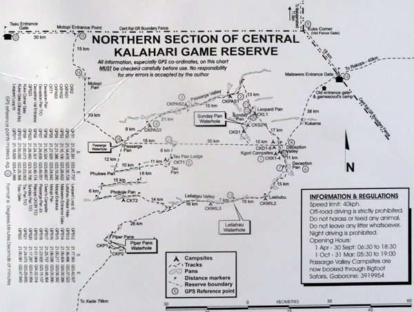
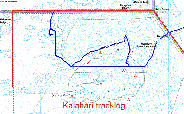
Central Kalahari Game Reserve
Sunday Pans CKSUN #3
The GPS road tracklog
from Rakops à Sunday Pans
from 2018/08/14 au 2018/08/14
Tuesday, August 14 I entered the Central Kalahari Game Reserve,
CKGR, at Matswere Gate to go to the campsite Sunday Pans CKSUN #3.
The track is sometimes sandy, sometimes corrugated, seldom
travelling. On the way I did not observe any wild animal only at an
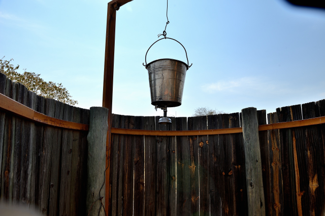
artificial water supply point close to Sunday Pans campground. I
arrived around 11:00 at the bivouac to discover a pit toilet and a
suspended water bucket as showers but without water. Each one brings
his water!
click on the pic for opening the gallery
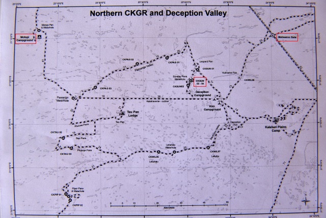
Motopi CKMOT #3
The GPS road tracklog
fromSunday Pans to Motopi Pans
from 2018/08/15 to 2018/08/15
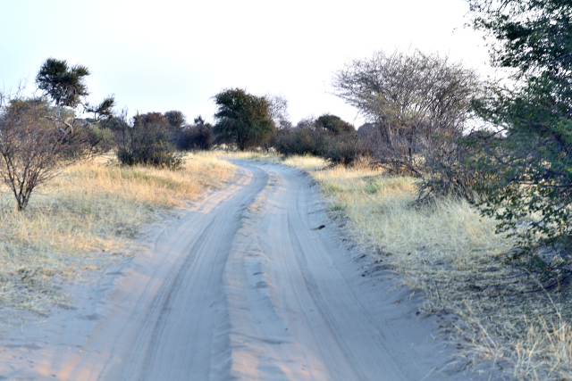
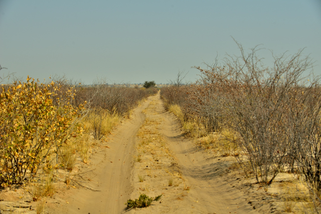
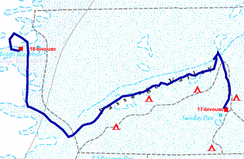
Wednesday, August 15 to go from Sunday Pans to Motopi Pans I passed
by Passarge Valley which is one of the fossil valleys in Kalahari.
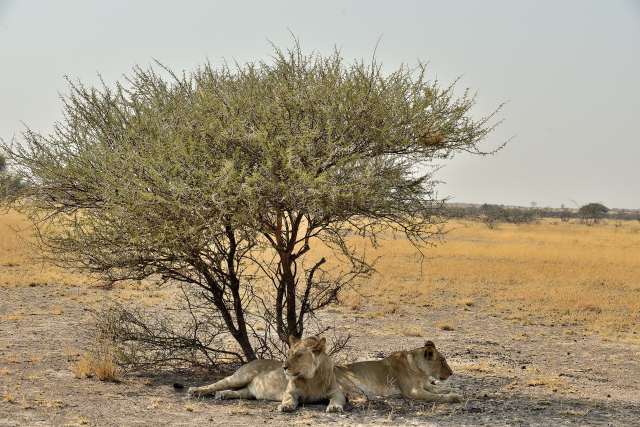
During my trip I saw gemsboks two lions which had difficult
digestion obviously, birds and a fox as well as anunidentified black
animal in the distance. The track is narrow with shrubs with branches
slowing down the progression. The reserved bivouac is Motopi #3,
identical to the precedent.
click on the pic for opening the gallery
|
|
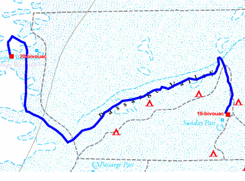
Thursday, August 16 I returned to the bivouac at Sunday Pans CKSUN
#3, because I had not obtained another space. I did not traverse the
same track to go to Motopi, I took the transverse quasi rectilinear
from Passarge Pan to the entrance of Deception Valley while forking
for Sunday Pan. The animals met were, of course, at the water point
of Motopi, Passarge Waterhole and Sunday Pan. But sometimes a
giraffe emerges from the coppice. A gemsbok found the easy way for
drinking clean water directly with the water pipe whereas the slender
springboks drink muddy water; it is the law of the strongest! As the
picture of opening of the gallery shows it, the tracks are narrow and
bordered with shrubs. The track was made by 4x4 standard, Toyota or
Land Rover; consequently I met neither truck nor Unimog whose width
of the way is between that of a truck and a 4x4. The GPS tracklog
does not correspond to the track of the RKHV map which misses
precision!. The diurnal temperature is always high 36/37°C;
fortunately the night temperature falls as in all deserts.
click on the pic for opening the gallery
Motopi CKMOT #1
The GPS road tracklog
back to Motopi Pans
from 2018/08/17 to 2018/08/17
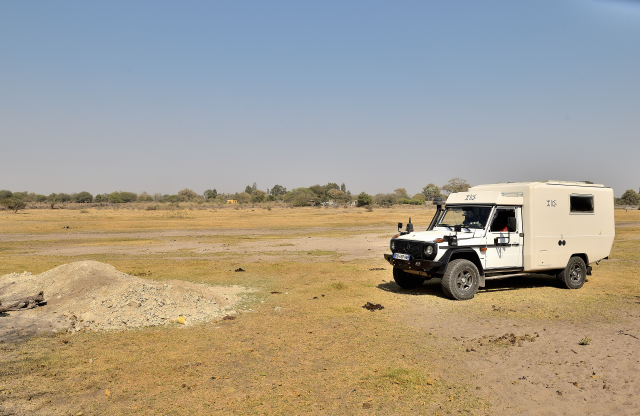
On Friday, August 17 I traversed Passarge Valley again i.e. 122 km
in 7:00 to try to see lions and cheetahs. I saw a lot of wild
animals but no predator. Mow, I arrived at bivouac CKMOT #1 shortly
after 16:00. It was my last day in the Central Kalahari Game
Reserve.
click on the pic for opening the gallery
Ghanzi
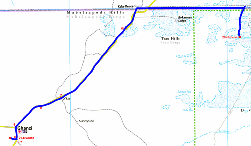
The GPS road tracklog
from Motopi Pans to Ghanzi
from 2018/08/18 to 2018/08/18
Saturday, August 18 was one stage of the three stages of connection
to leave Kalahari Game Reserve and to enter Kgalagadi Transfrontier
Park common between Botswana and South Africa. I put five hours to
make the 214 km of sand and bitumen. I stopped in Ghanzi to fill the
tank with diesel fuel and to publish Internet pages of Kalahari
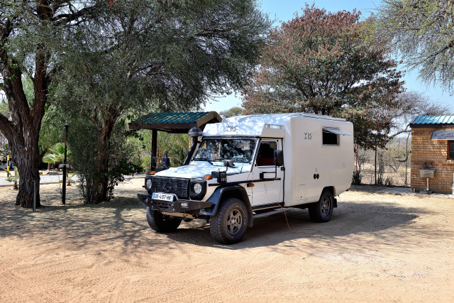
having been several days without Internet. I bivouacked at Ghanzi
Trail Blazers.
Kang

The GPS road tracklog
from Ghanzi to Kang
from 2018/08/19 to 2018/08/19
Sunday, August 19 was the second step of connection towards
Kgalagadi Transfrontier Park, of the bitumen on 255 km. In Kang
Lonely-Planet locates a Shoprite supermarket which does not exist;
actually it is in Ghanzi. I wished to make supply in food for the
last 10 days in Botswana in the park. I involuntarily drew a ball in
my foot. Fortunately there is a shop with some food, but neither
fruit nor vegetable. With which to trust, neither GPS nor
Lonely-Planet is reliable at 100%!
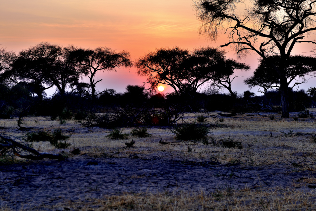
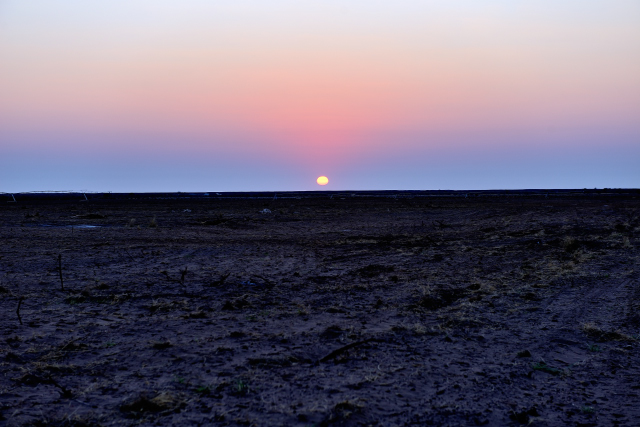 |
 |
| Lever du soleil, Sunrise at 7:00 a.m. |
Kang Ultra Stop Camping |