-- From Fort Nelson to Yellowknife
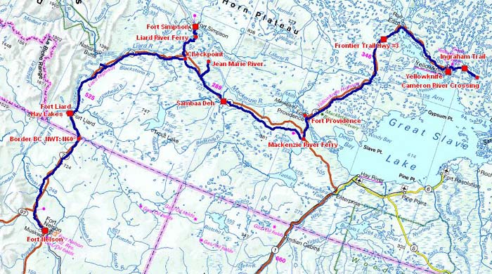
The road tracklog
from Fort Nelson to Yellowknife, ~1,400km
from 2011/07/25 to 2011/07/31
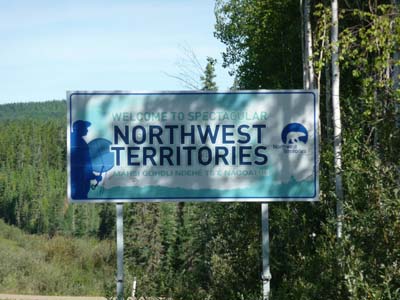
Northwest Territories
Liard Trail
The project of journey in Canada envisaged to go into the Northwest Territories to visit the Yellowknife capital from Alberta by Hwy # 1. Québécois met at Triple “G” in Fort Nelson advised me the Liard Trail, a gravel road, which is more direct. Weather was beautiful, I decided to take his advice. Indeed up to Fort Liard the gravel road was in good condition. The village counted about 600 inhabitants of the Acho Dene community having settled in the site over 9,000 years. Currently the economic activity is centered on the craft industry. It is considered “the Tropics of North” as it has the warmest weather in the NWT. For noon I stationed at the edge of Hay Lakes then I decided to remain there for the night. The temperature was high for this latitude, +20°C.
Border BC & NWT, N60°
Hwy #7
25/07/2011
Fort Liard
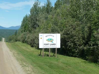
Fort Liard
En route
25/07/2011
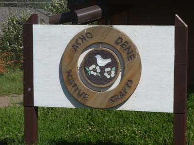
Asho Dene Native People
Fort Liard
25/07/2011
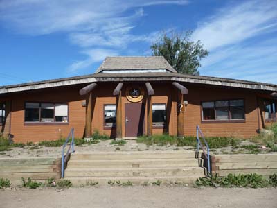
Craft shop/Visitor Centre
Fort Liard
25/07/2011
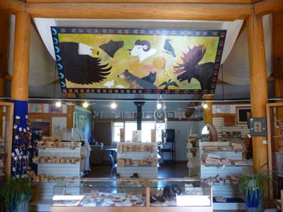
Craft shop/Visitor Centre
Fort Liard
25/07/2011
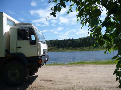
Bivouac
Hay Lakes
25/07/2011
Mackenzie Highway #1
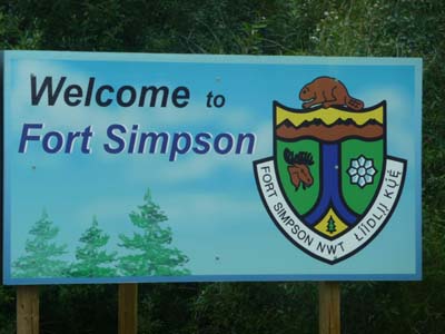
Fort Simpson
The following day the road of gravel, Trail Liard, was always also comfortable. Along the road to give rest for tourists interpretive signs were judiciously placed. To go to Fort Simpson it is necessary to fork westwards on Mackenzie Hwy # 1, a paved road up to the Liard River Ferry, free as all ferries in Northwest Territories. I arrived in the early afternoon at a Visitor Center where appointed had left to lunch. While waiting for her return I consulted my mailbox on one of the two computers in self-service at the office. The city was created in 1803 by Northwest Company under the name of Fort of the Forks at the junction between McKenzie and Liard Rivers. In 1822 it took the name of Fort Simpson after the first governor of Hudson Bay Company which succeeded the preceding one.
Fort Simpson
26/07/2011
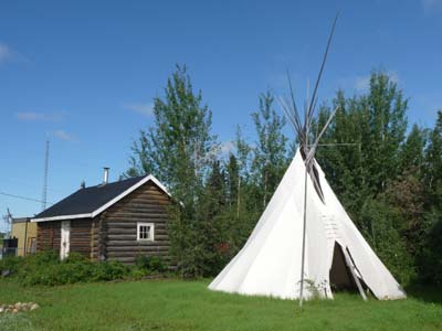
Walking Tour Map proposes the visit of sights of the hamlet whose four held my attention. The most interesting was the site where Pope John Paul II celebrated a mass at the time of his visit in 1987.
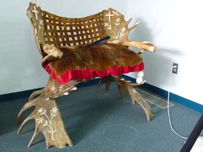
Pope's Chair
Fort Simpson
26/07/2011
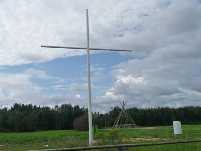
Site where John Paul II celebrated a mass
Fort Simpson
26/07/2011
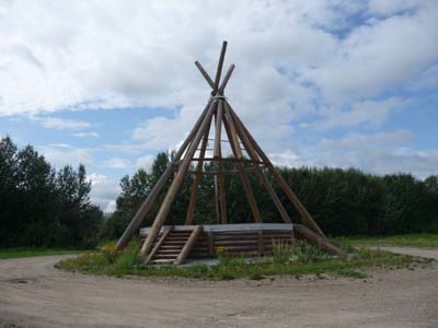
Tipi where the altar was
Fort Simpson
26/07/2011
On the other side of the street Historical Park is with for only building the McPherson House in ruin.

Historical Park, McPherson House
Fort Simpson
26/07/2011
A little further away always at the edge of Mackenzie River the Albert Faille's cabin occupied by a colorful character, prospector, trapper, hunter, fisherman and loner; his fame is due to a quotation in a novel ad his appearance in a short film. I photographed the inside through the pane of a window.

Albert Faille's cabin
Fort Simpson
26/07/2011
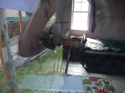
Albert Faille's cabin
Fort Simpson
26/07/2011
Finally somewhere between two current houses an old barn rotted slowly. I finished the day by driving back to the edge of the river to bivouac. Due to the lack of historical buildings and museum in the area I gave up to head to Wrigley, 440 km return on a gravel road. I should say that the interest of Fort Simpson lies in the tour operators who organize tours in Nahanni National Park accessible only by floatplane at an exorbitant cost for a solo traveler.
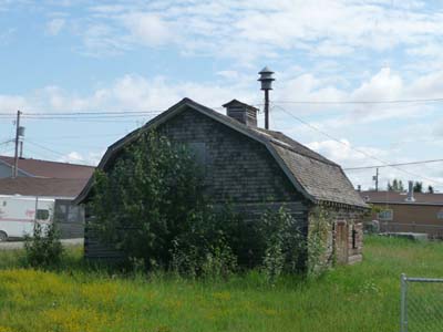
Old barn !
Fort Simpson
25/07/2011
Jean Marie River
As of early morning I embarked on the first ferry at 8 a.m. –at the top of each hour– at around 20 km further away from Fort Simpson. At the junction of Checkpoint Mackenzie Hwy becomes a pleasant gravel road. I made a detour of 55 km return to see the community of Jean Marie River -76 inhabitants- located at the junction between the Jean Marie & Mackenzie Rivers. It is famous for its craft by moose hairs and by the hold of Deh Cho First Nation's assembly in 2009.
Habitat traditionnel
Jean Marie River
27/07/2011
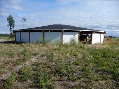
Assembly Hall
Jean Marie River
27/07/2011
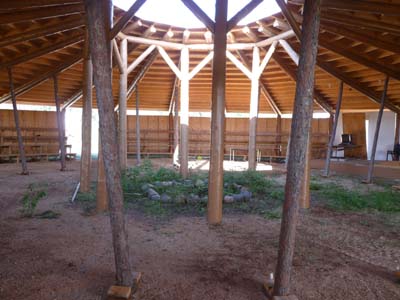
Assembly Hall
Jean Marie River
27/07/2011
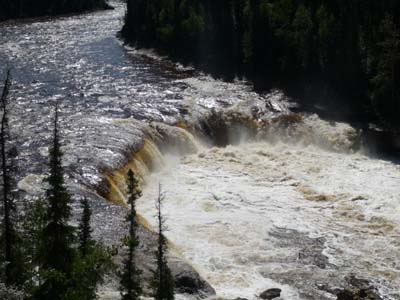
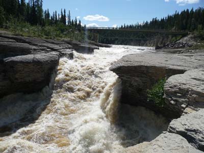
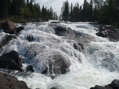
Sambaa Deh Territorial Park
About midday I entered Sambaa Deh Territorial Park where I lunched and decided to remain the night. This park has two water falls on Trout River, Coral Falls and Sambaa Falls.
Coral Falls
Sambaa Deh TP
27/07/2011
Sambaa Falls
Sambaa Deh TP
27/07/2011

Sambaa Falls
Sambaa Deh TP
27/07/2011
Frontier Hwy #3
Fort Providence
Long way to traverse Mackenzie Hwy # 1, gravel road, up to the junction with Frontier Trail Hwy # 3, paved road, then towards the kilometer 24 I embarked on a ferry to cross Mackenzie River while waiting for the completion of a bridge under construction; indeed it was improper to take a ferry to go to Yellowknife, capital of Northwest Territories.
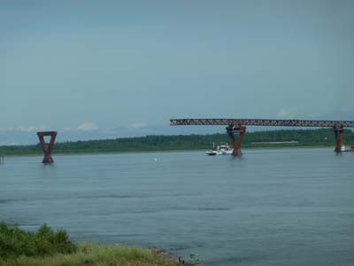
Bridge under construction
Mackenzie River
28/07/2011
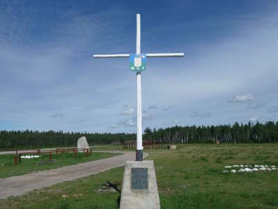
Ten kilometers further away I forked to pay visit to Fort Providence where a Roman Catholic Church, Our Lady of Providence, was established in 1861 by Oblates. In the west of the city at the edge of the river two cairns commemorative: a Cross with a plate for the centenary of the arrival of the Oblates and a Rock for the Sir Alexander Mackenzie's 1789 voyage.
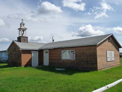
Our Lady of Providence's Church
Fort Providence
28/07/2011
|
|
Centennial of the arrival the Oblates & the Grey Nuns in Providence |
 |
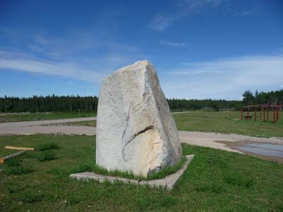
Sir Alexander Mackenzie's cairn
Fort Providence
28/07/2011
Hwy # 3 skirts Mackenzie Bison Sanctuary, it is not rare to see wood bison grazed on the side or wallowed in mud.

Wood bison
en route Hwy #3
28/07/2011
Yellowknife
By leaving the Open Pit where I had bivouacked, I met a thick fog in the area of the lakes, marshes. I noted with amazement that vehicles of North-American origin which had the day headlight on did not have the rear lights on, consequently they were invisible at the back in fog. Either the law is badly written, or carmakers are inconsistent, or drivers are unconscious by not passing in night light on. By arriving in Yellowknife the fog had gradually disappeared. The city became capital of Northwest Territories in 1967 and was officially declared a city in 1970. At the beginning the area had known a Gold Rush during 40 years, the last mine ceased its activity in 2004. In 1991 diamonds were discovered in the north of the city. Thus after having been a City Built on Gold it became the Diamond Capital of North America. The yellow knife is based on a copper powder knife used in the mining industry. It was important for the dynamite suppliers to use a copper knife because opening the powder cases with a steel knife could cause a spark. At the entry Visitor Centre offers all facilities for tourist of which an effective WiFi connection. The city is very concentrated with a population lower than 20,000 inhabitants at 50% of Northwest Territories.

Morning fog
en route
29/07/2011
At some steps beyond I visited Prince of Wales Northern Heritage Centre exposing items of the Territories relating to the life of the First Nations, archeology as well as the development of the mail service during the long winter months.

Sod House, Igluryuit
Yellowknife, Museum
28/07/2011

Sod House, Igluryuit
Yellowknife, Museum
29/07/2011

Birch Bark Basket
Yellowknife
298/07/2011
Beside the Legislative Assembly was inaugurated in 1993 for the works of the 19 deputies of the Territories. As in the old colonies of the Crown of England the Mace is an important symbol of the legislative rite.

Legislative Assembly
Yellowknife
29/07/2011

Legislative Assembly
Yellowknife
29/07/2011
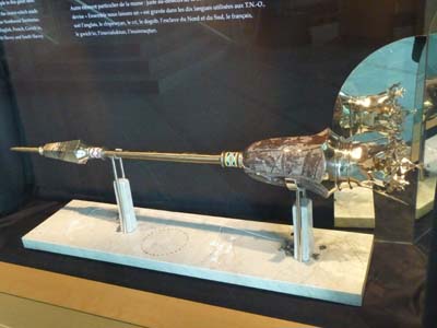
The Mace
Yellowknife
29/07/2011
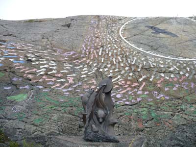
Always at the edge of Frame Lake and close to the City hall Samba' ke Park faces Prince of Wales Museum. In this Friday no cultural activity to retain tourists.
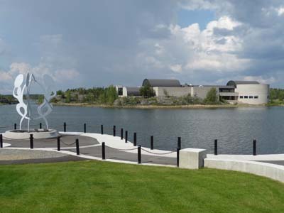
Samba'ke Park
Yellowknife
29/07/2011
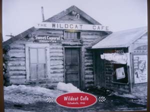
In the late afternoon I sauntered in the old town where Wildcat Cafe is at present in ruin by waiting for its restoration envisaged in 2012. I climbed the stairs to the Pilots Monument to have a eye bird's view on the city, alas the rain started to fall darkening the horizon, look at the gallery. I bivouacked at the intersection between the 52 & 54 streets.
|
|
Wildcat Café |
 |
Ingraham Trail
On Saturdays 30 July I undertook an excursion along Ingraham Trail which winds in Precambrian landscape with many lakes and waterfalls. I went for short walks to visit them, I had a picnic at Cameron River Crossing Day Use Area. It was a rest day under a slightly buckled sky. I established my bivouac at the edge of a lake while hoping not to be in infringement!
Cameron River Ramparts
Ingraham Trail
30/07/2011

Cameron Falls
Ingraham Trail
30/07/2011
In this Sunday morning outgoing of the laundry I met Sheryl & Kevin who had, the day before, photographed my truck on Ingraham Trail, of course I made them visited it. In the afternoon we met again at the Festival Old Town Ramble & Ride, alas the rain was also at the rendezvous, few visitors. Then I went to Visitor Centre to publish the pages of my website before leaving Yellowknife.

Kevin's picture
Ingraham Trail
31/07/2011

Yellowknife Bay, Great Slave Lake
Old Town
31/07/2011
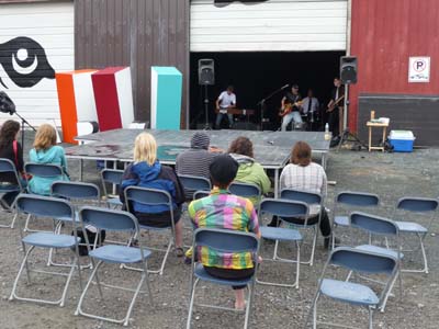
Ramble & Ride
Yellowknife, Old Town
31/07/2011
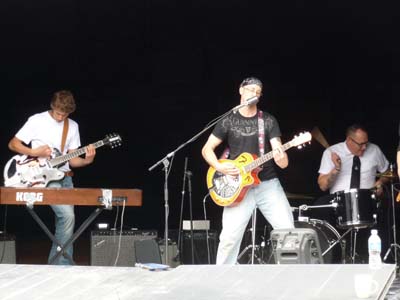
Ramble & Ride
Old Town
31/07/2011

Ramble & Ride
Yellowknife, Old Town
31/07/2011
Yellowknife Cultural Crossroads
Old Town
31/07/2011