-- From Yellowknife to Dawson Creek
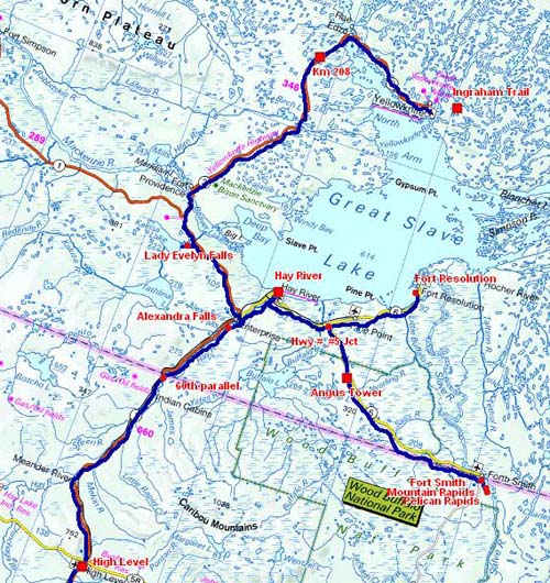
The road tracklog
from Yellowknife to High Level
from 2011/08/01 to 2011/08/04
I left Yellowknife around 5 p.m. after having published the pages of my website at the Visitor Center. I stopped again at the Open Pit at the km 208 on Frontier Hwy # 3.
En route
Frontier Hwy #3
31/07/2011
The day of August 1 started in the rain and fog, the latter disappeared in the morning but the rain persisted intermittently all the day and of course during the visit of waterfalls! On the way I embarked again on the ferry to cross the Mackenzie River.
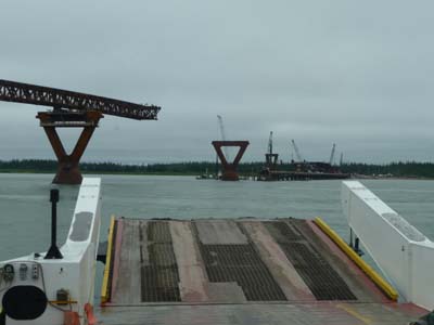
Ferry & bridge
Frontier Hwy #3
01/08/2011
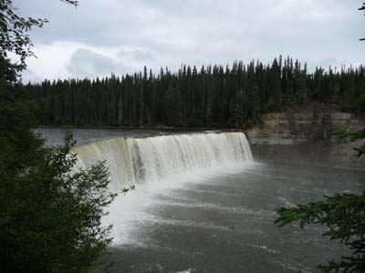
This day was devoted to the many waterfalls in the area on the rivers being thrown in the Great Slave Lake. Lady Evelyn Falls close to Kakisa, village of 40 inhabitants, is a giant curtain of water spill over a limestone sill.
General Store
Kakisa
01/08/2011
Lady Evelyn Falls
Kakisa River
01/08/2011
At the crossroads between Hwy # 1 & # 2 in Enterprise the Twin Falls, Alexandra & Louise, pour their cataracts in Hay River which I followed up to the Great Slave Lake to bivouac on its edge.

Alexandra Falls
Hay River
01/08/2011
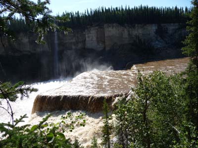
Louise Falls
Kakisa River
01/08/2011
In the early morning the low angle light of the raising sun lighted nicely the beach of Great Slave Lake where I had bivouacked.
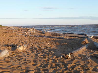
Great Slave Lake Beach
Hay River
02/08/2011
On the way to Fort Resolution I made a detour to admire an old church of the 19th century in Old Hay River listed at the National Historic Site.

Old Church
Old Town, Hay River
02/08/2011
In the old cemetery I raised an animal which I identified as a red fox. It looked at me fixedly and after reflection it concludes that I was not a predator. Calmly it turned its heels and showed me its plume, what a splendid tail. I like to stroll in the Garden of Death where the sleepers listen to silence and more especially in those where pioneers who made the history of North Canada rest.
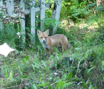 |
Red fox |
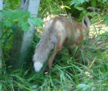 |
The site of Fort Resolution was the first settlement of the Hudson Bay Company in the area. Oblates settled there in 1852. Treaty # 8 was signed by the Crown with the Chipewyan people in 1900 of which hundredth anniversary was celebrated with ostentation in the year 2000. The Deninu Ke live there at the mouth of the Slave River with the eponym lake. Whereas I visited it a gentleman in charge of the community came to meet me offering to me two sets of table, plasticization of documents of the Treaty # 8 Centenary.

Deninu Kue First Nation
Fort Resolution
02/08/2011
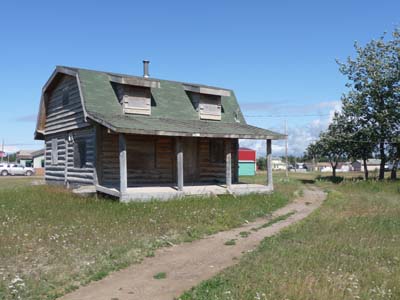
Old house
Fort Resolution
02/08/2011
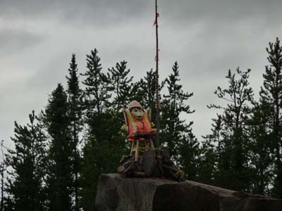
On the way towards Fort Smith I established my bivouac at Angus Fire Tower beside a huge hole, called doline, hollowed out by the collapse of a cave dug by an underground river. This day was agreeably sunny.
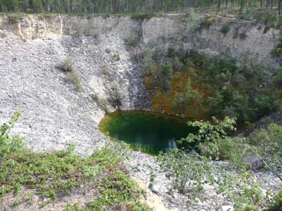
Angus Sinkhole
Wood Buffalo Route Hwy #5
02/08/2011
Wood Buffalo National Park
Fort Smith
Wood Buffalo NP is the Canada's largest park and one of the largest in the world. It extends from the south of the Northwest Territories to north of Alberta. It has the size of Switzerland but it is a boreal plain with salt-springs and rivers disappearing underground. National Park since 1922 it is listed in the UNESCO World Heritage Site. There would be more than 5,500 buffalo living in herd, old males are loner.
In the pale & chilly early morning I met a herd wandering on the road, feeding on the low side and drinking the not-clear wave where bovines urinated. They misted up the atmosphere with their animal heat and sui generis odor.
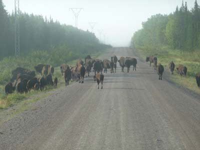
In the early pale morning
Wood Buffalo Route Hwy #5
03/08/2011
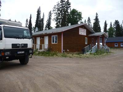
In Visitor Center of Fort Smith I was accommodated with humor by a charming hostess who seeing mosquito punctures on my forearm handled a huge mosquito puppet. In the showroom I discovered a red-fox picture confirming my identification of the day before. There is a free WiFi access. I visited the village on foot.
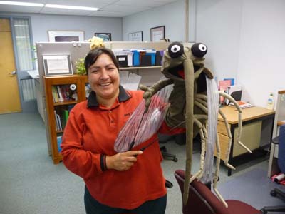
Visitor Information Centre
Fort Smith
03/08/2011

Red fox
Visitor Information Centre
03/08/2011
Fort Smith Mission Historic Centre gathers buildings, moved by “the bougeux de maisons” Quebec sentence for " Mover of houses", of the catholic mission established in 1912 by Oblates. The Bishop's Residence is remarkable by its Mansard roof style, already seen in Fort Resolution where the mission arrived in the 19th century. The Oblate's congregation of France was very active in the North of Canada struggling with Hudson Bay Company and Royal Mounted Police, some cities still have a French-speaking community.
Bishop's Residence
Fort Smith
03/08/2011
Northern Life Museum exhibits the life of the local tribes with a scanty light, I retained a definition of the interbreeding.
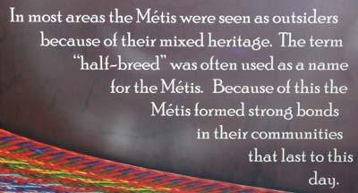
Northern Life Museum
Fort Smith Mission Historic Park
03/08/2011
One of major sights resides in a pelican colony on the banks of Mountain Rapids. Indeed between Fort Fitzgerald, in Alberta, and Fort Smith there are four rapids on the Slave River impossible to cross by boats. Since old times a 24-kilometre track skirts the river for the good portage. I visited two of them. In the late afternoon I returned to Visitor Center for Internet. I left Fort Smith around 7 p.m. heading back to my bivouac at Angus Tower.

Pelican Colony, Mountain Rapids
Slave River
03/08/2011
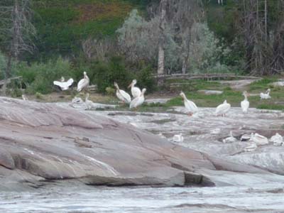
Pelican Colony, Mountain Rapids
Slave River, Alberta
03/08/2011
Pelican Rapids
Slave River, Alberta
03/08/2011
The road tracklog 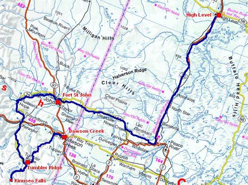
from High Level to Dawson Creek
from 04/08/2011 to 07/08/2011
Alberta
High Level
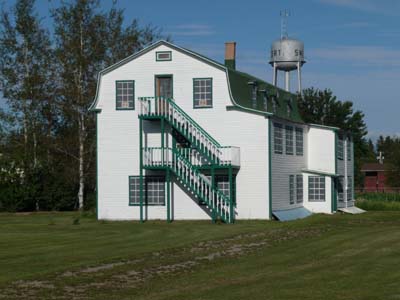
It was a long driving day to go back to Hay River by Hwy # 5 & # 2 then by Waterfalls Route Hwy # 1 to the border between the NWT & Al –Alberta– on the 60th parallel. These Hwys cross a plain covered with a dense boreal forest made up of black spruce, of birch and coppice. By place water leveled the surface of the ground and yet there are fires of forest. I stopped to throw an eye in Mackenzie Crossroads Museum in High Level, nothing remarkable. I found a waste ground out of the city for the bivouac. This day was particularly warm, 25°C.

Alberta
04/08/2011

Mackenzie Crossroads Museum
High Level
04/08/2011
I left my bivouac as of early dawn. On the move I stopped enticed by a sign announcing an old hospital, actually it dates back to 1947. I was not delayed in this village.
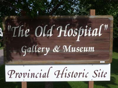
Old Hospital!
Manning
05/08/2011
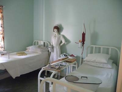
Old Hospital
Manning
05/08/2011
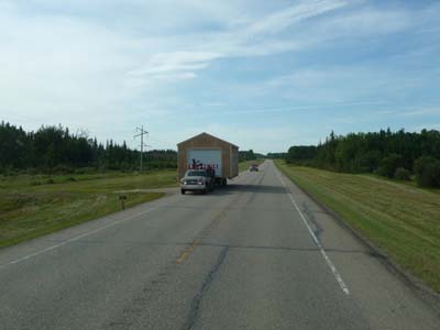
House on the move
En route
05/08/2011
In Grimshaw I made the dead end on local sights by taking “secondary” roads to head to Fort St John, BC. I crossed the deep Alberta dedicated to farming. I thought of my birthplace, Troyes, where I often went at my parents, the countryside was also covered with odorous colza in summer.

Colza
En route
05/08/2011
On the way at an intersection the hamlet Hines Creek exhibits its antiquities to tourists .
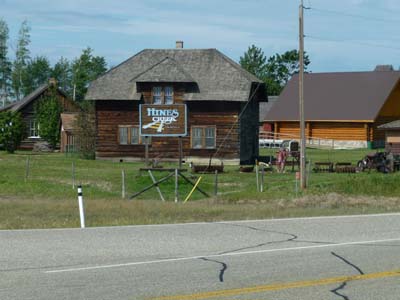
Museum
Hines Creek
05/08/2011

Museum
Hines Creek
05/08/2011
British Columbia, BC
Fort St John
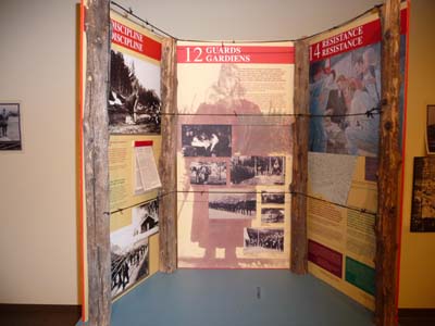
I arrived in the middle afternoon at Fort St John created in 1792 with other trading posts by very undertaking Sir Alexander Mackenzie. Dedicated to farming in the rich Peace River valley it became the capital of oil & gas industry in BC. The staff of Visitor Center was particularly helpful by seeking a workshop to carry out the service of my truck, alas without result. There is a free WiFi Internet access. Beside the North Peace Cultural Center is similar to these counterparts but it conceals a nugget by exposing in 24 panels a painful page of the Canada history during WWI relating to the internment of Ukrainians who it had made come as labor. According to the rule of the imprisonment of all nationals from an enemy country, Ukrainians underwent the worst affronts, at that time Canada was still a British colony. I vilified odds and ends of museums, but each one of them brings, despite everything, a stone at the building of the knowledge of Canada.
North Peace Cultural Centre
Fort St John
05/08/2011
The Deh Cho travel connection
Final report
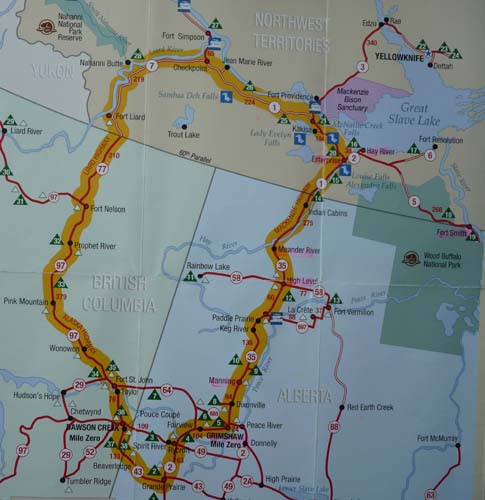 |

Tracé GPS de la route |
The trip in Deh Cho links the Mackenzie, Liard & Alaska Highways through three different regions, Northern British Columbia, the Northwest Territories & Northern Alberta. The booklet announces 1,800 km, I traversed 3,700 km in 11 days from Fort Nelson to Fort St John, of gravel roads, in majority, and asphalt roads without meeting alive soul during hours, what a happiness to let rove its spirit to imagine what could be pioneers' life by discovering these areas. It was a journey to the country of Hudson Bay Company, Mounties & Oblates who were opposed to control natives. I found again the three "G" of the Spaniard conquests, Gold, Glory & God. Vestiges of this recent history of Canada are respectfully preserved as well by aboriginals as by descendants of the pioneers. Such an initiatory route could not be complete without a winter stay, perhaps in another life. The world is vast but my life has a limit, the life expectancy of an European, in a few days I will celebrate my 71th birthday! I am conscious of being a superficial tourist in spite of meetings during this peregrination.
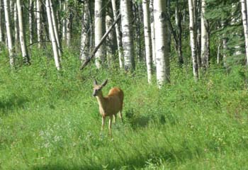
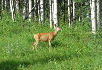
Peace Valley
According to the project of journey to Canada I wished to visit the very famous Tumbler Ridge and Kinuseo Falls. I thus left Fort St John to head up Peace Valley while making my way I met charming quadrupeds which I named hinds which are not probably but what imports. To take them in picture I stopped very far not to frighten them, what a pretty animal.
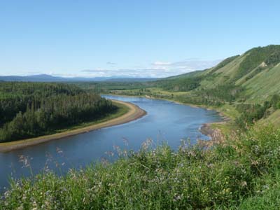
Peace Valley
Hwy #29
06/08/2011
 |
|
 |
Hudson's Hope, village of +1000 inhabitants, is on the banks of Peace River dedicated to farming and the forestry development. Its destiny was upset by oil industry and the construction of an enormous dam updating fossils of dinosaur skeleton. Visitor Centre sympathetic welcome, free WiFi Internet and museum in the open air of a pioneer settlement was the approval of this stage.
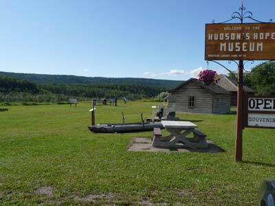
Museum
Hudson's Hope
06/08/2011
Chetwynd, community in a site called “Little Pairie” by the pioneers is also a capital of Chainsaw Carving. There would be more than 70 monuments peppered in the village, I selected some of them.
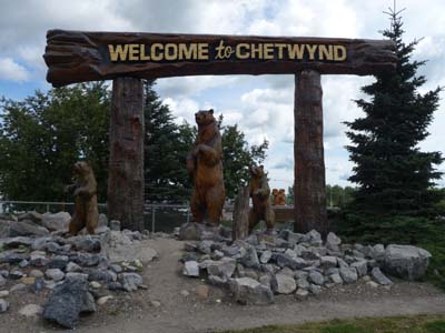
Chainsaw carving
Chetwynd
06/08/2011
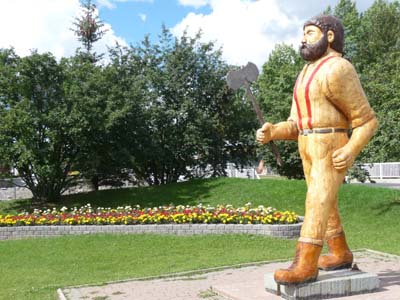
Chainsaw carving
Chetwynd
06/08/2011
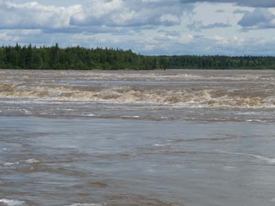
At Tumbler Ridge I went directly into Monkman Provincial Park to see Kinuseo Falls which according to a booklet are higher than the Niagara Falls! The 60 km track are of very bad quality. The points of view, lower & upper, are disappointing for lack of distance. The photographs of booklets are unrealizable except taking a boat to approach them. I arrived at Dinosaur Discovery Gallery after 5 p.m., closing time… I bivouacked at the exit of Tumbler Ridge at Quality Creek.
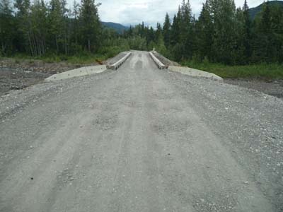
En route
Murray River FSR
06/08/2011

Kinuseo Falls
Monkman Provincial Park
06/08/2011
 |
Kinuseo |
 |
Dawson Creek
Mile "0" of the Alaska Highway
Dawson Creek was a peaceful village of pioneers and farmers when Japanese bombarded Pearl Harbor, Hawaii, little time after the USA and Canada made a decision to build the emblematic Alcan, Alaska Highway. More than 10,000 American soldiers, military vehicles, road equipment and civil workers were able to build in eight months 1491 miles of road from Dawson Creek to Fairbanks. Now economy of the city is based on oil industry employing approximately 12,000 persons. It is a modern city with a exposition park gathering a railway station for the transport of cereals with an elevator on the five old ones, Visitor Center as well as an art gallery. I bivouacked on the spot.

Milestone 0
Dawson Creek
07/08/2011
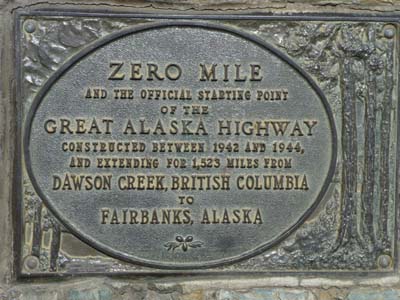
Milestone 0
Dawson Creek
07/08/2011
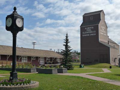
Northern Alberta Railways Park
Dawson Creek
07/08/2011

Traffic Circle
Dawson Creek
07/08/2011