-- From Gaspé to Pointe-à-la-Croix

The road tracklog
from Gaspé to Pointe-à-la-Croix
from 03/10/2011 to 09/10/2011
Gaspé
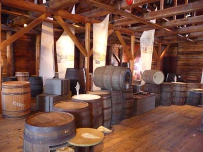
Before leaving Gaspé I visited the small museum which presents the life of the Gaspésie peninsula in some signs and the Jacques-Cartier's arrival in 1534. A reproduction of the Cross which he planted on the shore and a set of bronze steles commemorating his arrival and hiss dialog with Amerindians are outside exhibited. The museum presents also works by Suzanne Guité, sculptor, who made her tour of the world to learn her art. She remained in Percé where I arrived in the late morning in a chilly sky.
|
|
 |

Sculpture bas-relief 1704
Monument Jacques-Cartier

Sculpture Suzanne Guité
Musée Gaspé
03/10/2011
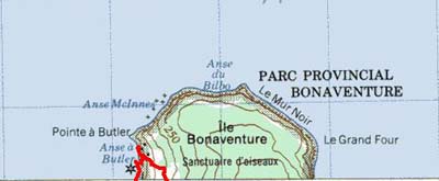
Percé
Tourist Office informed me that it was preferable to visit the Bonaventure Island this day because the weather of the following day was bad.

Panorama
Percé
03/10/2011
I took a boat at 1:00 p.m. for a tour of Rocher Percé -Pierced Rock- as of the island where it deposits tourists to go & see the colony of gannets at Pointe-à-Margaulx. A trekking of the site walks around 7,7km.
|
|
 |
|
|
 |
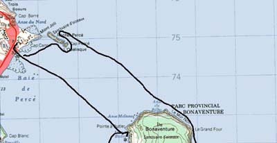

GPS tracklog of a boat
GPS tracklog of strolling
|
|
 |
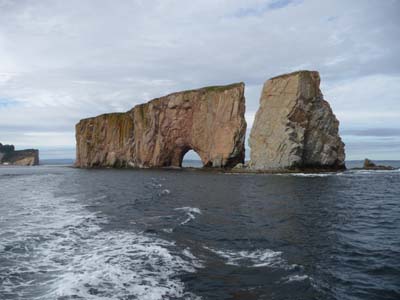
Rocher Percé
Île Bonaventure
|
|
 |
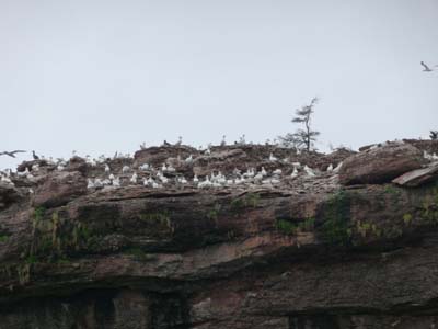
Gannets
Fur seals
Île Bonaventure
By unloading the boat a russet-red fox accommodated us while yawning, still tourists, and scanned us of its acute glance.
|
|
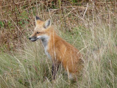 |

Yawning fox
Fox paying attention
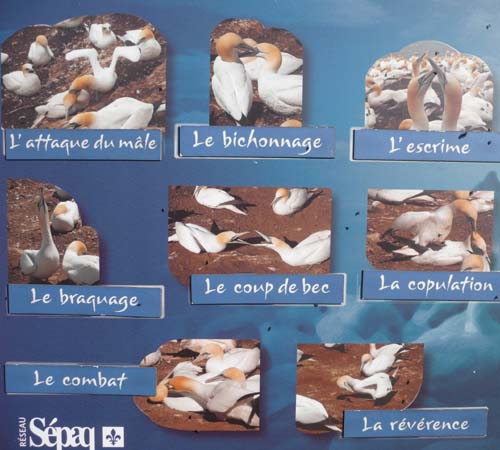
At the lookout overhanging the colony of gannets a naturalist answers questions thus I learned that the island gathers approximately 200,000 birds of all species including around 105,000 gannets. This beautiful bird is an extraordinary sailplane, an electronic implant showed that it traverses during its migration towards South Carolina, the USA, the distance in three days of day flight. Exceptional fact the odor of the excrements does not have anything pestilential.
|
|
 |

Gannets' colony
A beautiful bird
On the Chemin-du-Roi path back to the landing, I talked agreeably with a charming couple from Périgord, France, in excursion in the area, we exchanged travel souvenirs. At the end of the day the sun made its appearance lighting Rocher Percé in low angel light. Around 5:30 p.m. I looked for a bivouac which I found carrying out on a small mountain road to l'Anse-à-Beaufils.

Low angel light
Rocher Percé
03/10/2011
Percé
The following day I wished to visit the city of Percé but when I arrived I noted that it was quasi deserted, many hotels and restaurants were closed as well as the museum where I saw only a sculpture of ship prow no identified. In despair of cause and in spite of the information of the Tourist Office which announced 40% of chance of rain, I undertook a walk to have a bird's eye view of the Rocher Percé with a climb of Mt Ste. Anne at 340m high. I traversed the paths of Belvederes, Falaises, Sources, Pieds Croches, Crevasse and Grande Coupe for finally heading to Hwy # 132 and back to the carpark. I had walked 12.5km GPS in ≠3:15 without rain. I was regrettable that the sun does not appeared to emphasize the seascape. Trekking has the capacity to oxygenate the brain to profit from the plenitude of all senses. It was still a great egoistic moment. I returned to the bivouac of the day before.
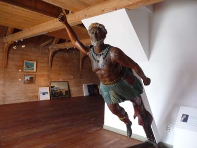
Musée
Percé
04/10/2011

Invite à la promenade
Percé
04/10/2011

GPS tracklog in red
|
|
 |


La grande crevasse
Percé
04/10/2011
|
|
 |

La Baie des Chaleurs
The 06/10 the sea was dismounted without it being known when it will have gone up! Of course it rained, not very encouraging to make visits in outside. The Bay of Heats owes its name after Jacques Cartier when he unloaded on July 1534 into full heat wave. I found a bivouac close to the Pointe-aux-Loups Marins.
|
|
 |

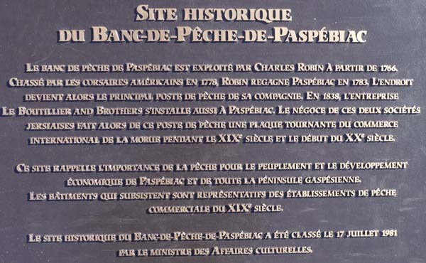
Pasbépiac
The first visit of the day was Paspébiac, historic site for cod fishing which was at the origin of the settlement in Gaspésie well before the arrival of Jacques Cartier. It was dispatched dried and salted in Europe and mainly in Italy and Spain.
|
|
 |

Bonaventure
The second visit was the museum of the town of Bonaventure devoted to the Acadians. Acadia was made up of the now called Islands New Scotland, Cape-Breton and Prince-Edouard. The Treaty of Utrecht 1713 gave these Islands to England which required French nationals to lend allegiance to the crown of England. Acadians refused, they were off-set in 1755.

|
|
 |
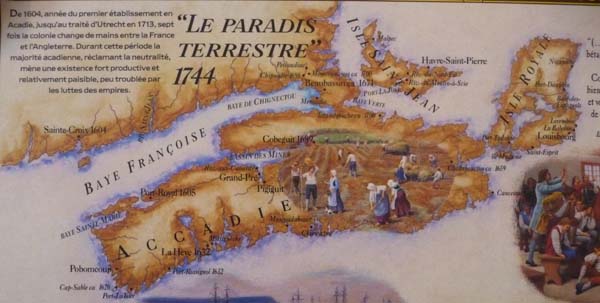
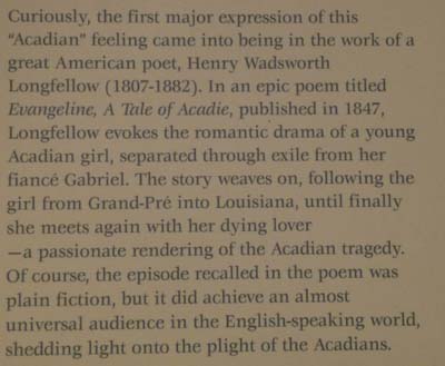
This deportation was called “the Great Upheaval”. The American poet Longfellow wrote a poem called Evangeline. Recently Queen Elizabeth II recognized this episode as historic by instituting a commemorative date on July 28: “A Day of Commemoration of the Great Upheaval”. In spite of a shy sun the day was particularly cold with 2°C at daybreak. Around 4 p.m. some crystal brushwood of snow fell. At the Tourist Office of Bonaventure the hostess taught me that the weekend would be the Indian Summer.

|
|
 |

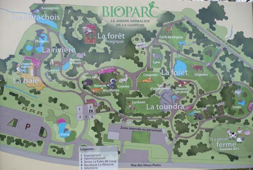
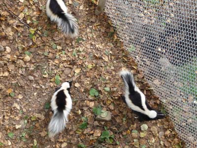
Bioparc de la Gaspésie
Friday 08 I returned to Bonaventure to visit the Bioparc of Gaspésie which gathers in semi-freedom some endangered species of the peninsula. A building at the entry gathers insects collected by George Brossard in his peregrinations in the world, he is the founder of the Insectarium of Montreal. I attended the meals of some animals accompanied by comments of an animalist. Although the Indian Summer was announced the temperature was negative in the night with -2°C in the early morning under my truck. The sun didn't shine for my walk in outside of Bioparc. In the afternoon I stopped at the bivouac of the day before.
Insectarium
Bonaventure
07/10/2011
|
|
 |
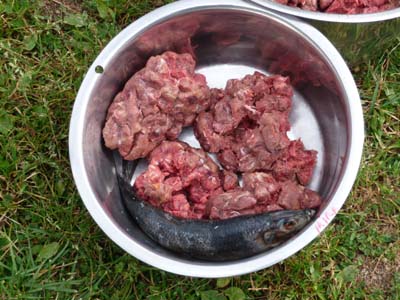
Meal of a cougar
Cougar
|
|
 |
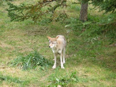
Coyote
Mouffettes
|
|
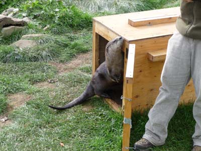 |

Red fox
Loutre de rivière
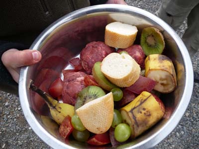
Meal of ratons laveurs
Bioparc
07/10/2011
|
|
 |

Raton laveur
|
|
 |

Caribou perdant ses bois
Mooses
Parc National de Miguasha
In this Saturday November 08 the Indian summer started for a week with temperatures above 20°C. Nature put on its autumnal clothes with beautiful colors. For this penultimate day in Gaspésie, Quebec, two emblematic visits animated it. The National Park of Miguasha listed with the World Heritage is a museum of natural history from fossils of the Devonian period discovered in cliffs since 1842. They made it possible to paleontologists to understand how was made the conquest of the land by the vertebrates. Collections of fossils as fish as well as plants are remarkable and very didactic for a layman. To apprehend this niche of fossils I give a map of the earth to this period, Miguasha, in red, was close to the equator in medium favorable to the sedimentary deposits to preserve fauna and flora hidden during million years. I spent the morning to stroll from workshop to workshop trying to memorize explanations accompanying specimens.
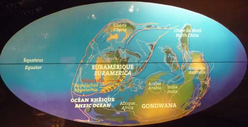
Earth 390 millions years ago, devonian era
|
|
 |

Animal burrow
Coprolite
|
|
 |
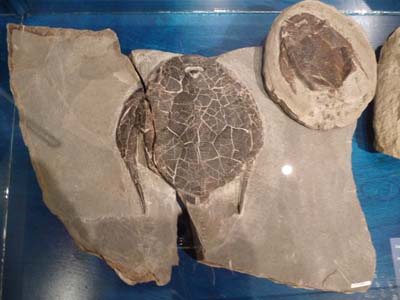
Bothriolepis canadensis
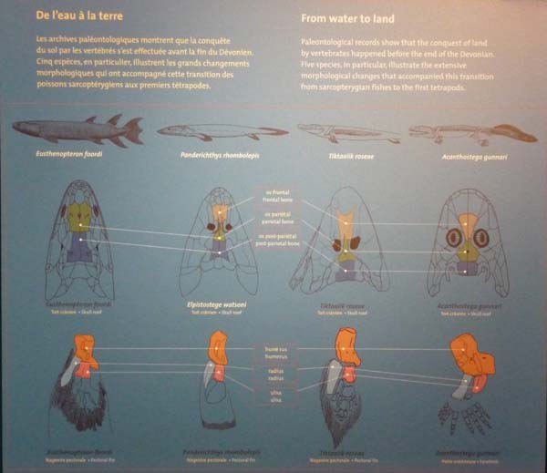
And fish go out water...

Battle of the Ristigouche, July 1760
A few kilometers further in another register the National Historic Site of Quebec of the Battle of Ristigouche exhibits with vestiges of underwater archaeological excavations on the wreck of the French frigate corsair “Le Machault” the last naval action between France and England for the possession of Nouvelle-France. The exhibit reconstitutes with remains of “Le Machault” the interior of the boat and the sailor life in the 18th century among vermin. Signs put in parallel the military forces involved, the inferiority of the French navy, continental power, is put forward compared to the number of war vessels of England, maritime power. The treaty of Paris in 1763 sealed the abandonment of the North American possessions of France which will be completed by the sale of Louisiana to the USA by Napoleon 1st to finance his wars against… England. If the History is not remade, it is necessary to note that the History is a continuum even in the 21st century confer the euro problems and the attitude of England!
|
|
 |

Model of the battle
Ristigouche River
|
|
 |

Pointe-à-la-Croix
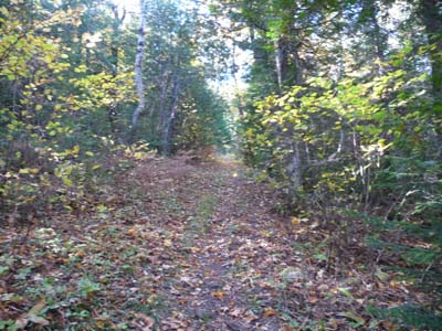
In this last day October 09 in Gaspésie, Quebec, I walked in the countryside at the edge of a creek murmuring in the rustle of trees but without songs of birds because heat was around +26°C. I climbed a hill at 205m high not without difficulty because the slope was short but stiff. The following day I left Quebec with a point of nostalgia, I had heard French Québécois and followed the epopee of the end of Nouvelle-France. Monday October 10 I entered the Atlantic Provinces for four weeks where Acadians lived up to the Great Derangement to be at the beginning of November in Maine, the USA, with a three-month visa.

GPS tracklog of the last trek in Gapsésie, Québec
|
|

|
|
 |

Flags of Québec, Canada & Acadia