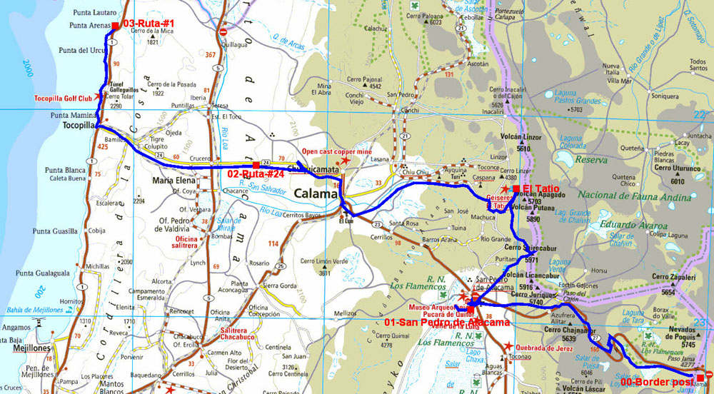
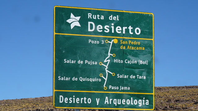
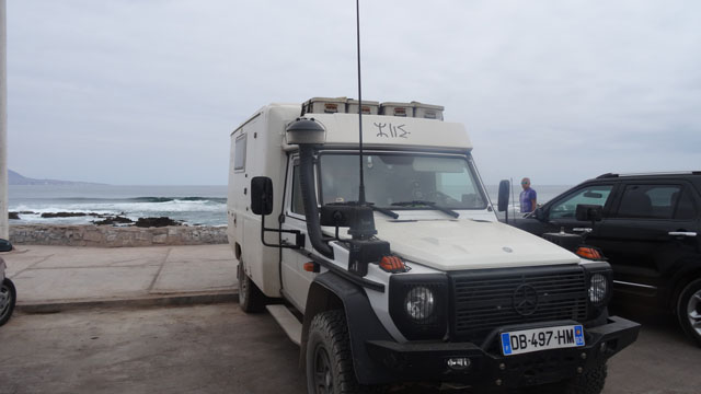
Paso de Jama
On Monday, August 1st I arrived around 10:00 at the border post of
Paso de Jama. In a room a counter is occupied by the immigration and
the customs of Argentina, and the immigration and the customs of
Chile. It was necessary for me less than fifteen minutes to fill the
formalities. A young lady accompanied me to visit my truck in order
to control that there were not prohibited products, fruits and
vegetables in others. The visa for traveller and the license to
circulate for the vehicle in temporary admission are 90 days. I
continued my way up to San Pedro de Atacama.
It was once in Atacama desert…
In a former life I climbed six summits in the world including two in Chile in
August 2002 in the desert of Atacama, Licancabur and Gallatiri. This
trip undertaken in August 2016 in the north of Chile is a
jubilee. I invite the Net surfers to follow the hyperlink:
Atacama desert,
Click the pictures to increase them
San Pedro de Atacama
In San Pedro de Atacama I took money at the ATM of a bank in the La
Paige street close to the Tourist office. I went around of the Plaza
de Armas by visiting the church. My Nokia smartphone under Windows
Phone 10 informed me that there was a WiFi connection of good
qualities. I returned to my truck to prepare the sending of the
publication of the last page of Argentina from Plaza de Armas. Then
I was going to seek a bivouac close to the entry of Valle of Luna in
the desert.
Visit San Pedro de Atacama, click the picture
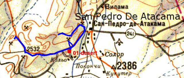
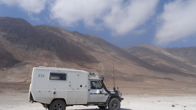
The following day two visits were in the program, Valle de la Luna
opens at 9:00; to see the rising sun I was going to the Mirador
Coyote on the road to Calama. Then I returned at the entrance of
Valle de la Luna. It is a trip of 11 km with parkings for points of
view and photographs. At the end of the morning I returned to my
bivouac in the desert at 2500 m to continue my acclimatization with
altitude before going to see the geysers of El Tatio at +4300 m of
altitude. The below Russian military map at 500.000e shows the way
in blue for the Watchtower Coyote then that of Valle de la Luna
starting from the bivouac 01-desert.
Visit d'El Mirador Coyotte & de la Valle de la Luna, click the picture
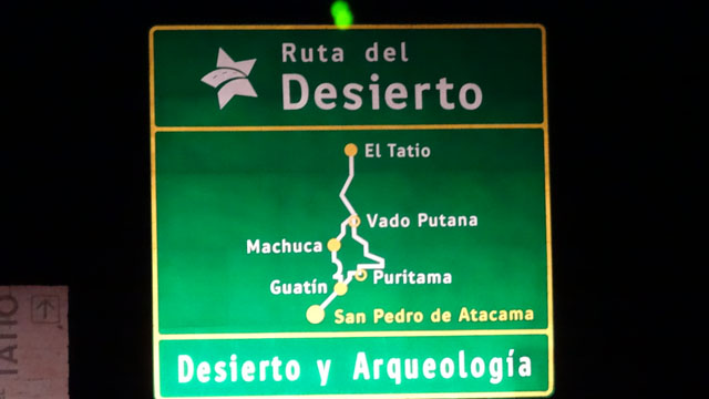
El Tatio
I left the desert close to the entry of Valle da Luna before the
sunrise to be in El Tatio. But the road is a track of 90 km in the
mountains. I arrived around 8:00. The tour operators from Calama had
already poured their horde of tourists. Some young girls in evil of
adventure played the naiads. I begun again the track up to Calama to
make supply before continuing towards the Coast of the Pacific.
Indeed I by-pass Chuquicamata drowned in a cloud of dust, I will see
on my return in two weeks. It is the deepest copper mine to
sky-open. It was open in 1912 by the US-Anaconda Copper Mining
Company before being nationalized by Chile. I found not without
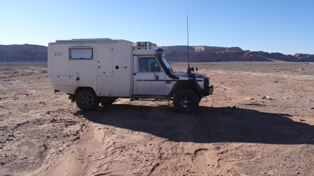
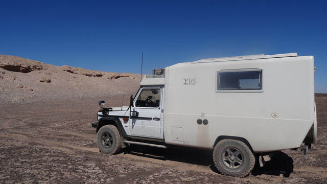
difficulties a bivouac in the desert.
Visite Geysers d'El Tatio, click the picture
|
|
| Tatio Geysers, a spectacular attraction |
Ruta-#24, bivouac
Ruta-#1
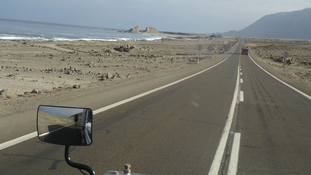
On Thursday, August 4th I went down from my bivouac in the desert
towards the sea. The change of weather was dramatic I left the blue
sky and the sun for a weather covered and gloomy at the edge of the
Pacific Ocean. I crossed the town of Tocopilla at approximately 10
meters of altitude without to stop to find a bivouac between sea and
mountain.
Ruta-#1, click la photo
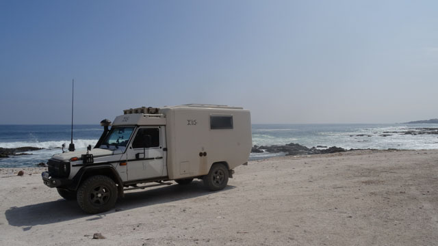 |
 |
| Bivouac between sea and mountain |
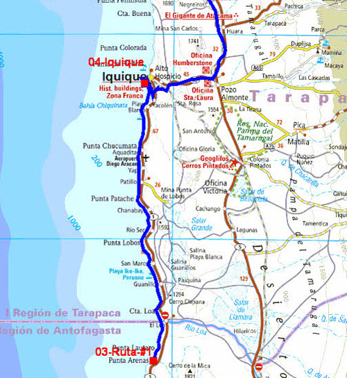
The GPS road tacklog
from Ruta-#1 to Iquique
from 2016/08/05 au 2016/08/05
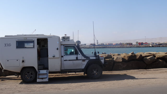
Iquique
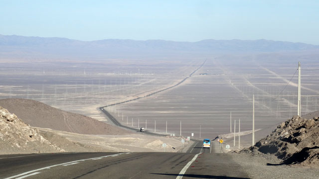
On Friday, August 5th I traversed the coastal road between sea and
mountain in the desert up to Iquique. The landscape is sometimes
Dantean by the tears of blocks of rocks posed there by a diabolic
hand. Many beaches are accessible for fishing and camping. The
approach of Iquique by a turnpike of 40 km is covered by fog
in this season and there too between sea and mountain like a mirage
in the desert. Plaza Prat is dominated by Torre Reloj in front of
the municipal theater. I tried to obtain booklets for Putre and
Parinacota at the Tourist Office without success. Moreover the
hostess could not indicate to me where to find a Wi-Fi connection! I
lunched of a soup and a fish slice in Mercado Centenario before
going to bivouac at seaside on the calle Capitan R. Perez.
Iquique, click the picture
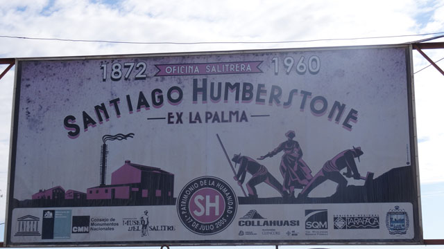
Humberstone
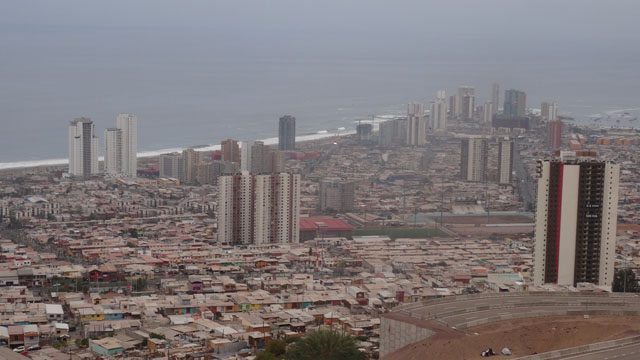 |
 |
| Iquique panorama |
On Saturday, August 6th the rise in laces of the dune overhanging
Iquique is spectacular and gives a bird's eye view dramatic. In
Humberstone the derelict land of Oficina Santa Laura gives a Dantean
outline of what was the exploitation of saltpeter by 1872 in a town
of 800 blue-collar workers. The discovery of synthetic nitrate
involved the closing of the site in the Sixties. I only walked in
the site by having in memory the visit of Auschwitz. Admittedly the
ultimate goal was without comparison but the atmosphere of
desolation, the succession of the dwellings and the hutments and the
human exploitation gave to me an impression of finitude of the man.
Only the pictures and the text clarifying the origin of the
paminos recalled me with reality
quite different from the two sites.
Visit Oficina Santa Laura, click the picture
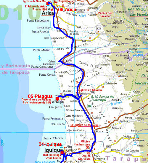
The GPS road tacklog
from Iquique to Arica
from 2016/08/06 au 2016/08/07
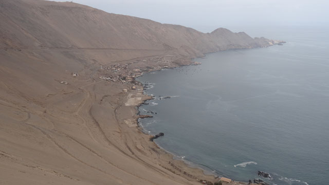
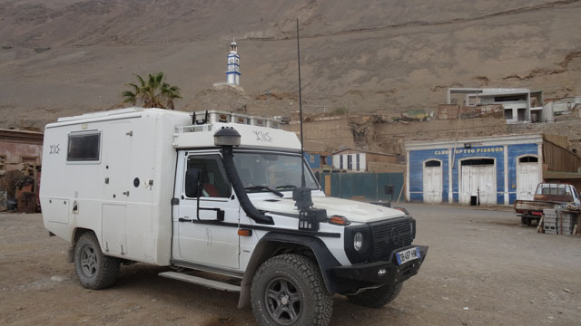
Pisagua
On the way towards Arica I made a detour to go to Pisagua unknown
historic site of Desembarco de Pisagua 2
noviembre of 1879! The descent from the altitude of 1000
meters to the sea level is spectacular with the view of the village
at the bottom of the dune. The highlight is Torre de Reloj. In the
single street I was stopped by two police officers in khaki behavior
and heavily armed. We discussed lengthily from where I come where I
go what it was my profession etc… without to ask my documents. It
was good-child, they advised me a site of bivouac. The village is in
the process of becoming a ghost town.
Visit Pisagua, click the picture
Arica
On Sunday, August 7th the departure from Pisagua was hard so much
the coast is sloping. The 40 kilometers up to the junction with the
ruta-#5 were traversed in the clouds. The sun appeared starting from
the altitude of approximately 1200 m. Work on road slowed down the
progression towards Arica. On the way a strange panel drew my
attention for a turning of a hundred meters I discovered sculptures
in the desert representing the guardian presence (protective). I
reached Arica, oasis in the desert at seaside, at the beginning of
afternoon. I made the location of the Tourist office to visit it on
Monday morning. I bivouacked on the small peninsula named
Nelson Mandela.
Monument de la Présence Tutélaire, click the picture