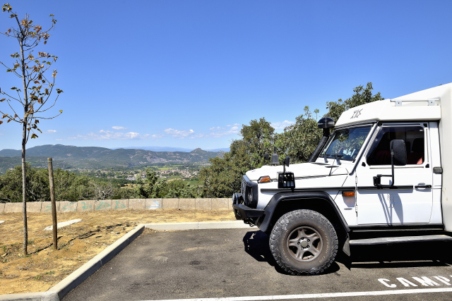
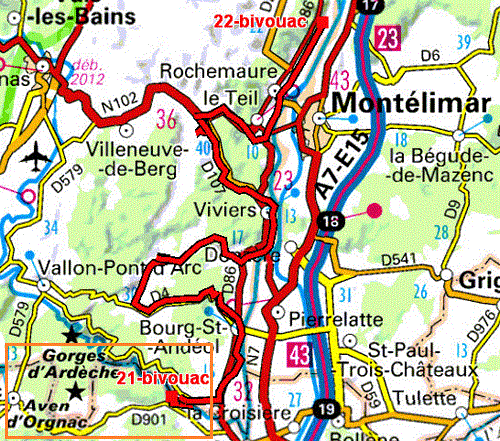
The GPS road tracklog
from Les Laurents to Vallon-Pont-d'Arc
from 2020/07/13 to 2020/07/13
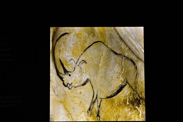
Monday July 13 I arrived at Chauvet 2 Cave,
here,
around 8.45 am to visit the reconstruction of the
prehistoric site of the closed Chauvet Cave in order to avoid the
pollution caused by the visit of tourists. The day before, I booked
a ticket online for a visit at 9.35. You have to download the
Chauvet-2 site on the smartphone with headphones to follow the
comments during the progression in the gallery of 10 stations,
no-photo. This reconstruction is a technical feat of three years of
work. The Aurignacian rock art is unparalleled in the prehistoric
world. At the store I bought the DVD "The geniuses of the Chauvet
Cave". On the way to Vallon-Pont-d'Arc I stopped at a picnic area.
For the record, I did not visit the Aven d 'Orgnac due to the 700
steps to descend, there is certainly an elevator to go up.
click on the pic for opening the gallery
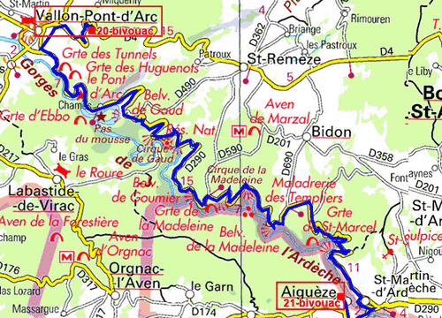
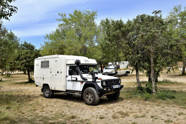
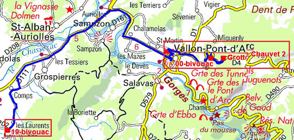
The GPS road tracklog
from Vallon-Pont-d'Arc to Aiguèze
from 2020/07/14 to 2020/07/14
Tuesday, July 14, France's national holiday, I traveled the Ardèche
gorges,
here,
by the splendid panoramic road from Vallon-Pont-d'Arc to
Aiguèze, 38 km from a succession of belvederes to admire the
meanders dug by the Ardèche in the limestone cliffs. I took almost
three hours, stop included. The Green Guide devotes more than 6
pages of description and comments that I would not plagiarize, to
read. The Pont d'Arc
here
is the result of the erosion of the water that cut
limestone rock for millions of years.The canoe trip is, according to
the Green Guide Book, an unforgettable, but difficult moment. The Great American Parks
clearly distinguish Windows, wind erosion and Arches, water erosion.
At the end of the morning I visited the medieval village of Aiguèze.
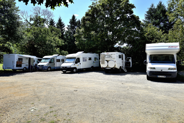
Then I bivouacked in the parking lot at the entrance to the village.
click on the pic for opening the gallery
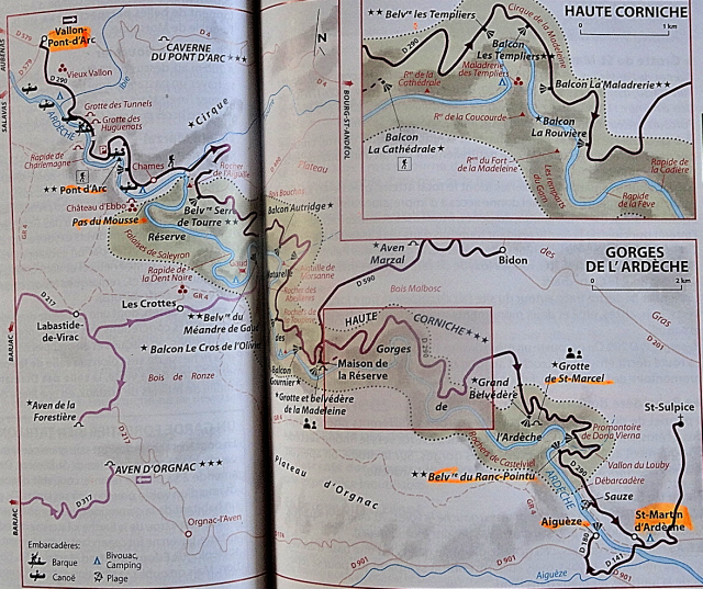
|
| Map by Green Guide Book |
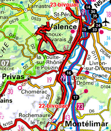
The GPS road tracklog
from Aiguèze to Cruas
from 2020/07/15 to 2020/07/15
Wednesday July 15 was a day without much interest and the
weather was gloomy. My road map provided for escapades in medieval
villages, alas very often the small departmental roads were either
inaccessible or blocked leading to detours sometimes in very narrow
streets. From a distance I can see Alba-la-Romaine's castle
here.
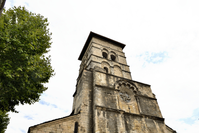
Then there was the fiasco of the non-visit of the Abbey of
St. Mary in Cruas,
here.
Indeed the tourist office indicates that the visit is
guided for a duration of 50 minutes every hour. I waited outside the
gate 65 minutes without result. I expressed my displeasure at the
tourist office, in a very vocal way.
click on the pic for opening the gallery
|
| Abbatiale Ste-Marie, tour-laterne, sur plan carré, Cruas |
The GPS road tracklog
from Cruas to St-Romain-de-Lerps
from 2020/07/16 to 2020/07/16
Thursday July 16 was a long walk in the Vivarais mountains of deep
France crisscrossing very, very narrow and often blocked
departmental roads for work due to the three months of Covid-19
pandemic lookdown. "Que la montagne est belle" (How beautiful the
mountain is) sing Jean Ferrat. But at the end I was dizzy going from
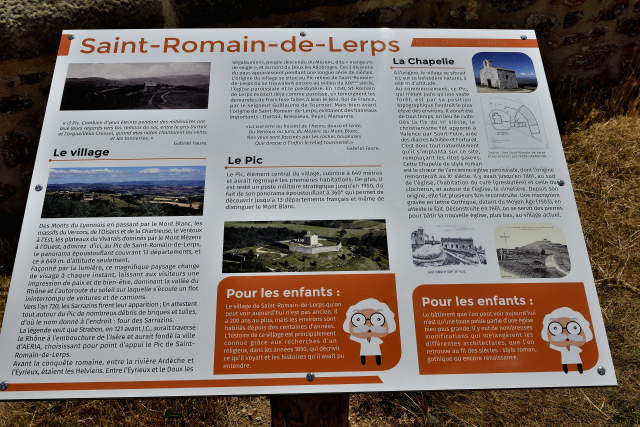
detours to unflected deviations. I was stranded at St-Romain de Lerps,
here,
where I parked at the foot of the Pic chapel, the hyponym
belvedere offering a panorama of thirteen departments and the Rhône
valley, superb. I discovered, at my expense, that the Internet
connection is random. Telecom operators, FAI, do not cover all of
France, the gray areas are very important in mountainous regions. A
certain owner, self-proclaimed of the left, of a network would be
wiser to invest in the coverage of the departments instead of
ranting on the television sets for 5G.
click on the pic for opening the gallery
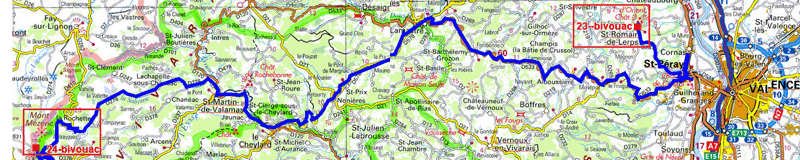
The GPS road tracklog
from St-Romain-de-Lerps to Mont Mérenc
from 2020/07/17 to 2020/07/17
Friday July 17 was a long trip in the country of Boutières,
here,
from Lamastre, D578, passing by Le Cheylard, D120,
St-Martin de Valamas, and the D278, very picturesque and very narrow
up to La Rochette and finally the D410 the Croix de Boutières. Landscape,
here,
of chestnut trees and terraced cultivation. Alas the
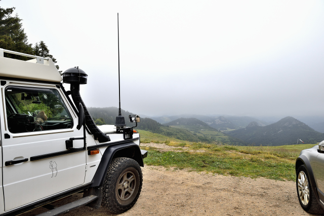
weather was overcast, gloomy and cold, certainly the altitude was
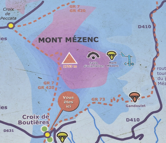
above 1000 meters at the foot of Mont Mézenc,
here,
peaking at 1753 meters. I bivouac in the parking lot at 1517 m, brrr.
click on the pic for opening the gallery
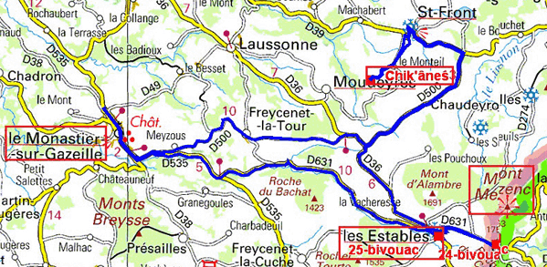
The GPS road tracklog
from La Croix Boutières to Monastier back to Mont Mérencthen to Les Estables
from 2020/07/18 au 2020/07/18
On Saturday July 18th the weather was no better than the day before.
I decided to go and get food at the Monastier sur Gazeille by making
a detour to introduce myself to the owner of Chik’Ânes who will hire
me a donkey to travel the GR 70, "Chemin de Stevenson", in
September. After my purchases at the Intermarché supermarket at the
Monastier I noticed that the weather had started to look good. I
returned to La Croix de Boutières to climb Mont Mézenc, 1753m. The
Green Guide bbok gives 1h15 round trip from the Croix de Boutières
to the top of Mont Mézenc. Left at 9:50 am I reached the summit at
11:05 am! Then I went to the orientation table in the east then to
the crucifix at 1744m finally I finished the journey back to the
Croix de Boutières at 1:10 pm, i.e. 3:20. The trip is mostly done in
the undergrowth on a wet track, the terminal part is quite rocky.
The panorama, the visibility was perfect, gives a view of the Alps,
the Rhone valley and to the south on Lake Issarlés. The ascent is
worth the painful endurance.
click on the pic for opening the gallery
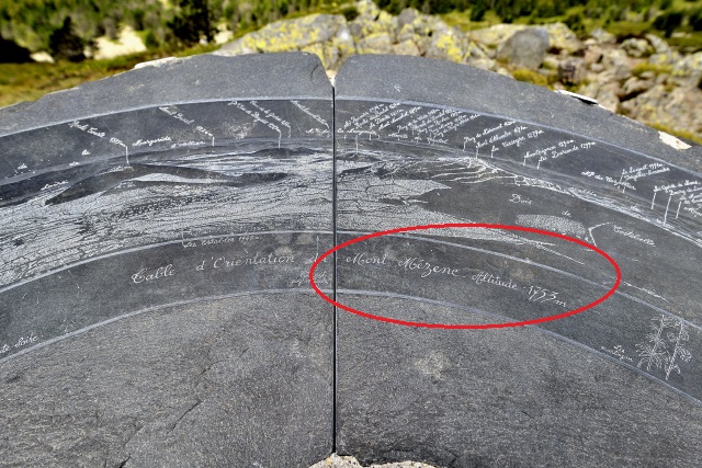
|
| Ascension du Mont Mézenc, Climbing of Mont Mézenc |
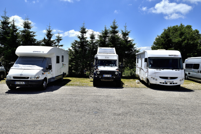
|
| Les Estables, bivouac |
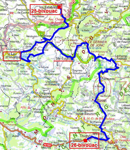
The GPS road tracklog
from Les Estables to Thueyts
from 2020/07/19 to 2020/07/19
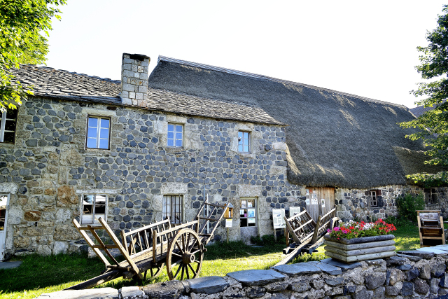
Sunday July 19 I crossed the Ardèche mountains in particular from
the Bourges valley to Thueyts, postponing the hike until later. I
stopped at Lake Issarlès then at Ste-Eulalie to admire the Clastres
farm with its slate roof and the barn with the broom roof. As all
primary school students know, I went to the sources of the Loire
river at the foot of Mont Gerbier-de-Jonc,
here.
Then a photo stop at the Bourlatier farm typical of
Ardèche. The Ray-Pic waterfalls did not hold my attention. Finally
after a magnificent D26 road I ended up on the N102 for Thueyts, too
late considering the heat to hike to Pont-du-Diable. I bivouacked in
the parking lot dedicated to motorhomes.
click on the pic for opening the gallery
|
| Ste-Eulalie, le ferme de (farm of...) Clastres |