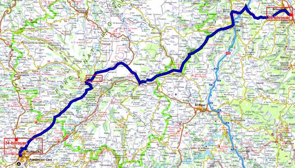
The GPS road tracklog
from Brioude to Aurillac
from 2020/07/27 to 2020/07/27
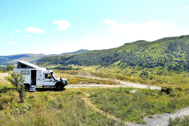
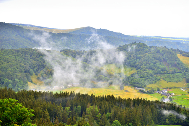
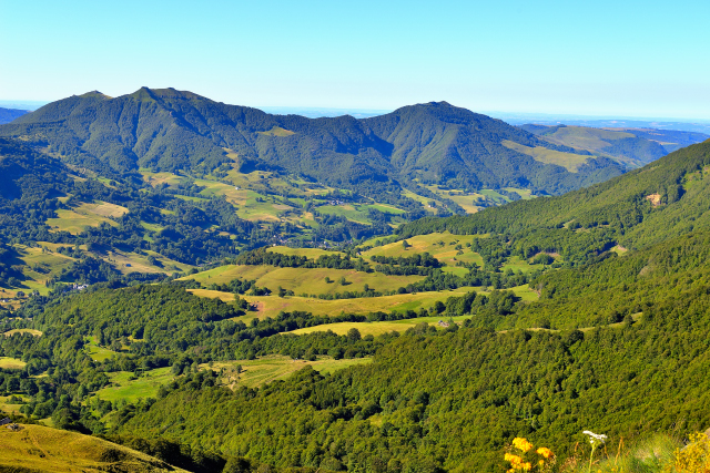
The highlight of Monday July 27 was the climb by the D680 from
Dienne to Pas de Peyrol, 1589 m altitude. As they approached the
pass, many cyclists and hikers scolded each other to climb the
coast, for the latter a goat trail led to the summit. The descent to
Aurillac via the D17 is just as remarkable. The city of Aurillac did
not hold my attention given the virtual absence of parking for
motorhomes. I continued to the City of Encanjac. The temperature
reached 37 ° C!
click on the pic for opening the gallery
|
| Les Monts du Cantal |
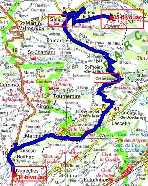
The GPS road tracklog
from Naucelles to Puy Violent
from 2020/07/28 to 2020/07/28
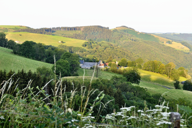
Tuesday July 28 the D35 departmental road led me to Salers,
here,
via the Legal pass; it zigzagged through hamlets, pastures
of salt cows and a few clumps of thin conifers. I arrived in Salers
around 8.30 am, no tourists. What happiness! But a bad hour because
the delivery trucks crowded the Tyssandier-d'Escous place, I waited
until 9.30 for it to be cleared. A resident informed me that the
Church of St-Mathieu opened at 10.00; que nenni at 10.15 it was
still closed? Information taken at the store opposite there is no
definite time. I went my way before the horde of tourists came down.
Okay, Salers is well restored, the houses are occupied by shops and
restaurants. All car parks are paid at a flat rate of 3 €. I decided
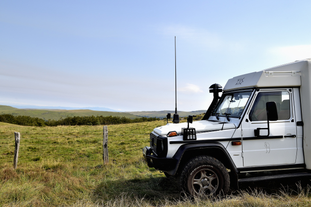
to go and scamper myself on the slopes of Puy Violent,
here,
by taking a local road. The parking lot is at an altitude
of 1370m and the summit at 1592m. Shoes and a walking stick, I went
to the ladder that crossed the barrier to cover the last few meters.
But the steep incline dissuaded me from going any further. I
bivouacked in the parking lot.
click on the pic for opening the gallery
The GPS road tracklog
from Puy Violent to Col (pass) de Serre
from 2020/07/29 to 2020/07/29
On Wednesday July 29, I left the bivouac at Puy Violent at daybreak
to descend to St-Paul-de-Salers and the Recusset circus to travel
the Vallée du Mars from Falgoux to Moussages via the narrow road
D12. Then, from Riom-ès-Montagnes, I followed the Cheylade Valley,
here,
with a visit to the former St-Léger priory, attested by
the 11th century Roman church. This approximately 100 km trip offers
splendid landscapes of volcanic Auvergne with its Puys interspersed
with narrow valleys with shady wooded slopes and sunny slopes with
mossy stone houses. Each village has a Roman-style church, the
oldest of which date back to the 11th century attesting to the
ancestral Catholic faith. I bivouacked above the Col de Serre (Pass
of Serre).
What Puy means:
here
click on the pic for opening the gallery
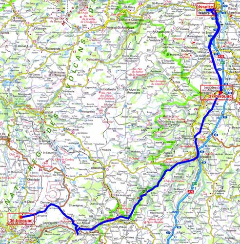
The GPS road tracklog
from Col de Serre to Issoire
from 2020/07/30 to 2020/07/30
Thursday July 30 was another departure at daybreak to be at 8.00 am
in Issoire,here.
I was there. So I found a parking lot near the grain hall and I
visited the city center with my hand out of the horde of tourists.
Of course, as I have already mentioned, in the south of France the
population is not early in the morning, no commerce, no museum open
before 10.00 except the bistros! The Clock Tower, the city's former
belfry, shows me the way to the central square, Place de la
République, with its fountain in line with the belfry and a few 15th
century mansions. The St-Austremoine abbey is the church of a 12th
century Benedictine abbey typical of the Roman style of Auvergne. As
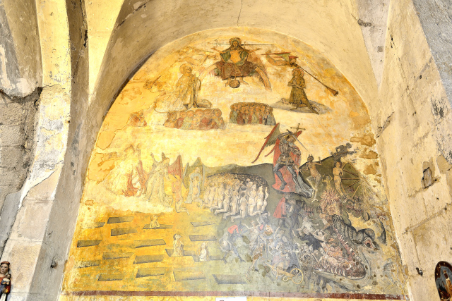
you enter the shop on the right, a 15th century mural depicts a
doomsday in an unorthodox humorous style. The choir offers an
ambulatory, the pillars of which are decorated with historized
capitals. The crypt contains a modern-style Virgin, 1945, embedded
in the ambulatory. Exiting the rear of the abbey has a very
harmonious apse whose carvings above the windows show the signs of
the zodiac, including Leo. Around 10.30 I returned to take my
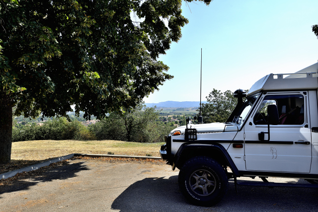
vehicle to park on a rest area seen in the morning in the village of
Lempdes-sur-Allagnon.
click on the pic for opening the gallery
|
| Jugement dernier 15e siècle |
|
| Aire de repos, Lempdes-sur-Allagnon |
The GPS road tracklog
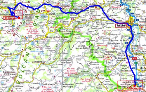
from Lempdes-sur-Allagnon to Col (pass) de la Croix St-Robert
from 2020/07/31 to 2020/07/31
Friday, July 31 Météo France announced a scorching day of + 39°C.
Once again, leaving early in the morning, I stopped at St-Nectaire,
here,
to take pictures of the St-Nectaire church built in 1150 in the
Roman style of Auvergne. Ravaged by the French Revolution, it
underwent a long and patient restoration. I did not visit it, the
opening hours were not posted. I continued my trip in the mountains
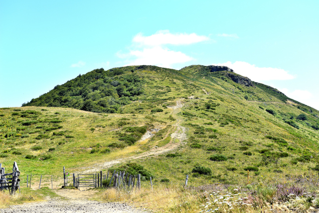
by the D996 to the town of Mont-Dore, then by the D36 to the Col
(pass) de la Croix St-Robert at 1451 m altitude, where I decided to
stay hoping for freshness. I took the opportunity to stretch my legs
by traversing a small part of the GR4 which climbs from the parking
lot to the top of Puy-de-Sancy where I was not going. I was doing 3.19
km round trip, see map below.
click on the pic for opening the gallery
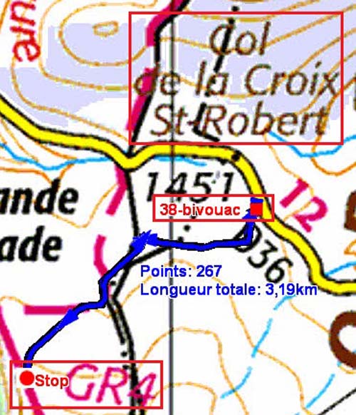
|
| Randonnée, trekking |
The GPS road tracklog
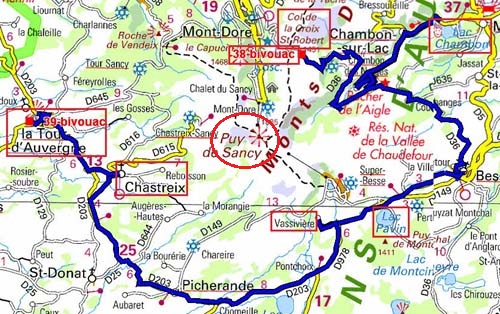
from Col de la Croix St-Robert to La Tour d'Auvergne
from 2020/08/01 to 2020/08/01
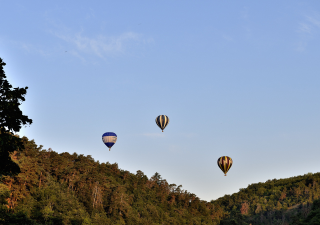
On Saturday August 1st I continued around Puy-de-Sancy by three
crater lakes, Lac Chambon overflown by aerostats,
here,
and the charming
little Lac Pavin without forgetting Lac Chauvet. Then two churches,
the Vaissivière chapel and the closed church of Chastreix and
finally the service area of La Tour d'Auvergne by the lake. At
around 3.30 p.m. a violent thunderstorm hit the air.
click on the pic for opening the gallery
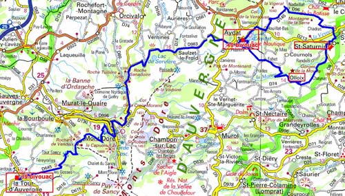
The GPS road tracklog
from La Tour d'Auvergne to Aydat
from 2020/08/02 to 2020/08/02
After a rainy and stormy night the temperature dropped to 19°C. On
Sunday August 2, I left La Tour d'Auvergne in the rain and fog
crossing Mont-Dore, still sleeping. I strolled between 1000 and 1300
m altitude over mountains and valleys in dramatic escarpment
landscapes. I did the loop from Lake Aydat, Nadaillat, St-Saturnin,
Olloix back to Aydat. Bingo, the Notre-Dame de St-Saturnin church,
here,
was open. It is in the Auvergne Roman style characterized
by its apse and its ambulatory of the choir. The crypt has a
sculpture of the descent from the cross. I bivouacked in the Aydat
parking lot behind the church.
click on the pic for opening the gallery