The GPS road tracklog
from Millau viaduct rest area to Peyre, parking Le Rocher
from 2020/09/21 to 2020/09/21
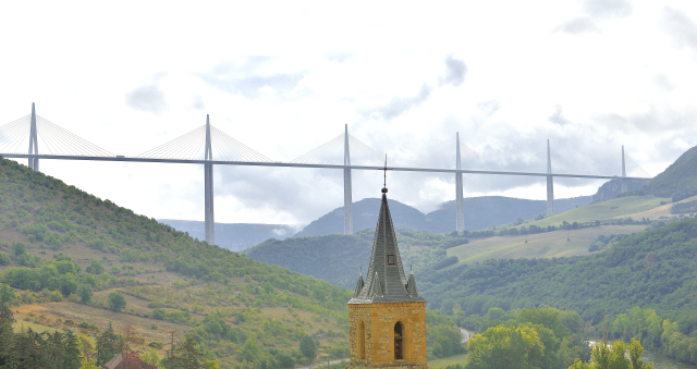
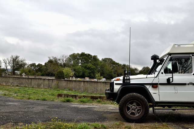
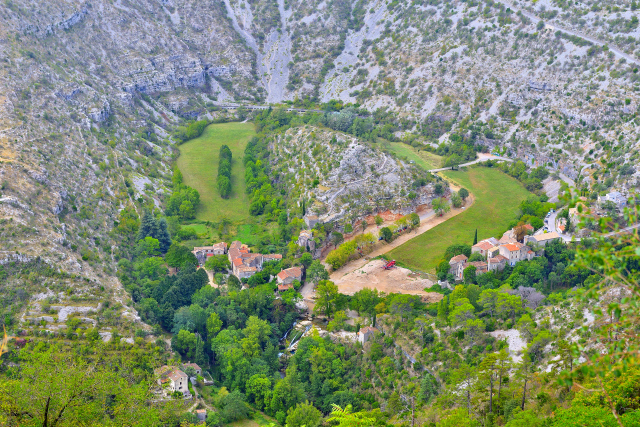
Monday September 21 I drove the road along the Tarn passing under
the viaduct to arrive in Peyre, a charming village, fully restored,
clinging to the cliff whose 12th century church is partially
troglodyte. I strolled through the alleys for about an hour with the
omnipresent viaduct, whose finesse of the architecture, all in all,
blends in well with the landscape. Certainly violent opposition
arose before and during its construction. But the economic fallout
mitigated them over time. I bivouacked above the village in the Le
Rocher car park, of course facing the viaduct!
click on the pic for opening the gallery
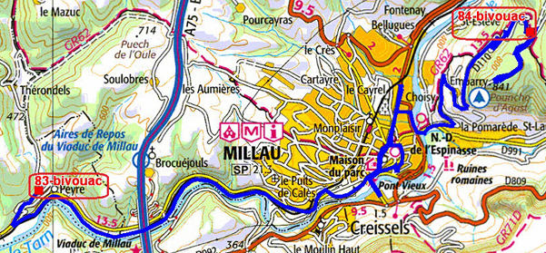
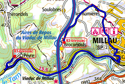
The GPS road tracklog
from Peyre, parking Le Rocher to Millau road D110
from 2020/09/22 to 2020/09/22
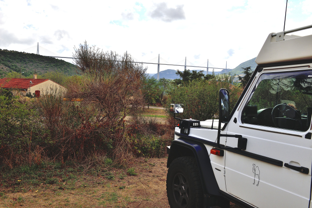
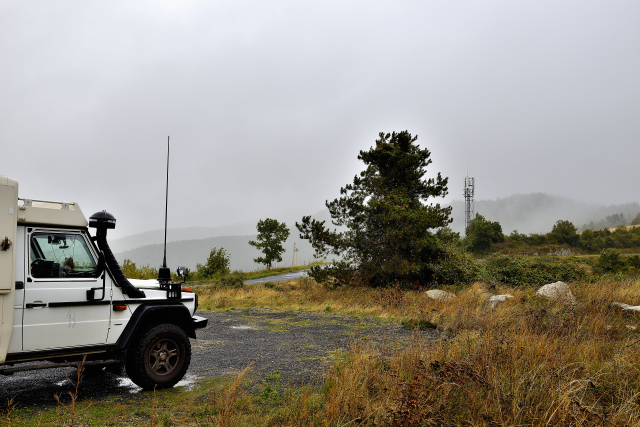
Tuesday 22 September was shaping up to be cold and brooding, it was.
The visit to the historic center of Millau was quick and
disappointing, admittedly out of season. The monuments were not open
and the grayness not very conducive to photos. The Tower of the
Kings of Aragon, Belfry,
here
was erected in the 12th century and topped by an octagonal
tower in the 17th century. The Romanesque-style Church of N.-D. of
Espinasse was rebuilt in the 17th century. I left the city to
go up to the take-off area of the Pouncho d'Agast paragliders at an
altitude of +800 meters, of course above the clouds, zero
visibility, circulate there is nothing to see, and more overnight
parking is prohibited. I set up my bivouac on an area on the edge of
the D110.
click on the pic for opening the gallery
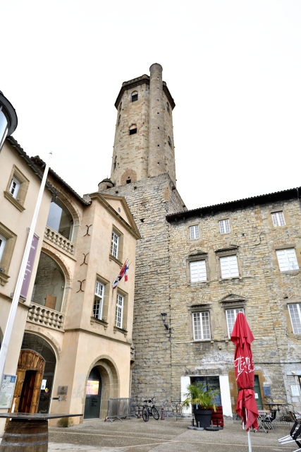 |
| Tower of the Kings of Aragon, Belfry, Millau |
The GPS road tracklog
from Millau road D110 to Cantobre
from 2020/09/23 ato 2020/09/23
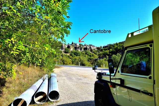
Wednesday September 23 I left the quiet of the pine forest of the
D110 to immerse myself in the Cévennes National Park,
here,
and more particularly Les Causses & Les Cévennes,
here,
by traversing the Dourbie Gorges,
here,
from Millau to Cantobre then the Tévezel
Gorges, round trip to bivouac at the foot of Cantobre, a picturesque
village at the confluence of the Dourbie and the Trévezel. I visited
it on the way up to the early 12th century Romanesque church. The
Trévezel Gorges are 30 meters wide at Pas de l'Ane and the road
surface is almost single lane! I did not meet any vehicle.
click on the pic for opening the gallery
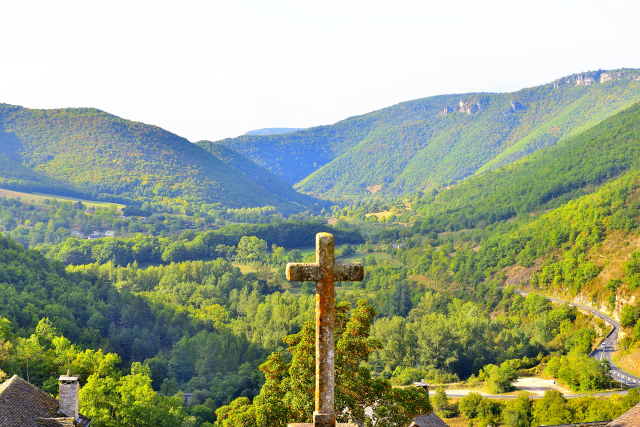 |
| Gorges de la Dourbie vues de Cantobre, Gorges of Dourbie river seen from Cantobre |
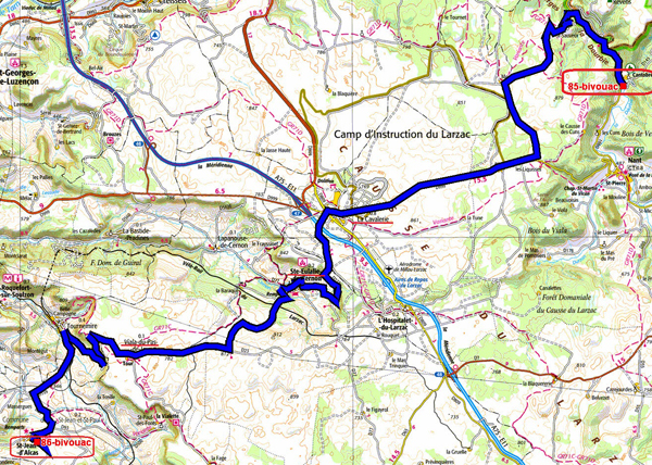
The GPS road tracklog
from Cantobre to St-Jean-d'Alcas
from 2020/09/24 to 2020/09/24
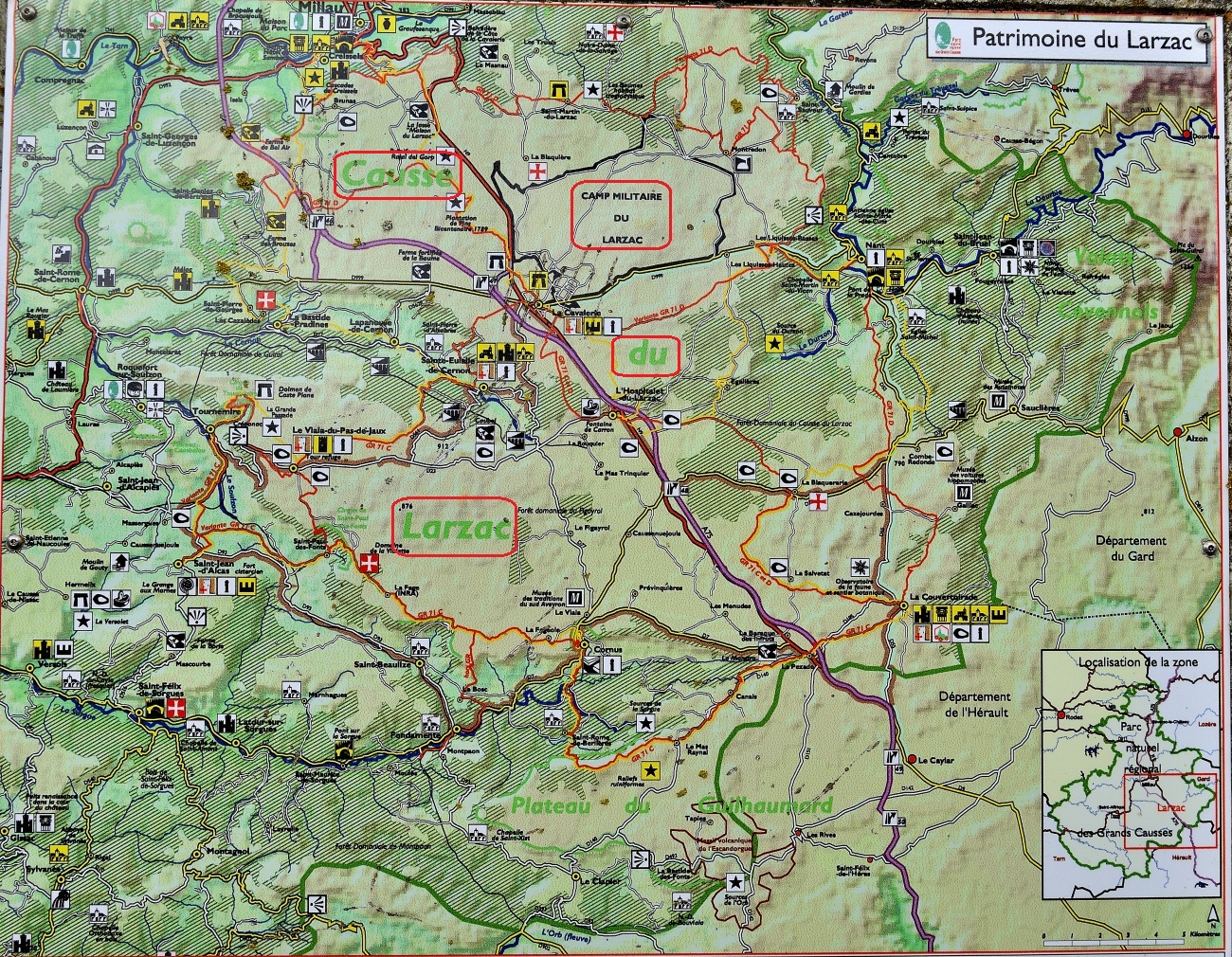
Thursday September 24 I climbed on the Larzac plateau by an unlisted
road starting from the D991 along the Dourbie Gorges. It is there
also almost single track and bends to St-Sauveur; leaving early I
did not meet any vehicle again. Then I followed the route of the
Commanderies of the Order of the Templars,
here,
and Order of the Hospital,
here.
The village of La Cavalerie was fortified by the Templars
in 1154,here.
The ramparts are beautifully restored. The village is also
the barracks of the 13th DBLE,
here,
on the Larzac camp, which was the object of violent
opposition to its expansion. The village of Ste-Eulalie-de-Cernon,
here,
was the seat of the commandery of the Templars then the
Hospitallers. The visit is interesting putting the life of the
monk-soldiers in perspective. The highlight is the 17th century
fresco hall. The village of St-Jean-d'Alcas,
here,
was fortified in the 15th century, retaining its ramparts
to this day. The Romanesque church is inside. I bivouacked in front
of the cemetery.
|
click on the pic for opening the gallery
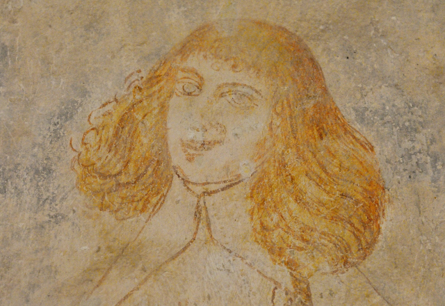 |
| Salle des fresques de la Commanderie des Templiers,
Hall of frescoes of the Commandery of the Templars |
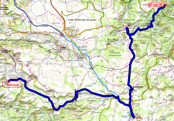
The GPS road tracklog
from St-Jean-d'Alcas to route D922 to Dourbies
from 2020/09/25 to 2020/09/25
On Friday September 24th it rained all night and then all morning
until around 1:00 pm. I continued to visit the Circuit du Larsac
Templier et Hospitalier. In Le Caylar,
here,
all that remains is the Clock Tower preceded by a sculpted tree. On the other hand, La Couvertoirade,
here,
is a medieval village still surrounded by a wall built by Knights Hospitaler. I made a quick passage in Nant
then I looked for a place for the bivouac on the road to Dourbies.
click on the pic for opening the gallery
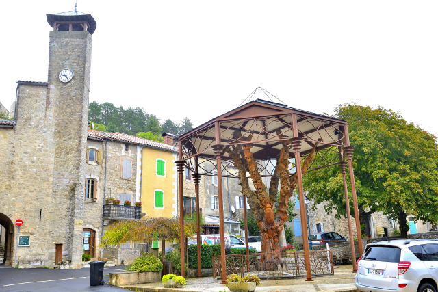 |
| Le Caylar, Tour de l'horloge et arbre sculpté,
Le Caylar, Clock tower and sculpted tree |
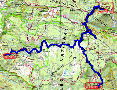
The GPS road tracklog
from Route D922 to Dourbies to Route D48 to Le Vigan
from 2020/09/26 to 2020/09/26
Saturday September 26th after a cold and rainy night at 918 meters
altitude I decided to go to Mont Aigoual,
here,
1567 m. At the end of September it was already covered with snow and in the clouds.
The road was icy. I wanted to put on my K-Way to protect myself from the
cold and the spray, alas it slipped out of my hands under a violent
gust of wind and disappeared into the mist and the mountains!
Visibility was almost zero. I left to come back down the mountain to
have a milder temperature. I found a platform at an altitude of 920
meters and the sun shied timidly around 3 p.m.
click on the pic for opening the gallery
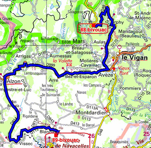
The GPS road tracklog
from Route D48 toward Le Vigan to Cirque de Navacelles
from 2020/09/27 to 2020/09/27
Sunday, September 27 in the cold and the rain, without K-Way flying
at Mont Aigoual, I went to the Cirque de Navacelles,
here,
a meander carved by La Vis river in impressive gorges. I set up
my bivouac on a platform near the access to the Blandas belvedere.
click on the pic for opening the gallery