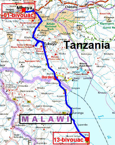
The GPS road tracklog
from Kasumulu to Mbeya
from 2019/02/25 to 2019/02/25
Kasumulu, border MW/TZ
Monday, February 25 before leaving Malawi I stopped in Karonga to spend
the last kwachas, MWK, by putting diesel fuel in the tanks. I arrived at
the border between Malawi and Tanzania at Songwe around 8:30 where I was
alone. My passport received the exit stamp and the two vouchers of the
carnet de passage en douane were duly filled and stamped. After the
bridge over the Songwe River the customs post of Tanzania,
here,
accommodated me
without drum nor trumpets but although I was always alone, waiting was
long for obtaining the 90 day visa for US$50, then the filling of
the carnet de passage en douane and finally the payment of the tax of
use of the roads for two months for US$45 to pay at the bank. I leave
the enclosure around 10:00 i.e. 11:00, time zone of the East Africa, UTC+3. But
at the gate a guy provided with a red apparatus delivered
me a ticket of toll of 10,000 Tsh, TZS, for the use of an end of road
crossing the village of Kasumulu!
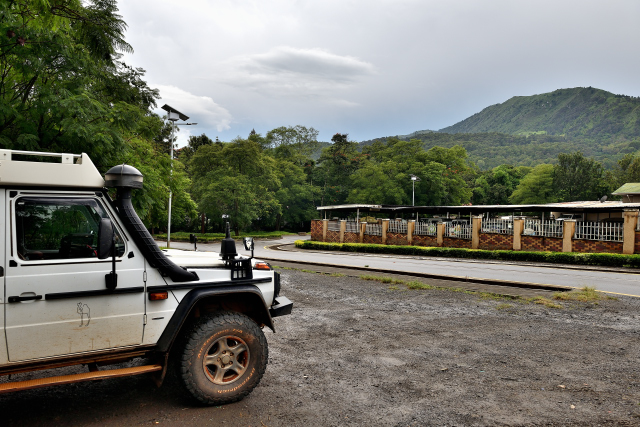
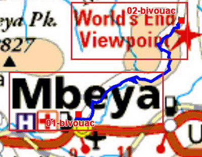
Mbeya
The road from the border to Mbeya climbs up to +2000 meters high to go
down again to 1757 meters altitude at the entrance of the city. As to
each entry in a new country I proceeded to the three usual purchases,
the SIM card for Wi-Fi, the diesel full of the three tanks and, of
course of the supply in food for the driver. During the purchase of the
SIM card a violent storm fell down on the city; I waited in the shop to
expect a lull. Between two downpours I found a parking behind a small
public garden to spend one peaceful night.
The GPS road tracklog
from Mbeya to World's End Viewpoint
from 2019/02/26 to 2019/02/26
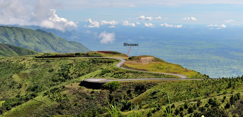
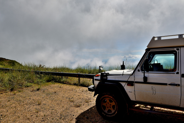
World's End Viewpoint
Tuesday, February 26 I decided to go to see World's End Viewpoint
praised by Lonely-Planet. The road curves up to +2400 meters of altitude
in tea plantations. The point of view is located on a peak connecting
two hills where a large carpark is to bivouac. I settled for one night
at 2102 meters of altitude dominating a landscape resembling a spinach
dish. At the beginning of afternoon the thunder thundered announcing a
storm. In one moment the carpark was in the clouds.
click on the pic for opening the gallery
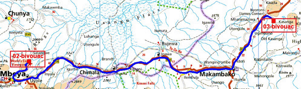
The GPS road tracklog
from World's End Viewpoint to Nyororo, Lake Nzivi
from 2019/02/27 to 2019/02/27
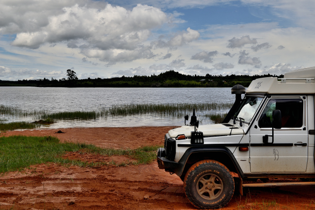
Nyororo, Lake Nzivi
After a resting night at 2102 meters of altitude I went down to 1843
meters at the edge of the Lake Nzivi by hoping that the rain will not be
too abundant making the track muddy. The road from Mbeya to Nyororo is
without much interest quite to the contrary, there are many villages
which are preceded by three times five bitumen rolls separate by
20 meters making vibrate the vehicle to announce an elevated pedestrian
crossing to take at very low speed. In end of the day I was harassed
with this constraint and very anger. I felt sorry for the truck drivers.
At all events speed is limited at 80 km/h and in the villages at 50
km/h. The road curving in the mountains the mean speed is lower than
50km/h on the 240 km than I traversed to bivouac at the edge of the
lake.
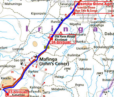
The GPS road tracklog
from Nyororo, Lake Nzivi to The Old Kisolanza Farm Hous
from 2019/02/28 to 2019/03/01
The Old Kisolanza Farm House
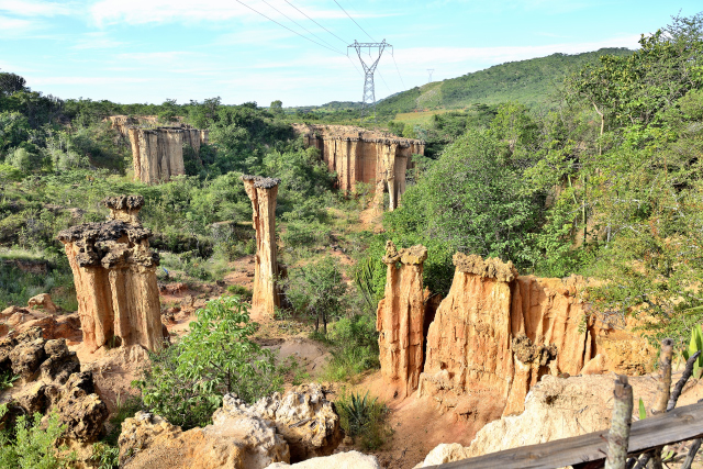
Thursday, February 28 I left the edges of the lake Nzivi for Isimila
Stone Age Site. It is a deep gorge alas dominated by pylons of electric
cables, excavated by the erosion which cut gigantic pillars called
chimneys of fairies in France. After the climbing of a gullied and stony
track I approached a balcony overhanging the gorge and the pillars; then
after a painfully descent I walked on in the river bed twisting between
the structures. The river dug a tunnel which I cross with precaution by
depositing all my implements. The return to the entry was always carried
out while walking on in the muddy river bed. A small museum exhibits
artifacts dating back to 60,000 to 100,000 years. This visit lasted
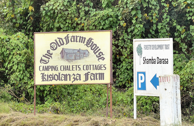
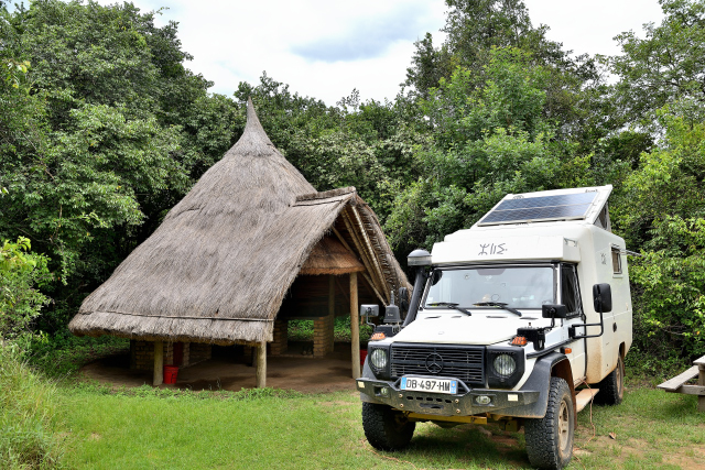
approximately two hours. I turned back to install my bivouac in the Old
Kisolanza Farm House during two days to have rest this visit at 1662
meters of altitude to make lie the cardiologists but alas to make right
to the rheumatologists.
click on the pic for opening the gallery
click on the pic for opening the gallery
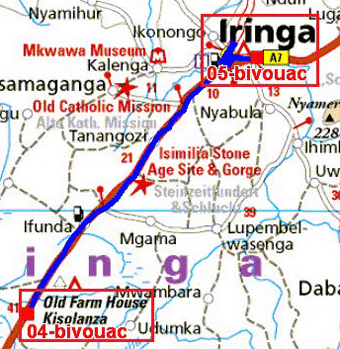
The GPS road tracklog
from The Old Farm House to Iringa
from 2019/03/02 to 2019/03/02
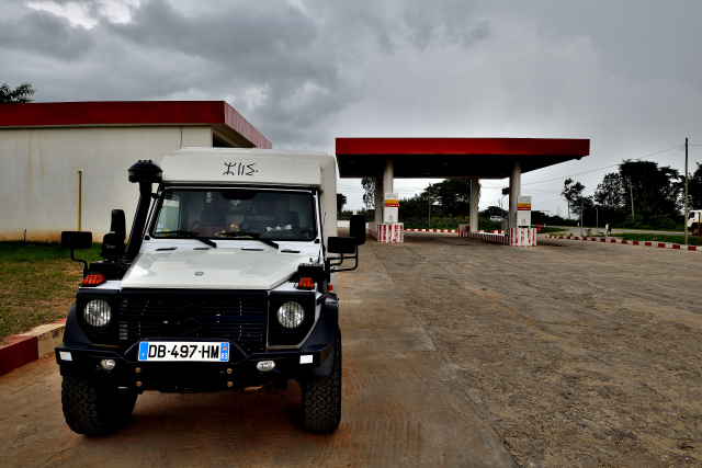
Iringa, Gas Station
Saturday, March 2 the town of Iringa did not hold my attention solely to
make wash my truck. Moreover the road which goes up to the city is sown
with rolls of bitumen which make dance the samba to all vehicles. Who
are the dummies who decided this installation. It would be necessary to
encourage the bus, truck drivers and other vehicle drivers to be
expressed with a yellow waistcoat.
 |
 |
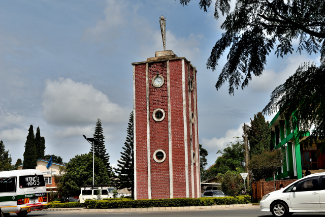
| Iringa, Clock Tower |
Iringa, gas station |