-- From Bukit Kayu Hitam to Ko Lanta

The road tracklog
From Bukit Kayu Hitam to Ko Lanta
From 17/09 to 21/09/2008
Border of Thailand
The entry Thailand was held simply. At immigration kiosk my passport
got a 30-day VOA and at customs office a “Simplified Customs Declaration Form” was
established from the preceding one by changing the dates.
It was then a driving day to go in Pak Meng Beach on Adaman Coast. On arriving
in Trang I paid visit at a TAT, then I was going to Tesco Lotus to do food
purchases. I installed the bivouac on the concrete esplanade opposite of huge
limestone blocks. I stayed two nights there.
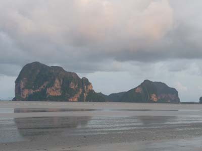
Limestone blocks
Pak Meng Beach
the 18/09/2008
On the move I noticed a signpost mentioning Ko Lanta. I thus headed towards a Ferry Jetti on knowing that vehicles could embark. I was after two ferries in Ban Sala Dan the only village on the island of Ko Lanta Yai. I was nicely welcomed by the local police. The village in this low season was deserted by tourists. I remembered that French people had remained in the Marine National Park. I decided to establish there my bivouac in this weekend.
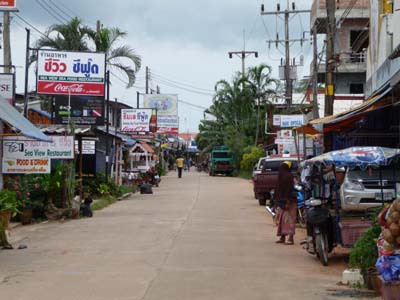
Ban Sala Dan
Ko Lanta
the 19/03/02/2008
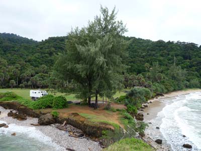
Marine National Park
Ko Lanta
the 19/09/2008
It is usual to compare the geographical shape of Thailand with a head of elephant. The
narrow band of territory ranging between the Gulf of Thailand and the Indian
Ocean is the horn. The southernmost provinces bordering on Malaysia Yala,
Narathiwat, Pattani, Songlhla and Satun on Adaman coast were conquered by the
Sultan Iskandar in 1387 and adopted the Islam and Malayan dialect. A
separatist movement born in the Seventies is latent due to the authoritative
policy of siamization by the government of Thailand. The provinces on each
side of the border are of strict Moslem obedience visible in the clothing garb
as well male as female and in the booming call to the prayer of the mosques.
The Federal State of Malaysia observes rigorous neutrality.
I strolled along Adaman coast as far as Ranong at the border of Burma.