-- From Pointe-à-la-Croix, QC, to North Rustico, PEI,

The road tracklog
from Pointe-à-la-Croix to North Rustico
from 10/10/2011 to 16/10/2011
Acadia
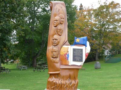
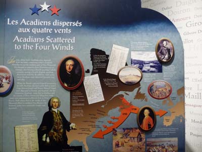
The first French settlers were established in Minas Bassin about 1600, they called the area Arcadia, name given by Verrazzano, Italian sailor at the service of king François 1st, this Greek word meaning “Pastoral Paradise”, which became Acadia in the 18th century. Another etymology gives as origin a word Mi'Kmaq, First Nation living the area, Algatig, meaning “place of camping”. Acadia were then the three current provinces of New Brunswick, Nova Scotia and Prince Edward Island. After the treaty of Utrecht, 1713, Acadian refused to lend oath to the Crown of England. In 1754 the governor Charles Lawrence ordered the deportation of Acadians. They burned houses and dispersed cattle. 14.000 Acadians were embarked on boats for the New England of whom some in Louisiana, Cajuns. Calm returned between France and England some Acadians returned in the Maritime Provinces, Acadia, but their lands were occupied by Loyalists. They were established in the Cape Breton, New Brunswick and in Gaspésie where they made stock. At National Convention of Acadians in 1881 hold in the Prince Edward Island, Acadians chose a flag. The French tricolor was adopted to show the origins of the people and the yellow star in blue marine symbolizes the attachment with the sea and with its holy Mary, Stella Maris. A national anthem was also made up.
New Brunswick
New Brunswick was occupied by the French since 1603 in the area of Bay of Fundy. They were expelled in 1755 and left to Quebec in Gaspésie at Baie des Chaleurs. At the time of the USA Independence war Loyalists came set up on the lands of Acadian expelled as well as in St John and St Croix River.
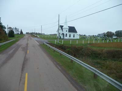
I left Pointe-à-la-Croix in the late morning, hour of New Brunswick (+1h). I crossed the bridge over the Ristigouche River and, on the other site all stores were closed, information taken it was Thanksgiving Day in British Canada. I went back to Quebec to do shopping. From Campellton I drove the road of the Acadian littoral identified by a yellow star with five branches being reproduced on the Tricolor Acadian flag at the top in blue close to the pole, it symbolizes the Virgin Mary. Splendid road snaking along the shore alas occupied by residences, there is no access to the sea. In the village Petit-Rocher (Small-Rock) looking at some caravans in edge of sea I was diverted and found a bivouac opposite a small-rock. Weather was sunny but with a strong wind coming from land.
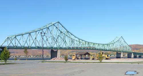
Bridge from Pointe-à-la-Croix to Campellton spanning the Ristigouche River

Bivouac opposite a small rock
Petit-Rocher
10/10/2011
L'Acadie
As of early dawn the moon had appointment with the sun, magic as the Egyptians thought it at the Pharaohs' era.
 |
 |
 |
The moon had appointment with the sun
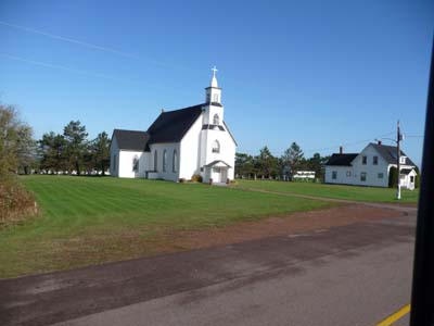
Grande-Anse is the Acadian Peninsula's gate, that is seen, everywhere the Acadian flag is hoisted up. Alas three times alas all are closed even Offices of Tourism. It was the case also at Caraquet which is proud to be the capital.
|
|
 |
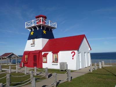
Office du Tourisme de Grande-Anse
Electricity pylon with Acadian flag

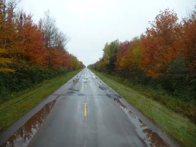
Autumnal warm colors
En route
11/10/2011
Little before I strolled in the Acadian Historical Village, of course closed, but tourist is authorized to traverse the historical path, knowing that it is specified, free. Without animation even in the sun, the site is unspecified. Buildings of 19th and 20th century were installed in 1980's coming from all the peninsula.
|
|
 |

Charles Robin-1855
School-1869, Chapel-1831, Blackhall House-1840
|
|
 |
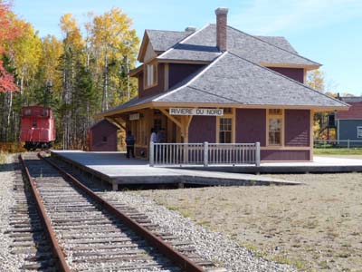
Railway Station-1930
General Store-1924, Hotel Chateau Albert 1907
I wandered in Caraquet which has the longest main street without doing a visit. Idle I settled at the library for a WiFi connection. At the end of the day I found a pleasant bivouac at Tabusintac at the edge of the mouth of the eponym river.
Bivouac
Tabusintac
11/10/2011
After Miramichi I entered Kouchibouguac NP where I went for two short walks on advice of the Center of Interpretation which showroom was under restoration until June 2012. I traversed the Beach of Kellys and its boardwalk to see the marsh and its inhabitants, birds of any species. A part from seagulls no bird of marsh. Admittedly the landscape is interesting but the light was scanty.
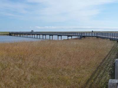
Boardwalk
Kouchibouguac
12/10/2011
|
|
 |

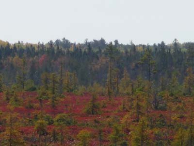
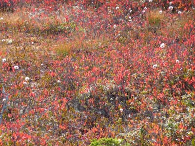
A few kilometers further away with my truck I threw my reserved on a bog and its observatory, there too no bird but an extraordinary carpet of color. Interpretation signs are enthralling concerning flora of a bog and its thousand-year-old origin. For bird watching mid-day is surely not the moment ideal.

Observatory
Kouchibouguac
12/10/2011
|
|
 |
|
|
 |

After an in situ collation I carried on my road up to Bouctouche where I hoped to have information concerning La Sagouine, que nenni, Tourist Office was closed for the season. But the following day at Lefebvre Monument I found an answer, it acts of a novel by Antonine Maillet, born in Bouctouche with Acadian ancestors. I acquired it. In season, July-August performances give to understand monologs by La Sagouine: Perhaps “J’ai peut-être ben la face nouère pis la peau craquelée, ben j’ai les mains blanches, Monsieur ! …” (no translation it is slang) She obtained the Goncourt Price in 1979 for Pelagie-the Return to a Homeland. In the late afternoon I arrived in Moncton where I went to Volvo to make my truck auscultate which emitted various noises by turning off the engine. In fact intermittent noises appeared after having drove very degraded roads involving longitudinal movements of the cabin. These noises disappeared after several driving days. Alas nothing was discovered. I suspected the back attachment of the cabin, to follow. I stationed at the night fallen at Walmart.

La Sagouine,
Viola Léger in the La Sagouine character
Bouctouche
12/10/2011
Memramcook
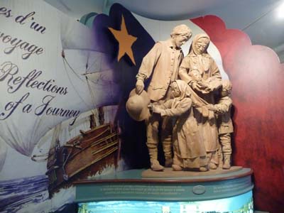
The following day two visits listed with the Canada Parks. Monument-Lefebvre commemorates this ecclesiastic who worked for the revival of the Acadian nation after the deportation in 1755-63. Born in Quebec he founded in 1864 the first college of French language in Memramcook. In 1881 the first national Convention chose Assumption Day, August 15, as national holiday. The showrooms are remarkable by the detailed synthesis of the Acadian tragedy. The second floor is a theater with a remarkable acoustic, I tested it.
Monument-Lefebvre
Memramcook
13/10/2011
|
|
 |
|
|
 |
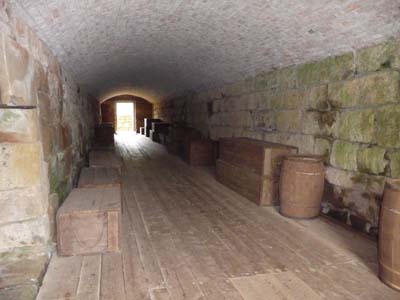
Fort Beauséjour
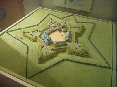
Fort Beauséjour was set up according to the Vauban's design in 1751 to defend the isthmus of Chignectou. It passed to the British hands in 1755 and was renamed Fort Cumberland. Its exemplary strategic situation caused the English covetousness well before 1755. The museum of the Fort does not have anything to retain visitor, exhibit of the collection of the doctor of the Fort made of odds and ends. I stationed at Baie Verte on the way to Prince-Edward-Island, PEI.
Fort Beauséjour
Aula
13/10/2011
|
|
 |
Jacques Cartier recorded the island in 1534 but settlement started only in 1603 with the arrival of several French groups coming from Poitou. The population grew in 1750 after the deportation of Acadian of Nova Scotia. In 1758 the British took then the Island called Île St Jean and expelled the French. It became officially British after the signature of the treaty of Paris in 1763.
Little before 10 a.m. I crossed the Bridge of the Confederation connecting New Brunswick to Prince Edward Island, it was named thus because it is in Charlottetown, capital of the province, that the Confederation of Canada was born in 1867. With 13 km long it is longest above the icy sea in winter. Toll is perceived at the exit of the island. The Tourist Office in Borden-Carleton at the exit of the bridge was open and gave any useful information in this winter season where all tourist activities were closed. There is a WiFi connection.
|
|
 |

Confederation Bridge
The bridge from PEI
I stopped in Summerside whose only Eptek Art & Culture Center were open exhibiting local artists.
|
|
 |
Dining out by Lori Ellis
No comment
Of course murals were accessible in full wind and maritime drizzle, I took pictures of some of them.
|
|
 |

Prince Edward Island Railway
Streetscape
|
|
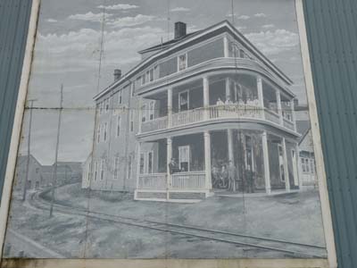 |
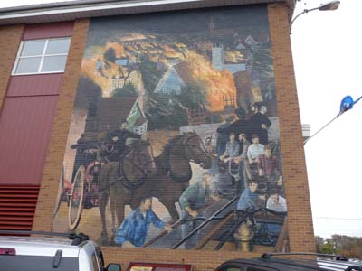
The Great Fire of 1906
The Acadians of Summerside & the Green Hotel
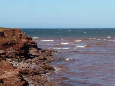
I traversed the Coastal Circuit North Cape connecting several Hwy with sometimes a play of track to find the crossroads. It crosses several Acadian localities of which the Evangéline Area. The Acadian flag is hoisted in front of many residences. The day was gloomy, the fog rose about midday without the sun making its appearance, wind & drizzle in spite of the mild temperature of the Indian summer. I bivouacked at the foot of West Point Lighthouse.
|
|
 |
On Hwy #11
On Hwy #14
The following day on the way towards North Cape I noted the permanent maintenance of the land surrounding houses giving a manicured landscape, so British.
Paysage
en route
15/10/2011
The point of the North Cape is the longest in the North American continent, it is exploited by wind mills installed and managed by a French company.
|
|
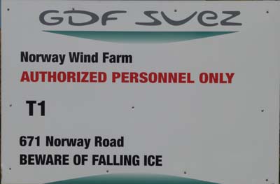 |
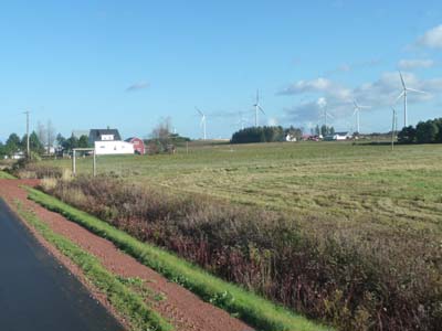
The booklet of the Tourist Office mentioned a Interpretation Center of the Northern Cape and of the wind farm as open until October 15, false it was closed.
|
|
 |
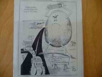
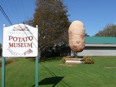
In the early afternoon I went to O'Leary in open potato field to visit the Potato Museum. It is very interesting, I learned much from enthralling things. The origin of this common tuber is southern American exploited by Incas. The Spaniards introduced it in Europe in the 16th century and discovered its antiscorbutic virtues, very widespread disease among sailors during the long voyages at that time. Antoine A. Parmentier was in contact with this tuber during his imprisonment in Hanover in the seven year war (1756-63) then he introduced it in France by persuading the king Louis XVI of its virtues. The day was sunny and very windy.
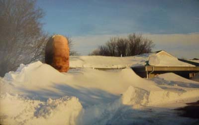
Potato Museum
O'Leary
15/10/2011
|
|
 |
|
|
 |

INCA pottery with potato patterns
Potato farming in the Andes
The day before by inspecting my truck I had noticed a nail in the right rear tire which I extracted and marked the position, this morning I checked the pressure of tires, anything abnormal, to follow. The day could have been lovely, the sun rose with a bird of good forecasts flying above. But very quickly weather was put in the rain. Another disappointment at Miscouche where the open-year-round Acadian Museum is, I discovered that it was closed for the season!
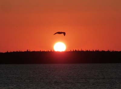
Sunrise with a bird
Lennox Island
16/10/2011
I drove on my road up to Cavendish through potato fields under harvest. The National Historic site of Green Gables was fortunately open. The farm of Green Gables was used as decors for Anne of Green Gables, a novel by Lucy Maud Montgomery, written in 1908 and translated in many languages. In the early afternoon I found a windy bivouac in North Rustico Harbour.
|
|
 |

L. M. Montgomery
Anne of Green Gables
|
|
 |
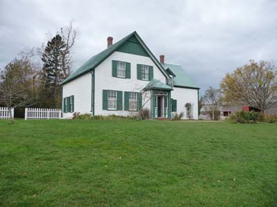
Green Gables
Anne's room