Cerro Sancho
After two rainy days spent at El Camping under the trees in moisture
but nearly the toilet block I left this place with the only
advantage and not of least to have a good Wifi connection. While
passing to the downtown area of Coyhaique I went to the only
cybercafé in the mall to print documents, alas all the stores were
closed in this Monday, shortly after January 1st! Obviously it
rained to do the way to my next bivouac at the bottom of Cerro
Sancho where I was going by the asphalted road ruta#240 instead of
the track ruta#7.
Puerto Cisnes
The next morning at the bivouac the temperature was of 4°C at 8:00
at 250 meters of altitude. Of course it rained, moreover it rained
all the day; it is the southern summer! I was going to bivouac in
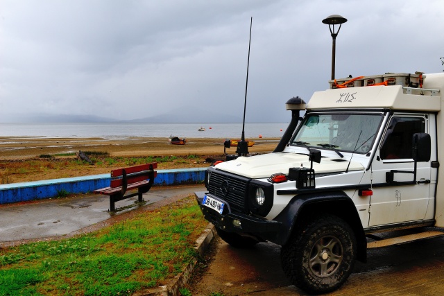
Puerto Cisnes where a pouring rain accommodated me in this quasi
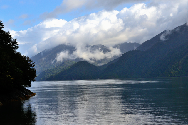
deserted village at the edge of the Puyuhuapi Channel.
 |
 |
| A 8h00 avec 4°C à 250 mètres d'altitude. At 8:00 am with 4°C at 250 high |
 |
 |
| Puerto Cisnes |
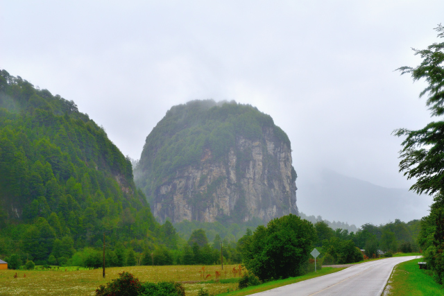
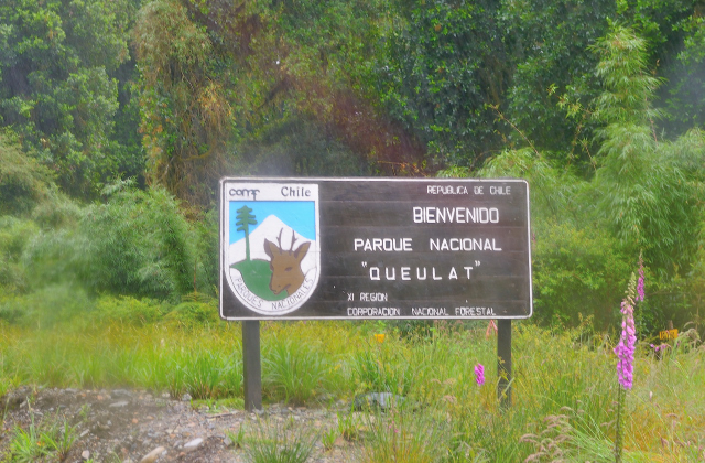
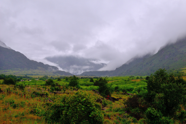
Parque Nacional Queulat
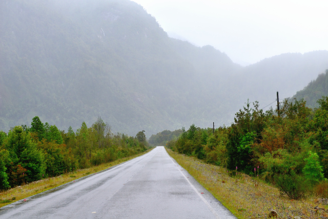
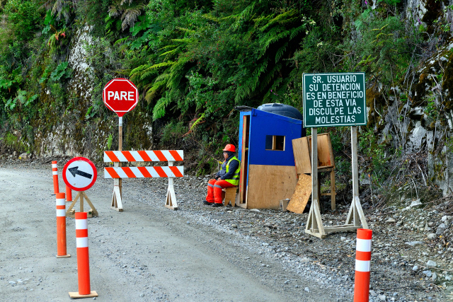
The days were followed and resembled each other, rain, low and
cloudy sky, winter temperature. From the junction with the ruta #X25
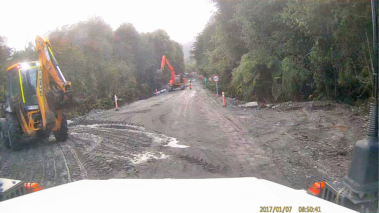
towards Puerto Cisnes the ruta #7 becomes a gravel road under work
for a later asphalting. Indeed Chile has a plan over thirty years to
asphalt the ruta #7, Carretera Austral, from Puerto Montt to Punta
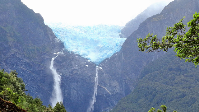
Arenas. At a speed of Senator's train I arrived at Parque Nacional
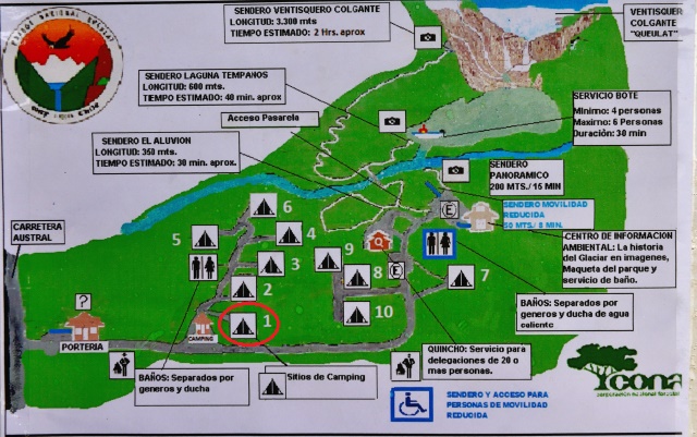
Queulat around 11:30 to see the glacier Ventisquero Colgante. A path
of 3.3 km one way leads to a lookout. I undertook this excursion,
but I gave up after half an hour of walk due to the difficulty of
the rise and especially of the return after two hours of rise.
The painful experiment of the return of the excursion on
"
Senda a Laguna Torre" carried teaching. Consequently
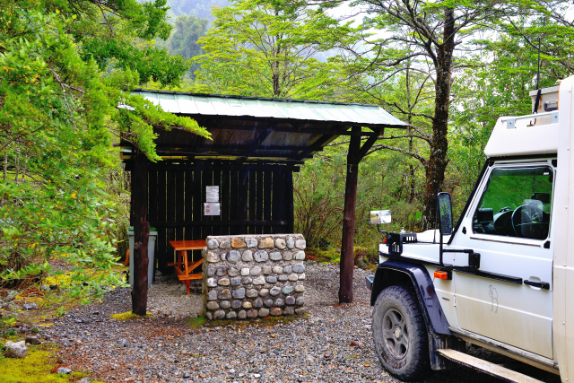
I decided to establish my bivouac at the camping of the
park at the sitio #1.
 |
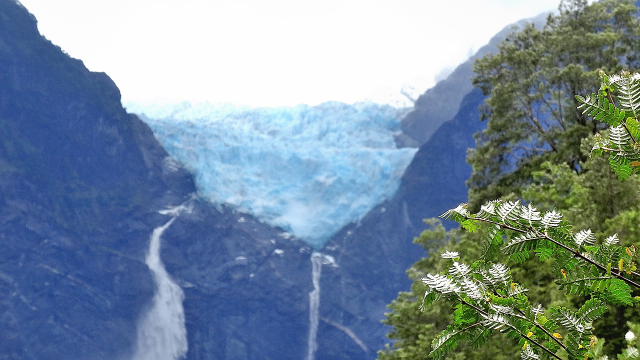 |
| Ventisquero Colgante |
|
| Bivouac sitio #1 |
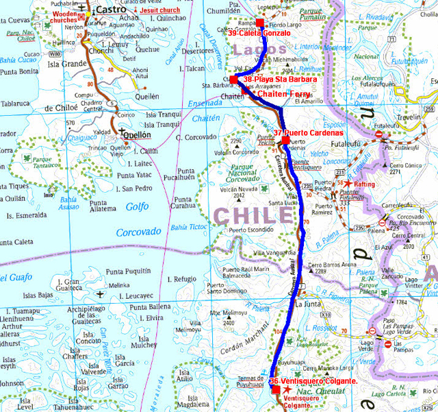
The GPS road tacklog
from Parque Nacional Queulat to Playa Sta. Bárbara
from 2017/01/05 au 2017/01/08
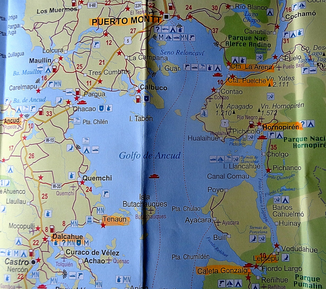
Puerto Cardenas
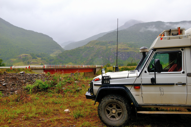
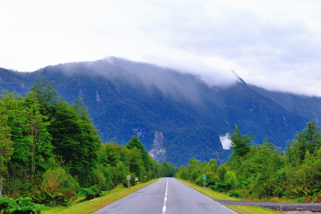
From the junction with the track going to Parque Nacional Queulat,
the ruta #7 became alternatively a gravel road then a tarred road
with four passages to a one way and waitings varying from 5 to 20
minutes according to the arrival at the stop (Pare) point. The way
from Parque Nacional Queulat to the Yelcho bridge, my bivouac,
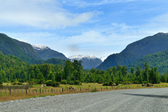
required 6:00 for 163 km, stops included. I took on my way some
pictures of this alpine landscape. Sometimes I thought of the
Switzerland landscapes. But the human, habitat, road etc.
environment, must make real progress; it will need much time for
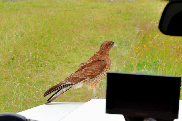
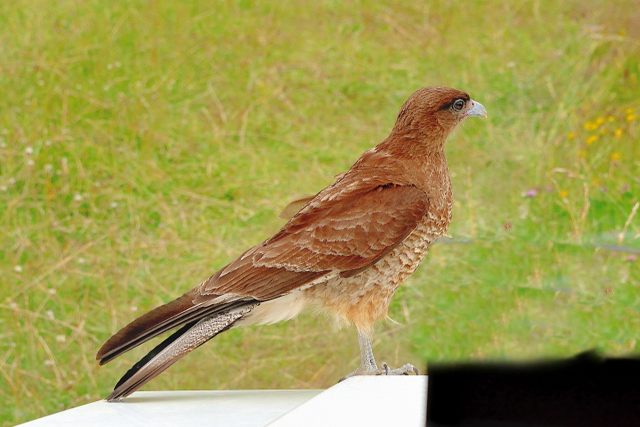
this latino-catholic population. In end of the afternoon a raptor
came to visit to me on the bonnet of my truck, what a surprised,
what a beautiful bird!
 |
 |
| ruta #7, Carretera Austral, under work |
 |
 |
| Villa Santa Lucia |
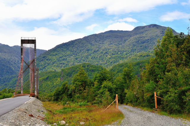
Puente Yelcho, Puerto Cardenas |
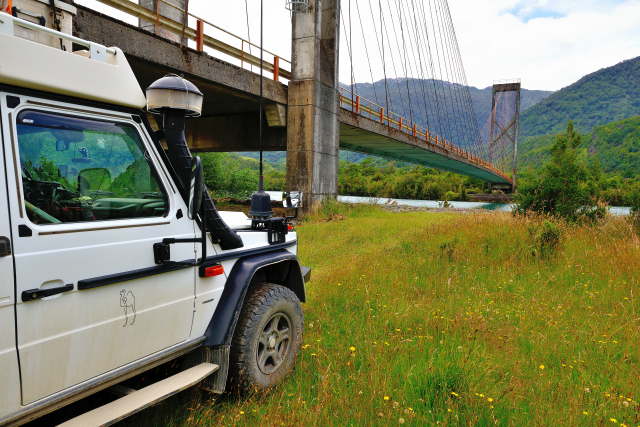
|
| Bivouac under the bridge! |
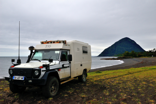
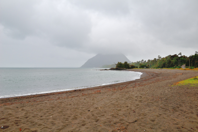
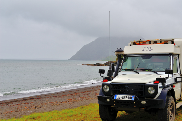
Playa Santa Bárbara
Friday, January 7th was still a glaucous day, rain and fog. I
stopped in Chaitén at the oficina of tourismo to take road maps. I
establish my bivouac in Playa de Santa Bárbara on a black sand
beach.
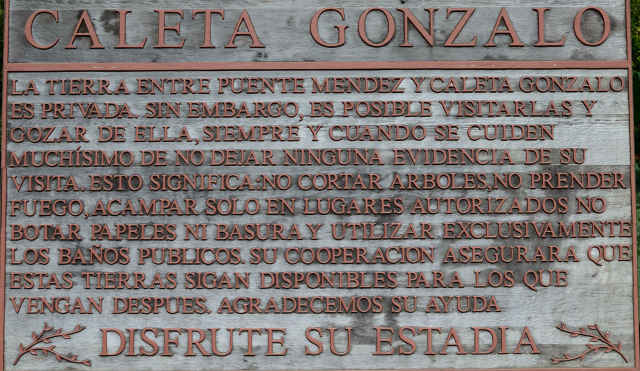
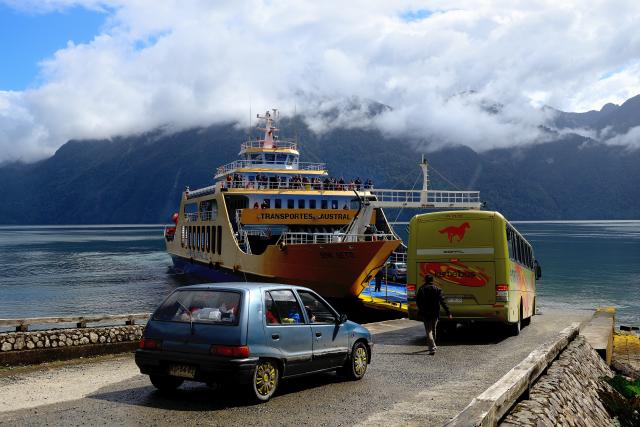
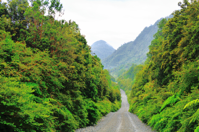
Caleta Gonzalo
The way from Sta Barbara to Caleta Gonzalo is 45km. The ruta #7
under work curves in a quasi virgin forest. Admittedly in Caleta
Gonzalo there is nothing to see if not the ferry which goes to Leptu
in 40 minutes then it is necessary to take two others ferries to
reach Puerto Montt. It is not the option which I had chosen because
I wished to visit Isla Grande de Chiloé by taking a ferry from
Chaitén to Quellón. I bivouacked on a carpark.
Playa Santa Bárbara
On Sunday, January 8th I returned to Playa Sta. Bárbara by the road
#7 under work, even on Sundays. I have the surprise to see again my
Swiss friends Renate & Bruno who went to Caleta Gonzalo and who
would join me in Playa Sta. Bárbara to take the ferry on Tuesday,
January 10th. It was still a day without sun but without rain.