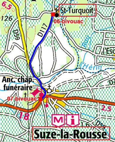
The GPS road tracklog
from Saint-Turquois to Suze-la-Rousse
from 2020/06/29to 2020/06/29
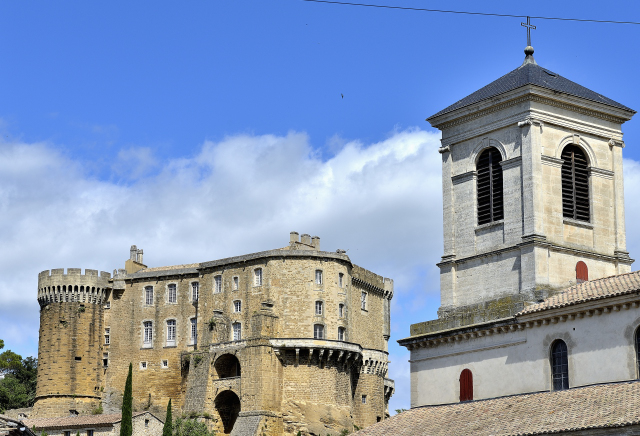
Monday June 29 I arrived in Suze-la-Rousse after 3 km. The medieval
castle,
here, dominates the village and the Lez valley. The exterior is
a military fort but the interior is Renaissance style. The only
devastation of the French Revolution concerns on the one hand the
hammering of the coats of arms of the main courtyard and the
dispersion of the furniture. It was returned to the La Baume-Suze
family in 1797. It is preceded by a rare tennis court that survives
in France. Of course the rooms are empty of period furniture but
replaced by a very didactic exhibition of the wine-making heritage
of Provence, an invaluable contribution of the Roman Empire. A
fresco shows the ports of Marseille, Arles and Vienne on the banks
of the Rhône, trading grape juice, ... fermented. The large dining
room is lined with decor called plasterwork,
here,. After the visit I strolled through the old village to
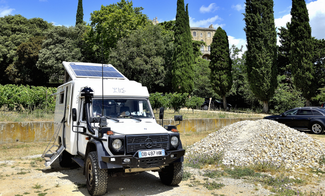
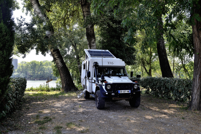
take a photo of the fort seen from down. I bivouacked on the large
parking lot.
|
click on the pic for opening the gallery
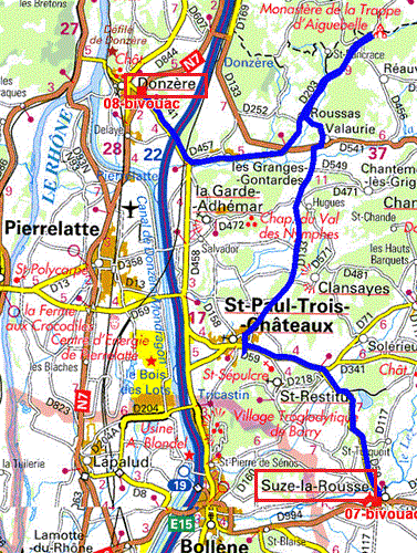
The GPS road tracklog
from Suze-la-Rousse to Donzère
from 2020/06/30 to 2020/06/30
Tuesday, June 30, I visited Saint-Paul-Trois Château,
here, market day. The stalls were full of fruits and vegetables
from Provence, sung by Gilbert Bécaud. My visit was doubly justified
by the 11th century cathedral of Provençal Roman style with its high
walls and its semicircular vessel. 12th century mosaics were
recently discovered in the heart. Further on, the Maison de la
Truffe et du Tricastin kindly welcomed me where I bought two jars of
sublime truffle cream. Returning to my truck I crossed the market
where I obtained three artisanal sausages, wild boar, pheasant and
five berries. On the way to Donzère I crossed the village of
Roussas,
here, overlooked by the ruin of a monumental castle. I was stop
in a parking lot at the entrance to the town of Donzère.
click on the pic for opening the gallery
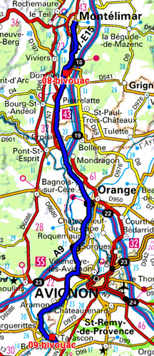
The GPS road tracklog
from Donzère to Montélimar then Tarascon
from 2020/07/01 to 2020/07/01
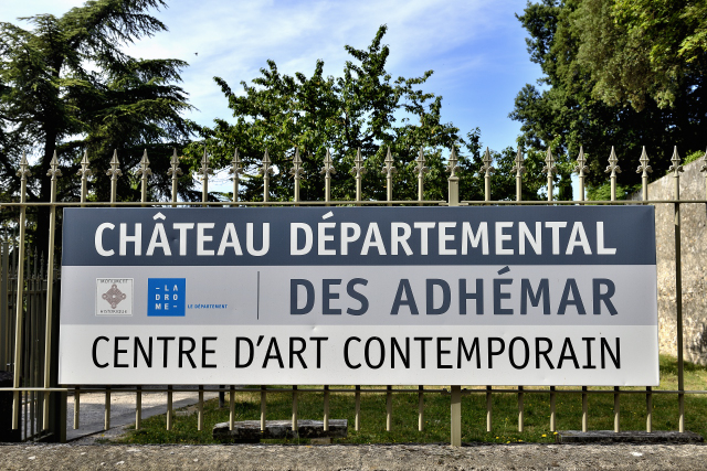
Wednesday July 1st I was going northward to Montélimar to visit the
Adhémar castle,
here,
a powerful 12th century family. The road to "climb up
there" is narrow and rough but it is worth the detour both for the
architecture of the fortress and for the panorama. The Narbonne
Tower to the north of the site is the only surviving part of an
ancient castle. St. Peter’s Chapel features a 13th century painting
of Jesus blessing the audience. A swirling staircase provides access
to the walkway for a 360° panorama. At the end of the morning I
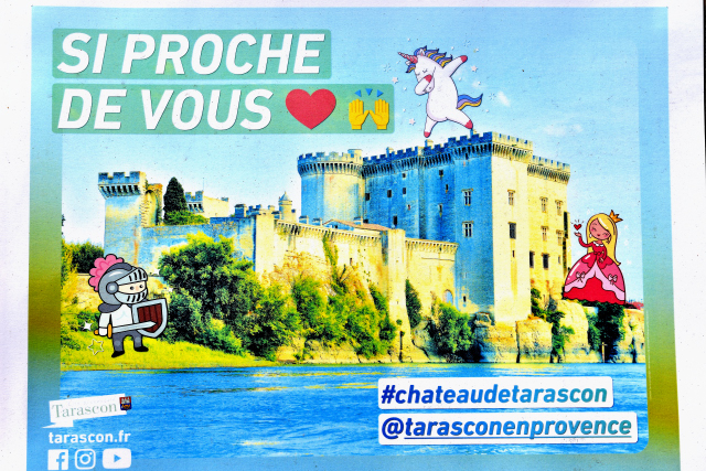
headed southward to Tarascon. But I forgot that the Provencals are
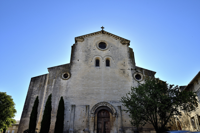
having a lunch break. I took the opportunity to visit the royal
collegiate church of Sainte-Marthe, religion is satisfied with
spiritual nourishment. Like all castles,
here,
in Provence, the rooms are without furniture but decorated
with displays of didactic photos from the period. The visit of the
four floors by tortuous staircases was very painful to me; culture
is earned, it's a personal investment. Around 4 p.m. I set up my
bivouac at the shaded Tartarin campsite almost at the foot of the
castle and on the edge of the refreshing Rhône river.
click on the pic for opening the gallery
click on the pic for opening the gallery
|
| Tarascon, camping Tartarin |
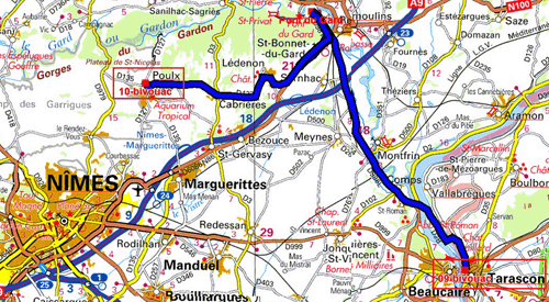
The GPS road tracklog
from Tarascon to Poulx
from 2020/07/02 to 2020/07/02
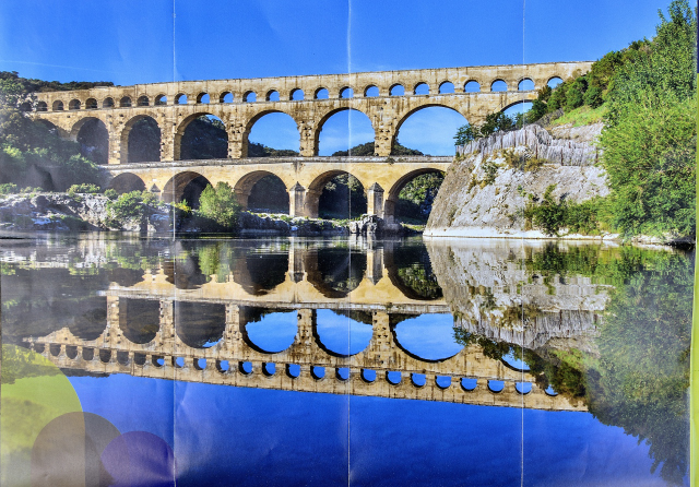
Thursday July 2 I visited the Pont du Gard,
here
it was built by the Romans during the 1st century of our
area to supply drinking water to the city of Nîmes. Without
maintenance it was abandoned in the 6th century. It is listed as a
World Heritage Site. I bivouacked in the parking lot of the Poulx
cemetery.
click on the pic for opening the gallery
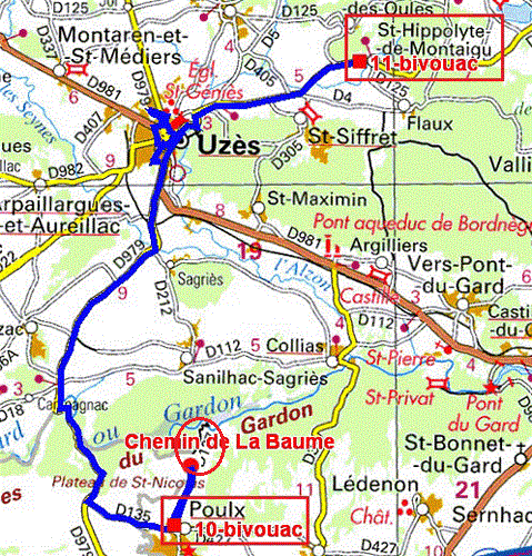
The GPS road tracklog
from Poulx to St-Hippolyte
from 2020/07/03 to 2020/07/03
Friday July 3, two kilometers from Poulx, I hiked to Gardon to see
the gorges. Then I went to Uzès,
here,
to visit the medieval old town. But before I looked for a
parking lot that was very difficult to find; I had to content myself
with getting on a sidewalk on the outskirts. I spent more than two
hours strolling from monument to monument through narrow streets.
The city is very clean and the buildings well maintained. I entered
the St-Etienne church whose facade is curvilinear and the interior
has a Jesuitic austerity. Then I approached the Duchy, a feudal
building, never destroyed from an unrestored period. Unfortunately
the visiting hours are very regulated. Opposite the 18th century
town hall has a beautiful interior courtyard. To the east, the 17th
century St-Théodorit cathedral was erected on the site of an 11th
century cathedral, of which only the circular bell tower remains
unique in France. The interior has beautiful ironwork and a Louis
XIV organ framed with painted shutters. I left town in the early
afternoon to park in St-Hippolyte in the cemetery parking lot.
click on the pic for opening the gallery
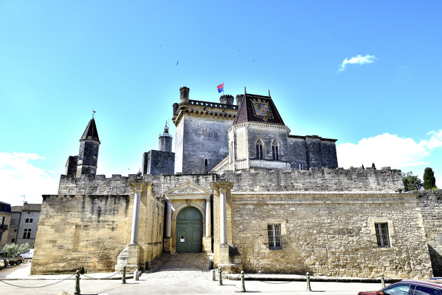
|
| Duché d'Uzès |
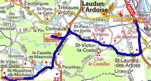
The GPS road tracklog
from St-Hippolyte to L'Ardoise
from 2020/07/04 to 2020/07/04
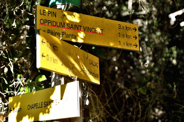
Saturday 04 July the morning was spent visiting the Oppidum of
St-Vincent de Gaujac. It was occupied from the 5th Century BC to the
6th Century AD. The ruins are difficult to access, only the outer
enclosures are perfectly visible. After the food supply at Casino
supermarket of St-Laurent-des-Arbres I found a peaceful bivouac
without tourists in the parking lot of Lpost Office of L’Ardoise.
The region is very windy on the banks of the Rhone refreshing the
atmosphere with a temperature of +30 to +34 ° C.
click on the pic for opening the gallery
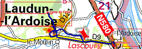
The GPS road tracklog
from L'Ardoise to Laudun l'Ardoise & back to L'Ardoise
from 2020/07/05 to 2020/07/05
Sunday 05 July I went to discover the 17 explanatory panels of the
art of the painter Albert André,
here,
in Laudun-L’Ardoise,
here.
My disappointment lived up to my expectations. I had two
pages of a pdf document published by the tourist office. The panels
are difficult to find. Neither a treasure hunt nor an obstacle
course, but a hassle at 33 ° C. Several times I inquired either with
the municipal police guarding the market or with a person met in a
bistro who showed me one of the signs, basta. I told him of my wrath
asking him to send it to the municipal council. At a time of digital
economy, the tourist office should make available to tourists a gps
file in international gpx format.
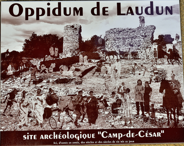
Then I headed for the
Laudun oppidum, called Caesar’s camp,
here.
Provence is very rich in archaeological sites from the
Roman and Gallo-Roman periods. It’s always a real pleasure for me to
discover the contribution of the Roman Empire and its urban
engineers. At the beginning of the afternoon I returned to the
solitary parking lot of the Ardoise.
click on the pic for opening the gallery
click on the pic for opening the gallery