The GPS road tacklog,
Clic on the pic for opening it
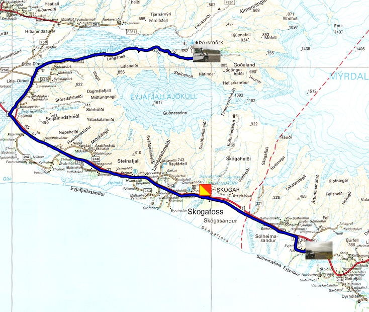
from Hvolsvöllur to Landeyjahöfn
from 2021/08/09 to 2021/08/09
Landeyjahöfn
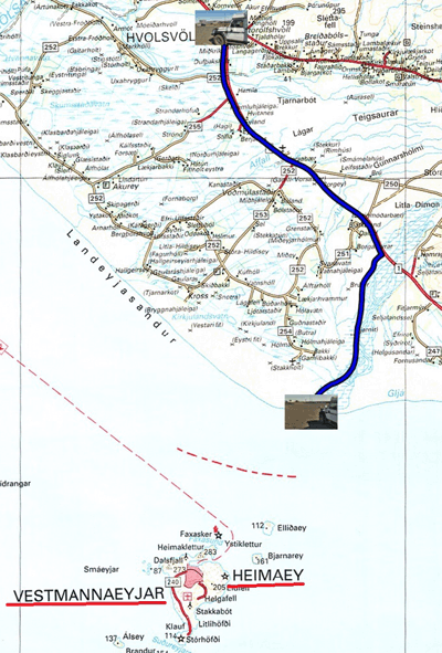
Monday August 9th began with a sleep-in until 7:00 am then a long
glance of revision of my truck before raising the bivouac around
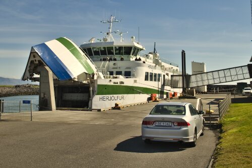
11:30 to calmly head for Landeyjahöfn at 30 km, ferry port for
Vestmannaeyjar, where I will embark tomorrow morning at 8:15 am for
forty minutes of crossing and for two days of visit of this small
island seriously damaged by a violent volcanic eruption in 1973. I
bivouacked on the huge parking lot by the sea.
 |
 |
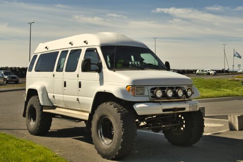
| To cross deep river |
The ferry to Vestmannaeyjar |
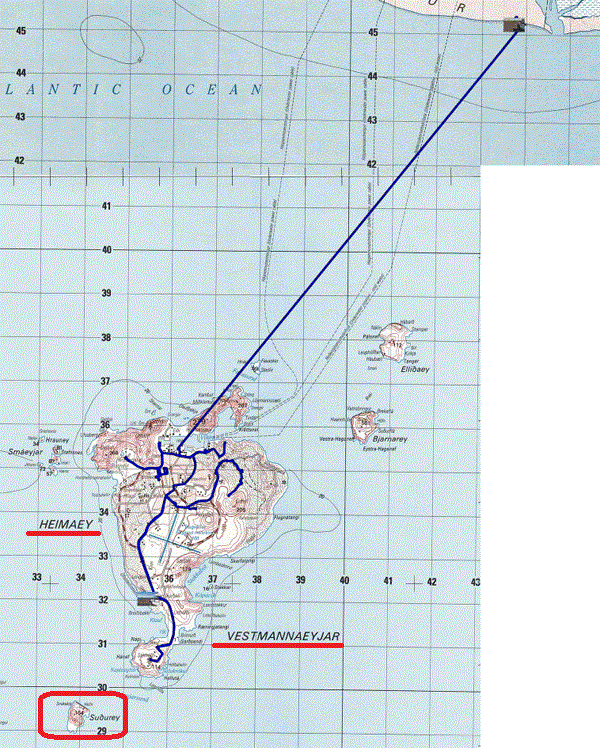
The GPS road tacklog,
Clic on the pic for opening it
from Landeyjahöfn to Heimaey
from 2021/08/10 to 2021/08/10
Heimaey-Island-1
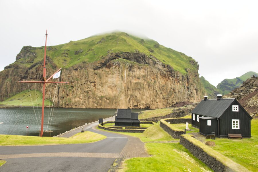
Tuesday August 10, the day of my 81st birthday, shortly before eight
o'clock I boarded the ferry to Heimaey from the Vestmannaeyjar
archipelago, whose Lonely-Planet has 4,500 inhabitants. The size of
the city and the many pavilions attest to a larger population. The
geographic and geological configuration is resolutely volcanic; I
recall that the island is located on the fault of the two tectonic
plates of North America and Eurasia. The recent emergence in 1963/67
of Surtsey Island during an underwater volcanic eruption attests to
this. I took my bearings while driving around town after
disembarking from the ferry. Then I went to explore the
approximately 8 km long island to the southern tip, Stórhöfði. I
approached the volcano, Eldfell, which caused the disaster during
its volcanic eruption in 1973. I was stationed at the foot of the
Cross, in testimony, looking dubiously at the track that climbs to
the top, it is no longer for me, moreover a strong wind swept the
ground, see the photo. I had spotted a bivouac area, a wild camp, on
my trip to the southern tip, and I headed there around 1:00 p.m. The
sun came out at 11:00 a.m.
click on the pic for opening the gallery
|
| Skansinn |
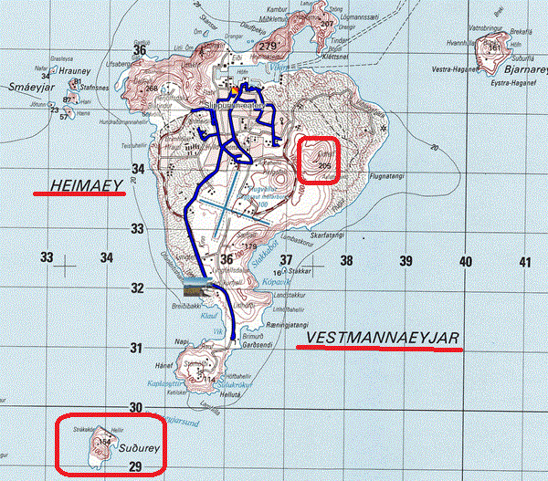
The GPS road tacklog,
Clic on the pic for opening it
from Heimaey à Heimaey
from 2021/08/11 au 2021/08/11
Heimaey-Island-2
Wednesday August 11, lazy day with a visit to the Eldheimar museum
dedicated to the eruption of the Eldfell volcano. The building is
built around a house that was excavated from lava. Interpretive
panels retrace the drama that occurred on January 23, 1973 at 1:45
am. More than 400 houses were buried under the lava. The city is
referred to as the Pompeii of the north. I spent a good part of the
afternoon at the Hot-pots before going to the Slippurinn eatery and
then returning to the Breidibakki bivouac.
click on the pic for opening the gallery
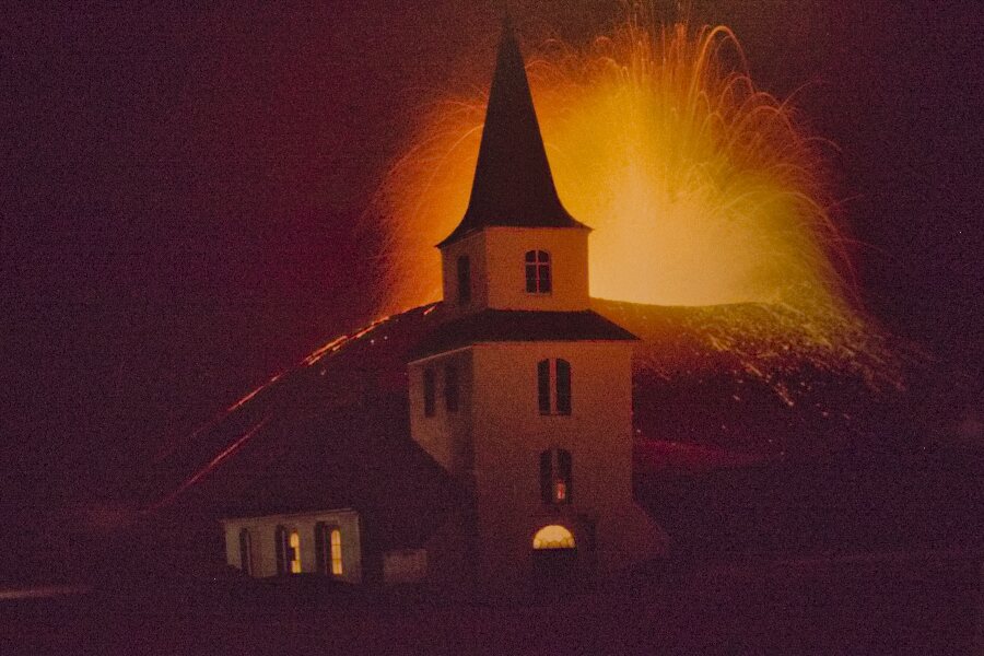
|
| Eldheimar museum, 1973 eruption |
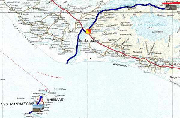
The GPS road tacklog,
Clic on the pic for opening it
from Heimaey to Þorsmörk
from 2021/08/12 to 2021/08/12
Þorsmörk
Jeudi 12 août je pris le ferry à 14:30
pour l’Islande. Je visitais la cascade Seljalandsfoss de 60 mètres de
haut, un chemin permet de l’approcher, trop de monde pour faire cette
petite randonnée. Je décidais de suivre la f249 jusqu’à Þorsmörk en
franchissant plusieurs gués. Le long de la route j’observais les
véhicules 4x4 que je croissais pour vérifier leur capacité de
franchissement. Ainsi de proche en proche j’arrivais à Þorsmörk vers
17:40. Bien sûr les paysages sont somptueux, mais le franchissement des
gués retint plus mon attention. La vidéo donne un exemple de rivière,
hélas la fin est tronquée par une erreur de manipulation lors de sa
confection, bien évidemment j’arrivais de l’autre côté. Je bivouaquais
face au village près de la passerelle piétonnière.
click on the pic for opening the gallery
|
| Seljalandsfoss |
|
|
| Crossing a river road F249 |
The GPS road tacklog,
Clic on the pic for opening it
from Þorsmörk to R1 Rest area
from 2021/08/13 ato 2021/08/13
Rest area
Friday August 13 (!) from 9:00 am, I left the bivouac of Þorsmörk to
take the back route from the day before, crossing the same fords
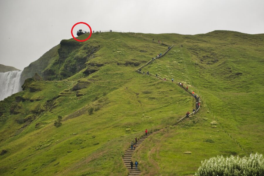
without apprehension. On the R1 road I was visiting the 62 meter
high Skogafoss waterfall, but I did not climb the stairs to the
observation platform, too steep and too many steps to go up and
down. The R1 road crosses a very cultivated plain of sheep grass,
therefore the search for a bivouac, wild camp, is uncertain. I
bivouacked at the end of a rest area, on wasteland, near the river.
click on the pic for opening the gallery
|
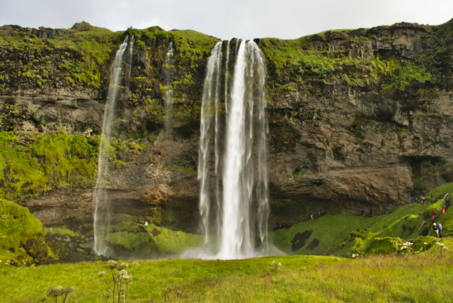
| Skogafoss |
The GPS road tacklog,
Clic on the pic for opening it
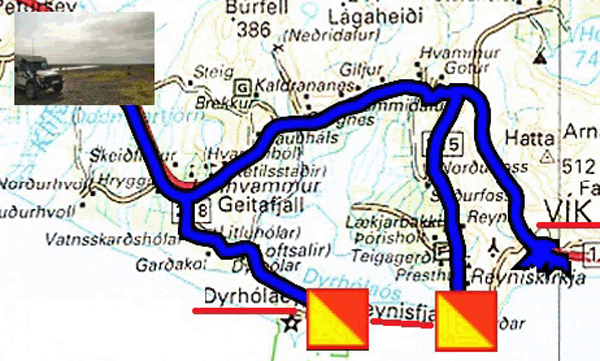
from Klifandi river-rest-area to Klifandi river-rest-area
from 2021/08/14 to 2021/08/14
Klifandi river-rest-area
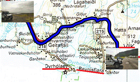
Saturday August 14th I visited the surrounding sights. Dyrhólaey is
a rocky plateau with arches carved by sea erosion, wind and climatic
changes for millions of years. But the highlight is the last colony
of shearwaters before their migration from August 15th. I love this
little bird that has charming attitudes, I enjoy tracking them down.
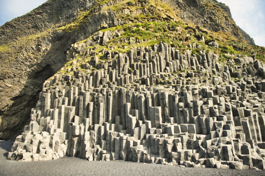
Further on Reynisfjara Beach of black sand attests to its volcanic
origin as well as its basalt columns where unfortunately individuals
with a basic IQ make clowns on the columns for selfies, human
stupidity at any age has no limits. I was very patient in taking a
picture, poorly framed, without a clown. I jumped over to Vik for
some supplies before heading back to the klifandi river bivouac.
click on the pic for opening the gallery
|
| Reynisfjara Beach, basalt columns |
The GPS road tacklog,
Clic on the pic for opening it
from Klifandi river-rest-area to Vik
from 2021/08/15 ato 2021/08/15
Vik
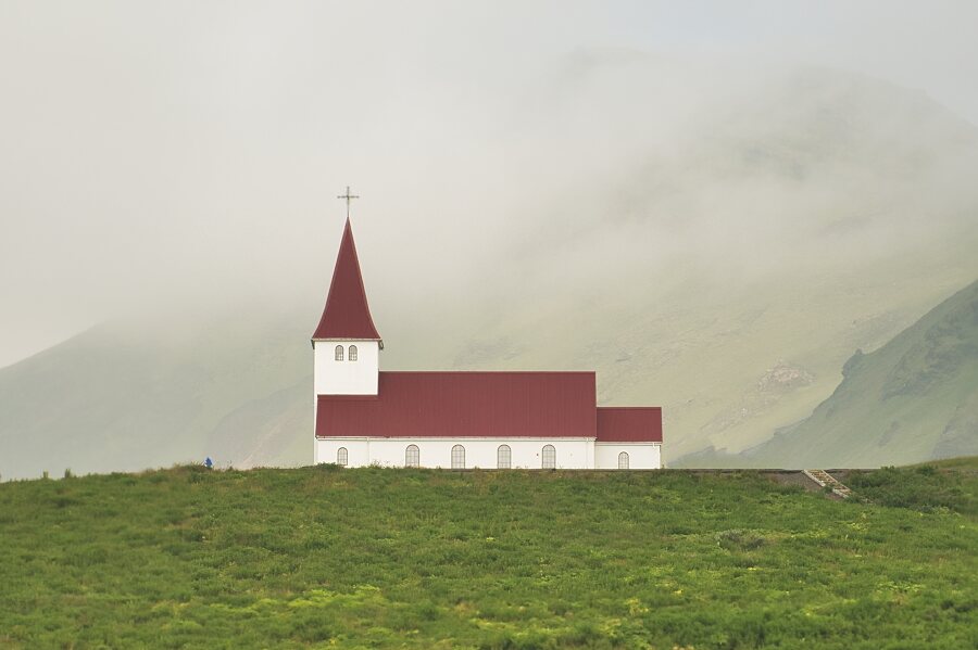
Sunday 15 August I stayed until the beginning of the afternoon to
prepare the journey of the next days. I'll go to Vik to wasch my
truck and make the full diesel. I visited the Vikurkirkja and I had
the privilege of attending a rehearsal of liturgical songs. I'm
bivouacking on a parking lot.
click on the pic for opening the gallery
|
| Vikurkirkja |