-- Leh, Nubra valley
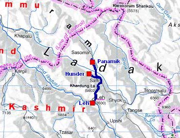
The road tracklog
Nubra valley
from 22/08 to 26/06/2007
Arrived in the afternoon of the 20/08 in Leh, I went to a cybercafé for the publication of my website. Alas the connection was cut. The next morning, the connection was established but very slow, moreover the script of the update was refused! In the end of the morning I met Marc, the German traveller of who I had made knowledge in Islamabad. We dined together to again exchange our projects for a possible meeting somewhere in Southeast Asia. The day was devoted to the purchases of food and to the filling of the water tanks. Then I obtained the necessary permit to visit the Nubra Valley. I had found an agency which agreed to sell me this permit for one person to at the price of 100 INR for seven days – Shanti Tours & Travels- (see menu Information).
The 22/08 it took me three hours to reach the Khardung-La at 40 kilometres from Leh of
which approximately an hour of stop to release the road of a landslide with
pulling of mine. The altitude of the pass given by map is 5602m high, the
Russian digital map gives 5364m and the GPS that day indicates 5373m. The area
called Nubra valley is composed of two valleys, that of Nubra River and that
of Shyok River. I went up Nubra River up to Panamik last village authorized by
the permit. The weather was been overcast and the landscape was arid. The
valley is broad and the river is not very important. In spite of the
statements of the LP it is not a flowered valley. Nubra valley is not Hunza
valley on the KKH.
I found a bivouac by taking a track at the milestone 6km before Panamik which
leads to the foot of a hill behind which is hidden a charming small salted
lake. I stayed two nights there to take one day of rest.
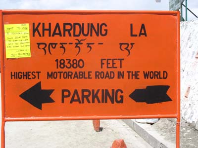
Allegations!
Khardung-La
the 22/08/2007
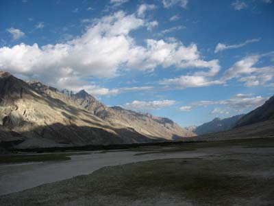
Nubra valley
Panamik
the 23/08/2007
In this 24/08 weather was not better; I left Panamik to Hunder, last village authorized by
the permit in the valley of Shyok. On the way I visited the monastery of
Samstemling having some beautiful thangkas. The road is at the milestone 25,
2km before Sumur. It is asphalted up to a small carpark in front of the
monastery. In Diskit I stopped at the bazaar to make food purchases. Then in Hunder I found a bivouac in the sand dunes near the camel’s park of Camel
Safari. I remained two nights there.
The visit of Nubra valley represents a way outward and return from Leh of
approximately 350km. It offers little tourist interest if it is not to have crossed the highest
motorable pass in
the world and to have been at the most septentrional allowed point in India close to
the cease-fire line with China!
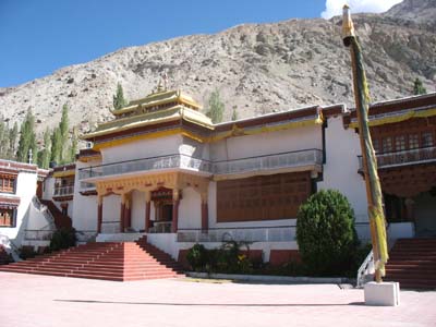
Samstemling Monastery
the 24/08/2007
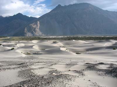
Sand dunes
Hunder
the 24/08/2007
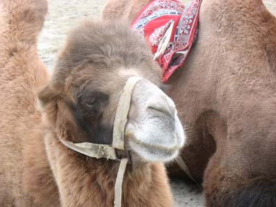
Camel
Hunder
the 24/08/2007
I went back to Leh the 26/08 by the same road crossing again the Khardung La which is always at a GPS altitude of 5373m high. The landscapes are dramatic, mineral desert.
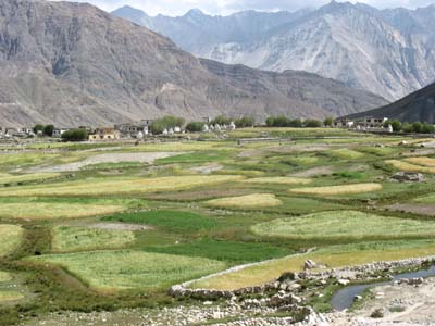
Mosaic farming
Khardung
the 26/08/2007
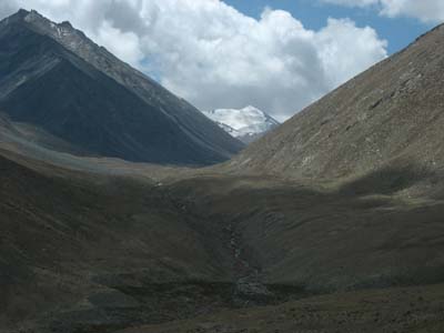
Landscape
en route
the 26/08/2007
The following week was dedicated to visit Pangong Lake and Tso Moriri on the move to Manali.