-- The road to Manali
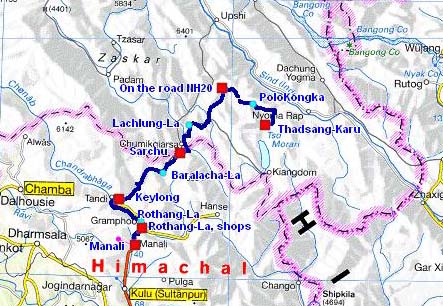
The road tracklog
from Thadsang Karu to Manali
from 03/09 to 07/09/2007
The 03/09 I left the shore of Thadsang Karu after having greeted the monks. I went again in opposite direction the metalled road up to the junction to Thukje. It then becomes a track with a rather bad surface quality, holes and corrugated sheet. I crossed the pass of Polo Kongka at a GPS altitude of 4966 meters high. Along the road workmen broke rocks to prepare it in view of its asphalting. At the end of the morning I stopped little before Thukje to publish pages of my website by the satellite modem. The only interest of the hamlet of Thukje is to have a pump drawing water in the ground water. I filled the tanks. Arrived on the asphalted road from Leh to Manali I bivouacked at its proximity at an altitude of 4659 meters high.
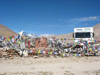
Polo KongKa
the 03/09/2007
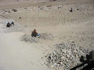
Rock brakeage workmen
the 03/09/2007
The following day was one day of driving on the NH20 from Leh to Manali. It crosses the Mounts of Zanskar then the Himalayas before going down to Manali. I drove 120 kilometres in six hours stops deduced in a fairy-like landscape by crossing the pass of Lachlung La at a GPS altitude of 5085 meters high. During all this day on a narrow road with a degraded surface I dreamed of a roadway with the European standards to appreciate the landscape, succession of gorges, peaks with glittering colours. Since I left Leh, I was at an average altitude of 45OO meters high with passes over 5000 metres high.
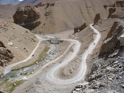
Gorge
the 04/09/2007
The 05/09 was still a day of driving which started on a bumped road in a dramatic
landscape. Alas that did not last a long time. The up hill of the pass of Baralacha
La, 4927 meters at the GPS, was a bravery bit. Then the down hill was done on
an entirely new surfacing roadway. But after a few kilometres the road became
an abominable track. One strong moment on this narrow and very degraded with landslides and works in progress
road was the passing of buses and tankers. On several occasions the wheels of
my truck were at a few centimetres of the ravine. One of the advantages of the
left-drive truck is to be able to drive to nearest. Moreover I was brought to
get out several times of my truck to recall to tanker drivers the rule of the
priority to up-hill vehicles, «Give a way for up hill traffic», obliging
sometimes drivers to move back.
I bivouacked in Keylong at the Bus Stand. The main street is a multitude of
shops and guesthouses.
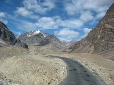
Day start
the 05/09/2007
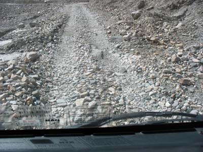
Towards the Baralacha La
the 05/09/2007
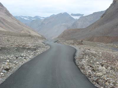
Afterwards the Baralacha La
the 05/09/2007
The following day I moved towards Manali. I put 4:50 to drive the 69 kilometres from Keylong to Rothang-La, 3983 meters of GPS altitude. I bivouacked on the southern slope in front of the tourists shops.
The 07/09 I discovered while getting up that there was a Dutch truck close to me. We made
knowledge and we exchanged information. They went to Leh.
The 53 km from Rothang-La to Manali were drove in four hours. I met Johann
Pavia, treks operator in Manali (see menu Information). He gave me useful
advice to visit Spiti and Kinnaur valleys. I bivouacked on the Mall opposite
the Piccadily Resorts.
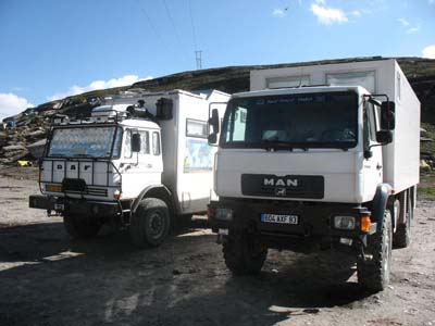
Two trucks
le 07/09/2007
The following weeks were dedicated to Spiti and Kinnaur valleys.