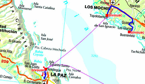
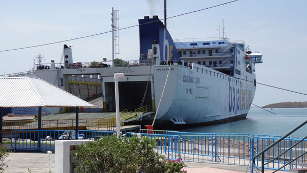
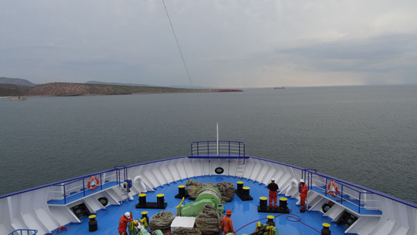
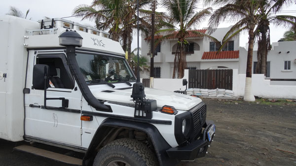
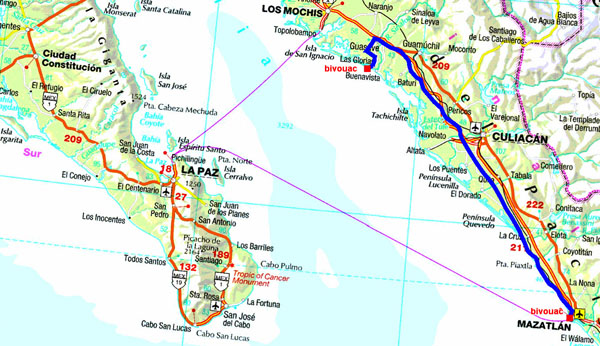
On Monday morning I returned to Paz to find a bar with a WiFi connection to publish my website. I found it close to the Tourist Information. Then I went in search of a shop to fill my tanks with drinking water. It is located at Calle Delta, for the moderate amount of 20 pesos. Although it was very early I went to the port of Pichilingue for the procedures of customs which were dispatched quickly. Indeed my passage on Saturday had been recorded. One of the customs officers used a Smartphone to obtain information then it required of me to press on a button of a limps which posted in green: Pase. The customs officer made me understand that I could go! After the payment of the harbor tax of 153 pesos I stationed my truck then I waited until the loading at 13:30. The ferry left the port on time and arrived at Topolobampo at 21:30. I unloaded then I found a bivouac in a parallel street while leaving the port vis-a-vis a Pemex service station. It was 22:00. After sending of my position by HF to winlink.org I lay down around 23:00, good night, a little noisy.
 |
 |

|
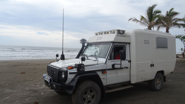
Although to lay down very late, on Tuesday September 2th I was awaked with the dawns. The Pemex station opens at 6 a.m. I did the administrative job not carried out the day before. Then I left for Los Mochis, town of +260,000 inhabitants. My target was to find the Tourist Office, because Lonely Planet does not mention it. I wandered in this big city with quadrangular streets. Nothing, moreover the natives don't know it and th police, as usual, when one needs it, it is not there. Moreover to circulate, there is nothing to see what explains why it is untraceable, if there exists. I had located during my research Walmart; but I did not wish to bivouac on the carpark. At the beginning afternoon I took again my road to find a beach, why not Las Glorias. Of course not mentioned by a map. It was necessary to ask the autochtones who with much kindness informed me. During my way a small rain refreshes the heavy atmosphere. The beach is of black basaltic sand and villas on seaside all unoccupied and were protected by sandbags against possible tsunamis.
 |
 |
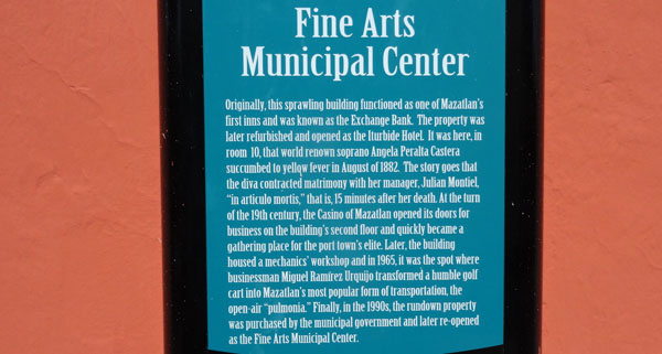
I wished to be in Mazatlan on Wednesday, September 2d for a short visit of the old city. The distance is of 390 km by highway of which the speed is limited between 60 and 110 km/h. The autopista is with toll, 407 pesos i.e. 22€. Old Mazatlan is registered in a very narrow quadrilateral and understands: Plazuela Machado, and its shops as well as Teatro Angela Peralta transformed into Art Gallery. Further the cathedral masked by the trees of Plaza Principal offers two yellow tours and a spectacular interior. Finally Central Mercado presents shops of clothing, fruit and vegetables, as well as butcheries and fish shops. My visit lasted approximately 1:30 under 38°C of temperaturein the shade. Shortly after 17 hours I took again the truck to stop on a grassy carpark not far from the seaside.
|
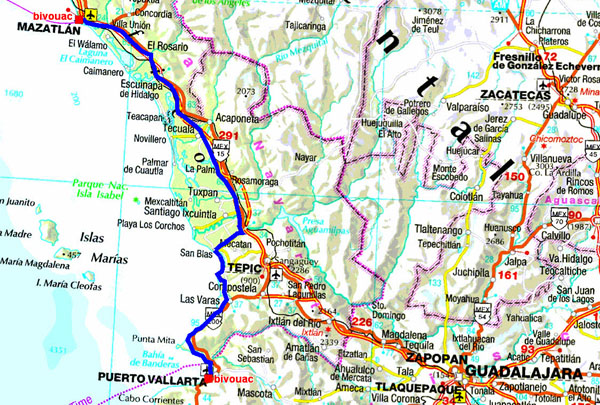
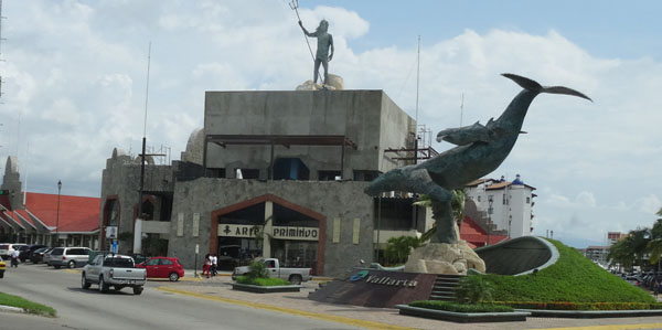
On Thursday, September 3rd was still a long driving day to reach Puerto Vallarta. In Mexico as in the USA the distances are large. After a two-track autopista but with toll! The last 170 kilometers were in the mountain with crossings of villages with several topes and vibradores. I entered Puerto Vallarta, approximately 280,000 inhabitants, by broad avenues and finally by quadrangular streets and with one way in Old Town ranging between Morelos and Juarez around Plazza Principal dominated by Templo de Guadalupe. The aficionados of Puerto Vallarta praise the various beaches of the north and the south of the city dominated by steep mountains. The city is in the time zone of the center of Mexico, + 1 hour. I bivouacked at the edge of the road #15 in the south of the city.
|
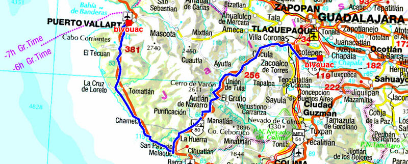
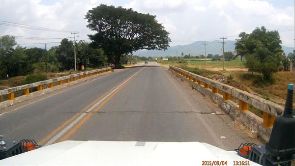
On Friday, September 4th was still a long driving day in the mountain; admittedly splendid but oh how much painful when it is necessary to wait in a long queue of vehicles blocked by trucks panting in the road without possibility to pass. Sometimes sumptuous trees lined the road and are cut by the trailers of the trucks giving the aspect of a vault as I had already seen in Indonesia. I had chosen to bivouac at the edge of the Lake Chapala, at 1550 meters of altitude, close to Guadalajara. But I gave up the access to the bank it is almost impossible and in addition the number of topes marking out the road aggravated me then exasperated me at such point when I saw a Walmart I decided at once to have there overnight with the agreement of the employees cleaning of vehicles on the carpark.
 |
 |
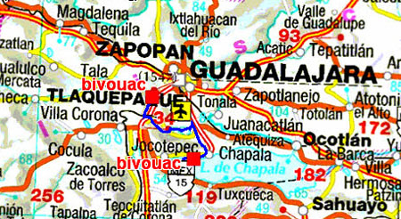
On Saturday, September 6th I took the road opposite the Walmart to go to Guadalajara. For years ago I had found a RV Park in San José del Tajo at 15 km southwards from Guadalajara whose access while coming from the south by the #15 is not easy it is necessary to find a retorno or a bridge to take the #15 in the North-South direction. The RV Park is at the end of a gravel route! Guadalajara is at the GPS altitude of 1657 meters. The temperature was of 28°C at the zenith. From Guadalajara the journey traverses in the disorder a trip made in August 1984, here, with my ex-girlfriend and her son Philippe.
Guadalajara is the second city of Mexico with nearly 2 million inhabitants. The day before, on Saturday, I had ordered a taxi for 9 a.m.; it arrived on timer. I was thus in Centro Historico around 9:30 to visit it. It is understood in a quadrilateral limited by Avenida Independencia, in north and Moreno in the south, in the west by Colion and in the east by Belén, with in the prolongation of Morelos Instituto Cultural de Cabanas. The historical buildings are surrounded by four Plazzas giving an unforgettable prospect on the cathedral's domes. The buildings have also a quadrangular shape enclosing of the raised patios. Incontestably the highlight is consisted with the murals by Miguel Hidalgo in the monumental staircase of Palacio de Gobierno and the murals by Jose Clemente Orozco on the first floor. Instituto Cultural de Cabanas in the invalids home built in 1805 by the bishop don Juan Cruz Ruiz de Cabanas exhibits other murals by Orozco. My visit lasted approximately five hours. I took again a taxi to return to the Trailer Park to do the administrative work!

|