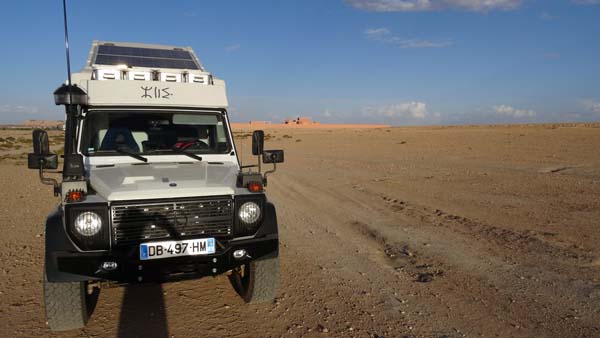
Oriental Morocco
Ra Track
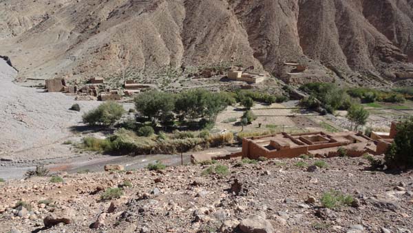
After having found the km 0 of the Ra
track I establish my bivouac there and
I began my daily work of the evening.
But around 17:15 a fellow well raised,
well equipped and being expressed in
good French asked me for my safety to
follow him to spend the night on a car
park in the city. Of course I
discussed his proposal bitterly, but
in front of his courteous insistence I
was agree. He was the first deputy
mayor of the city! I spent the night
on the car park of the Afriquia
service station.
 |
| Bivouac km 0 |
As of the daybreak I left Afriquia to
join again the Ra track Ra km 0. I
began the progression on a track along
the Charef Wadi when an indigenous 4x4
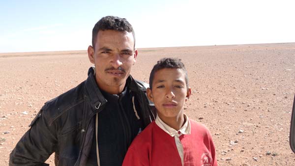
caught up to me and asked me to stop.
The driver was expressed in English
and asked me where I went and if I had
a map. I showed him my computer and
the Gandini guidebook. He answered me
that he knew him and thanked me good
trip in Morocco. The man had a
beautiful imposing presence and the
appearance either of a tourist guide
or of a good Samaritan for tourists or
of one…, but it is another story. The
day was announced mild and fresh in
the desert. It was my first experiment
of progression alone on track and
off-track. Quickly with my
technological prostheses I took active
insurance from waypoint to waypoint
either on track or off-track drawing
on the next waypoint according to the
GPS compass. Around 12:30 some clouds
accumulated and a strong rain
accompanied by hail fell down on the
track, Peuh! The storm lasted half an
hour when I arrived in front of the
only tree of the area. I must
recognize that the progression alone
in a sumptuous desert landscapes is
filling with enthusiasm and, I could
think of the discoverers in the
beginning of the 20th century, what a
splendor!
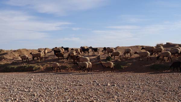 |
 |
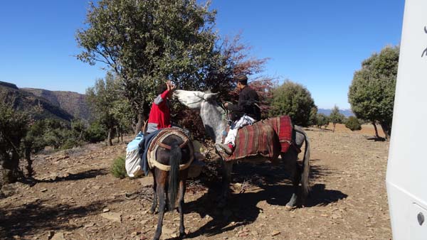
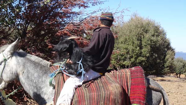
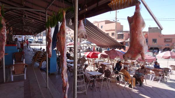
| Sheepherders in Oued Charef |
|
|
| Ra track, hail on the track |
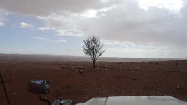 |
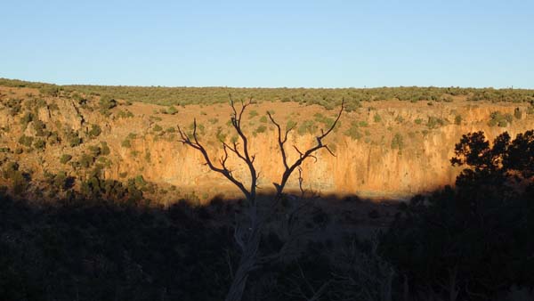
| It rains, a tree! |
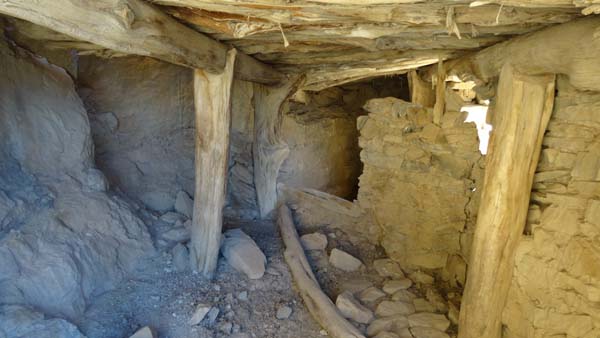
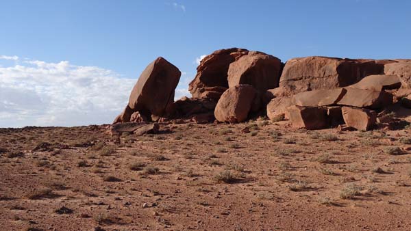
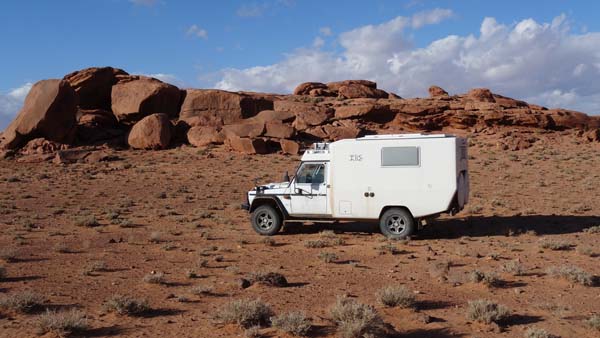
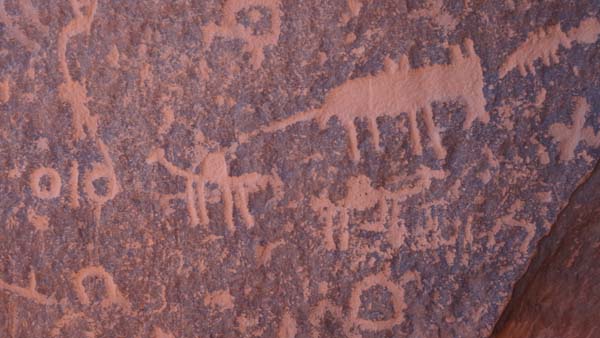
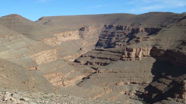
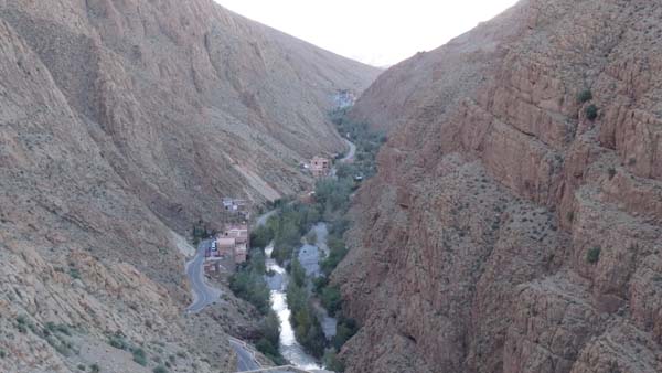
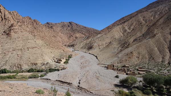
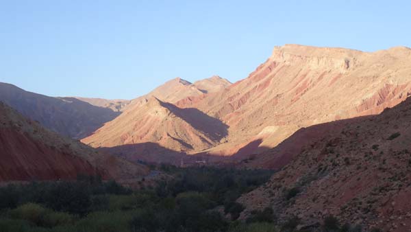
The Grand Ghilen
I arrived at the km 238, the Rocks of the
Grand Ghilen discovered in 1914 by E.F.
Gautier. It was 15:15. I decided to
establish my bivouac there and going to
look for of rupestral engravings.
 |
 |
| Rocks of Grand Ghilen |
 |
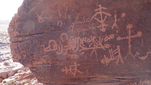 |
| Rupestral
engravings |
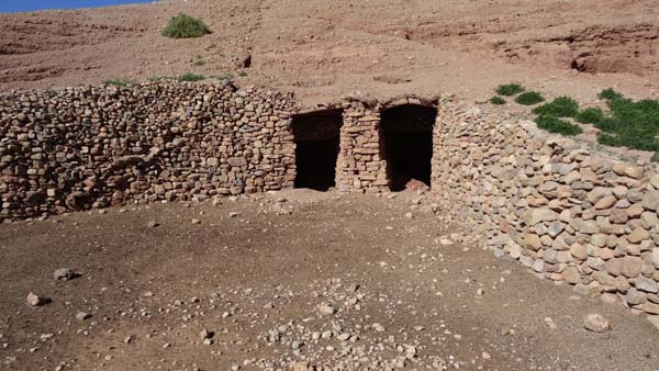
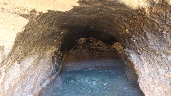
Bordj Ali ou Hadid
My first visit on Tuesday morning was
to go to find engravings rupestral at
Bordj Ali or Hadid in off-track. But I
looked for the flagstone with
geometrical engravings vainly.
 |
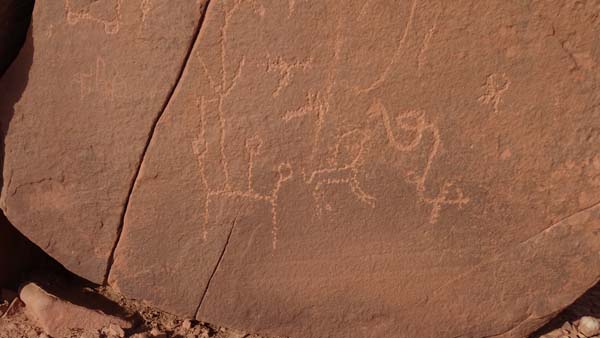 |
| Rupestral
engravings |
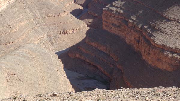
Rb track
Then it was the progression on the
announced Rb track : "...nice and easy…" Alas
such is not my opinion. Because I had some
difficulties on
two occasions. The progression in the bed of
the Sebkha Wadi was to stop by a guelta, it
was impossible for me to leave at the given
waypoint (km 21.5) It was necessary to go up
on bank and to look for further go down again
to take again the progression according to the
guide. Gandini is fond of the bed in Wadi! The
second galley was the progression in off-track
from the km 50 to the km 68.2, it was a
succession of gullies at the bottom side of
Jebel Mahrech of which some very deep
requiring the search for a possible passage.
In one of these gullies, the departure angle
of my truck was too small, the back carried. I
due to embank with rocks under the wheels to
release it. It took some time… The climatic
conditions dig the gullies each year, Gandini
would owe the knowledge. Moreover there is no
possible to exit it is necessary to progress
during 18.2 km. Several times my truck related
to the banks of the gullies. I hope without
damage. Mow, I stopped to bivouac at the
monument Estienne, km 113.2.
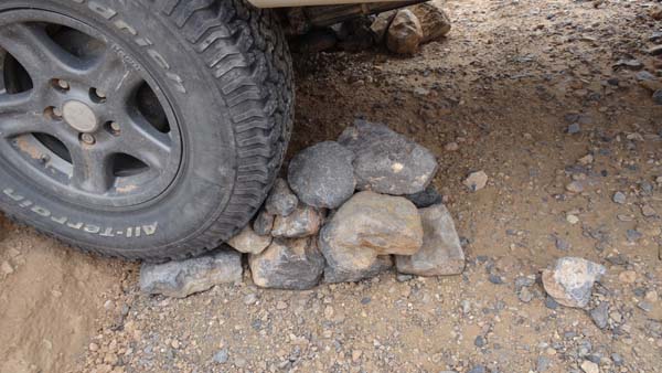 |
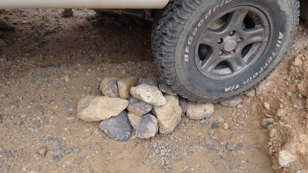 |
| Departure angle,
too small ! |
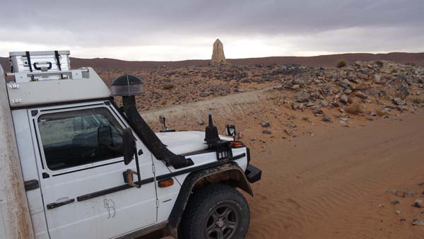 |
| Monument Estienne |
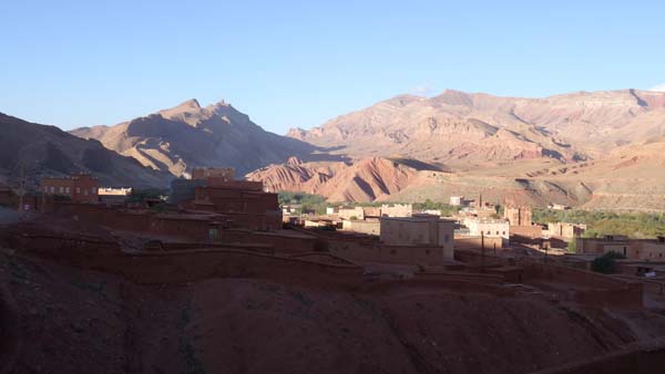
Middle Atlas
Midelt
The morning of the Wednesday, November
5 started with the completion of the
progression on the Rb track from the
Monument Estrienne km 113.2 to the km
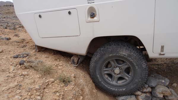
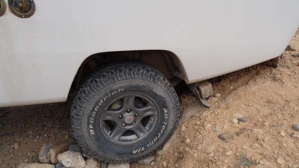
141. But before the departure I made a
visit of my truck as well as lower
parts to make the inventory of the
damage on the Rb track: number plate
postpones torn off like its fires of
lighting, rear lamps left guard HS
although the indicator functions
(LED), bulb night light of the
headlight before left HS, in lower
part the gray water tank embossed in
hollow with a small leak. The track was in very bad
condition by place making it painful.
I persist the Rb track is not nice nor
easy. Then it was tarred road in very
beautiful landscapes up to Midelt.
While there arriving I warned a
policeman to ask him where I could
have made a number plate because that
of the back had been torn off at the
time of the passages of the many
gullies. I found the shop whose
employee tells me that he was used
making foreign plates for the 4x4
coming from the tracks! At the
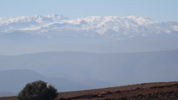
beginning of afternoon the sky darkens
followed by a violent storm. On the
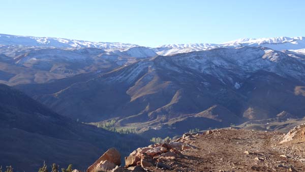
way I live that the tops of the
mountains of the Middle Atlas were
covered with snow. The tracks Ca and
Cb are in altitude up to +2000 M. On
the way towards the km 0 of the Ca
track I were taken in a snowstorm at
1760 m of altitude. I did not think
that snow fell at the beginning of
November at this latitude. I decided
to give up the Ca tracks and Cb and to
re-examine my road plan.
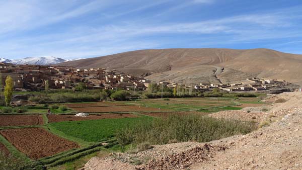
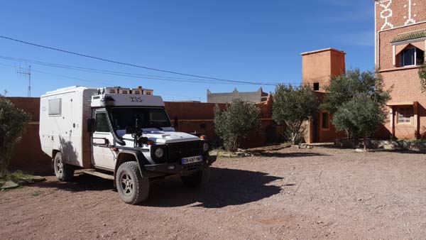
Attics on Aouchgal cliffs
La track
The night spent on the carpark of the
restaurant was peaceful and safety.
Indeed the royal gendarmerie spent the
night to control traffic at the
crossroads and the restaurant was
enlightened all the night. I moved
towards the km 0 of the track of
Cliffs of Agouchgal without much
conviction in view of pouring rain and
snow during the day before. But the
day was sunny. At the km 8.6 I have
the surprise to find an arrowing for
the visit of the attics and a
practicable track although very muddy,
cf photo. Altitude lie between 1800 &
1900 m. Whereas I took the track
through fields to see the attics
downstream I were join by a fellow
which prohibits to me to progress, was
the peasant of the fields which I
plowed? I turned back. At the carpark
announced by Gandini of the attics
upstream, there were three teenagers.
For the safety of my vehicle I gave
them 20 MAD while making understand to
two of them to keep an eye on my truck
and with the third to be used as guide
and, as hostage for the case where.
The descent towards the track for the
visit is embarrassing then practicable
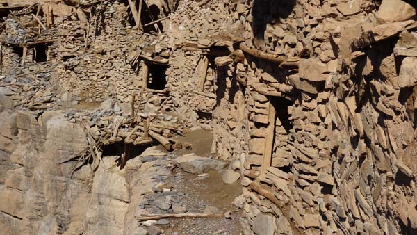
on the layer towards the attics which
are small houses out of dry stones
leaned with cliff. Their state is very
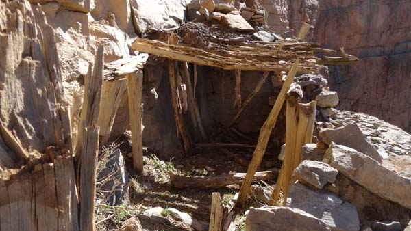
degraded if not in ruin. They were
used by the members of the tribe of
Aït Abdi to store grains, wool, and
other provisions. I left the carpark
around 12:00 to find a place peaceful
to lunch. The site was enchanter vis-a-vis
cliffs with far the mountains caped
with snow, after reflection I decided
to bivouac there risking problems in
the event of bad climatic conditions
tomorrow morning. One afternoon of
rest under the sun at 1900 m of
altitude by 7,5°C was always good to
take. Ah I forgot, I tasted a second
broad portion of the ragout of chamois
by Christophe accompanied by beans of
Saint Eloi.
 |
 |
| En route |
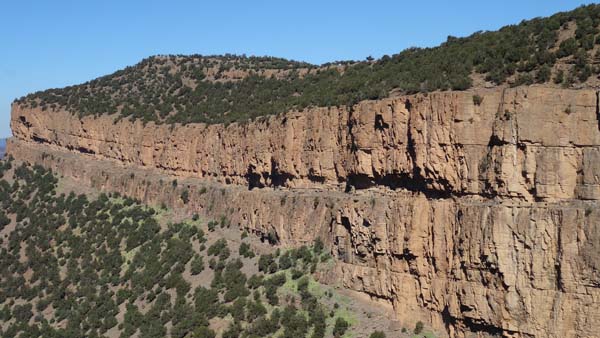 |
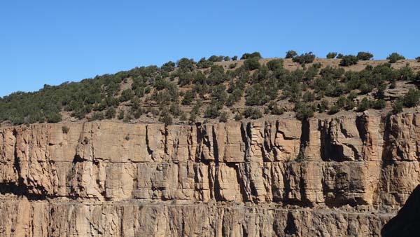 |
| Cliffs |
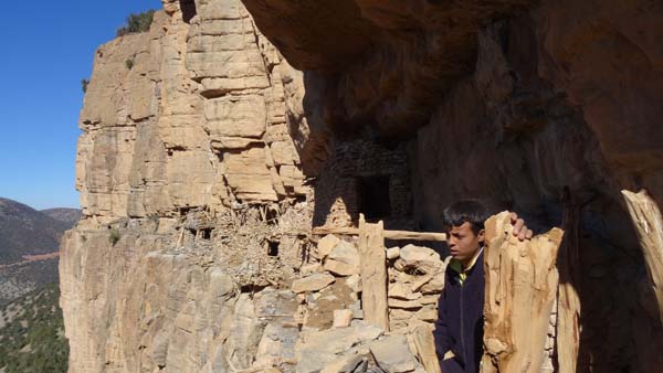 |
 |
| Attics & my guide |
 |
 |
| Meet at the
rest |
 |
 |
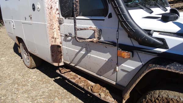
| State of my truck
at the bivouac, need for expander
of wing |
Lb track
On Friday morning around 7:00 I left
the bivouac in front of a fairy-like
spectacle. The km 0 of the Lb track is
at the ford of the Attach wadi that it
is necessary to cross with in entry a
deep gully. Gandini like to progress
in the bed of wadis and to jump
gullies. I already gave, it is enough:
“The wise man knows his limits”
by
Clint Eastwood.
The main track starting from the
forest house of Tasraft is full south
thus a priori towards Taghzout. I
traversed it by noting on the digital
map that it was in the right
direction. It was thus well a track of
fold avoiding the progression in the
wadi. Indeed I caught up at Taghzout
to take again the progression of the
Lb track. It was very muddy and
dangerous in the descents and the
turns, my truck drove out back!
Finally I arrived at good port at
Tassent by finding asphalt.
 |
 |
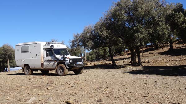
| Landscape at early
morning |
|
|
| Lb track, in low angle light |
The High Dadès
N track
Then it was a stage of connection by
Imilchil and Agoudal to join the N track in
High Dadès contrary to the progression
suggested by Gandini. The track develops
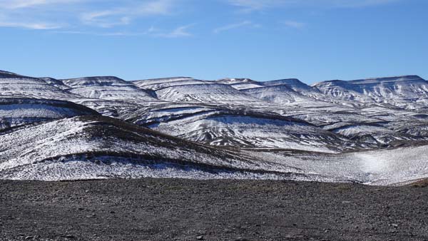
between mountains varying from 3000 to 4000
meters of altitude in quasi desert landscapes
without snow on the track, and it is so much
better for me. Moreover the track is very well
marked and no muddy. I arrived rather quickly
at Msemrir but alas without meeting sites of
bivouac so much the track is narrow. Then it
is an asphalt road up tol Boumalne of Dadès.
Phew, an about flat spot not far from
the road, I establish my bivouac there.
 |
 |
| Jebel Arhen Bou n'Ouerz,
Summit of Tizi n'Ouerz |
 |
 |
| The High Dadès |
 |
| Msemrir |
En route to Boumalne
du Dadès
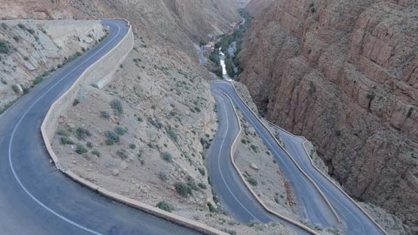 |
 |
| Downwards in the
Dadès gorges |
The Mgoun
Ma & Mb
tracks
Saturday, October 8 was a small
driving day on road and track. I went
down from The High Dadès by the gorges
up to Boumalne of Dadès to fill the
tanks with diesel. Then I went to
Kelaa of Mgouna to traverse the Ma &
Mb tracks. The track Ma is asphalted
up to the km 34 and Mb up to the km
9.9 tracks. The DPM must be very
disappointed, (DPM = devourer, taster,
discoverer of Moroccan dust and
landscapes, dixit Gandini!).
The last 10 km of track to arrive at
Aguerzaka curiously pointed out me the
desert landscapes of Ladakh which I
had traversed in a former life in
trekking then with my MAN truck.
Houses are in adobe as in Ladakh, the
same causes produce the same effects
at several thousands of kilometers. I
did not wish to make the trek
suggested by Gandini. On the other
hand I asked for the authorization to
have rest on a spot, it was refused. I
took again the track back to bivouac
further.
 |
 |
| Sheep-folds dug in
the mountain |
 |
 |
| Village Aguerzaka |
Back to Boumalne du Dadès
On Sunday, November 9 I treturned to
Boumalne of Dadès to establish the
bivouacat the camp-site Blue Sun in
the courtyard of the Hotel, not very
amusing. Moreover there is no
connection to screw on the water louse
taps to fill the tanks. A strong wind
rose around midday accompanied by
rain.
 |
 |
| en route |
 |
 |
| Boumalne du Dadès |
 |
| Camping Soleil Bleu |
Last minutes
Red light left guard
It was the fuse n°1!
I had not thought at the fuses. What
led me to control them it is a strange
phenomenon. I emit as amateur radio on
14,000 frequencies to send the
positions reports to winlink. I
noticed that one of these frequencies
made function the centralized door
close. Today this phenomenon it is
repeated several times during the
emission of the message. Finally I
checked if the centralized door close
functioned, well not. At this point in
time I thought of the fuses and I
discovered the fuse N°1 is out. I must
say, except knowing German, the
description of the use of the fuses is
obscure. But no fuse is seems it
causes for the centralized door close
that thus does not function any more.
It is not essential but it is
handicapping for the future and the
use of the frequencies amateur. I
cannot if Mercedes and/or SudCom,
fitter of the radio operator amateur,
would have an opinion on the subject,
to follow.