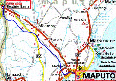
The GPS road tracklog
from the border ZA/MZ to Maputo
from 2018/012/06 to 2018/12/07
Mozambique is presented by Wikipedia,
here
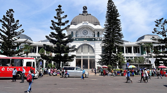
Maputo
Friday, December 7 with Lonely-Planet in hands I went on a tour of
Baixa, old downtown area. The fort, fortaleza, were built by Portuguese
in the middle of the 19th century. It is a high wall vis-a-vis the
Indian Ocean with some bombard but without building inside
except in support of the wall whose rooms are
occupied by an exhibit of very interesting
photographs. Then while going along the ocean I moved towards the
surmounted railway station by an elegant dome.
The sides of the station recovering the rails were designed, at the
request of the local architect, by Gustave Eiffel which never went to
Mozambique. On way I admired some beautiful
frontages of buildings of the colonial time. I arrived at the municipal
market with its long displays of fruits,
vegetables, and seafood. Shops exposed wigs for woman, one of
them was let photograph.
While continuing my visit under the burning sun, I passed beside
many old buildings in a state of advanced ruin. The vast place of
independence, Plaza da Independéncia, is bordered
with buildings of the Portuguese colonial time whose most
outstanding building is the solid mass of
neo-classic style city hall
preceded by a gigantic statue. The iron house, casa
ferro, was designed by Gustave Eiffel as
house of the governor. Its metal outside is unsuited to the tropical
climate, attesting that Gustave Eiffel never put his
foot at Maputo! Some paints are exposed in the rooms. The imposing white
cathedral dates from the middle of the 20th century. Inside an
interesting high altar and sumptuous stained glasses. A crib was under
installation for the nativity of Jesus. Afterwards many questioning I
found to buy a postcard but the research of the Post office was also a
piece of bravery and obstinacy so much the
inhabitants of Maputo were ignorant of its localization; moreover the
absence of customer inside attested of
its non-utilization. On
way I admired a pretty gate of Tunduru Garden. Back
to the hotel I pushed further to see the splendid frontage of manuelin
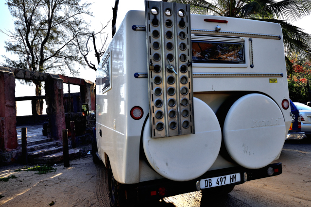
of Natural History Museum. My truck was parked in the street in front of
the Base Backpackers in 24:00 /24 guarding.
Maputo is the most big city of Mozambique. The
architecture of the apartment buildings in the
peripheral attests political regime after independence and their
frontage testifies to the tropical climate. It is typically orthogonal
city. The 100 pages of Lonely-Planet devoted to Mozambique are
poor. Maputo will not leave me an imperishable memory
click on the pic for opening the gallery
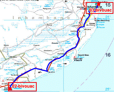
The GPS road tracklog
de Chidenguele à Ponto da Barra
du 2018/012/09 au 2018/12/10
Ponto da Barra, Lighthouse
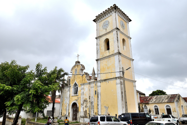
Sunday, December 9 I traversed +200 km to reach Inhambane where I
visited the two sights mentioned by the LP.
The cathedral Nossa Senhora de Conceição dating from the end of the 19th
century; alas in quasi ruin and inaccessible. I noticed on the high
pediment a beautiful image of the Virgin Mary carried out in azulejos
coming from Portugal. While continuing on the road of the waterfront I
arrived at old the mosque dating back to 1840 when I was accepted by
bearded with shaven skull muslim. I discovered
the old unused train station whose architecture testifies to
the political regime during its construction, as well as an engine of
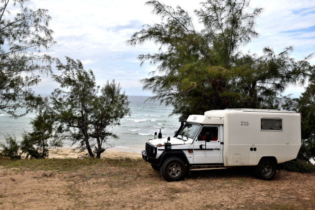
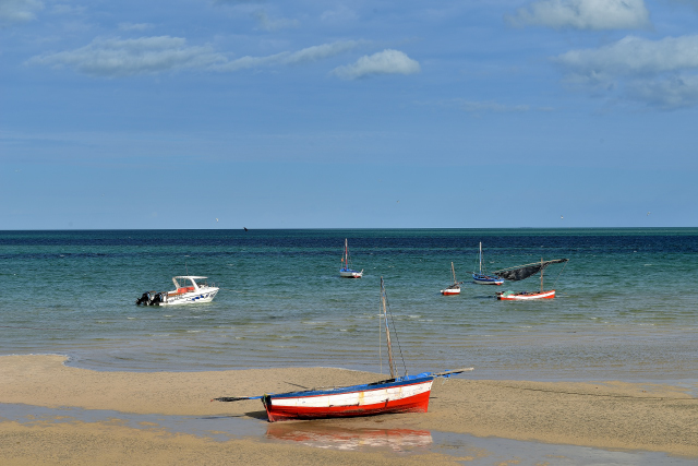
1897. Finally afternoon I rolled on the sand beach of Ponto da Barra to
bivouac on the hill of the headlight in a also campsite in ruin! There I
remained two nights under an overcast sky with an intermittent rain and
a temperature around 28°C.
click on the pic for opening the gallery
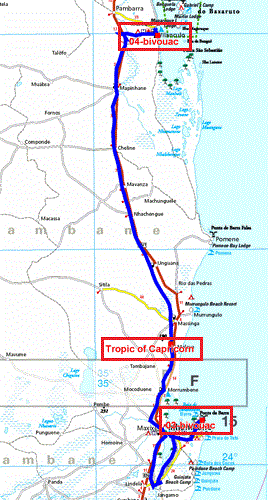
The GPS road tracklog
from Ponto da Barra to Vilankulo
from 2018/012/11 to 2018/12/11
Vilankulo, Baobab Beach Backpackers
Mozambique extends at a long North-South distance and small a
dispatcher. Consequently many kilometers should be traversed. Tuesday,
December 11 the distance from BPonta da Barra
to Vilanculo is 326 km. Admittedly the roadway
has a surface of good quality. On the way two events scattered my
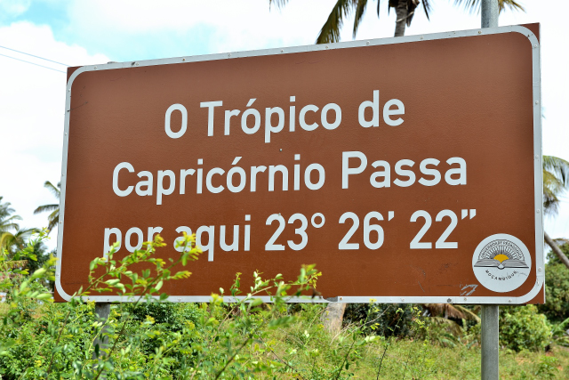
attention. First I cross for the nth one +
once the Tropic of Capricorn since I went the
world, to see Wikipedia
here
for the countries which it crosses. Then a
4x4 pass me and stopped on the
road side after the junction towards
Vilanculo, the driver signaled to me to join him
I did it; he was presented coming from Portugal established to
Vilanculo since +13 years and invited to me to take a
cup of coffee with his wife. We
exchanged many information and we agreed to see us again,… in another life.
I was going to establish my bivouac for one night at the
Baobab Beach Backpackers.
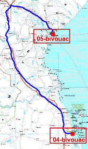
The GPS road tracklog
from Vilankulo to Beira
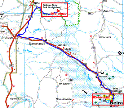
from 2018/012/12 to 2018/12/12
Beira
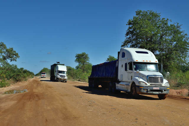
Wednesday, December 12 was a great purple passage to face the 526 km
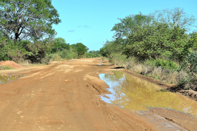
separating Vilancolos de Beira of which the first third is a slalom to
approximately 20 km/h between the pot-holes. Consequently I arrived in
the end of the afternoon at Beira after 10:00 driving
to bivouac on the carpark of Biques Restaurant
to enjoy with a fresh beer the sunset under an overcast sky. Of course
tiredness got to me a peaceful sleep surrounded by two guards.
The GPS road tracklog
from Beira to Gorongosa NP
from 2018/012/13 to 2018/12/13
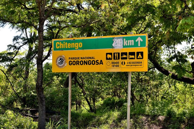
Gorongosa NP
Thursday, December 13 I left without regret the carpark of
Biques Restaurant to visit Gorongosa NP to
approximately 200 km. Alas after the excellent roadway of the EN6
up to Inchope the 70 following km break up
into 40 km of pot-holes and 30 km of track inside the park. While
arriving at the reception of the park I was informed that there was no
game drive idue to
rains which had fallen for one week; moreover the manager, of French
origin, taught me that the park will be closed
from December 15th to
the beginning of March 2019. my disappointment was enormous! I decided
to spend the night on the spot not to drive again
the 40 km of pot-holes in the same day.
Whereas I worked with the page layout of my website the receptionist
taught me that there will be a game drive at
14:00 because five people had just arrived for an ornithological photo
hunting. Obviously I agreed to take part in it. It was an enchantment to
circulate in this entirely wooded park where the mammals are hidden by
the abundant greenery. Moreover very many ponds are the biotopes
by excellence birds. I underwent the comments,
in vernacular language, of the five ornithologists. The solitary night
in the park was comforting although the multitude of monkey is
disturbing.
click on the pic for opening the gallery
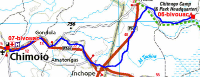
The GPS road tracklog
from Gorongosa NP to Chimoio
from 2018/012/14 to 2018/12/14
Chimoio
Friday, December 14 I left Gorongosa NP very
disappointed because it is worth the detour.
With courage I faced the pot-holes constantly dug by the heavy trucks
which furrow this road EN1. I arrived around midday at Chimoio to
bivouacin Pink Papaya Backpackers after having
made supply in Shoprite and the full with diesel fuel at the adjacent
Total petrol station before entering Zimbabwe.
Indeed only the beaches can retain the tourists followers of the sun bathing,
when the sky is not covered and that it does not rain. I am not tear of
the beaches; I thus curtailed my stay in Mozambique.
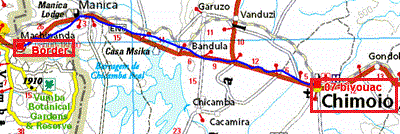
The GPS road tracklog
from Chimoio to Machipanda, Border
from 2018/012/15 to 2018/12/15
Machipanda, Border