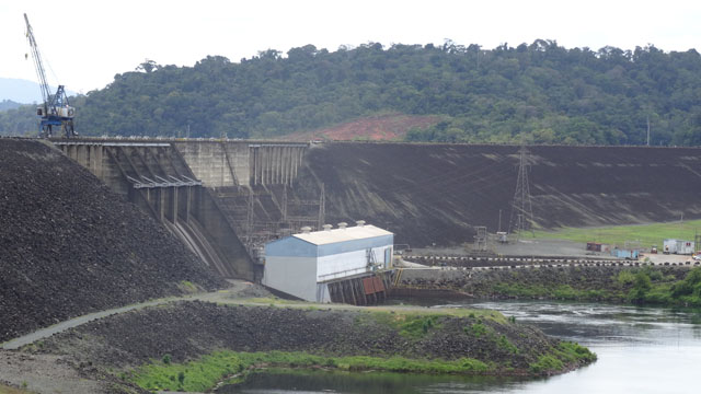
On Sunday morning after having published the pages of my website I went in Brokopondo Lake, artificial reservoir for the electrical production. While arriving the visitors questioned me from where I come where I go etc. Weather was gloomy with fog and rain. Despite everything I decided to remain on the spot.
|
The target on Monday, April 11th was of going to Atjoni at the edge of the river which supplies the artificial tank then to find a bivouac at the edge of the Brokopondo Lake. The Atjoni village is actually a wearing of loading for the Amerindian villages. It is composed essentially with supermarkets where the Amerindians come to supply themselves. Alas I did not find an access to the lake. The rain started to fall and the visibility became limited. I decided to return to the carpark of the lake dam.
|
I left Suriname on 12 April at Albina with the ferry at 15h00. look at the border crossing, here