Les îles Féroé signifirait les îles des moutons en vieux norrois, consultez Wikipédia :
![]() The Faroe Islands would mean the Sheep Islands in Old Norse, consult Wikipedia:
The Faroe Islands would mean the Sheep Islands in Old Norse, consult Wikipedia:
![]()
Le dossier PDF du voyage
![]() .
et des POIS
.
et des POIS
![]() .
ont été conçu avec le logiciel de navigation QuoVadis
.
ont été conçu avec le logiciel de navigation QuoVadis
![]() The PDF trip file
The PDF trip file
![]() .
and POIS
.
and POIS
![]() .
were designed with the QuoVadis navigation software
.
were designed with the QuoVadis navigation software
![]()
à partir de trois sites de voyage trouvés sur Internet,
from three travel sites found on Internet:
Sarah Green ici/here,
Andrew & Emily, ici/heree
ainsi que Raffael & Marion, ici/here.
Le tableau de synthèse du voyage en Atlantique-Nord, the summary table
of the journey in Atlantic-North est / is
![]() .
.
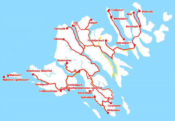
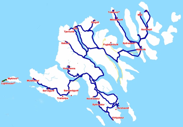
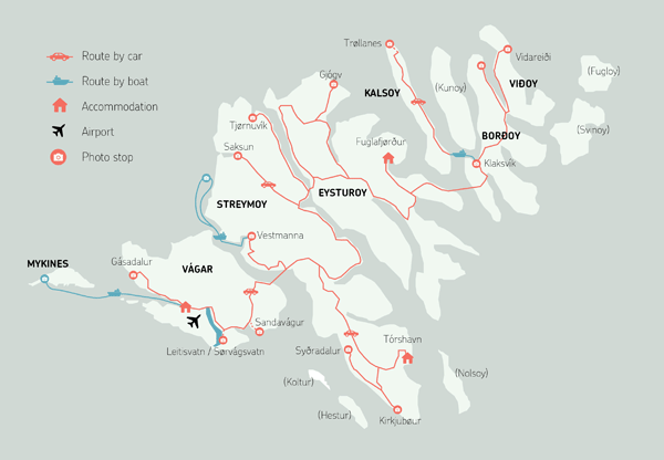
La carte ci-dessous montre le tracé prévisonnel du voyage qui sera actualisé in fine. The map below show the expected track of the journey which will be updated in fine.
| Expected tracklogs | Real tracklogs |
 |
 |
|
|
| Map by S. Green | |
In fine les dossiers ci-dessous sont mis-à-jour à la sortie du pays. In fine the files below are updated at the exit of the country.
Les tracklogs GPS sont présentés par Google Earth, the GPS tracklogs are presented by Google Earth,
Clic
![]()
De plus les waypoints des bivouacs sont montrés sur une carte du site Winlink, more waypoints of bivouacs are on a map
by Winlink website.
Clic
![]()
Les tracklogs & waypoints des bivouacs sont donnés au format international gpx de BaseCamp.
The tracklogs & waypoints of bivouacs are given with the gpx international format by BaseCamp.
![]()
Les dossiers du voyage / the trip files PDF format sont / are mis-à-jour / updated.
La liste des bivouacs, the list of bivouacs est / is
![]() .
.