Monday 23 August was a rainy morning until Breiðdalsvík, then Highway 1 up the mountain to the junction with Highway 939 to Öxi was mostly in the clouds; on the way back from the summit I found a bivouac at the edge of a torrent during a brief clearing. The end of the afternoon was totally in the clouds. On the way I passed bikers with numbers on the windshield, I inferred it was a solo cloud rally on a dirt road; some, with heavy BMW machines, did not seem very comfortable with the visibility low to the handlebars. Moreover, the distances between the competitors were important. Personally I drove with the main beam headlights, compulsory in Iceland, and the front and rear fog lights as well as the hazard lights; despite everything unconscious, locals and / or tourists, made me calls from the lighthouse to overtake me!

|
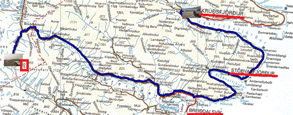
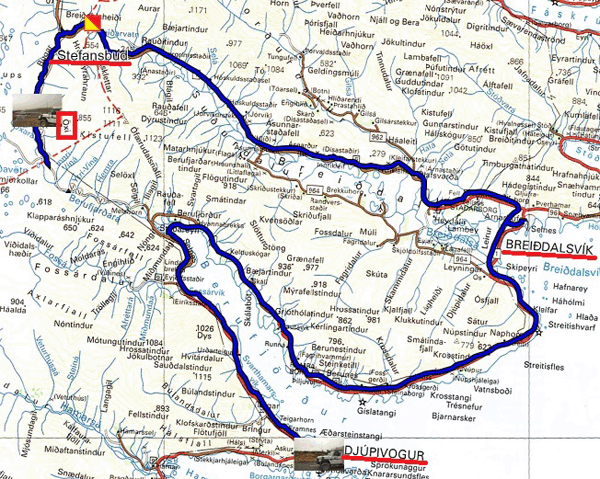
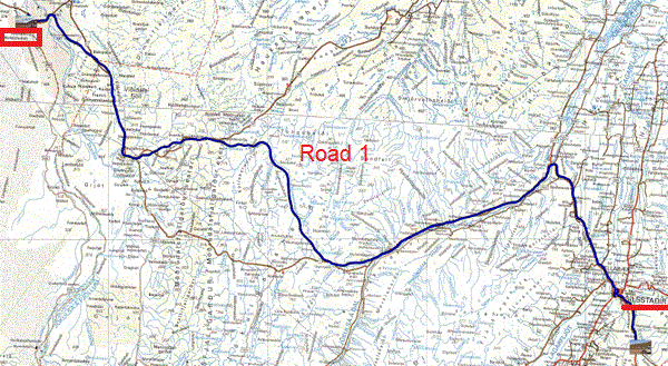
Tuesday August 24 was a good day, bright sun from 06:00 am in Öxi until the end of the afternoon It was the opportunity to stroll along the road 1 known as the coast road going from fjord to fjord between sea and mountains. It would have been necessary to have a real camera and not a Dash camera. Very early on I arrived in Fáskrúðsfjörður to settle in the port to bask in the sun, like the retired locals. The weather forecast announces the same weather for the next two days, va bene! From tomorrow, I consume the 14 days of the trip to Greenland canceled by Hurtigruten.

|
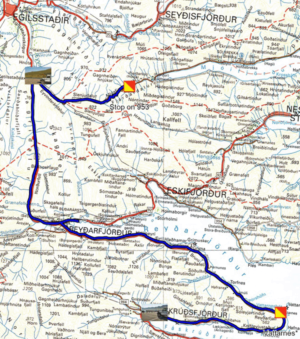
On Wednesday, August 25, I left the port of Fáskrúðsfjörður to discover an interpretive panel at the exit of the city mentioning that French fishermen came there and that several of them are buried in the city cemetery. The weather of the day was uncertain, indeed the city was in the fog to be cut with a knife, I was alone on the road. Quickly it became a gravel road. The Vattarnes lighthouse was inaccessible by the private road guarded by a tourist scarecrow and a prohibition sign! The road always twists between sea and mountains with almost zero visibility. Gradually the fog disappeared when I arrived in Reyðarfjörður where there is nothing to see, move on. I continued on my way to the Mjoifjordur crossroads to see the Klifbrekkufossar waterfall. I was jumping like a kid on my chair alas, alas, alas, the valley was in the clouds as shown in the photo. I turned back to bivouac at the water's edge.

|
Thursday August 26th I had bivouacked the day before 10 km from the city of Egilsstadir to do some shopping before starting to travel the F88 road which was closed during my visit on June 10 here. Then I was lounging in the Hot-Pots of the city pool before resuming my progress around 12:00. I bivouacked at the crossroads of road 1 and F88 in Hrossaborg behind an inactive volcano, of course.

|
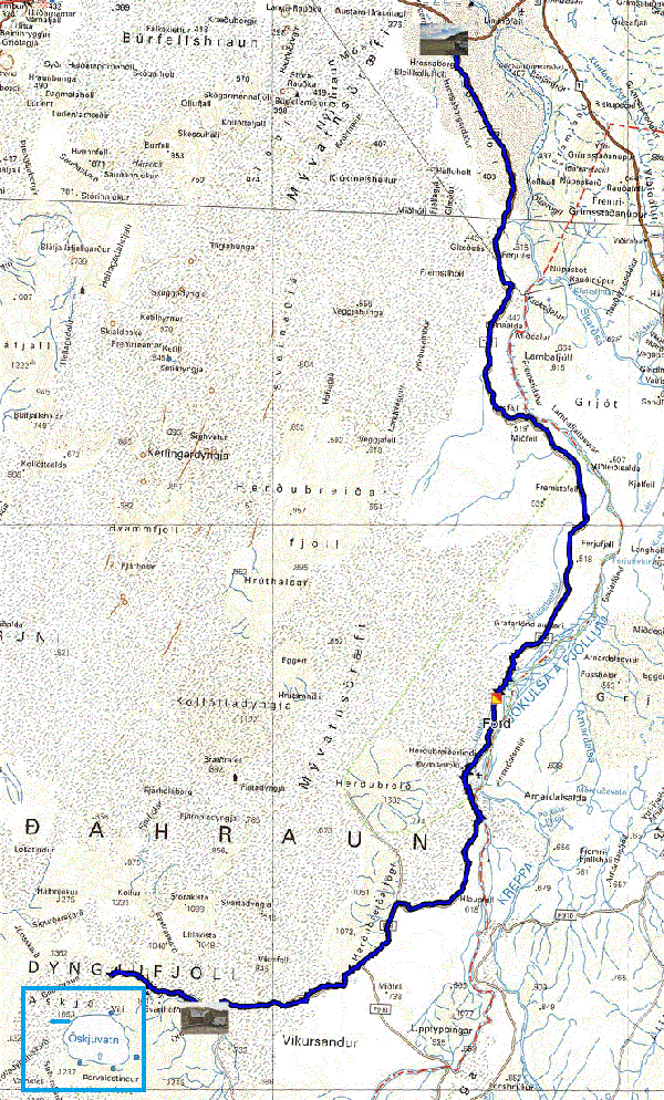
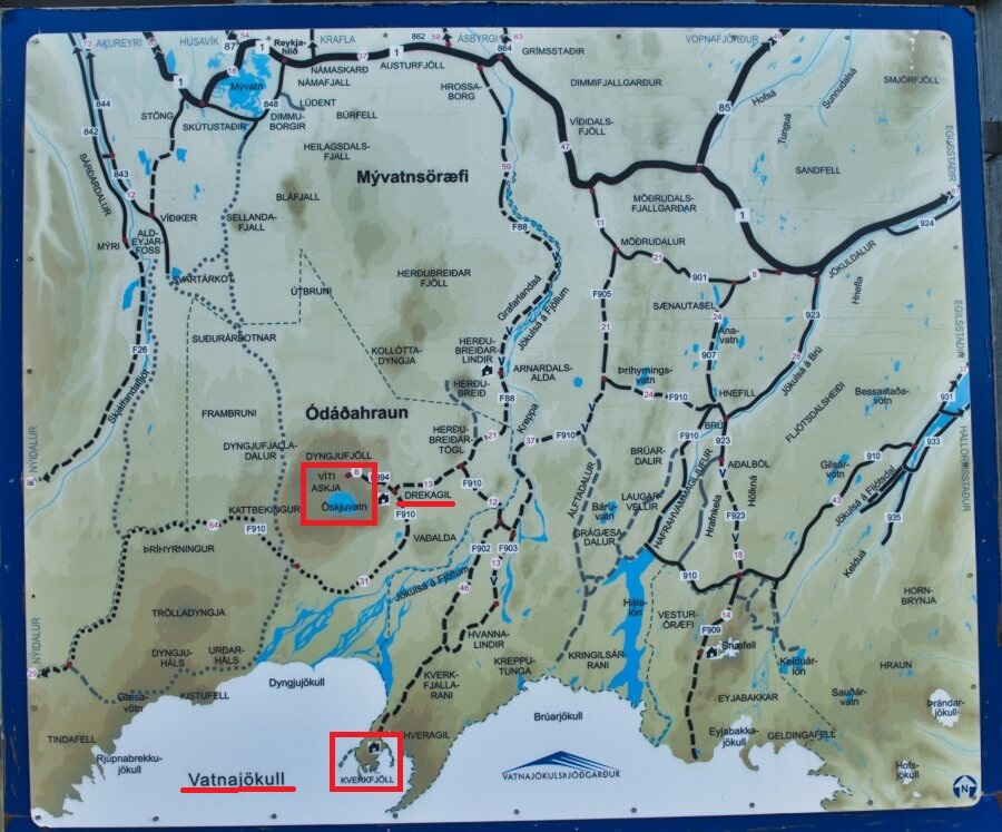
Friday August 27 I traveled the F88 road to Drekagil then Askja to see the crater of the volcano whose eruption took place in 1875. To arrive the landscape of the F88 is lunar, it reminded me of Neil Armstrong taking the first steps of a man on the ground of the Moon. Of course, Hergé had previously made Tintin, Captain Haddock and the incredible Professor Tournesol walk on the moon. As Askja approached the ground was covered with lava and the track slalomed between the boulders. It took me four hours to cover the 100 km. I parked my vehicle at the foot of the 2.5 km track that climbs to the volcano caldera. It took me 1:24 to make the 5 km round trip with a strong wind that nearly knocked me down. The astronauts, crew of Neil Armstrong, of the Apollo mission visited the Askja area twice.I bivouacked at the Drekagil campsite inside the park. The day was sunny and very windy. The rain, a few drops, fell around 5:00 p.m.

|
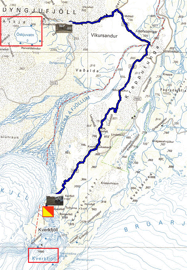
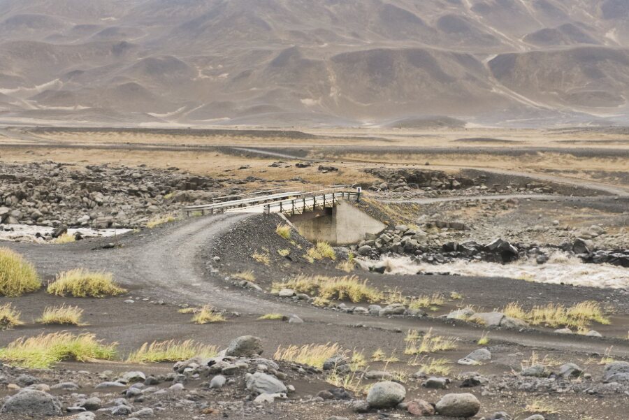
On Saturday August 28 I was going to Kverkfjöll, glacier in the Vatnajokuls & Jodgardur park, whose estimated distance was around 70 km. It took me four hours to cover them due to the variety of the condition of the track, soft sand, rockery, volcanic slag and of course corrugated iron Admittedly there were photo stops, no fords to cross but a bridge over a rushing torrent, Norður-Mulasysla. The landscapes, mountains, plains, etc. are at the origin of the condition of the track as well as the colors from intense black to ocher. It was a dazzling spectacle of beauty that only nature is able to conceive and offer to human beings who created the anthropocene that destroyed it, welcome to the Faustian planet. When I got to Sigurðarskáli, I registered and then went to the foot of the Kverkfjöll glacier where a marked path led further. I started to follow it but unfortunately the rockery made my progress very difficult. I threw in the towel after less than a mile.
|
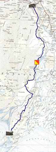
Sunday August 29th I followed the 902, 910 and F88 roads in the opposite direction to return to park in Hrossaborg at the foot of road 1, that is to say 127 km starting at 6:30 am to arrive at 12:00. The weather was completely blocked with a real leaden sky. Despite everything I took a few unpretentious photos. The deep ford was crossed without difficulty thanks to the rope to be followed as indicated on the sign.
|