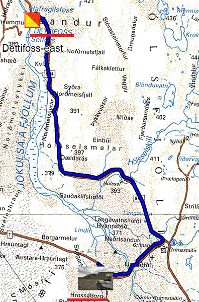
Monday August 30th I decided to go back to see Dettifoss on the east side, the weather was sunny. I arrived around 10:30 am on the site to trudge to the point-of-view, steep stairs to negotiate with my trekking poles, see here my visit on 06/20/08. The duration of my visit, approach, photos and return to the parking lot, 1:30. I calmly returned to my bivouac at the Hrossaborg volcano. Arriving a car, 2x4, was stuck in the black sand of the volcano. I lent him, not a hand, but the excavator to teach the driver, German, advising him to use reverse slowly to get out.

|
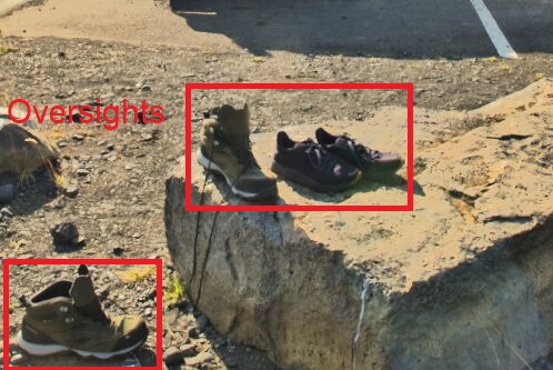
Yesterday I was in Dettifoss-east, Tuesday August 31st I was going back here to Dettifoss but west. The day was pleasantly sunny. When I arrived around 9:30 am few tourists, the crowded buses were not there yet. It was still a painful visit, the site is about a kilometer in the rocks with stairs, well, culture has to be earned. The waterfall is difficult to photograph and, moreover, I forgot to take the polarizing filter for the surface of the water. Speaking of forgetting, you can find everything in the parking lots, this time it's shoes that the owners have left in their impatience, but it's just the shoes!

|
 |
 |
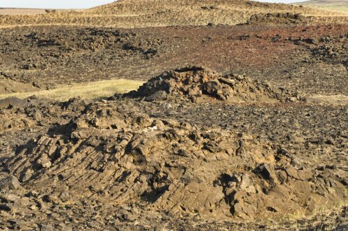
| Dejections from volcanoes like giant turds | On Dettifoss-west parking |
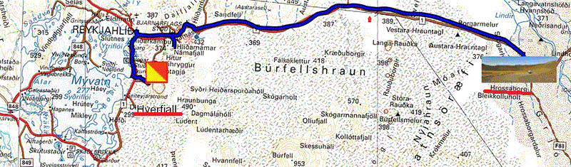
On Wednesday September 1 I continued to complete my visits at the beginning of June, so I went to the Hverfjall volcano here to attempt the climb up the steep trail in the slag from the 2700 year old eruption. The day was sunny but a strong wind was coming down from the summit making the vertical station uncertain. Not without difficulty, stopping to regain my balance and my breathing, I reached the summit greeted by a gust that almost knocked me to the ground. I remained standing thanks to my sticks stuck in the ground against my chest with my back to the wind. For the photos I had put the wide-angle lens (14 / 24mm) in my backpack but I couldn't take it out at the risk of the wind blowing my bag when I opened it. The descent was even more staggering with the cross wind and the feet sliding in the slag. I arrived standing and whole at the parking lot. It was my swan song… in Iceland. I was returning for my fourth bivouac at the Hrossaborg volcano at the entrance to the F88 trail.

|
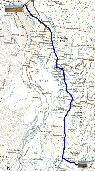
Thursday September 2 I started to travel the road 910 to return to Egilsstadir, of course it is a dirt road partly covered with corrugated iron. The day was shaping up to be gloomy with a leaden sky with a very low light not favorable to photos in a landscape of volcanic desert. At the entrance to the track, the place called Möðrudalur is made up of houses covered with tuff to attract the barge through the exotic. I did not meet any car of any kind, no tourist in need of feeling. Shortly before 11:00 am I saw a stretch of water to which a secondary track led, the map announced the Prihyrnings-vatn. No one around, I put my tipi on the edge.

|
| Popular 4x4 low-cost vehicle in Iceland |
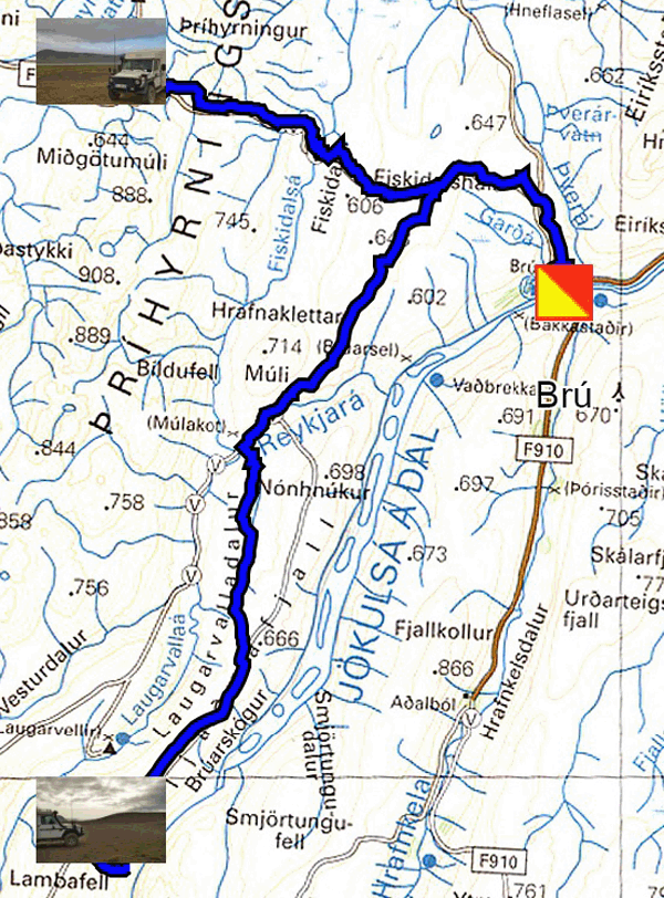
Friday September 3 began with a radiant sun which unfortunately disappeared at the beginning of the afternoon. Gone, therefore, early in the morning I did not meet any tourists and that’s good. The landscapes were flooded with light offering a panel of shimmering colors. Route 910 splits in two, part of it goes to Brú, the bridge, where I was going to see this famous bridge, nothing extraordinary. I returned to take the other part to go to Hafrahvammagljúfur, a very narrow and very deep canyon as shown in the photo of the interpretive panel; but unfortunately not very demonstrative when you have your nose on it. I bivouacked at the crossroads of the canyon track, the Laugavalladal track and the 910.

|
| Menhir ! |
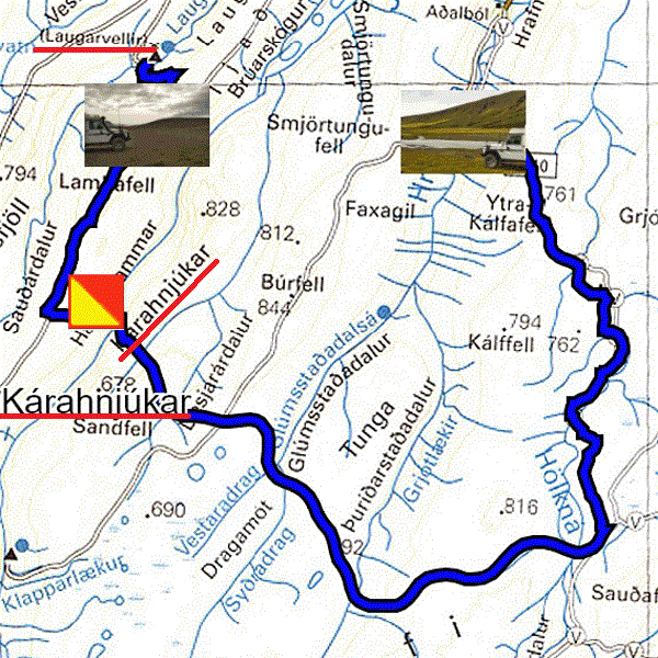
Saturday September 4 (1789, abolition of privileges and feudal rights) a ray of sunshine appeared, I got up to go see the Laugavalladalur which is a hot waterfall shortly after the Laugavellir farm. It was a short fifty minute hike back to reach the waterfall and its pool in which you can take a bath, although it is not easy! Then I continued my journey, route 910, to the Kárahnjúkar hydroelectric dam shortly before the Hafrahvammagljúfur canyon seen the day before. Then the track 923 in the valley leading to Aðalból led me to Hrafnkelsdalur where I put my penates. The ray of sunshine was ephemeral, for lack of wind to sweep the clouds.

|
| Laugavalladalur foss |
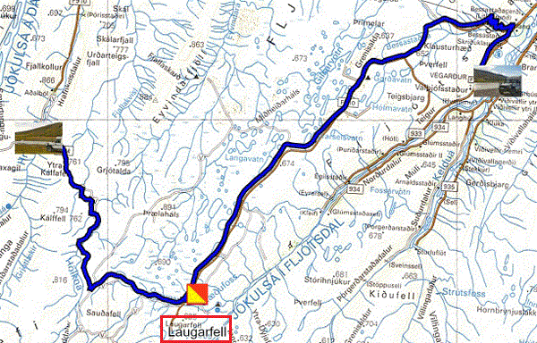
Sunday September 5 at the edge of the water at the bottom of the valley, the sun made a timid appearance despite a strong wind benefiting from the venturi effect to sweep it away. At the start shortly before 8:00 I started my truck to warm up the engine before starting the rough climb to extract myself by traversing the rocky track, of course I had blocked the center differential to distribute the force between the two axels. Again the low light was not conducive to the photos. On the track I overtook a Swiss Azalaï on a Defender with a number plate starting with BL (Basel); We greeted each other with thumbs up. On the way I made a detour of 2 km to take a photo of a deer's head on a column, a stylite! As of course, after a climb you have to descend into a valley of Lake Lagarfljot, the eastern shore of which is planted with trees, a rarity in Iceland. The sun persisted in playing hide and seek with the clouds. I parked my trailer by the water at a place called on the map Hliðarhύs.

|
| Laugarfell |
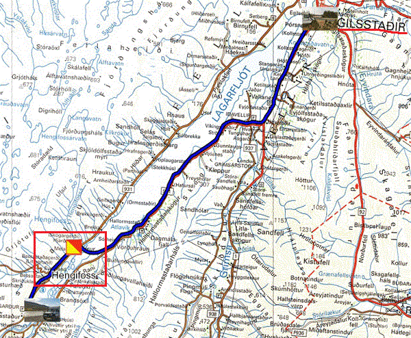
Monday September 6 I got up around 9:00 am to go for the 5 km return trip to take a look at the Hengifoss waterfall. The hike is strenuous, 1h15 over 2.5 km to reach the foot of the waterfall which, at the end of the season, is just a cat's pee. The descent lasted 1 hour, or a total of 2 hours 15 minutes for the 5 km return; again I would not be selected for the Olympics. It was sunny on the way up, but the descent was under a leaden sky threatening to collapse in pouring rain, which it did. As a result, I was going to settle down for the last two nights in Iceland at the Egilsstadir campsite.

|
| Hengifoss |
Tuesday September 7th was a day of cleaning the truck, washing clothes and adjusting the trip to Denmark taking into account the border blockage for 14 days in May.
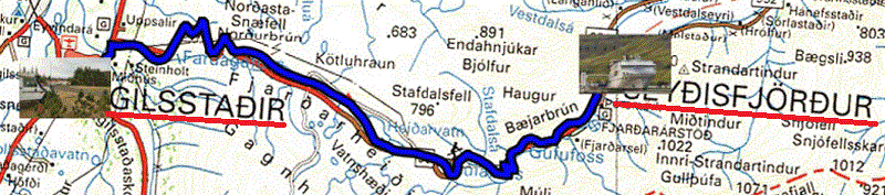
On Wednesday September 8, I was lazing at the campsite before going to Seyðisfjörður, 27 km, to present my vehicle two hours before the scheduled departure at 8:00 p.m.
My stay in Iceland lasted 100 days, covering a little over 8000 km. I will not write a rave review, tourist guides books, in all languages, do it regularly. I loved the austerity of the landscapes sculpted over millions of years by natural climate change. The damage caused by the postmodern activity of humanity in search, now and now, of unbridled consumerism is visible by the retreat of the glaciers and the erratic evolution of temperatures under the influence of greenhouse effects from unscrupulous countries. Icelanders are very industrious to survive in an unfavorable context, although tourist activity is a very important economic contribution despite its short duration, from mid-May to mid-September. The photos on my site tried to share my emotions, an invitation to travel. A winter trip would be a complement to capture the winter life of Icelanders and see, perhaps, an aurora borealis. My only regret is the cancellation by Hurtigruten of the trip to Greenland for reasons, direct or indirect, of the Covid-19 pandemic.