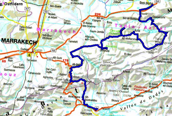
Crossing the Atlas
Jb track
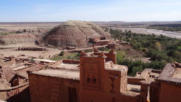
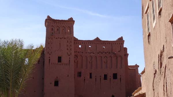
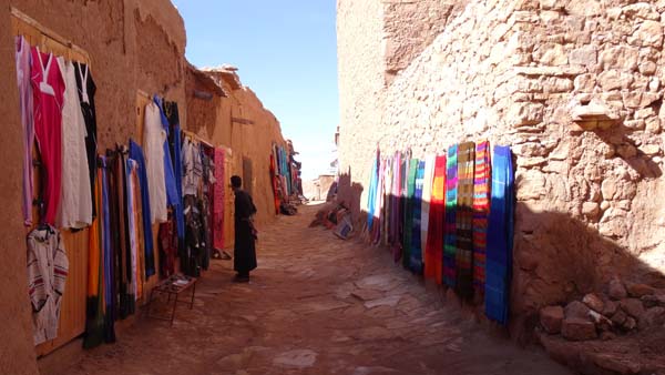
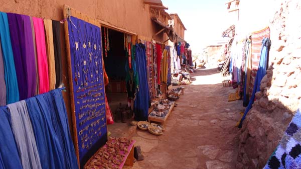
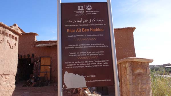
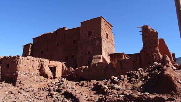
The highlight on Monday, December 8
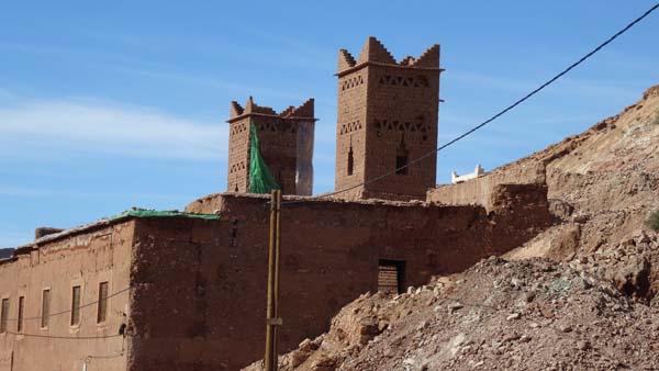
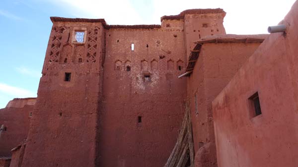
was the visit of Ksar Aït Ben Haddou
which was useful and is always used as
decoration for movies. All things
being equal the visit, even except
tourist period, resembles the visit of
all the sites referred in the guide
books. The lanes are bordered by the
gravers of the merchants of the temple
who having a developed psychological
sens are not aggressive, they can
detect the potential customers. After
lunching I began my progression on the
Gandini's Jb track which is asphalted
but narrow and in bad condition. It
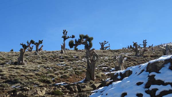
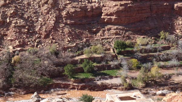
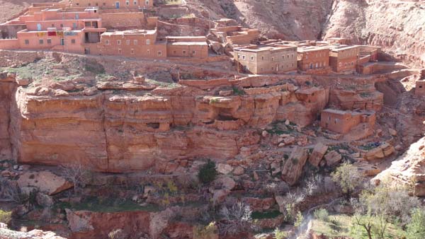
zigzags along the Ouinal wadi whose
bed is cultivated and bordered by many
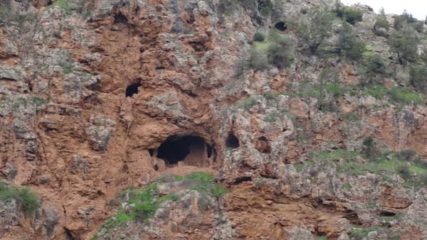
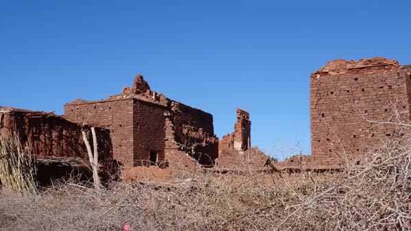
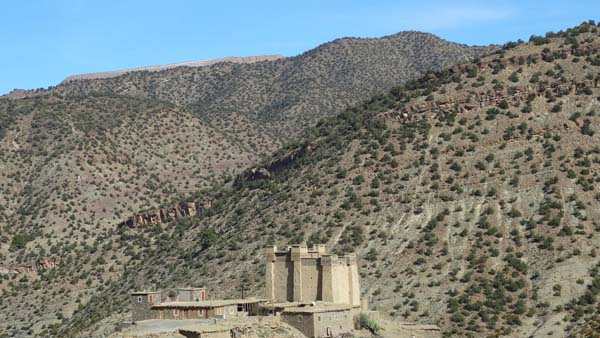
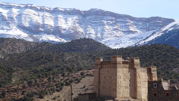
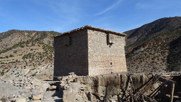
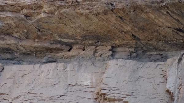
village with attics troglodytes. Each
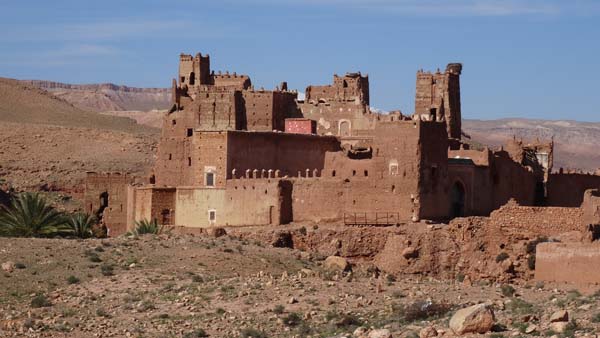
village has Tighermt more or less
ruins, the most known is that at
Animiter which was reproduced on the
tourist booklets of the time of
protectorate. In end of the day I have
difficulties in finding a site of
bivouac.
 |
 |
| Visitor early
morning |
 |
 |
| Aït Ben Haddou |
 |
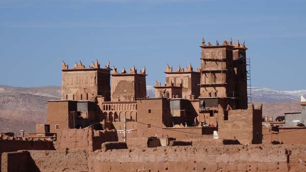 |
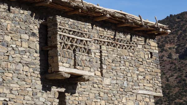
| Tighermt |
 |
 |
| Watch towers |
Ounila wadi bed |
 |
 |
| Attics on cliff |
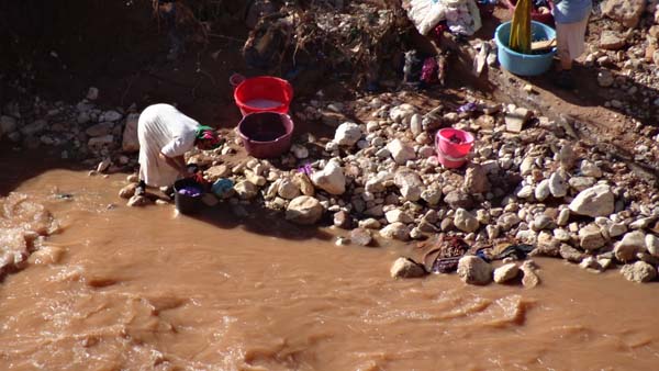
Lessive dans l'oued |
 |
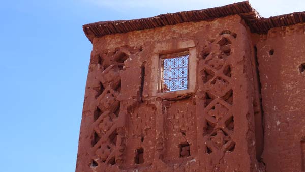 |
| Tigermt of Animiter |
Ja track
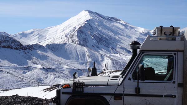
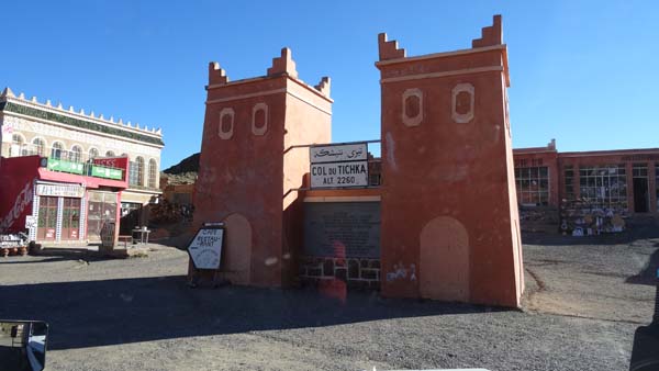
The day of the Tuesday, December 9
started with the sun to traverse the
road to Marrakech via the Tizi-Tichka
pass to the junction of the
Gandini's Ja tracki in the direction
to Ighy. The road was asphalted, I did
not complain any. But a careless
mistake at waypoint km 41.0 made me
continue on the bitumen. I desired
steps to turn back; I persisted
knowing that it carried out somewhere!
After several tens of kilometers I
arrived at Abadou, end of the tar. A
track carried out me up to the km 18.0
of Gandini to see a Glaoui's Kasbah in
ruin and a olive oil mill which
I vainly sought by questioning the
inhabitants who alas spoke only
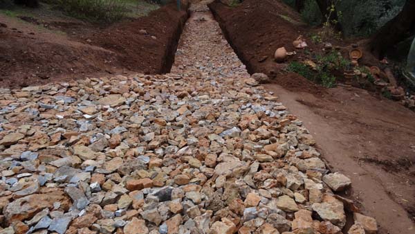
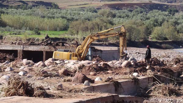
Berber. The bridge on the Ghdat wadi
was carried by the pouring rain. A
fellow informed me a track to reach a
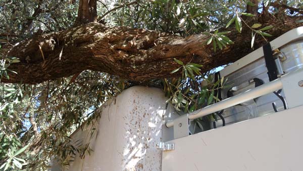
ford already took by 4x4. But a low
branch blocked my progression; even by
deflating the tires the solar panels
would have been damaged. After
operations I grind succeed in turning
around. Another road was to lead me to
the R210 road to Demnate. I found a
bivouac at the edge of the road for
Sidi Rahal.
 |
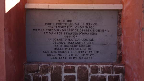 |
| Tichka pass |
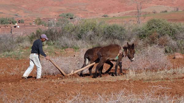 |
| Traditional tilling |
 |
 |
| Glaoui's Kasbah at km 18.0 |
 |
 |
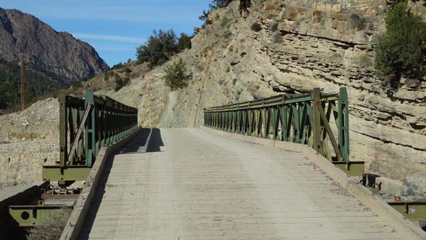
| Detroyed bridge at km 16.5, Oued Ghdat |
Too low branch |
Demnate
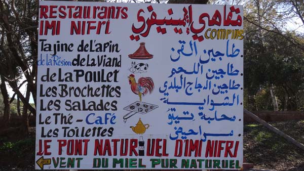
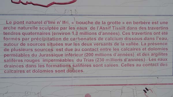
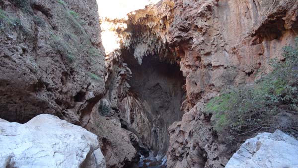
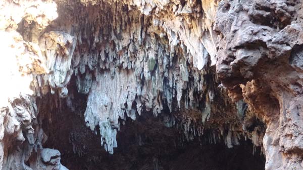
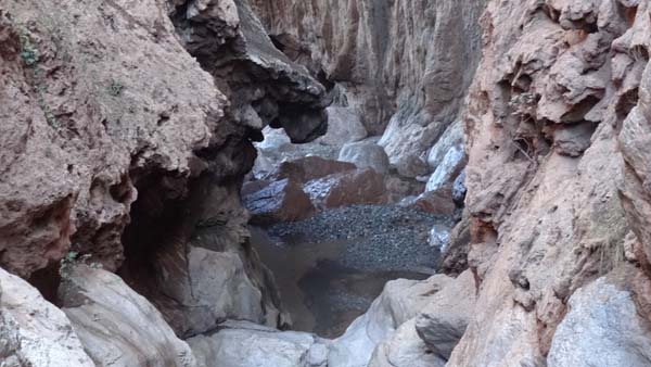
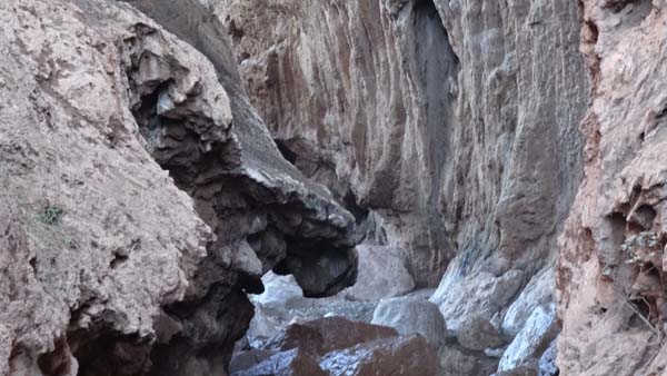
Imi n'Ifri, Natural bridge
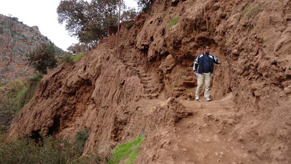
Wednesday was a small driving day
supplied with two interesting visits.
The first after Demnate the site Imi
Ifri or a natural bridge dug by the
erosion of two sources. As well on the
upstream side, most spectacular, as on
downstream side a splendid staircase
led to the level of the river. The
view is dazing by the beauty of
strange colors and deafening by the
noise of the river.
 |
| Downstream exit |
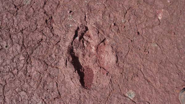
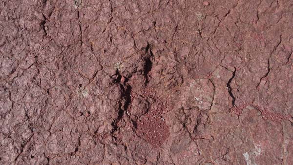
Iwariden-Iroutaln,
dinosaur's foot prints
The second from eight to ten kilometers
further the most famous site by the prints
from dinosaurs in Morocco locked up in an
enclosure whose key is held by a ten-year
kid. After a rough negotiation I gave him
10 dirhams. There are five traces of
prints in sediments which alas are
gradually destroyed by climatic erosion. I
bivouacked at the exit of the village.
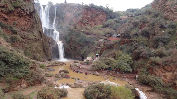
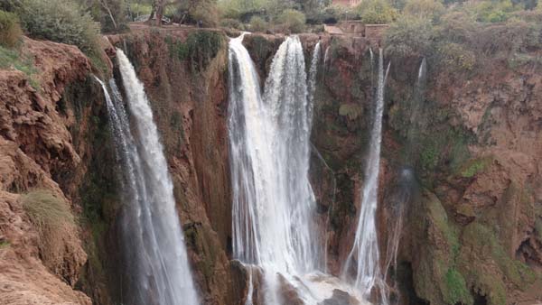
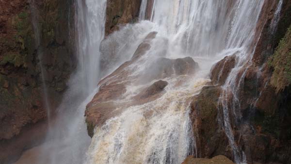
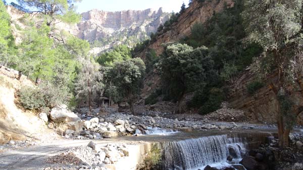
The cascades d'Ouzoud
Thursday the 11th December was still a
small driving morning to go to visit
the Cascades of Ouzoud high very
tourist spot in Morocco. Extremely
fortunately in this December not of
tourists, I was alone. I rented a
guide to possibly be used to me as
old-age stick although I put my
walking shoes and taken my trek
sticks. In view of abundant last
pluviometer the cascades were well
provided out of water what is not
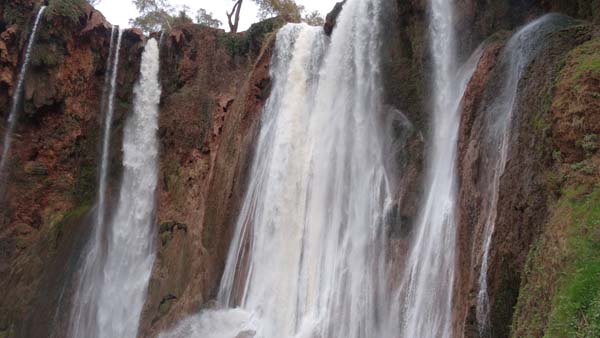
always the case. I went down by the
slipping staircase of left bank
bordered with gravers of trinkets.
Then at the bottom of the cascades a
small ferry made me cross the ten
meters of water.
 |
 |
 |
 |
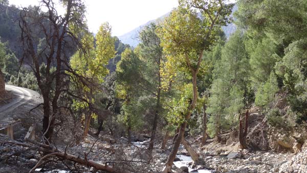
I climbed the ground right bank
without too many difficulties while
stopping to take pictures, alibi for
having rest. Into the side of left
bank some caves are used as habitat by
an important population of monkeys. At
the summit of right bank blue-collar
workers built a processional way for
the next tourist season. Back I found
a bivouac at the edge of the road
toAzilal at the top of a pass near the
pylons of radio/tv to 15 km away from
the city.
Jebel Azourki
Gandini's K track
On Friday, December 12 while arriving
at Azilal I asked the royal
gendarmerie if the road to Tillouguit
via Zawyat-Ahançal were open and
practicable. The answer was
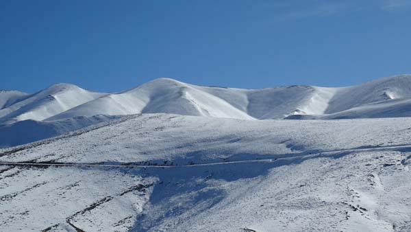
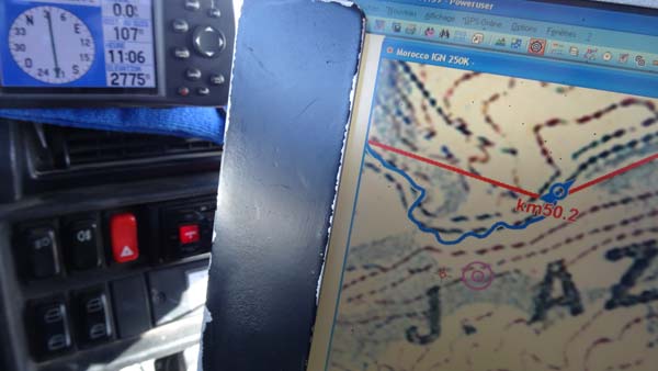
affirmative. The road up to Ahançal is
asphalted then it becomes a travelling
track. Of course the first part
climbed up to 2775 meters of altitude
but it had been released by a
snow-plow. The second part below 2000m
altitude curves in small valleys whose
habitat is very old. Jebel Azourki is
the cradle of the Berber nation. The
day was sunny with a pure sky. The
Gandini's aficionados, DPM, do not
like winter and it is so much better.
Alone on the track I did not have to
support the dust of the others 4x4. I
bivouacked at km 112.
 |
 |
| Tighermt, km 87,5 |
 |
 |
| Square Tigehermt |
 |
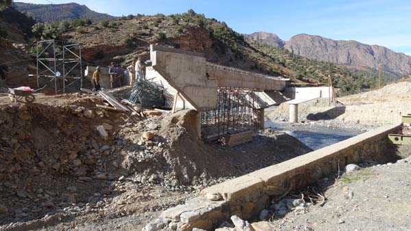 |
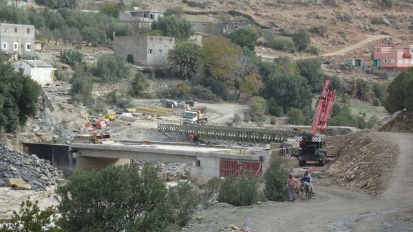
| Iron bridge km 99,7, new bridge under construction |
 |
 |
| Habitat, km 103,4 |
 |
 |
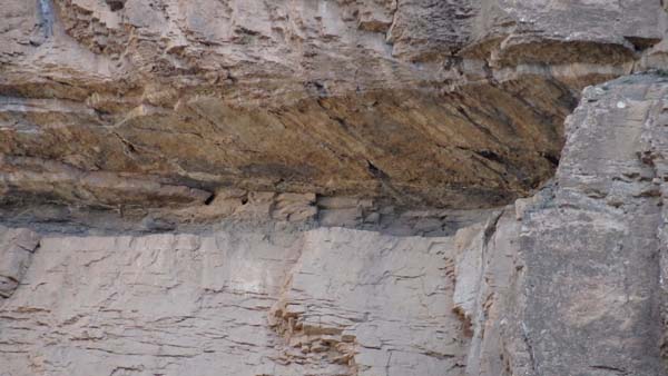
| Gully, km 109,4 |
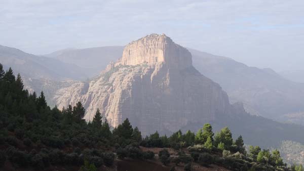
On Saturday, December 13 I continued
to traverse the K track in Jebel
Azourki. From Tilouguit the track
becomes asphalted at the exit of the
village. On the way many works of
civil engineer attest that the track
will be it, one day. The highlight was
the view of a monumental rock called
The Cathedral which dominates the area
of its splendor alas at my passage the
sky was encumbered with heavy clouds.
The crossing of the village of
Tilouguit, day of the souk, was a
purple passage. My objective was to
locate a bivouac at the edge of the
lake Bin El-Ouidane which I found
little before the eponymous village.
 |
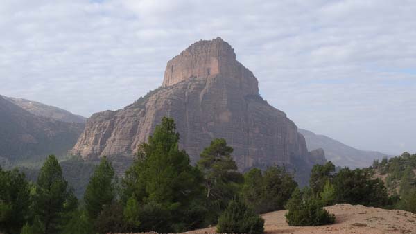 |
| The Cathédrale |
 |
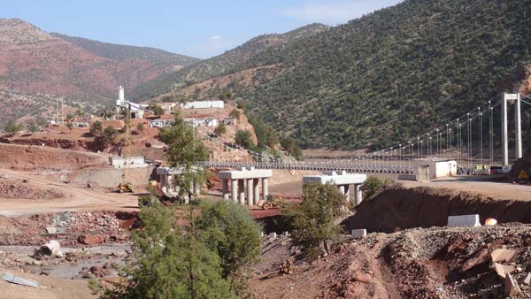 |
| Work on the track |
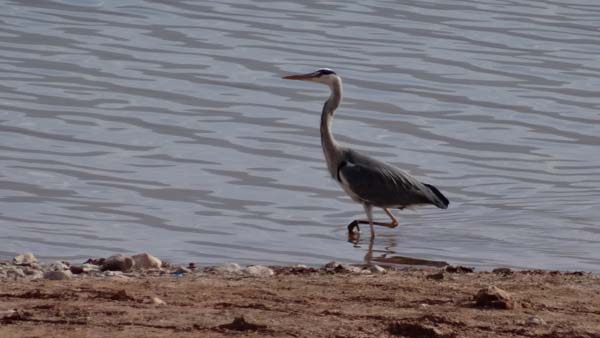 |
| Héron at the edce of lac Bin El-Ouidane |