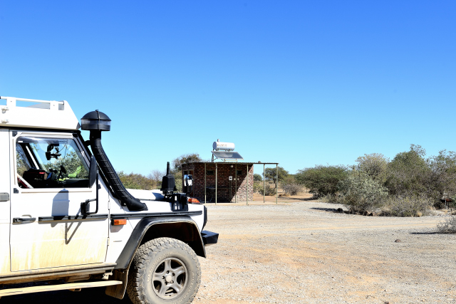
Noordoewer
Enter Namibie, NA
At immigration the employee gave me a card to be filled then stamped
my passport and directed me towards the case to pay (NA$ 295) the
entry duty and to drive on the roads,…, and the ground tracks. The
customs officer asked me how much alcohol bottles I had, any.
Arrived at 8:30 at the station of South Africa I leave the post of
Namibia at 9:30.
Holoog, bush camp
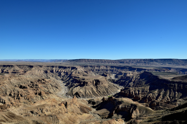
My road plan lays down to visit Fish River Canyon. I passed by
Aussenkehr, wine-producing area, then I avoided Ai Ais to arrive
around 13:00 at Fish River Canyon. Lonely Planet warns the tourists
that the season to see it in its splendor is from March to April, at
the time of high waters. I was thus off-season. Its dimensions are
impressive but the sight does not give from there an account, 160 km
length, 27 km broad and 550 m depth. Of course it is far from being
measured with the Grand Canyon in the west of the United States of
America. The landscape after having crossed the Oranje river, border
between South Africa and Namibia, is more desert. I got a point of
bivouac on iOverlander. Alas after a work one hour on my website a
car of the close spring came to expel me off this private property.
“Welcome to Namibia”. I took again the road to go further on to find
a bivouac at 23 km before Holoog beside the railway line.
click on the pic for opening the gallery
Keetmanshoop, Quivertree Forest camp
After one peaceful night I arrived on Friday, May 25 around 12:00 in
Keetmanshoop to bivouac at Quivertree Forest Camp. While crossing
the city I noticed the closed stores; by consulting Lonely Planet I
learned that May 25th is Africa Day. The downtown area presents a
remarkable building of the Germanic style of 1910, Kaiserliches
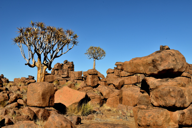
Postamt. The interest of Quivertree camp is to see two curiosities.
Initially in Giant's Playground where in a field of giant rocks,
grow the quivertree, kokerboom also called Aloe Dichotoma. A plant
with the smooth trunk of which the thickness can reach 1 meter, with
a 9 meters height and a lifetime ranging between 200 and 300 years.
Then around 17:00 tourists attend the meal of the cheetahs.
click on the pic for opening the gallery
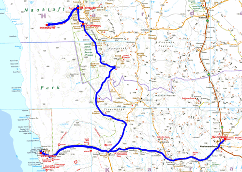
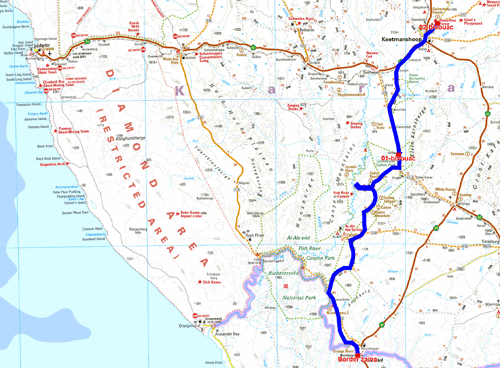
The GPS road tacklog
from Keetmanshoop to Sesriem
from 2018/05/26 au 2018/05/29
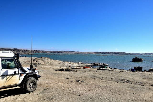
Lüderitz, bushcamp
On Saturday, May 26 I left Quivertree at daybreak to traverse the
most 340 km from Keetmanshoop to Lüderitz on the coast of the
Atlantic Ocean. The tarred road, full west, goes up on a plate to
+1500 meters high with a low-angled light on the ocher color
mountains. Then it traverses a desert bleached by the light for
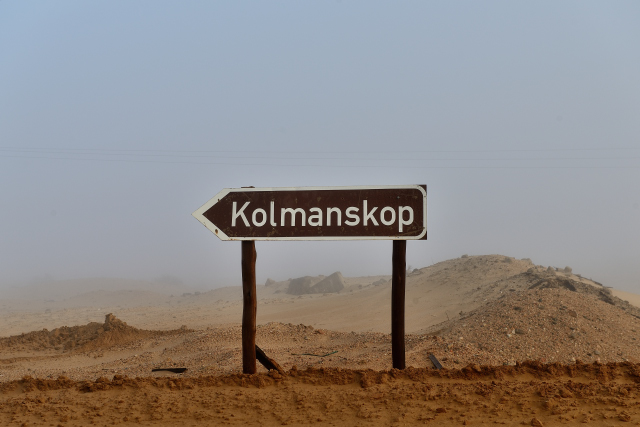
finished on arrival at Lüderitz by a lunar landscape. Lüderitz and
the Kolmanskop ghost town are inseparable from the history of the
German colonization of Namibia as well as that of the diamond
purchased by the world trust De Beers. Felsenkirche built on the
mountain of diamond dominates the city since 1911 and, not far
Goerke Haus from 1910 as well as Knapps Hotel testify to German
art before the First World War. I found a bivouac while following
Diaz street to Radford Bay.
click on the pic for opening the gallery
|
|
On Sunday morning May 27th in spite of a thick fog I arrived at 8:30
to discover Kolmanskop, a ghost town. It is neither an West American
ghost town where John Wayne saunters his hand on his revolver
swaying on its cowboy boots, Hello Guy, nor Dawson of the gold rush,
but the village of the rush of diamond with its German organization
and its concrete of the years 1910. I was alone, the horde of
tourists was not yet there. I strolled between the buildings in ruin
in a surrealist atmosphere of an interstellar landscape, it isn't
Star War. The main street is bordered with a casino, a theater and
of course a German bowling, without the odor of beer of
Oktober-Fest, invaded by the sand dunes. In the museum pictures of
time recall the epopee with comments. I noted two still existing
sketches of two buildings, the Goerke house and the Knapps hotel of
Bavarian style. Little by little the horde arrived and at 10:00 a
guided tour made the visit of the installations with in
South-African English comments. At 12:00 I turned over to my bivouac
of the day before.
 |
 |
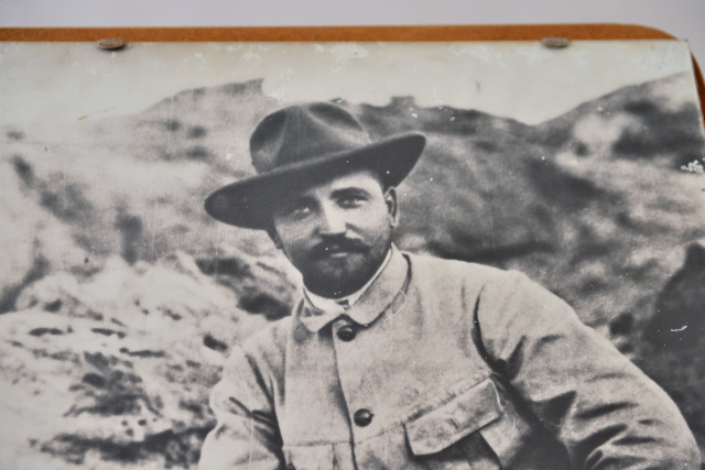
| August Stauch |
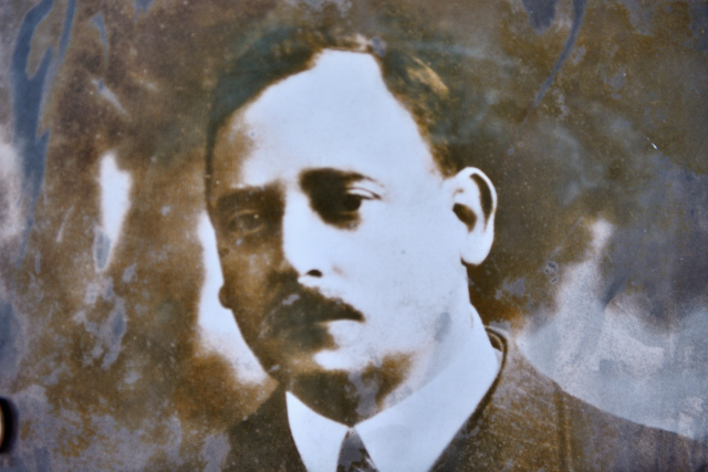
E. Oppenheimer, De Beers CEO |
|
| Hello Guy! |
Kolmanskop, click on the pic for opening the gallery
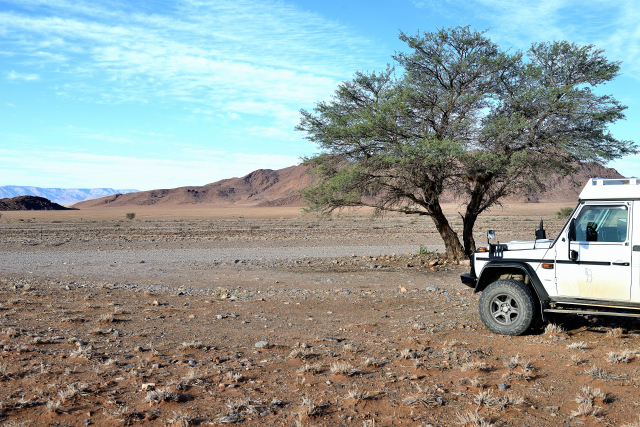
Picnic tree
On Monday, May 28 I turned over to Lüderitz to buy a Sim card to
publish the pages of my website. Then I went as far as Aus to take
the track to Sesriem which is driving but by place corrugated iron
makes its appearance. The colors of the landscape are very varied. I
saw my first animals as far. At 417 km away from Lüderitz of which
300 km of track, I saw a picnic tree which tightened me its branches
by inviting me to stop to bivouac, I did not hesitate.
click on the pic for opening the gallery
Picnic tree
Le lundi 28 mai je
retournais à Lüderitz pour acheter une carte Sim pour publier les pages
de mon site Internet. Ensuite j’allais jusqu’à Aus pour prendre la piste
de Sesriem qui est roulante mais par endroit la tôle ondulée fait son
apparition. Les couleurs du paysage sont très variées. J’aperçus mes
premiers animaux au loin. A 417 km de Lüderitz dont 300 km de piste,
j’avisais un picnic tree qui me tendait ses branches en m’invitant à
m’arrêter pour bivouaquer, je n’hésitais pas.
click on the pic for opening the gallery
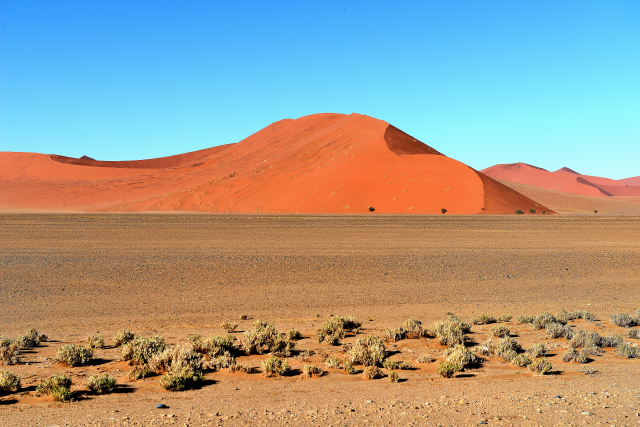
Sesriem, Sossusvlei Oasis Campsite
The highlight of the Tuesday, May 29 was to admire the dunes of
Sossusvlei at the rising sun under a low-angled light. I had thus
taken my measures for this event. I arrived at the main gate of the
park little before 7:30, opening hour. There was already a file
about ten vehicles especially of tours operators. When I got out of
my car to revive me the legs, I noticed, with my great astonishment,
that the left rear wheel was almost flat, a puncture! The devil had
appeared. Fortunately there is a gas station where the pump
assistants told me that the repairer will be at 8:00 there. If I
have as many punctures as in Central America, Welcome to Southern
Africa. Consequence no sunrise on the dunes. The puncture was caused
by a stone, a flint, which notched the tread between two sculptures;
whereas in Central America they were nails. After repair promptly
carried out I traversed the 60 km of tarred road to go to the car
park of the dunes and beyond making the last 3 km for the 4x4 only
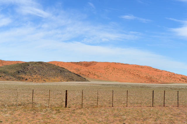
where I stationed at the pic nic area to have lunch. These dunes owe
their strangeness with their localization in a desert of broken
stones. According to the geologists they were work during million
years ago by the Orange river which brought the red sand from
Kalahari. At the back I made a detour to see Sesriem Canyon. It is
not Fish River Canyon. It is about a narrow and deep crack in which
it is possible to go down, dug by Tsauchab river in a compacted sand
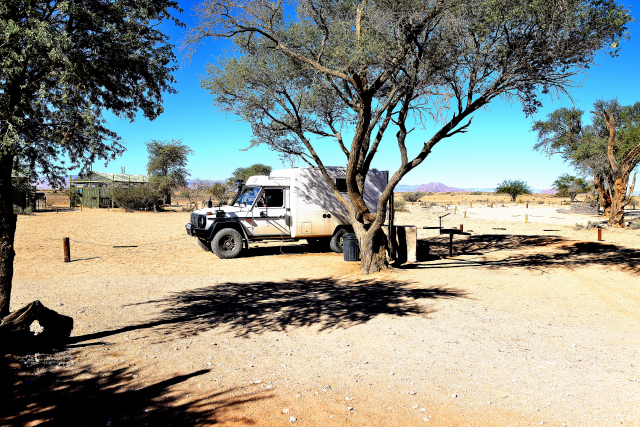
and stone conglomerate. I decided to bivouac at the camp-ground of
the gas station Sossusvlei Oasis campsite where I was in country of
knowledge since the morning 7:30.
|
click on the pic for opening the gallery
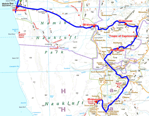
The GPS road tacklog
from Sesriem to Walvis Bay
from 2018/05/30 au 2018/06/04
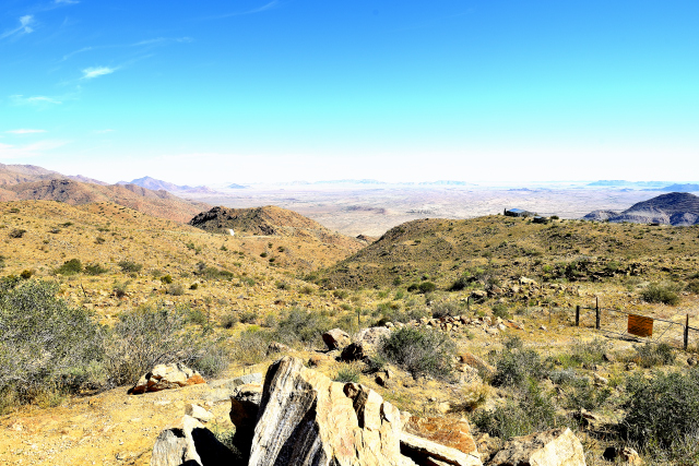
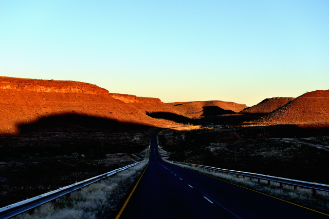
Spreetshoogte Pass
On Wednesday morning before leaving I checked the pressure of the
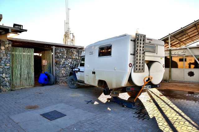
left rear wheel whose tire had been repaired the day before for a
puncture. I noted that the pressure had lost 0.2 bar. I decided to
make it check by the repairer. He arrived as the day before at 8:00.
He dismounted the wheel and plunged it in a vat filled with water.
he did not detect any anomaly. I was septic, but he went up the
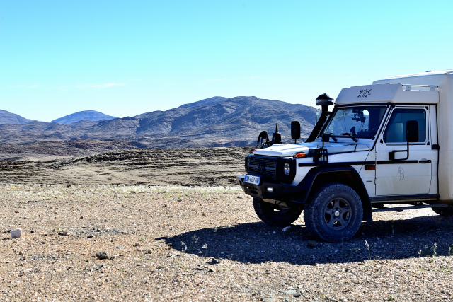
wheel. I left towards Spreetshoogte Pass away from 200 km on a track
sometimes badly corrugated. The luminosity crushed the landscape and
its colors. Spreetshoogte Pass is at 1707 meters high given by GPS.
The 2 km ultimate rise in laces is paved up to the top. The
birds-eye view is impressive in spite of the sun at its zenith. Few
visitors I decided to bivouac on the picnic spot.
click on the pic for opening the gallery
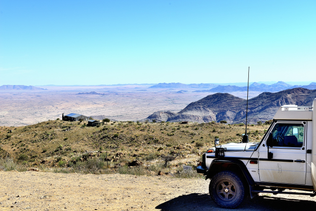
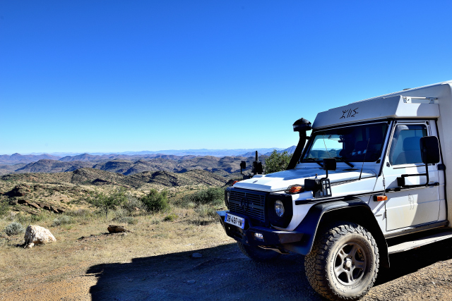
Gamsberg Pass
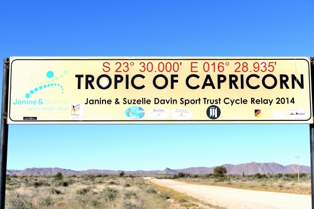
After having taken two pictures with a light more interesting than
the day before I gave up Spreetshoogte Pass to go to Gamsberg Pass
at 1870 meters high by GPS at the bottom of eponymous top
culminating at 2347 meters high. On the way I crossed the Tropic of
Capricorn announced by a panel on the picture of which I wrote its
geodetic coordinates given by GPS on the track. As often the
electric and telephone poles are used as place of lodging by birds.
As far I saw quadrupeds which I identified as impalas, without
certainty. The slightly misty sky made the pictures dull. I
bivouacked on a hill overhanging the track
click on the pic for opening the gallery
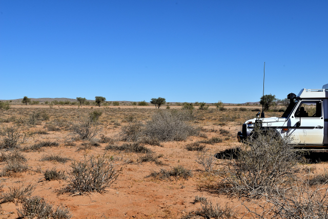
On track C14 vers walvis Bay
Before leaving I took again pictures with a morning light. The track
is badly corrugated. Abruptly I downwards saw a group of mammal in
the trees. The male carries twisted horns and close to it some
females. After a fast descent in laces the track traverses
rectilinear long distances in a flat landscape sown with dark
mountains. The iOverlander site gives a bush camp in Kuiseb river,
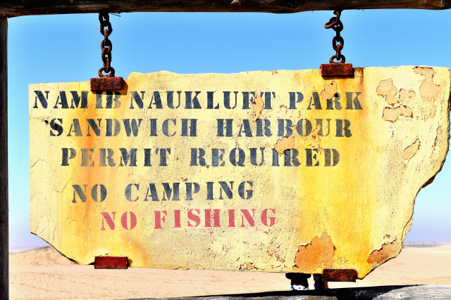
but in the park whose access requires a permit that I do not have. I
found a bivouac before on a platform.
click on the pic for opening the gallery
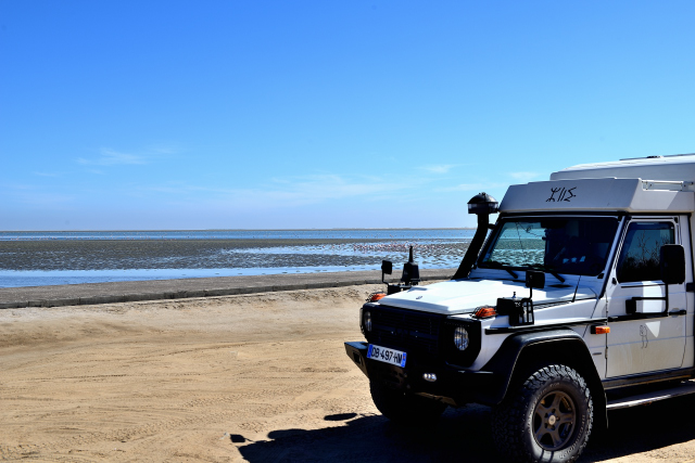
Walvis Bay
On Saturday, June 2 I left the platform as of the point of day to
arrive early at Walvis Bay. On the way I profited from a morning
light highlighting the state of the corrugated track. While arriving
I was going to inform me at the travel agency "Sandwich Harbour 4x4"
of the tour to visit the port of Sandwich Harbour. Of course the
person met strongly misadvised to me being gone alone in this
adventure without possible assistance in the event of incident.
Consequently I bought the four hour package return ticket on Monday,
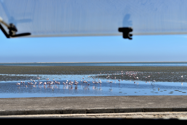
June 4 from 12:00 to 16:00. I decided to bivouac on the lagoon to
see pink flamingos in organized band seeking their food in the mud
at base tide.
click on the pic for opening the gallery
|
|
On Sunday, June 3, I waited until 11:00 for the mist to rise to
visit the surroundings.
In the meantime I did not satiate to take flamingos in photos in the
dense fog, it did not matter to them to get their breakfast.
Then I left to explore the peninsula to Pelican Pointe where is the
lighthouse.
I passed along salt marshes that supply 90% of South Africa's salt.
I was going to the junction of the track for the Pelican Point.
But in front of the state of the track in deep ruts of soft sand, I
gave up not wishing to "garden" in solo or to stay "to plant" all
the Sunday knowing that on Monday I went in cohort to Sandwich
Harbour.
I retraced my steps to visit Walvis Bay, which offers nothing
exciting.
The 1880 church, manufactured in Hamburg, was relocated to build the
port.
For the rest the city is recent unattractive consisting of low
houses type suburban without garden but surrounded by high wall.
The waterfront includes restaurants and travel agencies of which
Sandwich Harbour 4x4.
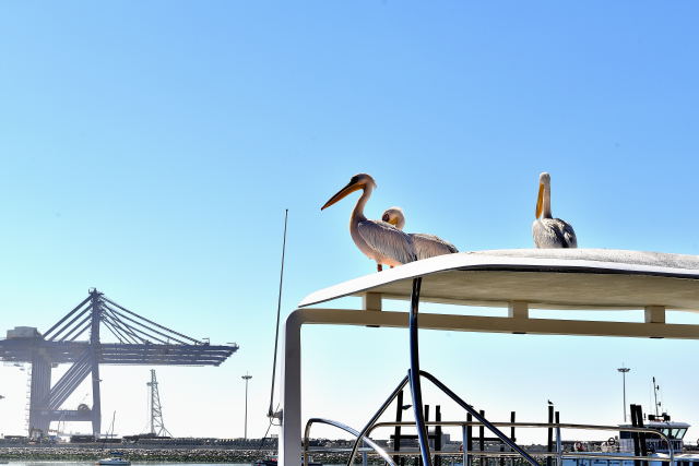
Three pelicans took up residence on the roof of the cabin of a
catamaran. I returned to my bivouac in front of the lagoon, home
sweet home of flamingos.
click on the pic for opening the gallery
Sandwich Harbour
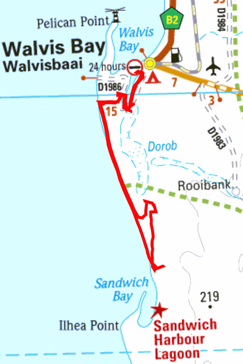
The GPS road tacklog
from Walvis Bay
to Sandwich Harbour aand back
from 2018/06/04 au 2018/06/04
On Monday morning at 12:00 I was at the agency Sandwich Harbor 4x4
for the circuit in the dunes. A Dutch-speaking Belgian couple spared
the vehicle during the four-hours visiting. Our driver was very
voluble in rocky English. The vehicle was a Toyota Land Cruiser V6
petrol of almost 300 horses-power whose tires were at the 1-bar
pressure. The first part proceeded on the full southwards beach at
the speed of approximately 100 km/h with photo stops. Then it was a
tour in the dunes in search of wild animals of which foxes, flights
of pelicans and an antelope. Moreover at the lunch pause, always to
the same spot according to our guide, two foxes invited themselves
to spare the remainders of the collation accompanied by a very well
sparkling wine. The return was carried out by the beach as the trace
by GPS etrex Garmin shows it. Admittedly the circuit can be made
into individual since there are two cars per safety.
P.-S.
Having acquired a SIM card, it turns out that the shadow areas
antennas are very large so much, to a lesser degree, for
communications with smartphone than, especially, for the
Internet. I tried my luck at each bivouac unsuccessfully outside the
agglomerations like Lüderitz and Walvis Bay.
click on the pic for opening the gallery