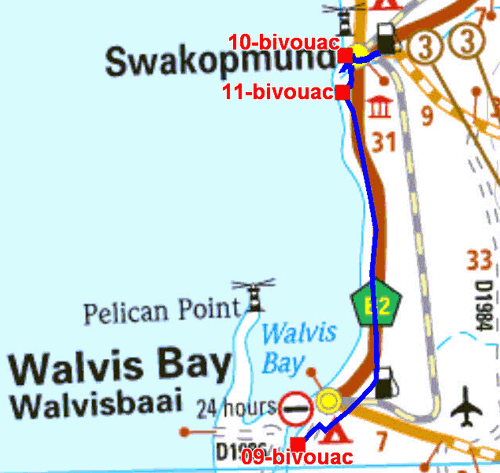
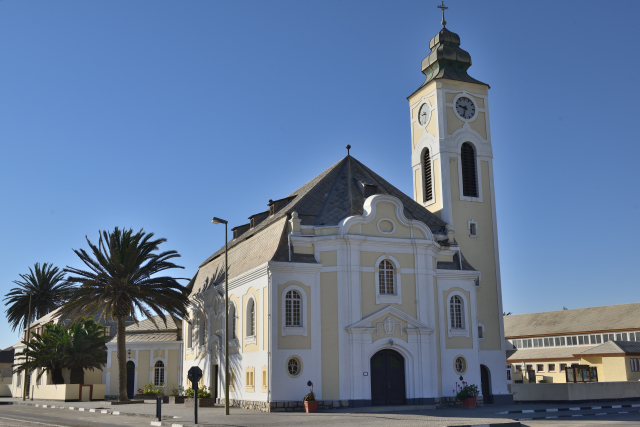
On Tuesday, June 5 I went at low speed to Swakopmund away from approximately 35 km of Walvis Bay. The name of the city means the estuary, the mouth, of the Swakop river. As of the entry downtown as in Walvis Bay I made attacked by a modern city built in sand with buildings for the majority without stored except the historical buildings of the time of German colonization. The first building that I saw was Prinzessin Ruppercht Heim of 1902 as military hospital. Of course at side the oldest building, Alte Kaserne goes back to 1892, it is transformed into youth hostel and perhaps that in the years 1935 it became a youth hostel… But it is another story. By carrying on my way I reached Jetty de1905 restored with concrete pillars was built to transship the passengers from steam-boats due to the strong swell at this place. Then Hohenzollern Building of 1906 capped with an Atlas supporting the world. Woermannhaus of 1905 was set up to shelter commercial firms before falling in decrepitude to be finally restored in 1988. The lighthouse of 1902 dominates Kaiserliches Bezirksgericht which became the summer residence of the president. I made the dead end on the other monuments considered historical of the colonial period. At the beginning of afternoon I establish my bivouac on a car park vis-a-vis the sea.
|
|
| Bivouac in Swakopmund on parking |
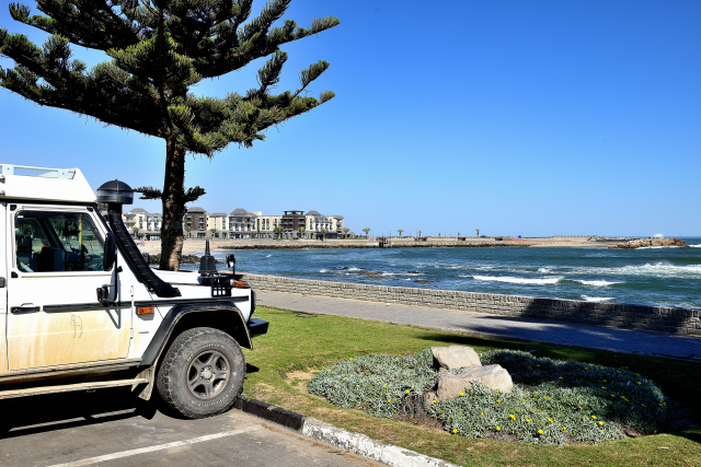
The day of the Wednesday, June 6 occurred meanly in purchases and visit at NWR to obtain the permit to make the tour of Welwitschia Plains. At the end of the morning I went on a beach at the entrance of Swakopmund which I had located at the time of my arrival.
|
| Bivouac before Swakopmund on beach |
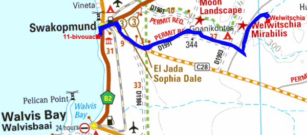
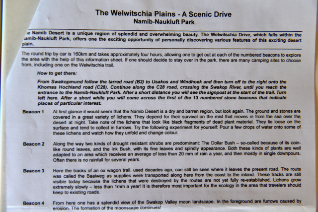
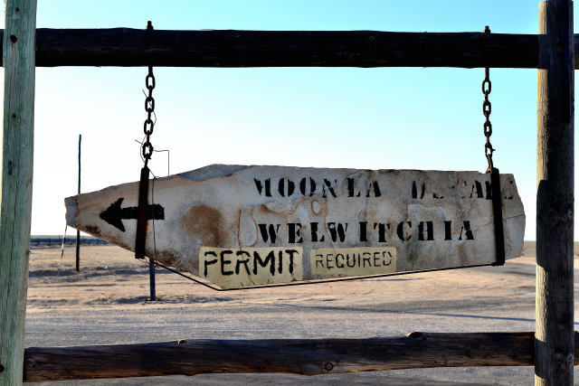
The trail “The Welwitschia Plains” is an initiatory tour in the Namib desert marked out of beacons numbered and referred by the road book indicating sights to be seen. The distance return from my bivouac on the beach is of 141 km according to the mileage odometer of my vehicle. I traversed it in four hours stops included. Of course the target is to go to see the extraordinary plant called after the name of its inventor Dr. Welwitsch in 1860, here. The track crosses desert landscapes of great beauty of which one is called “Moon Landscape”. The road book clarifies some of the pictures. On my way I met a French man on vacation in Namibia.
 |
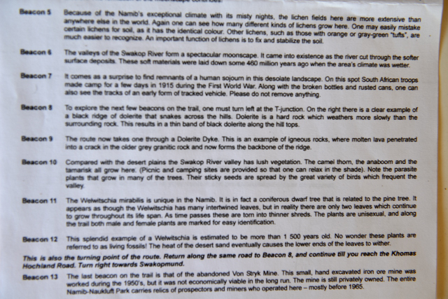 |
| Welwitschia road book | |
|
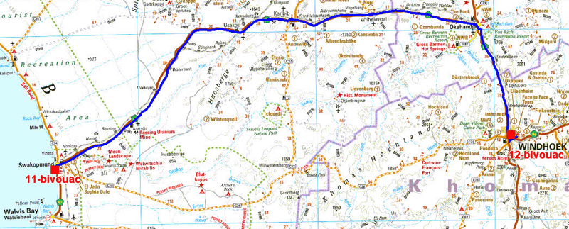
On Friday, June 8 I left the beach of Swakopmund as of the daybreak to rejoin Windhoek to roughly 360 km by the tarred B2 road. While arriving I was going to inform me at Mercedes-Benz of the garages sharpened in north of the country to carry out the periodic revision of my vehicle. The reception was cordial and hastened. Only Ondangwa has a Mercedes-Benz garage before I leave Namibia. Then I establish my bivouac for three days in Urbancamp. I spent the afternoon to reserve a camp-site in two wild life parks, Erindi Private Game Reserve and Okonjima Reserve.
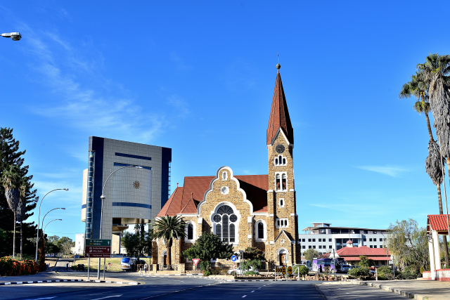
On Saturday, June 9 I visited the town of Windhoek located at 1660 meters of altitude given by GPS with a population of approximately 330000 inhabitants. For German colonization it was the general headquarter of the Imperial Army. Then with independence it became the capital of Namibia. Except for the buildings of the colonization of the beginning of the 20th century, the city is resolutely modern with buildings large-height as the panorama from the top of Independence Memorial shows it. The railway station goes back to 1912 in the Cape Dutch style with a remarkable room of the counters. In frontage a German steam locomotive, Poor old Joe, throne from the top of its antique date goes back to commissioning in 1899. Neighborhoods, locomotives are exposed with a boiler, immense coal stove. Further on Turnhalle from 1909 was transformed into gymnasium. The palace of the government, modern building, is preceded by a raised garden with very coloured subtropical flowers. At a roundabout Christuskirche is in foreground of Independence Memorial. It was built and devoted in 1907 to the Lutheran rite. It is seen from the top of Independence Memorial and is often regarded as the landmark of the city. The panorama gives an outline of this modern city. In front of Independence Memorial the statue of the founding father of the nation, Sam Nujoma, holds up the act of independence vis-a-vis the bell-tower of Christuskirche. Before returning to Urbancamp I made food supply in Pick n' Pay with alas an underground car park limited to 2.2 meters height. I stationed neighborhood with the possibility of using the caddy of the supermarket to transport the mineral water jars.
Sunday, June 9 was devoted to the publication of the pages of my website, to the preparation of the visits of the wild life parks and at rest of my spirit by philosophical readings, Paul Valéry and Rémi Brague, in particular.
|
| Christuskirche |