-- Smithers to Skagway
The road tracklog
from Smithers to Dease Lake
from 2011/05/30 to 2011/06/03
Monday May 30 the sun played hide-and-seek behind clouds then a storm burst around 4 p.m. In the late morning I visited in Hazelton two historical villages of the First Nations, Ksan Village then Kispiox Village. Ksan Village –Gitxsan people– is composed of seven Longhouses preceded by Totem Poles of which four are visited with a guide, alas No picture. The museum exhibits some traditional items but the three others are much more interesting with an audio animation presenting the objects in their cultural vocations inserted in the lifestyle. Houses, objects and totem poles are made with red cedar.
Modern village
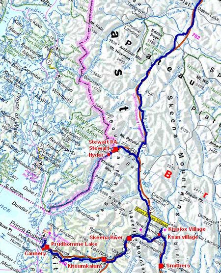
Hazelton
30/05/2011

Historical Village
Hazelton
30/05/2011

Totem
Ksan Village
30/05/2011

Frontage
Ksan Village
30/05/2011
Further away Kispiox village exhibits about fifteen totem poles on a background of snow-capped mountains. I bivouacked at the edge of Skeena River on a rest area on the way towards Prince Rupert.

Totem
Kispiox Village
30/05/2011

Frontage
Kispiox Village
30/05/2011

Bivouac
Skeena River
30/05/2011
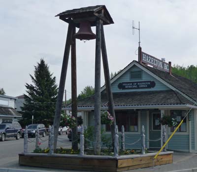
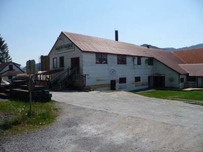
The last day of May was a great sunny day with a light fog descended from the snow-caped summits. The first stop was in Terrace to visit the Heritage Park Museum. The city was built in the end of the 19th century and took its rise with the completion of the railway to Port Rupert then in the Twenties by the construction of a steel bridge spanning Skeena River. The Thirties and the great Depression involved its decline at 500 inhabitants. The World War II by the Japanese marauder warships started again the economic activity with the arrival of the Commonwealth armies. Today the city is an important economic hub by forestry industries and a huge complex of aluminium smelter at Kitimat. The Park hosts eight red-cedar log houses built in the beginning of the 20th century.

Heritage Park Museum
Terrace
31/05/2011

Heritage Park Museum
Terrace
31/05/2011
Heritage Park Museum
Terrace
31/05/2011
Hwy 16
En route
31/05/2011
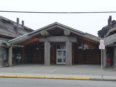
The second stop in the early afternoon was in Port Edward to stroll in the only still existing salmon cannery on the Pacific coast created in 1889 it was in activity during nearly one century. Then I returned on Hwy 16 to bivouac at the edge of the Prud'homme Lake.
North Pacific Cannery
Port Edward
31/05/2011

North Pacific Cannery
Port Edward
31/05/2011

North Pacific Cannery
Port Edward
31/05/2011
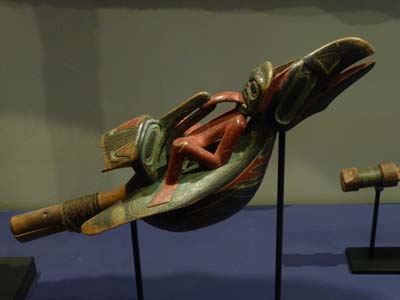
I arrived in Prince Rupert in a thick fog and a sharp cold. I immersed myself in the Museum of Northern British Columbia during most of the morning. It is installed in superb a red-cedar log longhouse. I show the items of the part concerning the First Nations, the remainder is the odds and ends of settlers. Then I strolled the few streets of the city and Cow Bay where there was no alive soul. After the lunch at Charley's Lounge I made a stop at the Prince Rupert Library to consult my mailbox. On this June 1st tourist activity was null, I took again my way to Terrace where I arrived little before 5 p.m. to make the wheels of my truck rotated, already 10,000 km from Houston 18/04/2011. I bivouacked in Kitsumkalum Park.
Museum of Northern British Columbia
Prince Rupert
01/06/2011

Museum of Northern British Columbia
Prince Rupert
01/06/2011

Museum of Northern British Columbia
Prince Rupert
01/06/2011

Museum of Northern British Columbia
Prince Rupert
01/06/2011

Museum of Northern British Columbia
Prince Rupert
01/06/2011

Museum of Northern British Columbia
Prince Rupert
01/06/2011

Museum of Northern British Columbia
Prince Rupert
01/06/2011
Museum of Northern British Columbia
Prince Rupert
01/06/2011
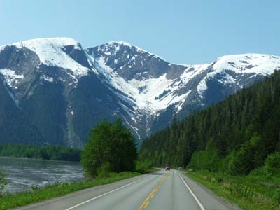
As of dawn I balanced the pressure of my truck tires which had been rotated then I filled the tanks with diesel and the refrigerator with food for the long road northwards. I left Terrace towards 8 a.m. At Kitwanga I took Hwy 37 called Stewart-Cassiar Highway for Watson Lake, it avoids making a long detour to take Alaska Highway, Hwy 97. Alas, on the way I discovered a signpost announcing that Hwy 37 was closed but that Hwy 37A was opened. I thus head to Stewart and Hyder, the twin city in Alaska. Only interest of these two cities is to see glaciers as in season salmons up to the river. The crossing to Alaska does not pose any problem it does not have customs there, but back to Stewart there is the customs of Canada which checks the passport symbolically. I discussed with the customs officer on the cause of closing Hwy 37. A forest fire released a cloud of smoke darkening the atmosphere in Yukon. I could go up to Dease Lake then to decide heading northwards…
Glacier
Hwy 37A
02/06/2011

Main Street
Stewart
02/06/2011

Ghost Town
Hyder
02/06/2011

Main Street
Hyder
02/06/2011
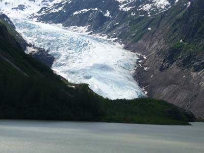
On my waking I had decided to try my luck by carrying on my road on Hwy#16 in spite of signposts Road Closed. But before reaching the junction of Hwys#16A and #16 I took two pictures, initially the glacier and its translucent blue colour then a bear grazing grass of the slope and looking me without fear like a cow.
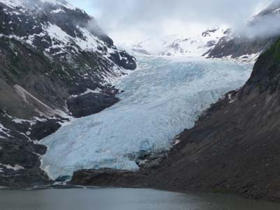
Glacier at 7am
Hwy#16A
03/06/2011

a bear !
Hwy#16A
03/06/2011

The road tracklog
from Smithers to Dease Lake, Alaska, USA
from 2011/06/03 to 2011/06/05
On the way I informed myself at the met roadhouses, I always obtained the same answer: the road is closed, but at Dease Lake you will have information. Mow, I was obstinate continuously. In Dease Lake I learned that the road was open in convoy with a pilot at 160 km northwards of the city where I arrived at 4 pm. A convoy left at 5 pm to reach one hour later the junction with Hwy#97. Conclusion, worst is never certain, but sometimes it is a gamble. It was a long day with a cold, misty and rainy weather. Trees of the forest in edge of the road were burnt on all the way and fumaroles still escaped from ground and logs while an helicopter whirled in observation. I was perplexed as for the cause of the fire…

Pilote car
Hwy#16
03/06/2011

Burnt trees
Hwy#16
03/06/2011
The following day I visited two villages. First Testlin where the Tlingit people of the First Nation had established its camp since a long time. George Johnston was a Tlingit, trapper, fur trader, entrepreneur and photographer. A nice small museum is devoted to him with of course many pictures.

George Johnston's car
Teslin, museum
04/06/2011

Photo in 1930's
Teslin, musée
04/06/2011
Further away Tlingit Heritage Centre exhibits modern Totem Poles and Masks created by local artists.
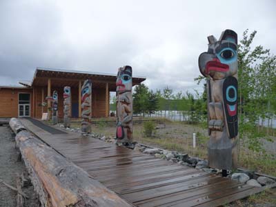
Totem poles
Teslin, Tlingit Heritage Centre
04/06/2011
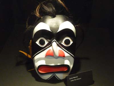
Modern masquee
Teslin, Tlingit Heritage Centre
04/06/2011
Towards Skagway on Hwy # 2 Carcross, Tagish people, is the focal point of waterways, roads and railway. The village is under restoration for the opening of the tourist season. The museum within the station presents pictures of time with the history of the construction of the railway and the Gold Rush. Still a long day in landscapes typically of North Canada by a gloomy weather at an altitude varying from 750 to 900 meters high.

General Store
Carcross
04/06/2011

Train station
Carcross
04/06/2011

Photo in 1900's
Teslin, Tlingit Heritage Centre
04/06/2011
Sunday June 5 as of 7:30 am hour of Yukon Territory –Pacific Time– I left my bivouac to enter Alaska, USA but before I briefly passed from Yukon Territory into British Columbia. Skagway at the edge of the Pacific Ocean is in the -Alaska Time- that is to say one hour less than the YT and the BC and ten hours in advance of Paris Time. The visit of Skagway is thus in the travelog of the USA.