-- From Klondike jct to Fort Nelson

The road tracklog
from Klondike & Dempster Jct to Whitehorse
from 2011/07/18 to 2011/07/19
Silver Trail
The Silver Trail Hwy # 11 connects Stewart Crossing on Klondike Hwy and the silver & gold mining fields at Keno. Mayo the first city at about 54 km away was created in 1903 to transport the ore from Keno to Whitehorse by barges on Stewart River. Binet House, restored old house and transformed in museum, recall the economic activity of the city and exhibits old pictures putting forward the life of its inhabitants at the edge of the river.

Mayo
18/07/2011

Binet House
Mayo
18/07/2011
Keno City
At 60 km away in the mountains the town of Keno, 23 inhabitants today, had its heyday in 1900's. Currently the social life is centred at the crossroads of muddy gravel tracks where the museum and its appendices, the Anglican Church transformed into library and the very famous Snacks Bar are, if not buff. The day was rainy, my truck was muddy again, with a mild temperature at this latitude.
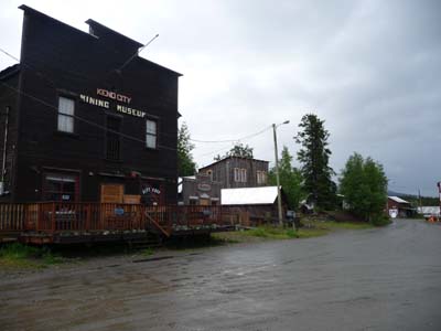
Mining Museum
Keno City
18/07/2011

Old picture
Keno City
18/07/2011

Main Street
Keno City
18/07/2011

Snack Bar
Keno City
18/07/2011
As in other museums it is mentioned Beringia, I did not resist to give two bad-quality pictures but interesting, one presents with humor migration of wild animals in the two directions and the second was at the edge of Halfway Lakes where I bivouacked.
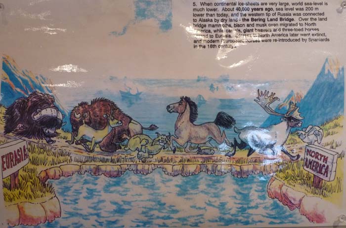
Beringia
Keno City
18/07/2011

Beringia
en route
18/07/2011
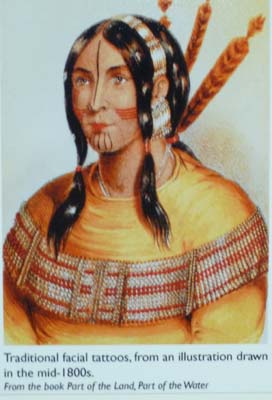
The day was particularly rainy and misty. I had projected to go in the mountains at Faro and at Ross River, I gave up to go directly to Whitehorse the capital of Yukon Territory. On the way I made two cultural halts. The first was in Pelly Crossing to see the exhibit of items of the Selkirk First Nation housed in the Big Johnathan House.
Pelly Crossing

Big Johnathan House
Pelly Crossing
19/07/2011
|
|
Tatoos & paintings |
|

Carmacks
The second was in Carmacks at Tagé Cho Hudän to admire artifacts of the Northern Tutchone First Nation. I arrived in the late afternoon in Whitehorse.

Tagé Cho Hudän Interpretive Centre
Carmacks
19/07/2011

Tagé Cho Hudän Interpretive Centre
Carmacks
19/07/2011
Be careful, meeting of third type!
en route
19/07/2011
As of 8 am I looked for a tire workshop to rotate the wheels of my truck already +10,000 since Terrace on 01/06/2011. The work lasted about 45 minutes. Then I was heading to visit Yukon Beringia Interpretive Centre where I stayed all the morning to attend two films. The Centre exhibits in various tables the origin of the lost continent, fauna, flora and the arrival of the first settlers coming from Asia.
Whitehorse
Beringia
The lost sub-continent of Beringia dates back to the last great ice age. While the rest of Canada lay frozen under massive sheets of ice, a region encompassing eastern Siberia, Alaska and Yukon remained untouched by glaciers. Sea levels dropped by as much as 125 meters and a grassy tundra appeared, supporting as astonishing variety of animals and plant life. The New World earliest human inhabitants moved into what in now North America from western Beringia, following the various herds of animals. (From the booklet of the Centre)

Yukon Beringia Interpretive Centre
Whitehorse
20/07/2011

Yukon Beringia Interpretive Centre
Whitehorse
20/07/2011

Yukon Beringia Interpretive Centre
Whitehorse
20/07/2011
After a short stop at the library for Internet without possibility to publish the pages of my website I lunched at McDo where WiFi connection is always powerful. In the afternoon I visited the impassioning McBride Museum of Yukon Territory which exhibits the various species of animals, the epopee of the Gold Rush without forgetting the construction of Alaska Hwy by US Army and the odds and ends of last century.

McBride Museum of Yukon History
Whitehorse
20/07/2011

McBride Museum of Yukon History
Whitehorse
20/07/2011

McBride Museum of Yukon History
Whitehorse
20/07/2011
Finally en route to do shopping I paid a visit to Old Log Church Museum. One day filled well in the rain.

Old Log Church Museum
Whitehorse
20/07/2011

Old Log Church Museum
Whitehorse
20/07/2011
The last day in Whitehorse was agreeably sunny, I left in excursion at Miles Canyon located at km 1416 on Alaska Hwy. At the Gold Rush era intrepid stampedes descended it by emergency rafts, today it is controlled by a hydroelectric power.

Miles Canyon
Whitehorse
21/07/2011
Back to downtown I visited Transportation Museum presenting some specimens of ancient vehicles and of course some old pictures.
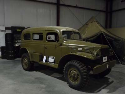
Transportation Museum, Dodge Carryall
Whitehorse
21/07/2011

Transportation Museum
Whitehorse
21/07/2011
On the Yukon River bank S.S. Klondike was ran aground for tourists. It is the largest sternwheeler boats with paddles at the back having sailed on Yukon River. Between 1860 and 1950 two hundred and fifty sternwheelers sailed on Yukon River, they were designed with a draught of one meter to coast out of not very deep water.

S.S. Klondike
Whitehorse
21/07/2011

S.S. Klondike, wheelhouse
Whitehorse
21/07/2011
In the afternoon I strolled in downtown where I attended a concert at Lepage Park.

Old houses, today
Whitehorse
21/07/2011

Old house, in previous century
Whitehorse
21/07/2011
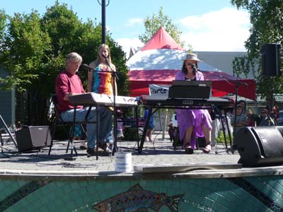
Lepage Park
Whitehorse
21/07/2011
Alaska Highway

The tracklog
from Whitehorse, YT, to Whirlpool, BC,
The 22/07/2011
Leaving Whitehorse I took the emblematic Alaska Hwy # 1 southwards. I had traversed a part of it on 4/06/2011 heading to Alaska. Passing again at Teslin I took again a picture of Totem Poles of The Teslin Tlingit Heritage Centre that I had seen in the rain. Of course I photographed the Bridge of Teslin whose local people are very proud.
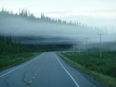
Morning fog
en route
22/07/2011
Teslin
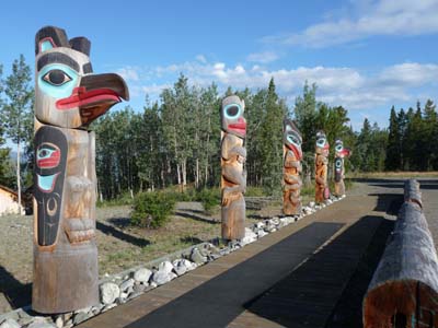
The Teslin Tlingit Heritage Centre
Teslin
22/07/2011

The Bridge
Teslin
22/07/2011
Watson Lake
In Watson Lake except Interpretive Centre about the construction of Alaska Hwy there are two major sights. The Sign Post Forest which was at the beginning created by a homesick GI during the construction of Alcan Hwy. Since sign posts multiplied, it would have some more than 68,000 of any origins of which a French.
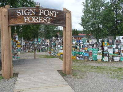
Sign Post Forest
Watson Lake
22/07/2011

A French sign-post
Watson Lake
22/07/2011
On the other side of Hwy # 1 Northern Lights Centre presents on a dome with an
ad hoc projector two movies, one on the astronauts in space, the other more
specific on the aurora borealis, highly recommendable.
…”The Northern Lights –Aurora Borealis– are actually the
result of collisions between gaseous particles in the Earth’s atmosphere with
charged particles released from the sun’s atmosphere. Variations in color are
due to the type of gas particles that are colliding. Oxygen molecules located
about 60 miles above the earth produce the most common auroral color, a pale
yellowish-green. Rare, all-red auroras are produce by high-altitude oxygen,
at heights of up to 200 miles. Nitrogen produces blue or purplish-red auroral.”
(From a booklet of the Centre)

Northern Lights Centre
Watson Lake
22/07/2011

The tracklog
from Whirlpool, BC, to Fort Nelson, BC,
From 23/07/2011 to 24/07/2011
From Whirlpool I made many photo stops as well for landscapes as for wild animals met on the road. Of course some animals fled at the noise of my truck, they were a bear, two foxes and hares, it was impossible to take them in photo while driving. On the other hand the bison herds grazing on the low sides of the road were by no means frightened; size of animal obliges, they did not have anything to fear. They seemed identical to those seen in snow of Yellowstone NP in the USA. At the time of the climb towards Summit Lake -1295 meters high some mountain animals licked the roadway containing salt of antifreeze. I lengthily slackened in the Liard River Hot Springs. In the late afternoon I found a bivouac in the descent from the Summit towards Fort Nelson.

Bison
Alcan Hwy #1, BC
23/07/2011

Bison
Alcan Hwy #1
23/07/2011

Liard River Hotsprings
Alcan Hwy #1
23/07/2011

Mother & cub
Alcan Hwy #1
23/07/2011
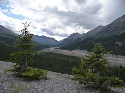
Landscape
Alcan Hwy #1
23/07/2011
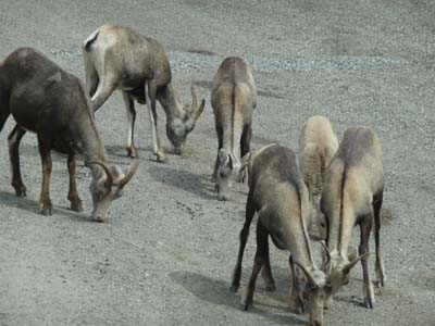
Chamois ?
Alcan Hwy #1
23/07/2011
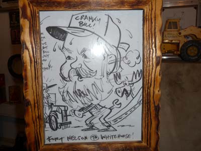
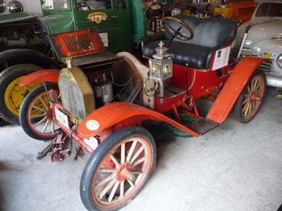
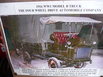
Fort Nelson
Quietly Sunday July 24 I drove to Fort Nelson for a Sunday bivouac in a RV campground, Triple “G” Hideaway RV Park. The city whose economic activity is the lucrative gas extraction has as only attraction a museum located at Milestone 300 on Alaska Highway. This museum holds especially of a break-in of old vehicles, it is not that of Fairbanks, and two or three log cabins. The only presentable cars are in a hangar, others rotted slowly outside according to the rhythm of winters with extreme temperatures. An antique Ford headed from Fort Nelson to Whitehorse, 968 km. From Fort Nelson to Whitehorse Alcan is like as a secondary road in deep France! At the bivouac after Summit Lake I underwent a violent storm during several hours,. in Fort Nelson weather was milder.
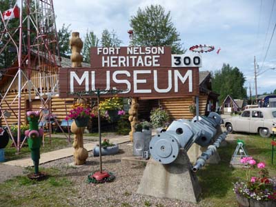
The Museum
Fort Nelson
24/07/2011

The Museum
Fort Nelson
24/07/2011

The Museum, Old Ford
Fort Nelson
24/07/2011
The Museum, Ford's team above
Fort Nelson
24/07/2011
The Museum, Brush 1909
Fort Nelson
24/07/2011
The Museum
Fort Nelson
24/07/2011