-- From Québec to Rivière Tartigon
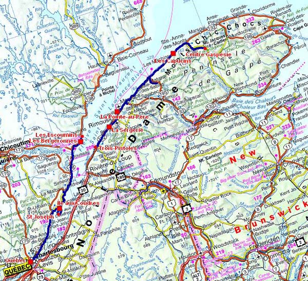
The road tracklog
from Québec to Rivière Tartigon
from 19/09/2011 to 25/09/2011
Île aux Coudres
L'Île aux Coudres was named by Jacques Cartier the 06/09/1635 when he mourning in la Baie de la Prairie. He discovered there hazel trees called couldres. A 26-km road circle it.
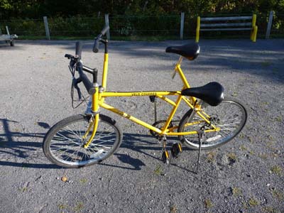
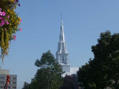
At the campground of Furnace Creek in Death Valley, the USA, I met the 12/03/2011 a Canadian having a shop of bicycle hiring on this island, Vélos-Coudres. I had promised to visit him. This morning by leaving Québec I headed to take a "traversier", Quebecer word stand for the Anglicism ferry. With the booklet that he gave me I met him. We used a strange machine for two people, this disposition is preferable to a tandem. He gave me useful information of which a remarkable bivouac at the edge of the Saint Laurent opposite a church.
|
|


Bivouac
Île aux Coudres
19/09/2011
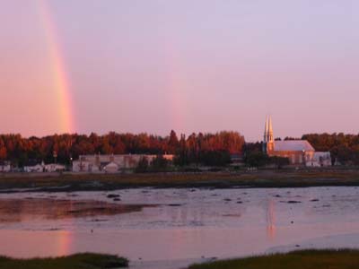
In the early morning on September 20 the sky was black of clouds darkening the sunrise. But during a short moment a rainbow appeared then a pink light flooded the mountain, a great moment of happiness. The day was gloomy, rain and fog with a poor visibility. I jumped La Malbaie, named by Samuel de Champlain in 1608 whose ship had to await the tide to leave: “the worst bay”.

Sunrise
Île aux Coudres
20/09/2011
|
|

Tadoussac
Tadoussac, tourist village, were in the maritime drizzle. The city was a fur trade post for a long time, it accepted the visit of Jacques Cartier -1535 - tourist bus had poured their hordes of -Whale Watchers-

Chapel of Tadoussac & eponym Hotel
Tadoussac
19/09/2011
In 1600 Pierre de Chauvin founded a small trade post where he left sixteen men of which only five survived. Gilles Vignaux: “My homeland, it is not a land, it is the winter”.
|
|


I visited the Center of Interpretation of the Marine Mammals -CIMM- presenting in a succession of signs their life and their loves: “They do like us”. I choose the Paradis-marin campground to try & see these great mammals out noisy tourists.
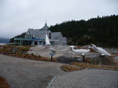
Centre d'Interprétation des Mammifères Marins
Tadoussac
2O/09/2011
|
|

The 21/09 was a day of observation and waiting of the passage of whales in the estuary of the Saint Laurent. I did not remain sited in front of the river, I am not a contemplative man. In the morning I saw to pass far away black backs with a dorsal fin as well as two white whales, beluga. At the end of the afternoon I was luckier with a whale close to the shore. In the absence of several species I give the pages of the CIMM pamphlet. This day was the only sunny one in the middle of a rainy fortnight according to Canada weather. The remainder of the day I prepared my journey in New Brunswick and Nova Scotia before entering Maine, the USA, with a three-month visa.
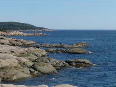
Les Bergeronnes
20/09/2011

|
|


Les Escoumins towards Les Trois-Pistoles
After having left the Paradis Marin campground where it is necessary to pay shower $1 per minute I found a WiFi Internet connection in the center of Les Escoumins what enabled me to kill time while waiting for the departure of the ferry to Les Trois-Pistoles at 18:30 where I got off night about 20:30. After around 40km a rest area accommodated me for the night.
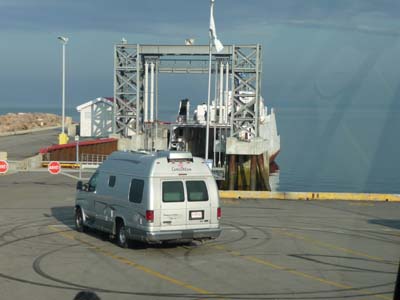
Les Escoumins
22/09/2011
RimousKi
Rimouski is a charming prosperous city which was drowned in a thick fog. Before entring downtown I went shopping at Walmart. Tourist Office was very accessible and moreover there is a WiFi connection. In the late morning I arrived at Pointe-au-Père where the musée de la mer is. I lunched on the carpark behind the Onondaga submarine later I decided to spend the night there. The afternoon I visited the lighthouse built in 1909 offering a bird's eye view on the surroundings still covered with a light fog.
|
|


Pointe-au-Père
23/09/2011
The musée de la mer is entirely devoted to the shipwreck of Empress of Ireland on May 29 1914 which made 1012 victims after colliding with Norwegian collier in the fog. It was one relaxed day strolling on the site in a warm sun.
|
|


La Gaspésie
Gaspésie is a peninsula bordered in the north by the estuary of Saint Laurent River and in the south by the Gulf of Saint Laurent and the Baie des Chaleurs. In 2009 the National Geographic Soceity classified Gaspésie as the third more beautiful destination in the world after the fjords in Norway and the national parks of Koonetay and Yoho in British Columbia. The area is a true culture medium since the First Nations, the French, the Acadian and many other nationalities from Europe.
I entered Gaspésie at Sainte Flavie where I visited the Tourist Office whose reception was cordial and well documented. Moreover I asked for the address of a computer shop because that of which I use for navigation had been polluted by a software which claims to improve and accelerate operation. Alas this software had put my broken down computer. The shop was closed on Saturdays but the owner agreed to deal with my problem. I set out again at the beginning of afternoon. On the way I was diverted to see a covered bridge “Pierre Carrier” close to Saint Ulric and another in Saint René-de-Matane, look at the Gallery of pictures. There remains nine in Gapésie.

Sainte Flavie
24/09/2011

Saint Laurent
24/09/2011
|
|


Parc National de Gaspésie
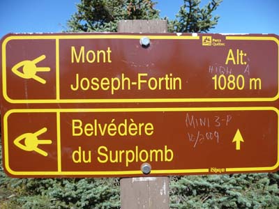
The National Park of Gaspésie in the south of St Anne-of-Mounts is one of the most beautiful in Quebec with the Mounts Chic Cock and McGerrigle. It has the only herd of Caribou in the south of the Saint Laurent River.
The Center of Interpretation exhibits an exceptional gallery of pictures of animals. On helpful of a ranger I undertook the trekking of the Mount Joseph-Fortin given for 9,8km with uneven of 490m. Actually I walked 11,3km GPS with the lookout of la Falaise in about 3h36 without the pause lunch at the Belvedere of the Mount Fortin. Landscapes along the track started to get dressed with the autumnal colors of the various tree species of the forest. I spent a pleasant Sunday in the sun with an announced temperature of 20°C accompanied by a strong wind. Alas I returned to St Flavie because the computer of navigation was again broken down. I bivouacked at the edge of the Saint Laurent close to the Tartigon River.

Centre of Interpretation
Parc National de la Gaspésie
25/09/2011
|
|


Grands Harles
Le Grand-duc d'Amérique

GPS Trek map
Parc de la Gaspé
25/09/2011

Trek track
Parc de la Gaspé
25/09/2011
|
|


|
|