-- From Mont-Joli to Gaspé

The road tracklog
from Mont-Joli to Gaspé
from 26/09/2011 to 02/10/2011
Mont-Joli
Monday September 26 as of 8:30 I was at the gate of the computer shop. I explained the new dysfunction of my laptop of navigation. The person dealt with it for the day. In the morning I passed a scan on my old laptop which lasted about 2:30. SuperAntiSpyware detected a spy that Avast did have never found! In the afternoon I strolled in the town of Mount-Joli by traversing the fresco tour which tell in twenty murals the story of the city, its contractors and its children passed, present and future. The day was sunny and windy.
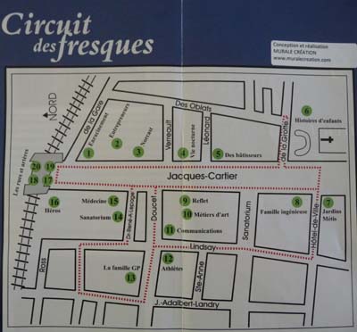
Murals
Mont-Joli
26/09/2011
City whispering
Mont-Joli
26/09/2011
|
|


Kids... stories
Development of communications
|
|
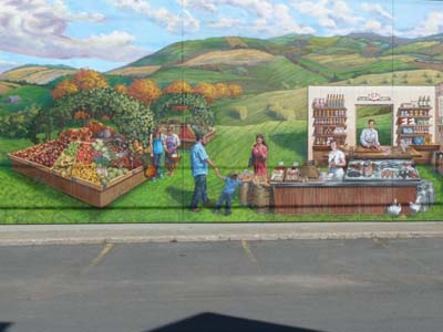
From dream... to prosperity
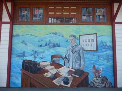
Country doctors
Tuesday 27/09 the Panasonic laptop was ready about 1 p.m., I could thus publish the pages of my website and send my emails. I devoted most of the afternoon to reading the French press. Nothing amusing good, the usual gesticulations of the political community occupied the cover page of newspapers as well as the crisis of the euro always on standby of a pride-national consensus. The second laptop was repaired about 5:30 p.m. For security my computers are only set up with Microsoft Security Essentials, SuperAntiSpyware & Ccleaner. I took the road to find the bivouac at the Capuchins again.
Parc National de la Gaspésie
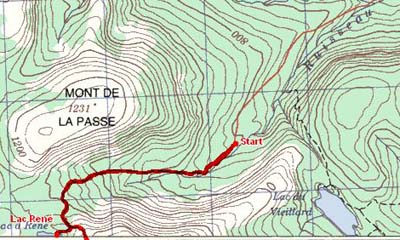
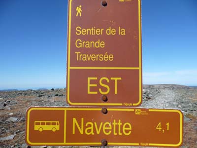
I had consulted Meteo Canada which announced a sunny day I decided to favor me of the repair of my computers within a new trek in the Park of Gaspésie. The rangers proposed the path of the MT Jacques-Cartier to me. I taken a bus for the Jacques-Cartier campground then a shuttle for the departure of the trek of which the first 100 meters are in a marvelous undergrowth. Then the track becomes rocky in the mountain, my knees sighed about it of pleasure. On the move I made two diversions, one for one moment of rest at the edge of the lake Rene then another on the path of the Caribou. The Center of Discovered had announced to me a view of a herd of Caribous, alas they were not with go. I walked the outward journey & the return 11,3 km GPS in about 3:30.
|
|
 |
 |
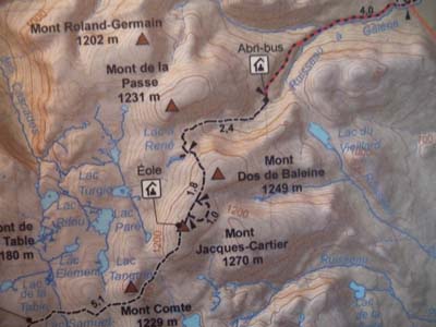
Carte du Centre
Trace GPS de la rando
|
|

Start of the track
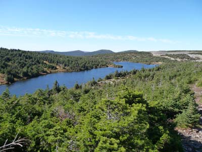
Lac René
|
|

Caribou track
Caribou track

Sommet du Mt Jacques-Cartier
Parc de la Gaspésie
28/09/2011
|
|

Return track
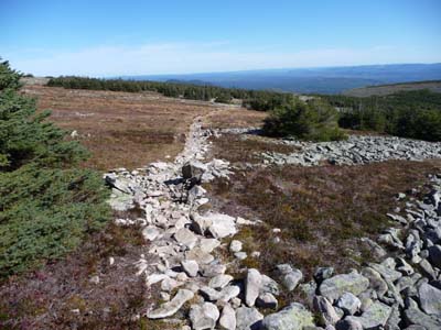
Rocky track!
In the return shuttle I met a Canadian who proposed me to accompany him not to await the return bus and to walk the 4,5-km loop of the Mt Ernest-Laforce to see mooses. There too animals were not visible although an army of over-equipped photographers were on standby event. The observation of the wilder animals is a long patient search. Tardily at the fallen night I found a bivouac at the edge of the St Laurent River at Ste. Anne-des-Mounts.
|
|
La côte nord
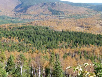
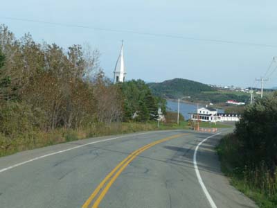
I left the bivouac in the late morning for a small driving day, the road meander between sea and mountain with sometimes the climbing of a hill. The townscape of villages built in a handle is characterized by a church tower and a lighthouse; each one has its function, for one soul safeguard in the upper world and for the other physical safety in this lower world. In this end September all sites are closed, no visit… The day weather hesitated between a covered sky and a shy sun.
|
|

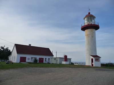
La Martre
Lighthouse museum
|
|
Ste Madeleine, The church
Ste Madeleine, the lighthouse
Gaspésie land's end
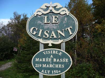
Following day 30/09 was a day without sun but without rain in spite of a dark sky. From a belvedere overhanging the village of Grande Valley a superb view on the small peninsula puts the church in prospect with the marine landscape. Beside a path under wood then a staircase go down at the edge of the shore to see lying, well but with much of imagination.

Belvedere view
Grande Vallée
30/09/2011
|
|

Grande Vallée sight
un gisant !
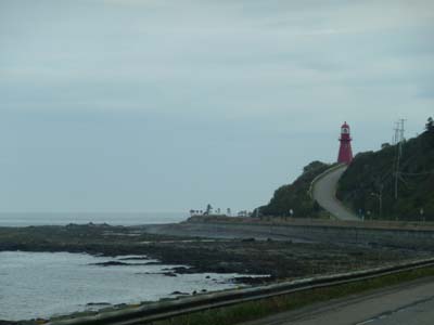
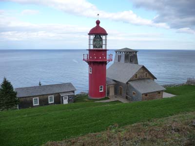
The very rugged coast and the many reefs were the theater many shipwrecks at the time of the sailing boats. Lighthouses were built of which some are preserved as national historic site. The La Pointe-à-la-Renommée has a famous lighthouse for the Guglielmo Marconi's visit into 1904 who installed the first wireless telegraph in North America in a dramatic seascape. Alas in this Friday the site was closed. Despite everything I visited it outside.

Lighthouse
Cap des Rosiers
30/09/2011
|
|

Closed !
Marconi 1904
Forillon National Park
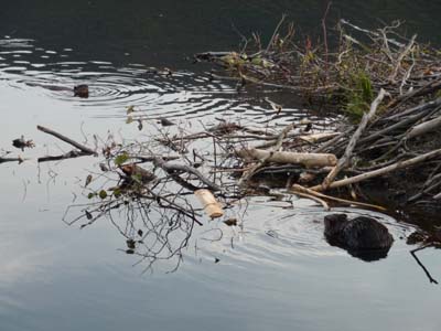
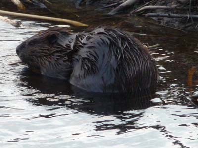
In middle of afternoon I entered Forillon National Park where I learned that at 4 p.m. a naturalist led a tour of the “beaver and its field”. At the night falling a beaver family left the hut to feed. I already remembered to have observed such a spectacle but at daybreak in Hinton, AB. I establish my bivouac for two nights at the campground Des Rosiers hoping to go for walks in the park without rain.
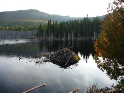
Beaver's lodge
Forillon
Park
30/09/2011
|
|
Saturdays 1st October I undertook the trek of the Mt St Alban loop. The weather was gloomy in spite of a weather forecast of the sun which remained hidden during my walk. At Cap Bon Ami a commemorative plate recalls a WWII fact which shows that Nazi Germany had carried its sword on all the seas in the world. The excursion is announced for 7,8km with 280m of uneven at the observatory, I traversed 8,14km GPS in 2:46.
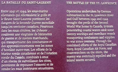
WWII
Cap des Rosiers
01/10/2011
|
|
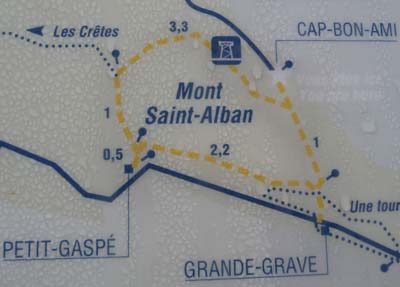

Map from Parc Forillon
GPS tracklog
From the top of the observatory the panorama is exceptional in spite of a fog darkening the view.
|
|

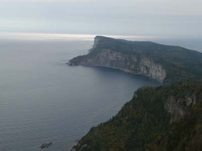
Cap des Rosiers & the lighthouse
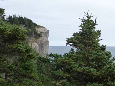
Cap Gaspé
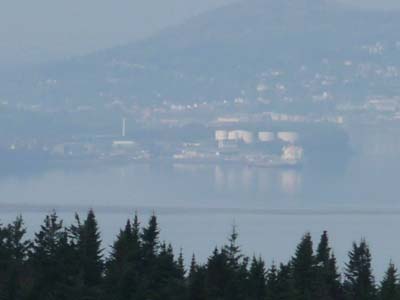
Far away Gaspé town
The path twists up hill and down dale in undergrowth among birds' songs, trees' rustle, creeks' murmur and forest odors. It was a great moment of quietude and inwardly peace.
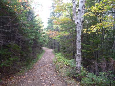
The track in undergrowth
Mt Saint-Alban loop
01/10/2011
Peninsula of Forillon
On Sunday I offered me a second trekking in the Park of Forillon. I had chosen the walk on the southern coast hoping to see marine mammals, whales, or terrestrial mammals, bears. I walked from Grande Grave to Cape Gaspé 16 km return in about 3:04 collation pause deduced. I saw neither the ones nor the others.
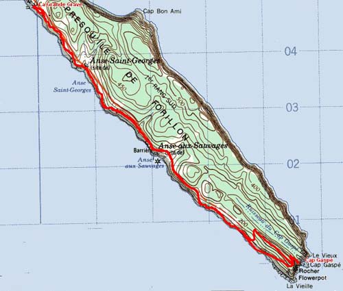
GPS tracklog from Grande Grave to Cap Gaspé
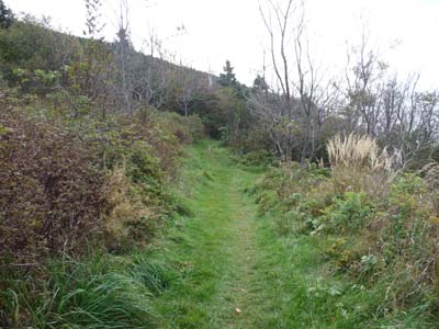
Weed track
trekkinge
02/10/2011
On the other hand bears leave on the ground some indices of their passage.

Bears ?
trekking
02/10/2011
|
|
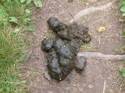
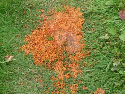
Bear droppings
Bear droppings
Of course at Cape Gaspé there is a lighthouse still in function with a sound electronics component to inform boats in the event of visibility lower than 2 nautical miles.
|
|


|
|

Cape Gaspé
Gaspé Bay

Track in undergrowth
trekking
02/10/2011
At the return the General Store in Grande Grave, historic site, was open exhibiting collections of items sold at the beginning of last century.
|
|

