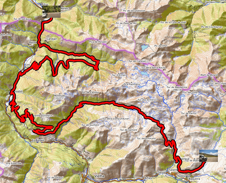
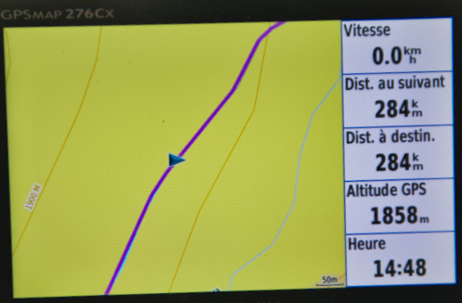
Theé GPS tracklog
Clic on the pic for opening it
from Fos (Haute-Garonne) to Pla-de-Beret
dfrom 2022/08/01 to 2022/08/01
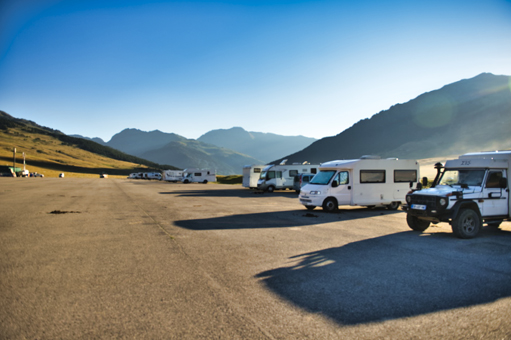
Pla de Beret
Monday August 1st first track of 2022 in the Spanish Pyrenees. I
took my marks and discovered after about twenty minutes that the GPS
mouse was faulty. I restarted the laptop the GPS signal was good,
but after about twenty minutes new failure and so on. We are always
betrayed by electronics. I bivouacked in a huge parking lot at Pla-de-Beret.
click on the pic for opening the gallery
|
|
| Bivouac Pla-de-Beret, Spain
|
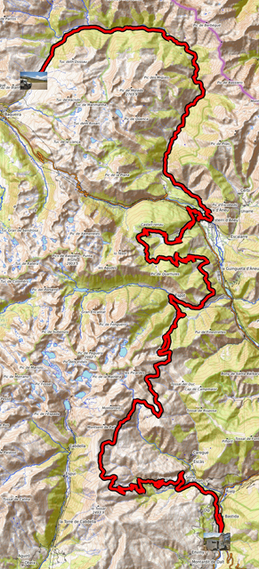
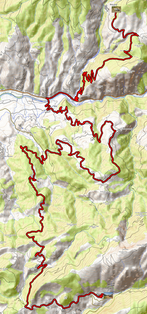
The GPS tracklog
Clic on the pic for opening it
from Pla-de-Beret to Sort
from 2022/08/02 to 2022/08/02
Sort
Tuesday August 2 long day +6h00 of driving, with only pee stops, in
grandiose landscapes but a tiring track from Esport to Llessui at
+2000 meters of altitude on the mountainside jumping from one pass
to another. On arrival in Sort I found the heat wave +33°C at 900
meters altitude with a bivouac in the city center in full sun. Oh
dear !
click on the pic for opening the gallery
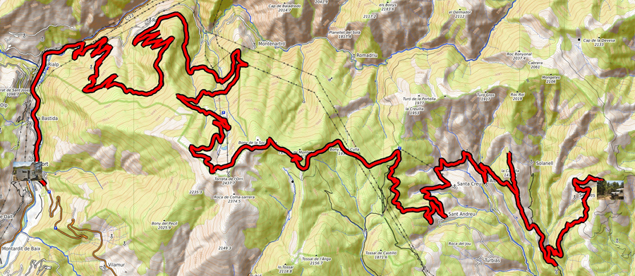
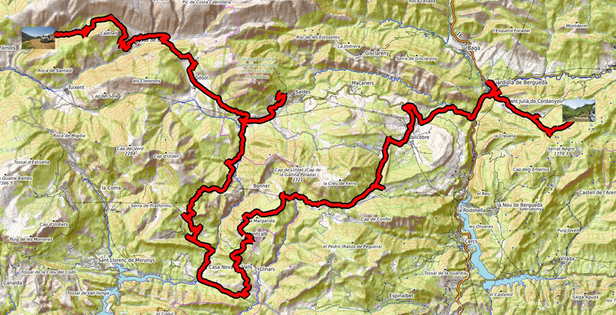
The GPS tracklog
Clic on the pic for opening it
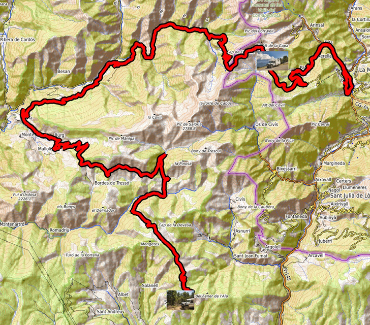
from Sort to WP-179
from 2022/08/03 to 2022/08/03
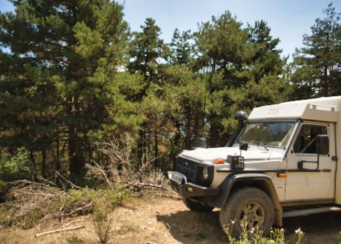
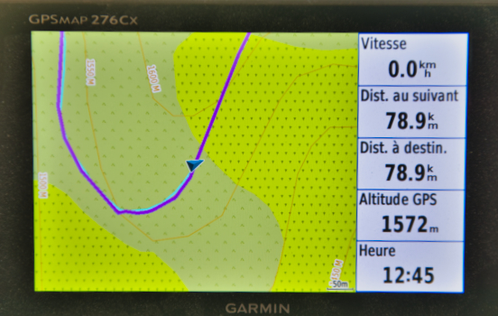
Waypoint-179
Wednesday August 3 another long day of +6 hours of driving for a
distance less than yesterday, 82 km. The track without being brittle
is difficult, especially the course between WP-163 and WP-166; twice
I engaged the reducer the tires slipped on the patches of rocks. The
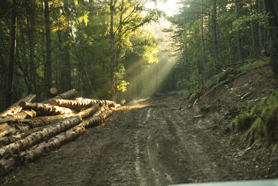
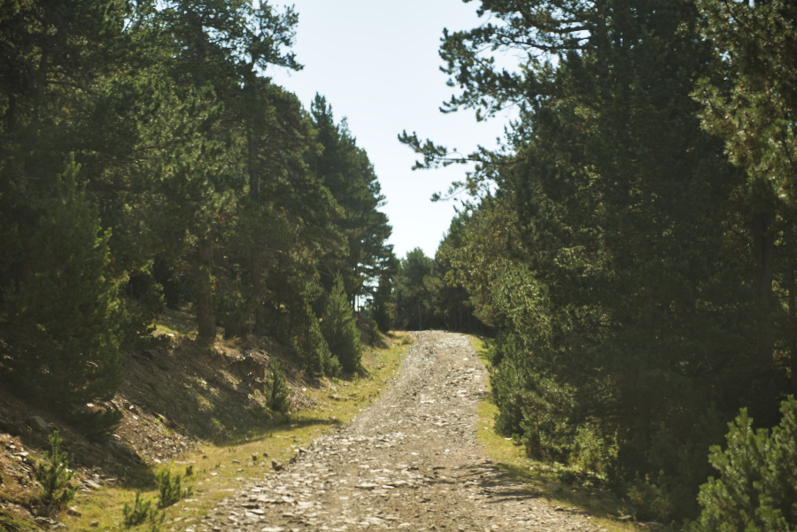
landscape is very changeable but the track is lined with different
trees, mostly conifers. I stopped at the edge of the track to
bivouac at WP-179 at 1572 meters altitude to have freshness.
click on the pic for opening the gallery
|
|
| Bivouac WP-179, Spain
|
The GPS tracklog
Clic on the pic for opening it
from WP-179 to Pal
from 2022/08/034 to 2022/08/04
Pal
Thursday, August 4, the trail will cross the high mountain pastures
where domesticated quadrupeds used to eat for human beings graze, a real
melting pot of races! After Tor the track weaves between the cliff and
the torrent on a narrow and stony track where the crossing of vehicles
is almost impossible. The rocks were pointing the nose making the
progression dangerous for the tires, the speed is about 5 Km/h. I
entered Andorra to fill up with diesel at a Total station at the price
of 1.635 euro per liter of Excellium! I returned to the heights to
bivouac at 2120 meters above sea level.
click on the pic for opening the gallery
| alt="img"
the GPS tracklog
Clic on the pic for opening it
from Pal to Waypoint-16
from 2022/08/05 to 2022/08/05
Waypoint-16
Friday, August 5, the day was eventful. I had planned to visit Andorra
and more particularly, Ordino, La Cortinada and the capital Andorra la
Vella. I was fine in these modern cities, but the car traffic is insane;
I went my way. In St-Julia de Loria same situation. This is the
beginning of the second Road Book in the Val d'Aran. But I made a
navigation error at waypoint 09 and the sanction was immediate. I
started on a rutted track with very deep ruts on unstable ground made up
of rock slag. I crashed the truck. I took out the shovel to clear the
wheels and put stones. The work was arduous and took a long time. A
vehicle was approaching and stopped, an SUV, too light to tow me. The
Spanish-only driver made unsuccessful phone calls. A second vehicle came
to pass, a MAN van, too light. The driver walked around my vehicle
making me understand that he would take it out. After continuing my work
of clearing the wheels. He got out my vehicle blocked axles and reducer
in reverse. I thanked him warmly. The solidarity of off-roaders exists
all over the world. I experienced it several times in my trip around the
world. Surely Providence was in every situation with me; I can say that
I am blessed by the Gods. I bivouacked at the edge of the track at
waypoin-16. Like yesterday, a violent hailstorm hit around 3:30 p.m.
|
The GPS trackloge
Clic o-053n the pic for opening it
from Waypoint-016 to Waypoint-053
from 2022/08/06 to 2022/08/06
Waypoint-053
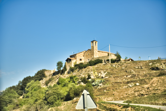
Saturday, August 6 the day began with descents in laces then reassembled
also in laces on a narrow track, only one vehicle at a time, I did not
meet anyone. The turns required two to three maneuvers which became
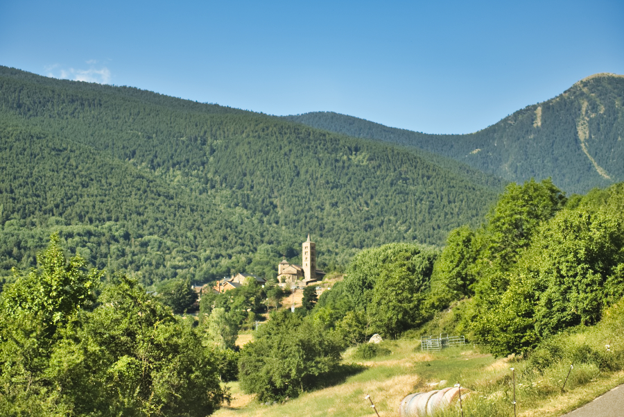
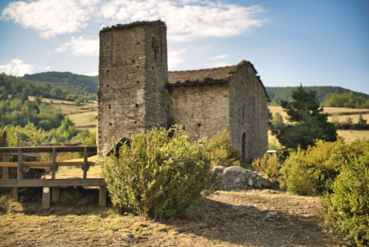
painful and unattractive. Of course the landscapes are sumptuous and the
villages are clinging to the mountainside. In this desert the meeting of
a chapel testifies to a very old habitat. I bivouacked at waypoint-053.
The GPS de la route
Clic o-053n the pic for opening it
from Waypoint-053 to Waypoint-161
from 2022/08/07 to 2022/08/07
Waypoint-0161
Dimanche 7 août la journée se passa sur des pistes très
caillouteuses requérant une faible vitesse, 10 Km. Heureusement il y avait
de longues portions asphaltées. Aucune difficulté de navigation sauf sur les
portions asphaltées sur lesquelles les locaux connaissant la route et leur
destination circulaient à la vitesse maximale autorisée. Pour ne pas faire
d’erreur de navigation j’adoptais une vitesse lente pour me diriger ; la
conséquence fut une longue file de véhicules derrière moi sans que les
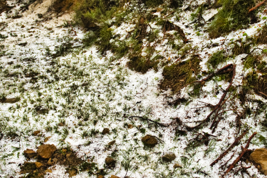
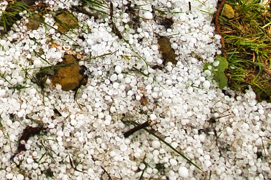
conducteurs manifestent leur mécontentement. Comme tous les jours je
cherchais un emplacement de bivouac en début d’après-midi, avant l’orage,
que je trouvais dans une courbe serrée avec un site plat idéale. Vers 16h00
un violant orage s’abattit sur les montages pendant une heure avec des
grêlons de bonne taille. Je mis un certain temps pour me rendre compte que
l’eau poussée par le vent dégringolait par les bouches d’aération du toit
sur le duvet et le matelas, dégât des eaux ! Il faudra plusieurs journées
pour le séchage ? Pour la première fois de mon
périple sur les pistes espagnoles, la connexion Internet est inexistante,
éloignement des habitations.
|
²
|
|
²
|
|