-- Flores, from Labuhanbajo to Larantuka
The road tracklog
From Labuhanbajo to Larantuka
from 12/08 to 20/08/2009
Flores Island
Histoire :
-- Before the 16th century the coasts of Flores Island were in the hands of
Makassars and Bugis de Sulawesi practicing barters with villagers. The east
Flores island was ruled by Ternates of Makalu.
-- In 1512 the Portuguese
unloaded and named the east cap, Cabo das Flores. They were interested only by
the trade of the sandalwood.
-- In the 17th century the Dutch pared the
Portuguese and in 1850 they bought the last Portuguese enclaves with Larantuka.
-- In 1949 Flores became a province of Nusa Tenggara and was attached
administratively to Kupang.
Population :
The population is 1.8 million inhabitants divided
into five ethnic groups. Those of the west are rather of Malayan origin and
those of the east rather of Melanesian origin.
Religion : 85% of the population
is catholic with animist customs –adat–, the remainder is Muslim in the
fisherman villages.
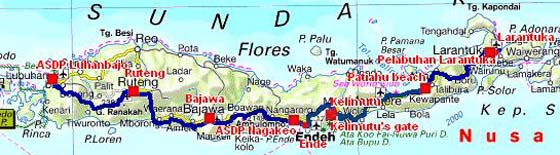
Labuhanbajo
The 12/08 the arrival of the ferry in Labuhanbajo was around 04:00 a.m. The truck unloading was very fast. I finished my night -I never drove after dark, it was too dangerous- on the carpark of the port close to a mosque whose the sound system bawled during ten minutes around 04:45 a.m., it was long. About 08:00 a.m. I presented myself at a Tourist Office, TO, to ask the ferry timetable from Larantuka to Kupang, Timor Island. The met people called the Ferry Office which did not answer. Then he led me to a cybercafé to publish the pages of my website concerning Sumbawa Island. Then I went again to the TO which had obtained desired information. The given timetable was different from those obtained in Labuhan Sape. Once again the reliability of information is random. As previously I reiterated my request along the road at each met TO.
La baie
Labuhanbajo
12/08/2009
Description of the road
by Lonely Planet
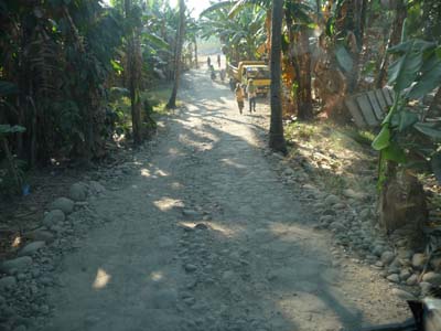
What one Indonesian leaflet charitably calls the" Trans-Flores Hwy" spirals, twists and tumbles nearly 700 km from Labuhanbajo to Larantuka, at the eastern end of the island. It's sealed all the way, ..., and the road is narrow and tortuously winding.

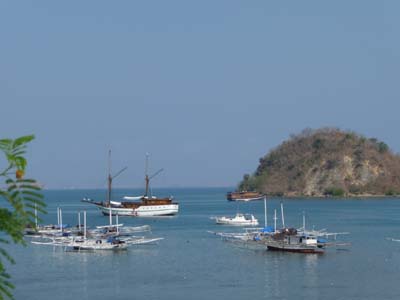
En route
towards Ruteng
12/08/2009
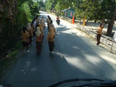
Along the road I saw a number of children leaving schools. The average age of the Indonesian population is very young besides government set up since several years a family planning.
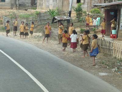
En route
towards Ruteng
12/08/2009
The irrigation system allows the rice culture in rice fields.
En route
towards Ruteng
12/08/2009
I arrived in the early afternoon in Ruteng where I did shopping then I turned again to the city entrance where I had located a platform for my bivouac close to the Bus Terminus.
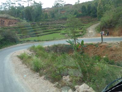
Bajawa
The road leading to Bajawa corresponds perfectly to the description by Lp, it twists again. It culminates at 1341 meters GPS.
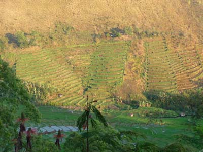
Rice terraces
vers Bajawa
13/08/2009
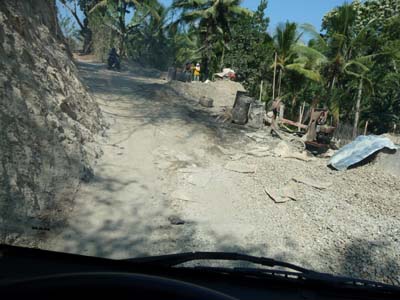
The roadway surfacing is on average of good quality, some sections were renovated with low sides on standby of consolidation, some sections under work and others were much degraded.
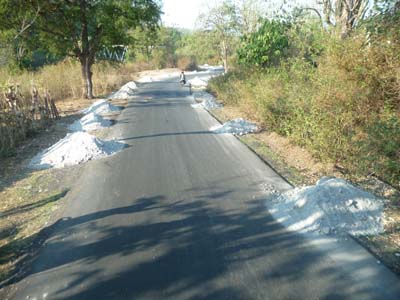
En route
towards Bajawa
13/08/2009
En route
towards Bajawa
13/08/2009
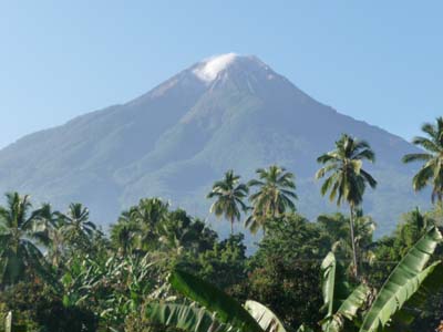
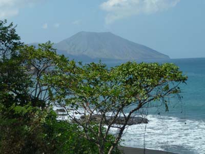
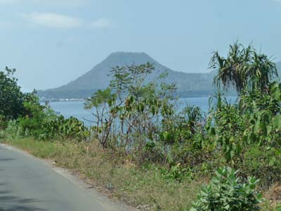
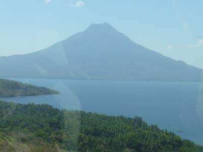
It crosses some villages decking out with the Indonesian colour flag as in the other islands and passes at the foot of Gunung Inerie -2245m- perfect volcanic cone.
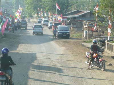
Village
towards Bajawa
13/08/2009
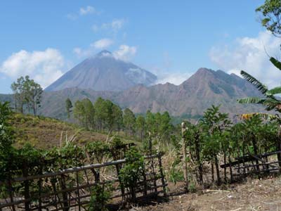
Gunung Inerie
towards Bajawa
13/08/2009
The town of Bajawa does not have particular sights; its very coloured market offered all fruits and vegetables of creation.
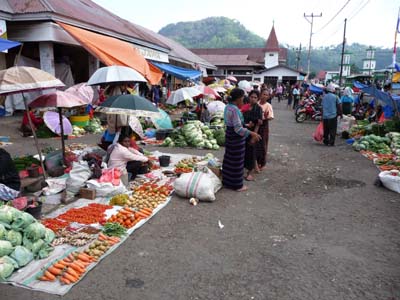
Market
Bajawa
13/08/2009
Flores Island is at 85% Catholic, however Indonesia is Muslim; tolerance obliges, a mosque faced a one of the four churches which I counted.
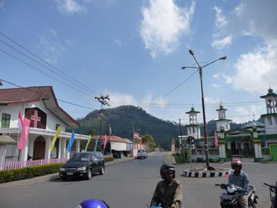
Ecumenism
Bajawa
13/08/2009
By arriving I had gone to the TO which was to me of any utility neither to have the ferry timetable nor to find a campsite. At the septentrional borders of the city the Santu Josef Church has a vast platform favourable for my bivouac; the priest of the parish authorized me to park my truck. Then I looked for a guide to visit the Ngada surrounding villages. I had an appointment the following day with Maximilain, the guide, at eight O'clock am with other Western tourists.
Bivouac, Santu Josef
Bajawa
13/08/2009
Maximilian proved to be very professional as well in his behaviour as in his explanations and comments, highly recommendable.
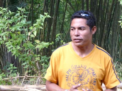
Guide
Maximilian
14/08/2009
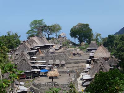
Traditional Ngada villages
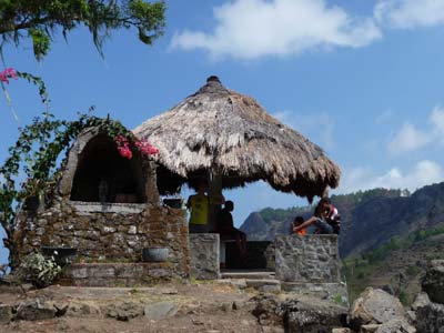
The Ngada people, 60000 people, live the plateau of Bajawa on the slopes of Gunung Inerie. Christianized by the Dutch missionaries, it practices a syncretism of Animism and Catholicism. Its origin is much discussed several theories were emitted. At all events the villages present two symbols characteristic of the Animism. – Ngadhu and Bhaga, the first representing the male ancestors consists of a covered thatch parasol on a pole, the second, ancestors females, is a small covered thatch house. – Some raised stone slabs grouped in circle with horizontal stone slabs for offerings; these megaliths would be of Dongson origin, civilization from the south of China and the north of Vietnam. These sets are visible in Indonesia, Malaysia and Laos.
The Luba village at the foot of Gunung Inerie is a quadrilateral of houses built on low pillars with the very sloping thatched roof and a symbol on the ridge sheathing, either a house or a male effigy. In the centre three terraces that of the medium receives Ngadhu and Bhaga as well as recent burials. Women of the village practice the weaving of traditional clothing while the men are in the fields.
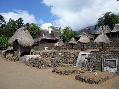
Ngadhu & Bhaga
Luba village
14/08/2009
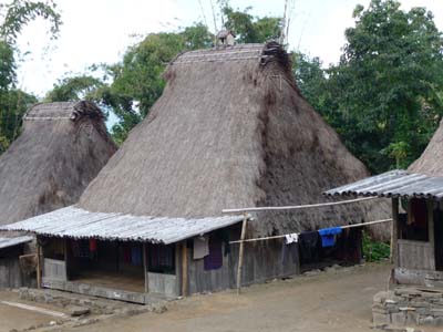
Traditional house
Luba village
14/08/2009
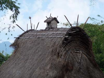
Faîtage
Luba village
14/08/2009
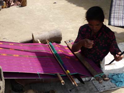
Ikat weaving
Luba village
14/08/2009
Bena, another Ngada village, is composed of two rows of houses along an elevated terrace receiving the Animist symbols. We attended a ceremony of traditional abattage of the pigs, men split cranium with the machete. At the top of the village an observatory offers a superb sight on the MT Inerie.
Panorama
Bena village
14/08/2009
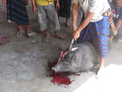
Pig cutting down ceremony
Bena village
14/08/2009
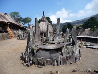
Menhirs
Bena village
14/08/2009
Sommet
Bena village
14/08/2009
The day finished in Mangaruda Air Breaded, hot spring, where we took a regenerating bath.
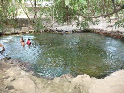
Hot spring
Mangaruda Mata Air Panas
14/08/2009
Ende
On the way towards Ende the road “twists again” in landscape where volcanoes are omnipresent. On the road I met children of the schools preparing the national festival of the Independence of August 17th, 1945.
En route
vers Ende
15/08/2009
En route
vers Ende
15/08/2009
En route
vers Ende
15/08/2009
En route
vers Ende
15/08/2009
En route
vers Ende
15/08/2009
By arriving in Ende, the 15/08, I took contact with the TO to obtain the ferry timetable. The met people telephoned the office of the ferry company; the only ferry was planned for Monday 17/08 at eight o'clock am. But this information was to be confirmed the following day afternoon. Then of course I went to Internet and I did shopping.
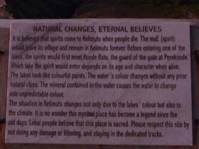
Kelimutu National Park
Three Lakes of water colours changing
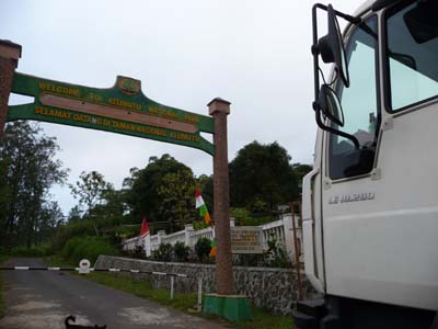
After having lunch I headed towards Kelimutu where I arrived in the early afternoon. The entrance gate on the road to Moni has a vertical clearance of approximately 3.8 meters high. The personnel of the checkpost did not authorize me to bivouac on the carpark at the top. I was to remain on the spot awaiting the opening the next morning at 05:00 am.
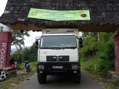
Entrance gate
Kelimutu
15/08/2009
Checkpost
Kelimutu
15/08/2009
Sunday 16/08 I went up with many vehicles, buses, cars and motor bikes. The sunrise was splendid. The three lakes are close to each other and their colours are turquoise for two of them and brown for the third. I went down again around 09:00 am to prepare the publication of pages of the previous days. It is regrettable that it is not possible to bivouac in the park as in those of the other countries of the South-East Asia. Then I headed again to Ende for the confirmation of the date and the hour of the departure of the ferry to Kupang.
Kelimutu
16/08/2009

Sunrise
Kelimutu
16/08/2009
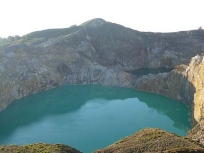
Tiwu Nua Muri Koo Fai & Tiwu Ata Polo
Kelimutu
16/08/2009
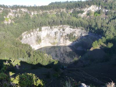
Tiwu Ata Mbupu
Kelimutu
16/08/2009
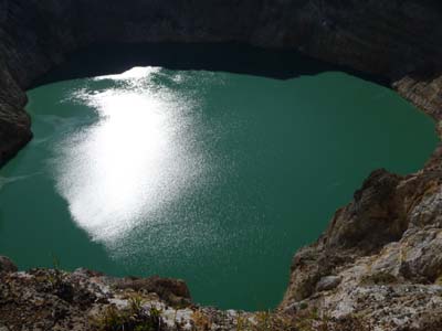
Tiwu Ata Polo
Kelimutu
16/08/2009
ASDP Nagakeo
Pelabuhan Ende
Then I returned to Ende to go to the port located in Nagakeo at approximately 15 km in the west on the road to Bajawa. The port was deserted and the gates were closed but not padlocked; I entered and I installed my truck on the carpark.
ASDP pelabuhan
Nagakeo
16/08/2009
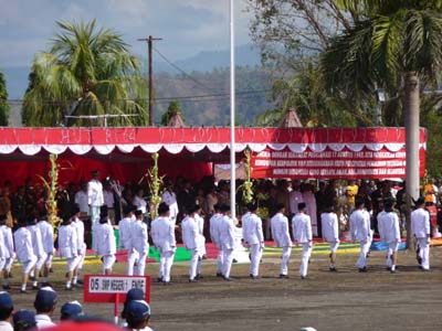
Independence Day
17 August 1945
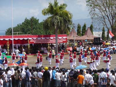
This Monday August 17 the ferry didn’t come any official information; the offices were closed. Some people made me understand that the ferry had damage under repair in Sumba. No forecast as for the date of arrival. Consequently I returned to Ende to try and see someone at the TO, alas it was the Independence Day of Indonesia, 17/08/1945. All shops were closed. I attended the parade, military procession, children of the schools and majorettes, of course without forgetting an interminable speech of more than one half an hours.
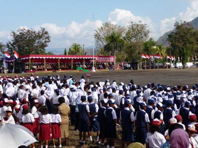
Ende
17/08/2009
Ende
17/08/2009

Ende
17/08/2009
Ende
17/08/2009
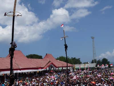
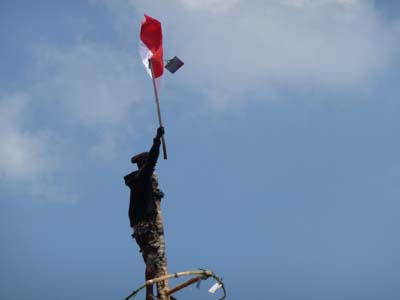
Finally in the late morning a contest of pole of dreamland, bamboo with an oiled trunk, to take down the national flag attracted crowd of idlers with laughter and hurrahs.
Ende
17/08/2009
Ende
17/08/2009
After having lunch I returned to the carpark of the Nagakeo harbour while waiting of divine Providence for the following day. But on Tuesday 18th the ferry was not yet landed.
But on Tuesday morning a ferry was not landed. I returned again to Ende at the TO looking for information. The met people tried to join ASDP in Ende without success. Then at my request he called ASDP in Larantuka which confirmed a ferry on Friday at 08:00 with a stop Lembata and the expected arrival in Kupang on Saturdays around 08:00. If I went to Larantuka I should to present myself a day before at ASDP. I decided to await the hypothetical arrival of the ferry in Nagakeo until Wednesday 07:00am.
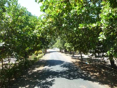
On Wednesday morning at 06:00am no ferry was in sight, nobody in the port, none to be questioned; consequently I prepared my truck and I left around 06:30am to Larantuka death in my heart. Of course the road twisted again and again up to Maumere where I walked to the TO for having information. The young woman met, charming moreover, called ASDP in Larantuka, yes there was well a ferry on Friday to Kupang via Lembata but the schedule was not known, it depended on the winds! I carried on my road up to approximately 33 kilometres to establish my bivouac at Patiahu Beach. From Maumere the road was almost rectilinear but the branches of trees were very low, the vault was cut by trucks at 3.8 metres high. I had to drive in the middle of a very narrow roadway.
En route
vers Patiahu Beach
19/08/2009
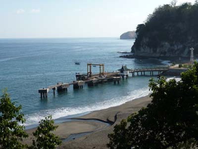
As opposed to what the charming young woman of the TO had affirmed, the road twisted again up to approximately ten kilometres away from Larantuka. At four kilometres of the city the port of ASDP is at Waibalun. I stopped to obtain information; I met only subordinate employees who confirmed the arrival of a ferry for Kupang on Friday 21st around 2 p.m. I continued to the city where I had lunch. The cybercafé located at Telekom Office did not function. I installed my truck on the carpark of the port to have patience until the arrival of the ferry which I wished not to be hypothetical.
En route vers
Larantuka
20/08/2009
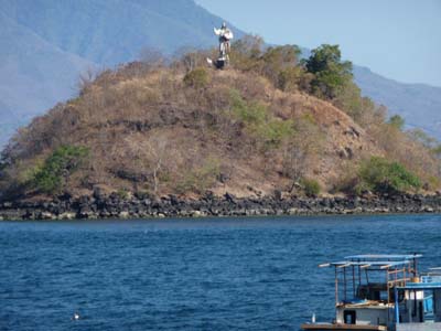
Jésus protège
Larantuka
20/08/2009
Well a ferry landed in Waibalun, Larantuka, on Friday August 21 2009 around 07:00am. At 08:30 I bought a ticket then I waited the hour of loading about 09:30 for a getting under way at 02:00pm and a landing in Kupang the following day Saturday around 04:00am. By waiting for, it was the visit of the castle, my truck, by policemen, public relations with the authorities.
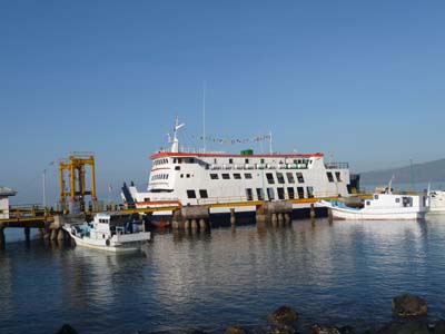
Pelabuhan Waibalun
Larantuka
21/08/2009

Vertical clearance, 3.8m
Larantuka
21/08/2009
After the loading of vehicles, gradually until the hour of the departure, passengers embarked. The sited places all being occupied, the passengers lay down close, on and under vehicles.
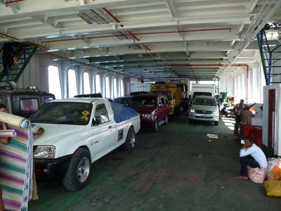
Vehicles
Larantuka
21/08/2009
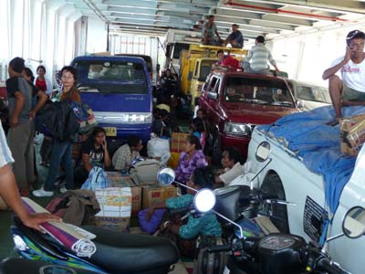
Passengers
Larantuka
21/08/2009
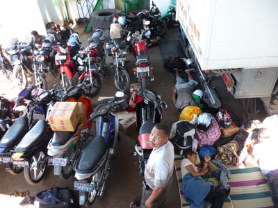
Passengers
Larantuka
21/08/2009
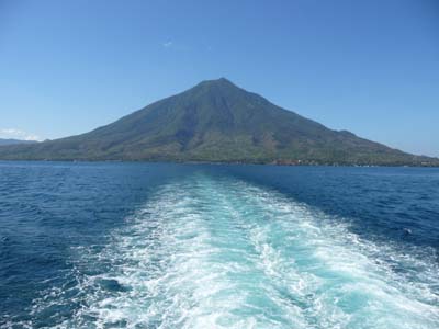
Adieu Flores Island
Larantuka
21/08/2009
Final report of my trip in Flores
I spent ten days on the Flores Island, two driving days, three driving & visiting days including two in Bajawa and one in Kelimutu and three waiting days in Nagakeo harbour then two driving days to Larantuka. The surroundings of Bajawa deserved much more, but uncertainties on the ferry schedules and the expiry of the validity of my visa did not enable me to stroll on the move with my suitability. The Flores Island at present is very badly served by ferries. However there are three ports, Aimere, Ende and Larantuka where ferry lands to sail to Kupang but the schedules are not fixed and the highway from Labuhanbajo to Larantuka gave me a headache. I decided to take a ferry at Ende, Nagakeo when it landed, however no ferry landed; I had to head to Larantuka which is the the closest harbour to Kupang, Timor Island.