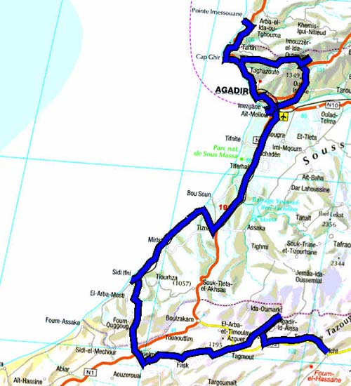
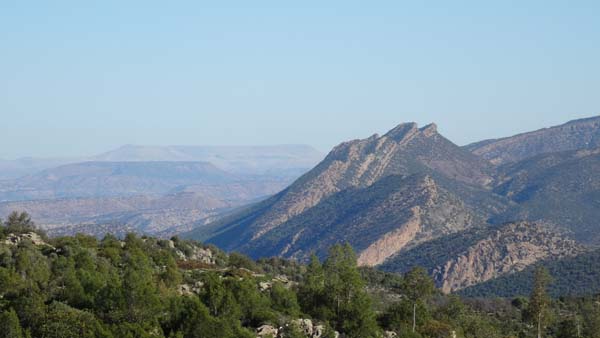
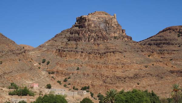
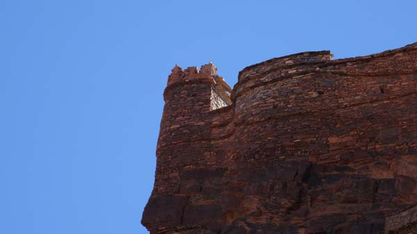
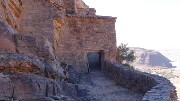
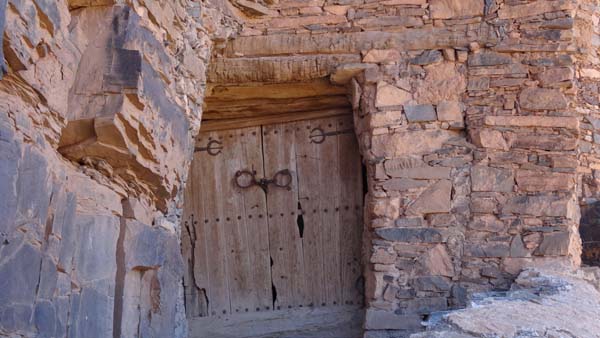
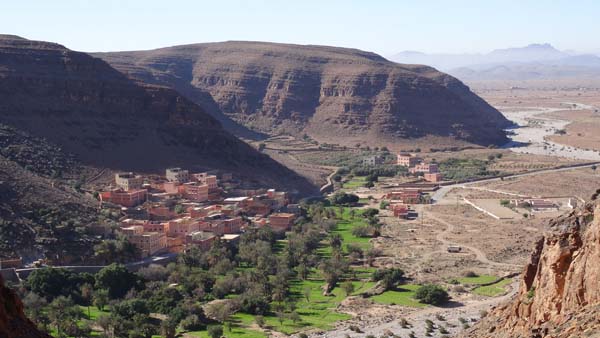
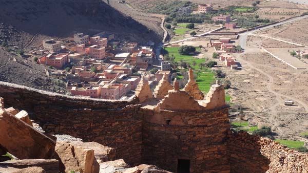
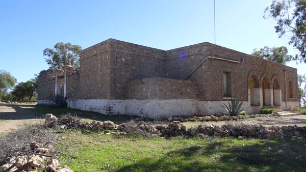
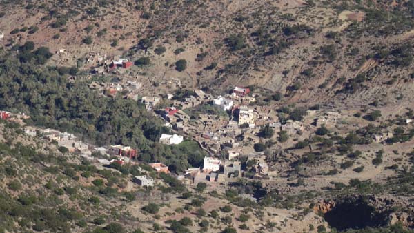
Amtoudi
Id Aïssa
On Monday, December 29 I went to
Amtoudi to visit the most beautiful
Agadir in Morocco according to Lonely
Planet. I met a Frenchwoman, so-called
Jojo, who called the guide Mohammed
and invited to me to take the coffee.
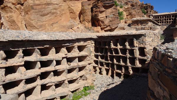
Indeed such a Ksar it is
perched on a piton whose climbing by a
mule track requires a certain time.
But the effort is rewarded by the
beauty for the site and the work which
would date back the 12th century. The
video shows that the equipment of the
stones underwent the insult of the
centuries without damage. The 73
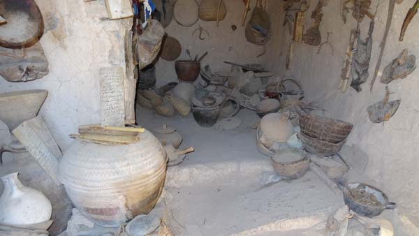
attics are in the wall surrounding the
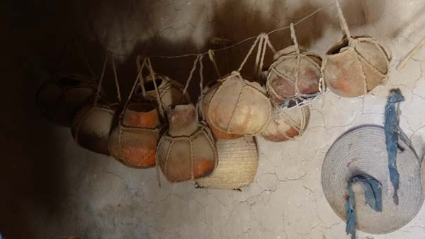
piton. I was surprised by a large
number of apiaries, alas deserted by
the bees, fault of water. The other
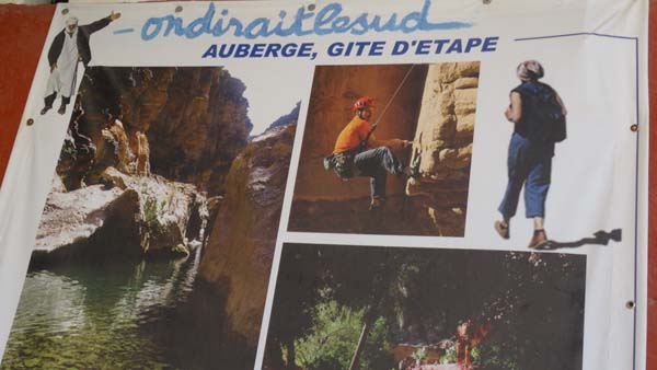
curiosity of the village is the inn
“On dirait le Sud” considered for its
tajine of kid. I due to wait 2 hours,
because it is on order. Alas the kid
had only the skin on its bones. Around
17:00 I visited Jojo who made me visit
her house in construction. Then we
discussed trips and my Azalaï
motorhome. I bivouacked in the palm
grove close to the dry wadi!
 |
 |
 |
 |
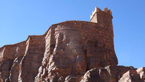 |
| Angle tower |
 |
 |
| Barbacane |
 |
 |
| Apiaries |
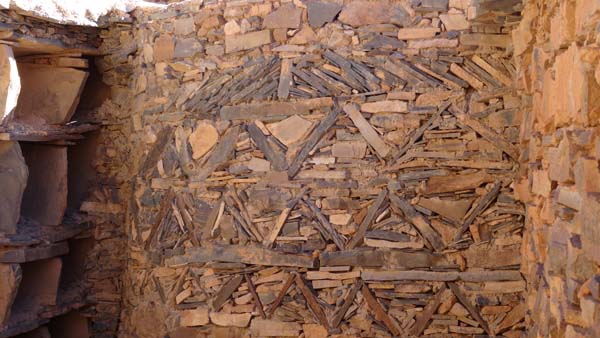
Arabesques |
 |
 |
| |
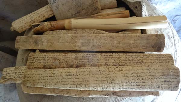
Coran |
 |
 |
| Panorama |
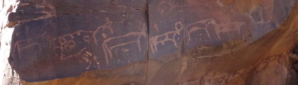 |
| Rupestral engraving |
 |
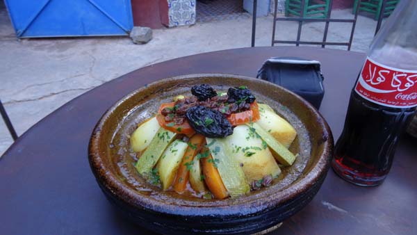 |
| Inn "On dirait le Sud" |
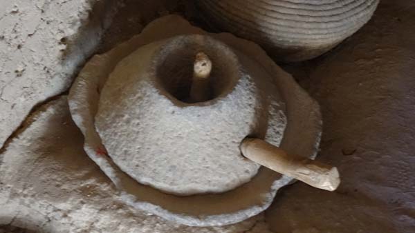
En route to Sidi Ifni
I left Amtoudi around 7:20 to go to
Guelmin. After Taghjicht a cross-road
leads to Fask. This road traverses
splendid desert landscapes. Then I
took a junction to Tighmert, oasis
length of approximately eight
kilometers planted with palm trees.
Marie & Jean-Luc had suggested me
visiting their Eli friend who lives
the village. Using a Moroccan I found
her. We passed +1h00 to discuss
journeys into Morocco and I indicated
to her the track for the Smouguene
canyon. Of passage at Guelmim I
stopped in Marjane for shopping and I
benefitted from it to establish an
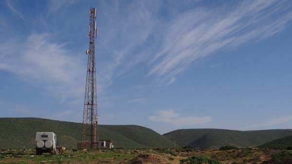
Internet connection. The road to Sidi
Ifni is open. I bivouacked at the
bottom of a radio pylon with a 3G
Maroc Telecom connectionj!
Sidi Ifni
I went down from the bottom of the
radio pylon to join Sidi Ifni at
approximately 13 km. But eight km
before two young women made me
understood that the road was cut and
that it was necessary to return. I
warned a track along a wadi leaving in
the right direction. I end to an
asphalt road that I took on the left
while following the indication of the
GPS compass. I arrived on the heights
of Sidi Ifni whose main bridge had
been carried by the risings wadi in
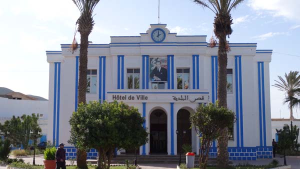
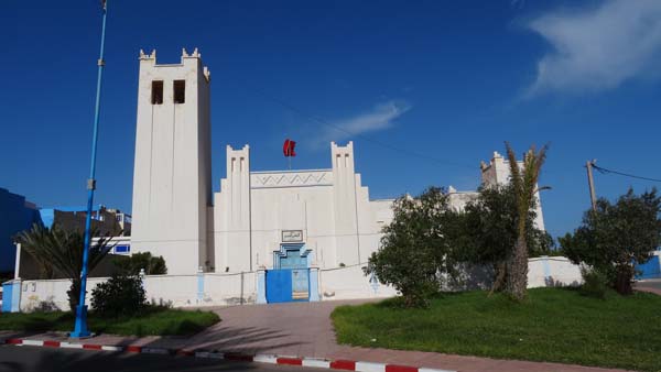
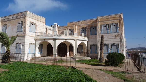
the beginning of December. CSights are
limited to the Place Hassan II, former
Plaza de Espana, whose square is
surrounded by buildings art-decor of
the 30's. This place overhangs a
camp-site along the beach where the
motor homes like a HLM pile up. The
camp-site-drivers like the environment
which they know, promiscuity!
I took an appointment with
Mercedes-Benz at Casablanca on January
8th, 2015 to carry out the revision of
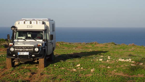
my truck. Leaving for Tiznit I found a
bivouac dominating the sea at the
bottom of a radio pylon with a 3G
Maroc Telecom connection again.
 |
 |
| Town Hall |
Royal Palace |
 |
 |
| Old church, law courts |
Spanish consulat |
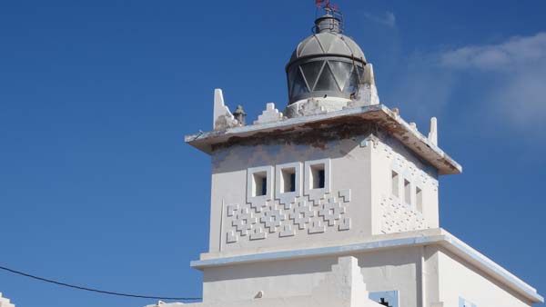 |
| Lighthouse |
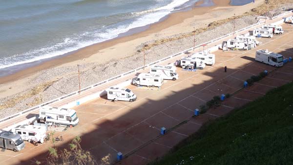 |
| Camping-ground! |
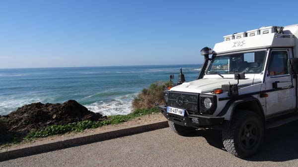
1st Januaryr 2015
For the first day of the year 2015
I remained on the spot at the seaside
at the bottom of the radio tower in idleness.
 |
 |
| Bivouac |
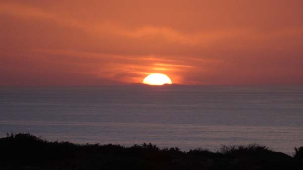 |
| Sunset on the sea |
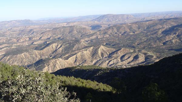
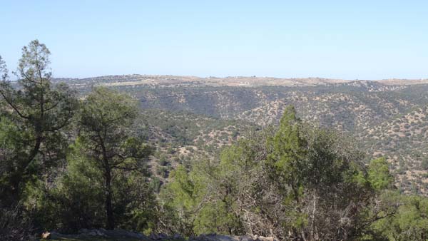
Ida country
Ea track
On Friday morning I traversed the
connection road from the seaside to
the Ea track of the Ida country which
is an asphalt road. I circumvented
Tiznit then Agadir by avoiding the
downtown area. I stopped at the forest
House dating from protectorate in a
forest of argans. The Ida country is
famous for its honey and its winter
cascades, when there is water!
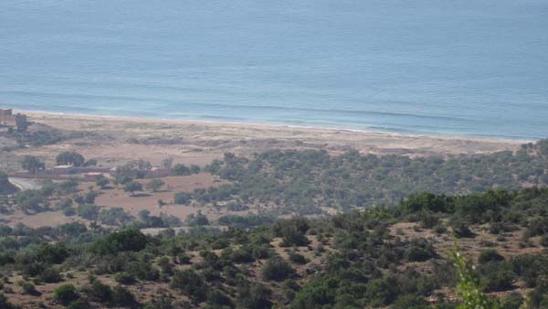 |
| The sea from the Ea track |
 |
 |
| Bivouac |
 |
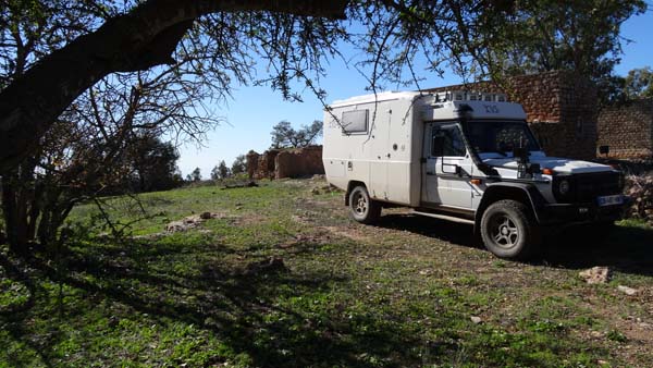
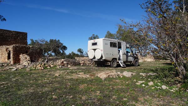
| Forest house dating back from the protectorate |
 |
 |
| Panorama from the bivouac |
|
|
| Descent from pylon bivouac
& arrival at the forest house bivouac |
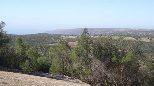
From Km 10.8 to the km 47.2 the Ea
track is a “Orangina” track according
to the expression by Gandini, it is
indeed badly shaking. I put +3h30 to
traverse 37 km! From Sea level maximum
altitude was around 1340 Mr. The
crossed landscapes are sumptuous with
colors very different from the
Moroccan south.
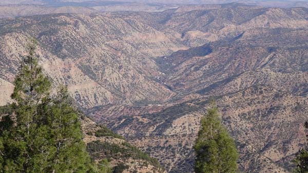 |
 |
| Panorama |
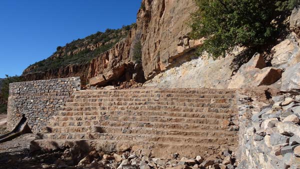
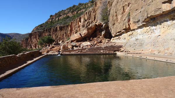
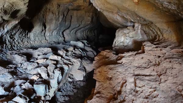
Eb track, Wintamdouine cave
At the crossroads to Imouzzer I made the
dead end on the cascades to stop at the
Wintamdouine Cave. The Eb track is
entirely tarred up to the carpark of the
cave which is a resurgence of the
eponymous underground river which 8500
meters would be long. I bivouacked on the
spot.
 |
 |
| Pool |
 |
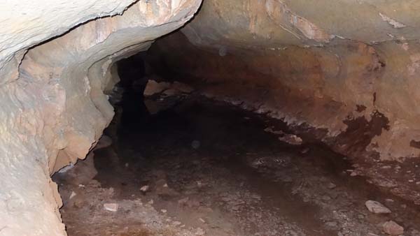 |
| Wintamdouine cave |
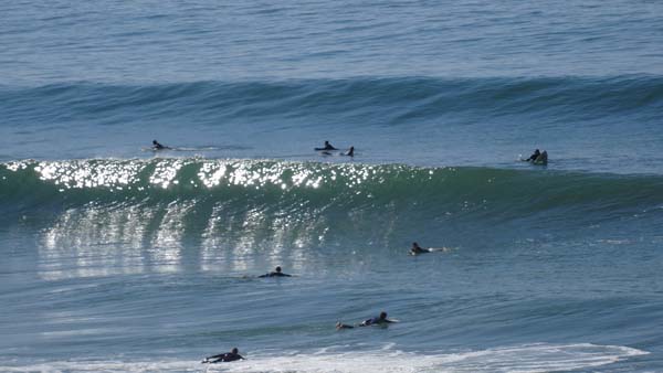
Back to Agadir, road to Imsouane
On Sunday morning I went back to
Agadir to find a spot with a 3G Maroc
Telecom connection to publish the
weekly page of my website before
traversing the connection road up to
Imsouane beginning of the Gandini's D
track, the Atlantic coast.
 |
| Imsouane, edge of sea |
 |
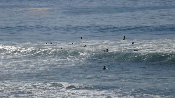 |
| Surfers |