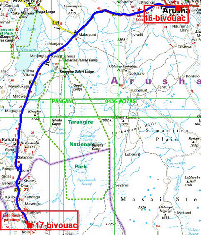
The GPS road tracklog
fromArusha to Wild Camp
from 2019/03/25 to 2019/03/25
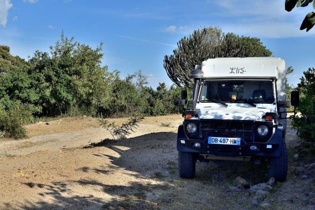
Wild Camp, side road T5
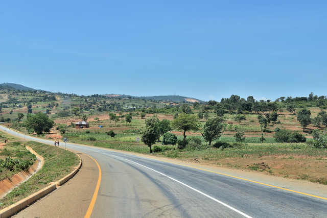
Monday, March 25 I left Arusha and Masai Camp to go full south by the
road T5 from Arusha to Dodoma, capital of Tanzania, to visit Kondoa
Rock-Art sites listed on UNESCO,
here. The roadway is splendid but alas
the obstacles, speed calming, to slow down speed make it tiresome. I
stopped at approximately 5 km away from my target to have rest on an old
longitudinal track of T5 away from the main road and safe. Altitude is
of 1748 m guaranteeing one fresh and peaceful night .
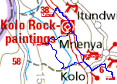
The GPS road tracklog
from Wild Camp to Wild Camp
from 2019/03/26 to 2019/03/26
Wild Camp, Kondoa Rock-Art Sites
Tuesday morning as of 8:30 I was at the Office of Kondoa Rock Paintings
in Kolo along the road from Arusha to Dodoma to organize my day of visit
of three of the sites of murals dating back to approximately 7000 years.
Well, a guide is not obligatory it proved that he was essential, because
there is no signpost as well for the track of access in the vehicle as
for the track of excursion to go to the caves where they were carried
out. If I can publish the traces of the tracks of access with my 4x4
vehicle, it is not the same traces of the three excursions between 1500
and 1700 meters of altitude because I had forgotten to take my GPS
eTrek. On the way my guide did make a whole speech to dissuade me to go
to Thawi asserting the rocky track; but it was in our tariff
negotiation. As it shows the GPS trace, the way from Kolo to Thawi the
track that he made me take was longer than the track of the return to
the main roads. I had been misled; I passed it the remark to him who he
answered by incomprehensible quibbles. The visit from beginning to end
lasted 8:00 including four hours of painful walking by 30°C. When I paid
him I omitted to give him a tip, he turned me the back without to greet
me. At the back I returned to my bivouac of the day before, harassed but
very satisfied with my visits I was to sleep very early to have rest.
Once more I noticed in my tour around the world that the first hominids
of all the areas of the globe carried out murals according to similar
techniques. Moreover I cannot not recall that the first human appeared
in this part of the world, the Rift valley in the East Africa, then they
have immigrant in particular northwards, their aspect having adapted to
changing climatic the skin becoming white, the blue eyes and fair hair
amongst other things! Do not displease any to the racists, to
xenophobes, and to other ideologists of any obedience propagating of
fake news. While discussing with the guide, I learned that he is Moslem
with two women and eight children, potential candidates to immigration,
it is in genes! Yes but, immigration in Europe is required very prosaically
to finance the pensions of retirees up sharply from 2030 due to low
fertility women with 2.1 children do not allow renewal generational.
click on the pic for opening the gallery
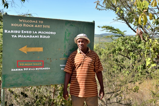
|
| My guide |
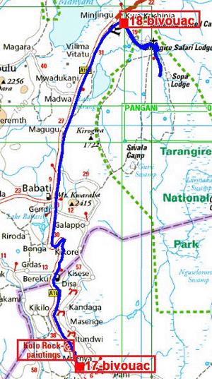
The GPS road tracklog
from Wild Camp to Tarangire NP, Zion Campsite
from 2019/03/27 to 2019/03/27
Tarangire NP
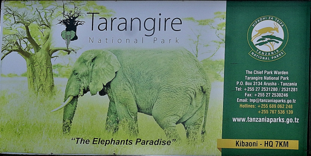
Wednesday, March 27 I arrived at Tarangire National Park,
here, around 9:30 to carry out the formalities of entry. This park
all in length is famous to be the paradise of the elephants. Indeed
along the river and on the shade under the trees they are legion. In
search of “Big Five” I did not meet them. Around 16:30 I established my
bivouac at the entrance of park into Zion Campsite by a temperature of
+38°C inside the cell of my motor home.
click on the pic for opening the gallery
The GPS road tracklog
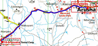
from Tarangire NP, Zion Campsite to Arusha, Masai Camp
from 2019/03/28 to 2019/03/28
Arusha, Masai Camp
I left Zion Campsite as of 6:00 to be very early in Arusha to do supply
in food and in diesel fuel by avoiding the congestions at rush hours. I
returned to Masai Camp where I had my habits knowing that there was no
tourist.

|
| Arusha, Clock Tower |
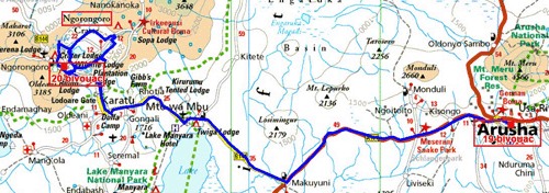
The GPS road tracklog
from Arusha, Masai Camp to Ngorongoro Crater, Simba A Camp
from 2019/03/29 to 2019/03/29
Ngorongoro Crater, Simba A Campsite
Friday, March 29 I crossed the gate of Masai Camp as of 6:00 to arrive
in the morning at the entrance of Ngorongoro Crater,
here. There still being alone the formalities of entry were promptly
carried out by presenting the documents of Tarangire NP. The track which
uses the edge of wall caldera is often of good quality with sometimes
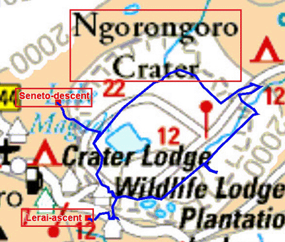
parts out of corrugated. The descent in the crater is carried out by
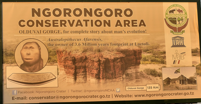
Seneto descent road. To describe Ngorongoro Crater I will use the image
of a basin whose bottom is at 1750 meters high and the edges on average
at 2350 meters of altitude. Of course the basin is not exactly
cylindrical; nature is not a geometrician. The surface of the bottom of
caldera is estimated at 264 square kilometers. There are only three ways
to reach the bottom, two in descent and one in rise. Thus the bottom of
the crater is an immense enclosure of pasture where the wild animals
evolve of which the predatory ones. The presence of water, lakes, rivers
and marshes ensure pasture and beverage of the herbivorous animals
usefully which can be devoured by the carnivores. I spent 6 long hours
to explore it by being lucky to see a lion and 6 lionesses fed after
having feasted and, wallowed close to the track sometimes the legs in
the air! As the gallery shows it below I saw many other animals and
birds. I established my bivouac in Simba A campsite where I have the
visit of a French couple as alone with a tour operator. The night was
peaceful at 2320 meters of altitude with despite everything a storm
around 2:00 am in the night.
click on the pic for opening the gallery
The GPS road tracklog
down the crater
from 2019/03/29 to 2019/03/29
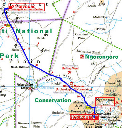
Le tracé GPS de la route
de Ngorongoro Cratère à Serengeti NP, Tumbili Camp
Du 2019/03/30 au 2019/03/31
Serengeti National Park
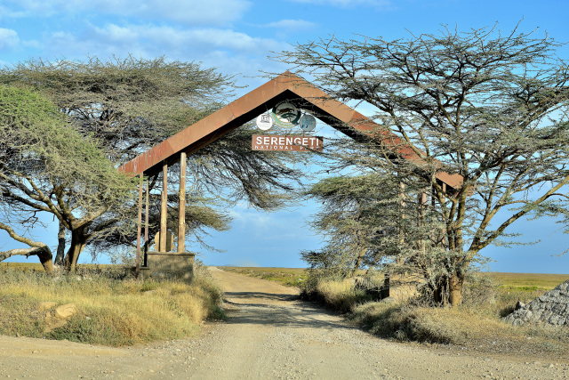
On Saturday morning as of early dawn I left for Serengeti National Park,
here, where I very often arrived at the end of the morning after
having traversed the corrugated track making the progression tiresome
and painful. After having selected a camp-site to be alone during two
nights, Tumbili at 1525 meters of altitude, I decided to have rest by
completing the page layout of my visit in Ngorongoro Crater and by
preparing the trip of the following day. A violent storm burst around
16:00.
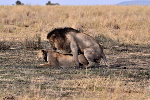
Sunday, March 31 I traversed the vast Serengeti National Park during
more 10:00 at low speed on often muddy tracks to track the wild animals.
The herbivores are in great numbers to be fed in these rich pastures. On
the other hand the predatory ones are difficult to unearth sometimes on
the shade under the trees as the couple nonchalantly to sleep tenderly
before coupling itself. Although announced the rain did not appear. I
returned to the bivouac to put to me at work at the page layout of my
website.
click on the pic for opening the gallery