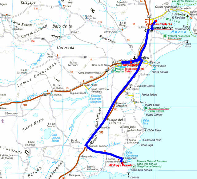
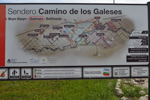
Gaiman
On Monday, October 24th while arriving at Puerto Madryn I found the
drinkable water supply point close to Prefectura, then the
collection of the booklets at the Oficina de Turismo and a
complement of breakfast in a café with a Wifi connection, of course
asthmatic. To finish in this city I made supply at the Carrefour
Market before leaving for Gaiman which was created by Welsh
emigrants in the years 1870. With the booklet of the tourist office
I made the tour of the ancient houses. I found a bivouac close to
the Bethel churches.
Visite Gaiman, click la photo
The GPS road tacklog
from Camarones to Petrified Forest
from 2016/10/26 au 2016/10/27
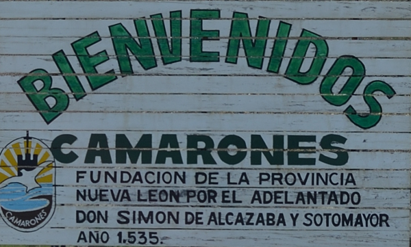
Camarones
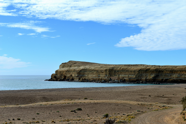
A person met with Puerto Madryn had praised me the beauty of
Camarones. On Tuesday, October 25th I thus made a detour of +75 km
to go to visit this village on seaside. At the entry and in front of
Oficina de Tourismo a police officer, to occupy himself, stopped me
to fill his notebook with information from my passport and
automobile license of my vehicle. At the tourist office the hostess,
a charming young-lady, gave me many information concerning the
village. Then while leaving she tenderly embraced me on the two
cheeks. What a kindness these Argentinian! Well, this village does
not have anything exceptional, except the landscape of the
seaside. For rewarding me I lunched of crawfishes with a glass of
chardonnay in a small restaurant. Then I took the coastal track to
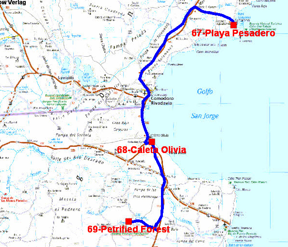
find a bivouac at Pescadero.
Visit Camarones, click la photo
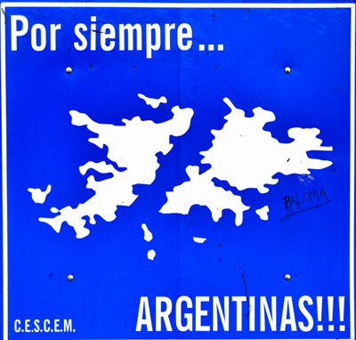
Les Iles Malouines, Las Islas Malvinas, The Falkland Islands
Sailors from Saint-Malo, France, discovered and occupied islands
at the 16th century that they called “Les Malouines” according to
the name of the inhabitants of Saint-Malo. They were expelled by the
Spanish conquerors. Later the British occupied part of the islands
according to their technique of creation of a commercial company as
in Canada. In spite of the Falklands War in 1982 with a 74 days
occupation by the Argentinians, the Falkland Islands are always
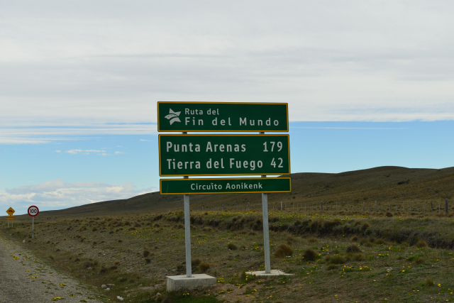
British. On the roads in Argentina panels recall: “Por Siempre Las
Malvinas son Argentinas”.
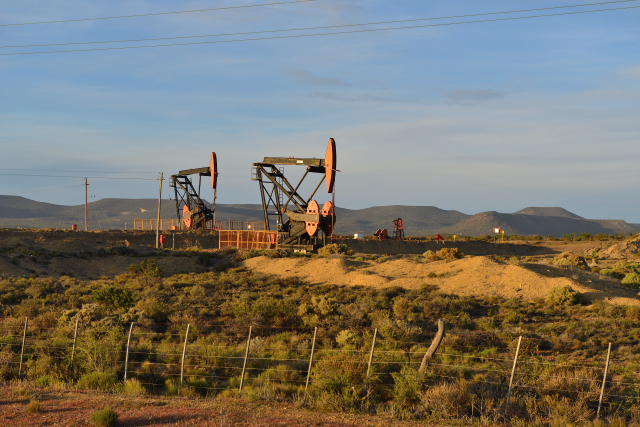
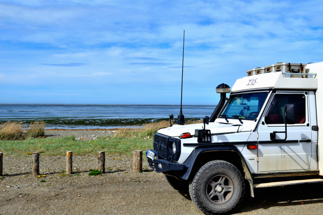
Caleta Olivia
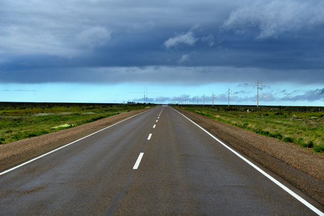
Wednesday, October 26th started with an icy drizzle. But around
10:00 the sky is cleared up with clouds breaking into white horses.
I crossed Comodoro Rivadavia without stop. At the entrance of Caleta
Olivia a file of trucks was in parking and the police diverted
traffic without indication of the route to follow. I wandered in the
city to leave it. I found a bivouac at the edge of the ocean. The
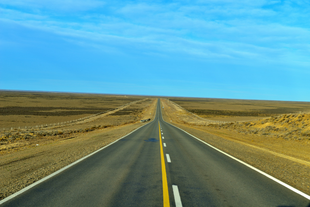
road is still long for Ushuaia, 1,400 km.
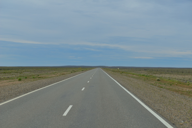
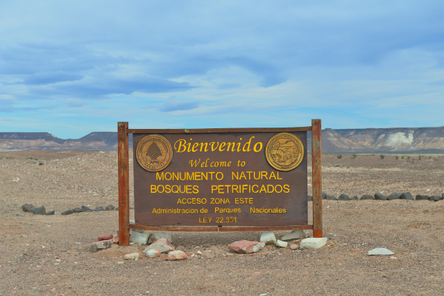
Petrified Forest RN #3 Km 2074
On Thursday, October 27th I left the seaside to go to see fossilized
trees in Monumento Nacional y Reserva Natural Bosques Petrificados.
Museo is very didactic with fossils, photographs of fauna and of
course interpretative panels. The trip makes approximately
+1.5 km curving in the hills where the gigantic fossilized trees
stay. I give
here the link with Petrified National Park in the USA which I
visited in April 2011 then in November 2012. The page layout of my
site evolved during years. The museum has a Wifi connection, but the
guards did not know the password! Moreover it is
prohibited to camp on the carpark. I further established my bivouac
on track RP #49.
Petrified Forest, click the picture
|
| Bivouac on trail RP #49 |
The GPS road tacklog
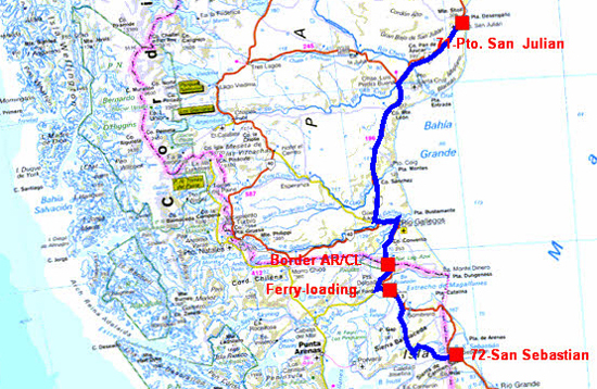
from San Julian to San Sebastian
from 2016/10/28 au 2016/10/29
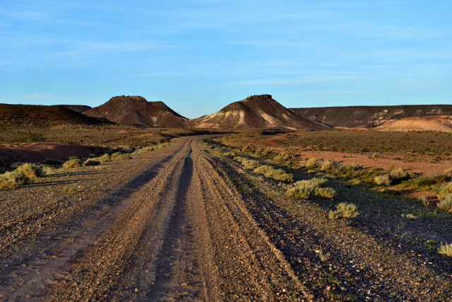
Camino Costero
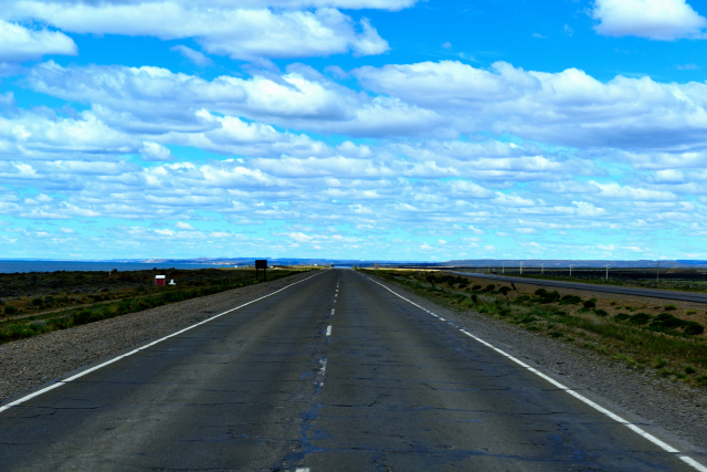
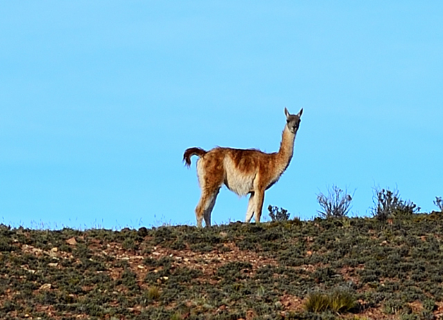
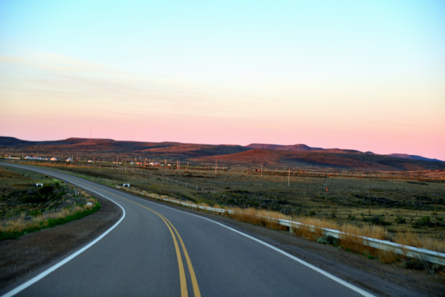
On Friday, October 29th at the forefront of day I traversed the
track to join the ruta national #3. In my way I collected low-angled
light on the sumptuous landscape as well as a guanaco on the peak of
a hill. On the way I warned a panel indicating Camino Costero a Pto.
San Julian. I took this five-kilometer detour to skirt the coast in
a sublime landscape in spite of an overcast sky. I stopped to
bivouac at Punta Panomarica to 25 km of Pto. Julian.
 |
 |
| RP #49 lumière rasante, low-angled light |
 |
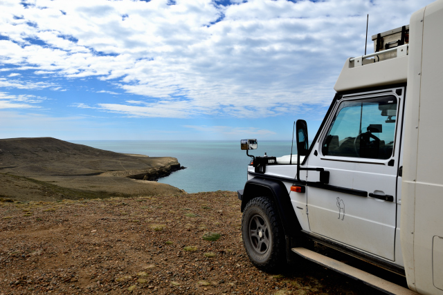 |
| Camino Costero |
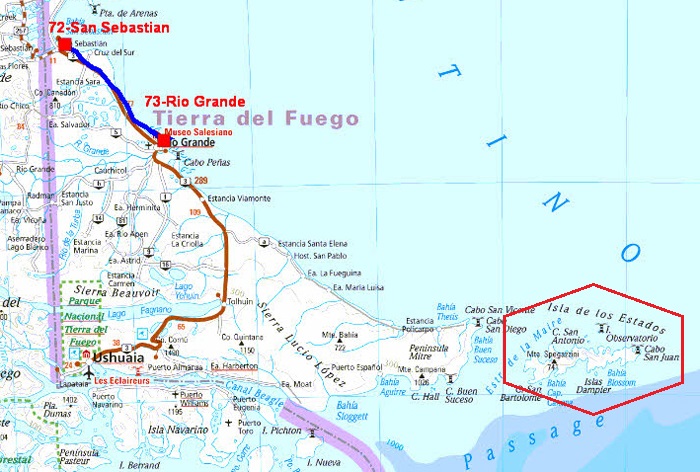
The GPS road tacklog
from San Sebastian to Rio Grande
from 2016/10/30 au 2016/10/30
San Sebastian
On Saturday, October 29th was a very long driving day as of early
dawn from San Julian. Three events occupied this day. The crossing
of frontiers between Argentina and Chile which was carried out in a
common complex for both countries and lasted little of time due to
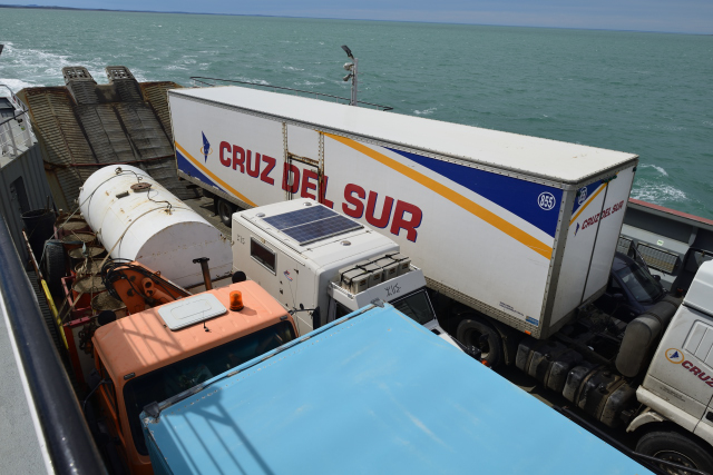
the absence of tourist. Then it was the ferry in Chile to cross the
Magellan Strait. Two boats make the shuttle because there are many
trucks. I was lucky to embark on my arrival at the quay. Then the
road is partially asphalted in the Chilean way. Consequently I
arrived tardily at the border post between Chile and Argentina.
There are two distant posts about five kilometers. There too the
procedure was quickly dispatched because the travellers do not stop
on their way. I didn't know the history of the conflict between
Argentina and Chile which involved the division of the Land of Fire,
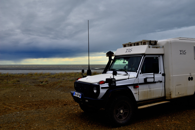
for reading on Wikipedia. I bivouacked close to the border post of
Argentina at the edge of the ocean. The night was announced cold, it
was it with +1°C at daybreak.
 |
 |
| En route |
 |
 |
|
Ferry, Magellan Strait |
|
| Bivouac San Sebastian |
Rio Grande
Sunday, October 30th was a short driving morning after
having done the administrative job not carried out the day before
having arrived tardily and tired after 633 km of tarred and ground
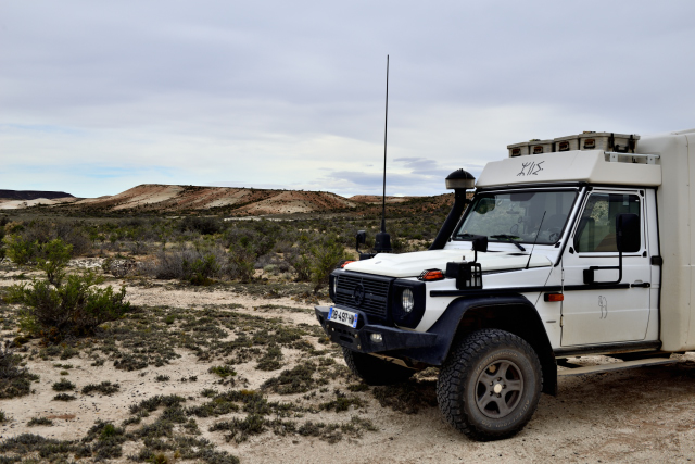
road. At Rio Grande I started by assuming the constraints, diesel
fuel for my truck, at YPF, and food for the driver, at
Carrefour-market. Then I was going to check the localization of
Mercedes-Benz where on Monday morning I will give an appointment at
my return from Ushuaia in order to carry out the periodic revision.
Then I found a bivouac, as usual on seaside, it was 16:00. I finally
thought of being able to lunch!
|
| Bivouac Rio Grande |