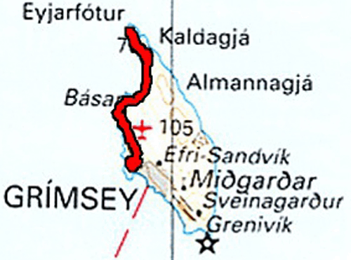
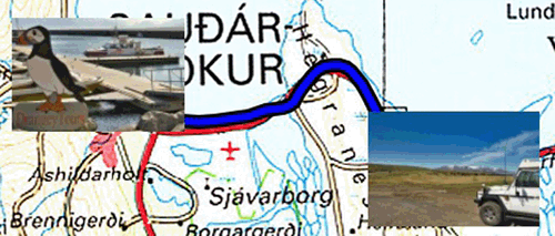
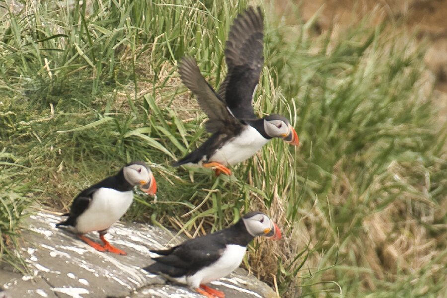
On Monday June 21 I bought the return ticket to Grimsey Island for a shearwater (puffin) photo hunt. At Samskip's office the attendant assigned me a computer to make my request, sometimes in English and often in Icelandic. The highlight was the payment by Orange bank card which requires Internet access to validate the payment; I had to go get my TP-Link modem. Finally the ticket was sent in pdf format in my mailbox. In Iceland without the Internet there is no salvation and payments are always made by credit card. Currently I do not have fiat currency. The trip from Dalvik to Grimsey takes at least three hours for a distance of 40 kilometers, so on the way it was 3:10 and on the way back 3:20. Departure from Dalvik is at 9:00 a.m. and return from Grimsey at 5:00 p.m. The Blue-Trail shearwater hike is 6.86 km return to the far north of the island, crossing the Arctic Circle (N 66° 30′). Shearwaters colonize the northwest cliff of the island. They are several hundreds or even thousands, a scathing personal evaluation. It was a treat to see this little bird They are quite small with an average size of 18 cm and weigh around 500 grams. A lot of people like them because they are cute and funny, because of their colors and the way they walk. Their plumage is black on the back and white on the front and a multicolored bill. The return from the northern point to the village was, as usual, an ordeal. I refreshed myself by drinking two hot chocolates in quick succession before taking the ferry back to Dalvik, where I arrived at around 8:20 pm.
 |
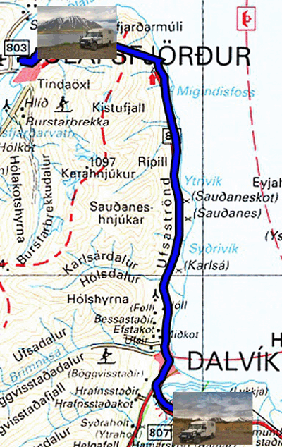
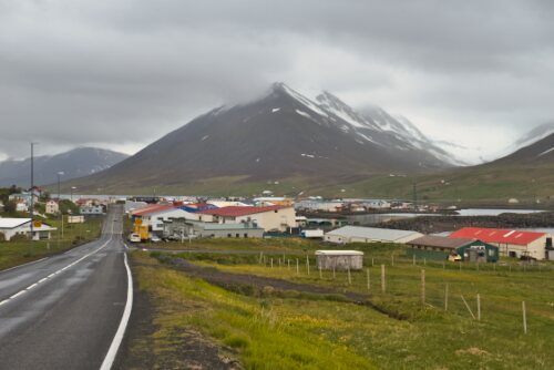
Tuesday June 22 I spent the morning reporting on my visit to Grimsey. Then I took the road to Olafsfjördur 18 km from Dalvik with a long one-lane tunnel with clearance locations marked with a letter M on the right side when coming from Dalvik. After a quick tour in this fishing village, I returned to the exit of the tunnel for the bivouac.
 |
 |
| Olafsfjördur | |
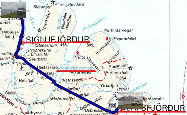
Wednesday 23 June, a short trip from the exit of the tunnel before Olafsfjördur to the exit of the tunnel after the visit of Siglufjördur. The weather was cold, 6 ° C, and rainy. The visit to the village of 2000 inhabitants was quick. The bronze statue was the occasion of a facetious interpretation. Yesterday, I finished reading Michel Onfray's latest opus, "The Art of Being French", it can't be invented! It consists of twelve letters to French youth to put the dots on the i's and the bars on the t's.
 |
| Hedinsfjardarvatn |
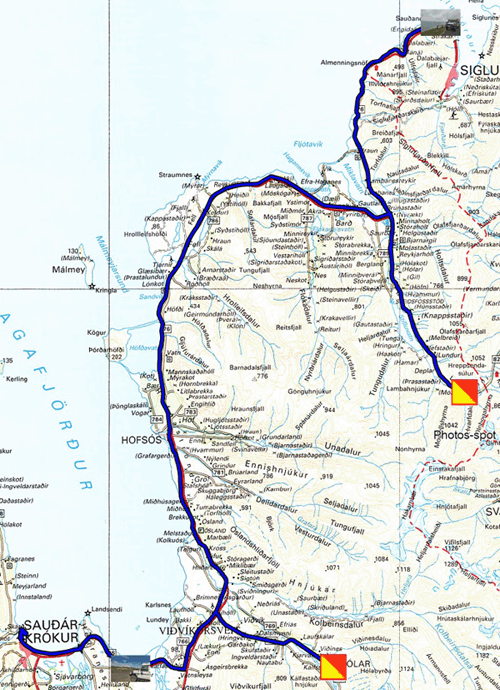
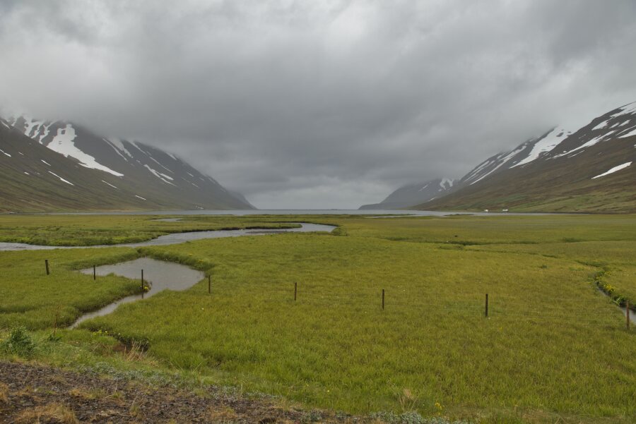
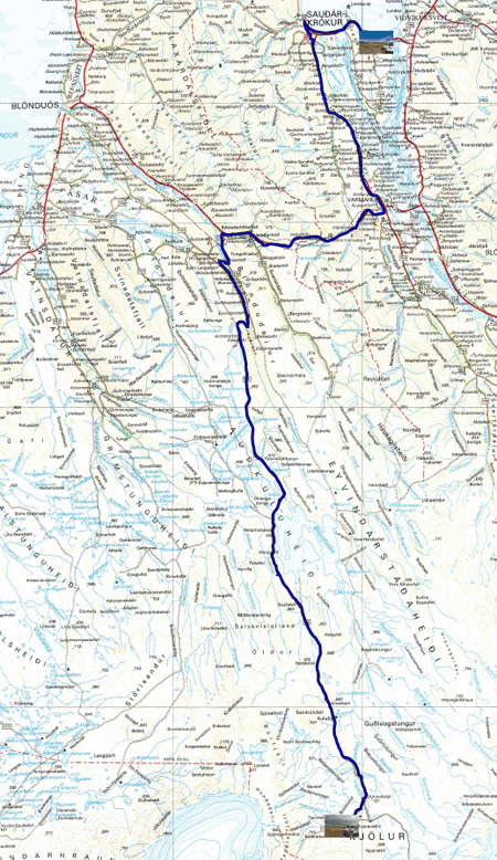
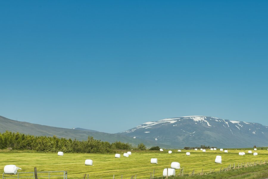
Thursday June 24 was a bright sunny day with summer temperatures for Iceland. The west coast road of the Tröllaskagi Peninsula is sumptuous and dramatic similar to the coasts of Brittany, Cornwall and Big Sur. I was strolling at a speed of 40 km / h. I followed the advice of the ZiZagvoyages Icelandic guide by making an excursion into the interior of the peninsula by road 82 for a photo shot. Then another to visit the village of Holar i Hjaltadalur by road 767. The first church dates from 1106 it became a cathedral with the creation of a bishopric. The current church was completely renovated from 1988 to 1990. I had the privilege of meeting the ecclesiastic, a woman, in charge of the parish. I arrived in Saudarkrokur to find that the 10 GB credit on Siminn's SIM card had run out. Connection to Siminn's site is in Icelandic! After inquiries I went to the village supermarket where someone assisted me to buy a new 10 GB loan. I bivouacked about 10 km before the village on a vacant lot by the road 76.
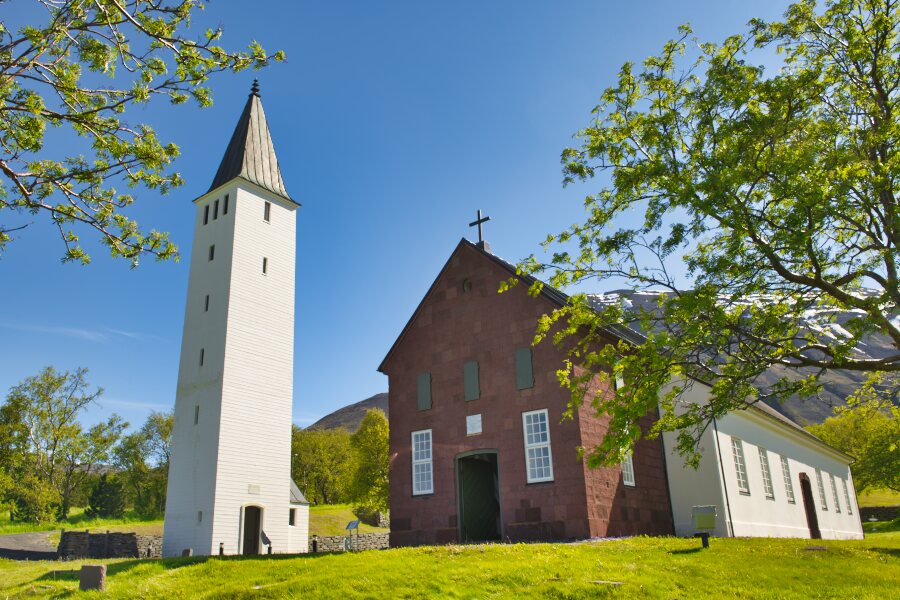 |
| Holar i Hjaltadalur |
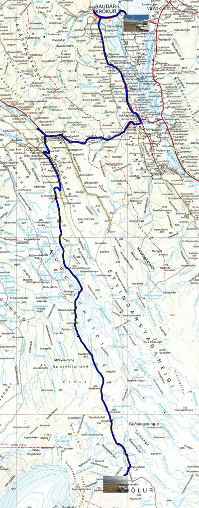
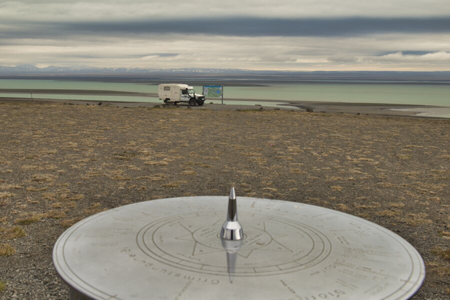
Friday June 25th I wanted to go to Drangey Island to observe shearwaters; alas the wind was too strong and the ocean rough. Operator Drangey Tours was canceling the trip. I decided to take the F35 road known as the Kjölur road from Saudarkrokur to Hveravellir. Leaving late, I arrived around 1:30 pm on a track in relatively good conditions except the strong wind which made it difficult to get out of the vehicle to hike on marked trails, off-piste is strictly prohibited. The landscapes are of an austerity magnified by the desolation and the absence of trees. I bivouacked in the parking lot of the Hveravellir station.
 |
| Holar i Hjaltadalur |
Saturday June 26th after a cold and violently windy night, I left the bivouac under a radiant sun with an outside temperature of 8°C. The wind was still blowing violently, I held the door with both hands as I left the cabin. When I got to Saudarkrokur I filled the main tank with diesel, washed my truck and bought groceries at the convenience store opposite. I hoped that tomorrow Aeolus will blow less forcefully to go to Drangey Island to observe the charming shearwaters. I returned to the previous bivouac.
 |
Sunday June 27, I had an appointment at Saudarkrokur marina with Drangey-Tours to observe the shearwaters on Drangey Island. The climb from the Drangey pier is very steep, the start is in a scree of rocks that I cross with the help of the Drangey-Tours guide. He helped me both up and down to the hut built in 1984 where I was staying. The show is grandiose, unforgettable. The birds nest in the cliffs. The puffins, shearwaters, are innumerable and not shy with tourists. The tour lasts approximately 4 hours from 10:00 a.m. to 2:00 p.m. I was back at the bivouac around 2:30 pm to publish the photos on my website. The temperature was mild, 11°C, with mist in the early afternoon. The tour operator Drangey-Tours is highly recommendable.
 |