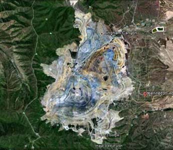
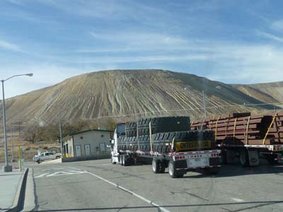
Kennecott's Mine, Orem
The morning was occupied with pieces of
housework of which a laundry and, the
washing of my truck before leaving Salt
Lake City. I had plan to visit Kennecott's
Mine, largest and deepest open pit
in the world visible from the moon. Alas
when I arrived the Visitor Center was
closed for Winter Season… I continued my
road up to Orem to bivouac at Wal-Mart.
 |
 |
| Kennecott's Mine by Google
Earth |
Entrance |
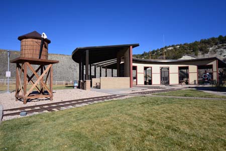
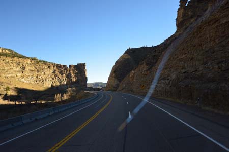
En route, Price
The following day was one driving day
without interest with a lunch pause on a
rest area exposing a replica of a rotunda
of railroad with interpretative panels.
Then I crossed a pass at more 2200m high.
Once again I bivouacked at Wal-Mart.
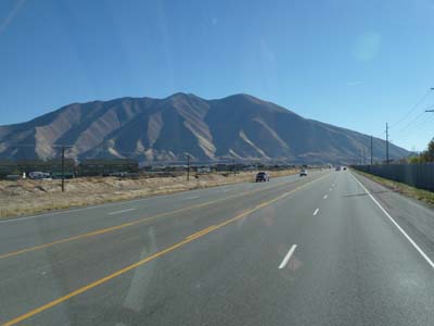 |
| Landscape, Hwy #15 |
 |
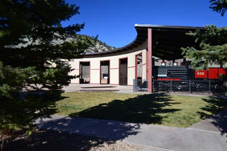 |
| Rotonda of railroad |
 |
| Landscape, Hwy #6 |
Hwy #6, rest area at 49 km southwards
Before leaving the Wal-Mart carpark
during the inspection of my truck I
noticed a fatty stain under the left
diesel tank. By lowering me I observed
drops at the level of the drain plug under
the tank. Anxious I leave the tools and I
checked the tightening of the plug.
Actually the leak came from a connection
above the tank, but why! I decided to
leave and stop at the first rest area for
a fuller investigation. At 49 km
southwards from Price a surface
accommodated me. Curiously there was no
more leak, this was due to altitude. I
tightened despite everything connection,
to follow. Weather being mild and rest
area quiet, I decided to do my truck
serviced, in particular anti-rust paint on
the back bar anti-embedding and in various
places. I lunched around 1 p.m. Around 2
p.m. I decided to bivouac on the spot at
1700 m high.
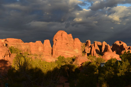
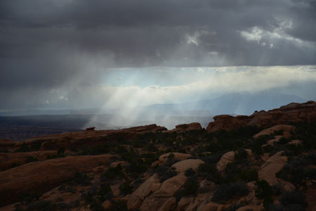
Around 5 p.m. I attended an exceptional
sunset, during few seconds the landscape
flared up, unforgettable.
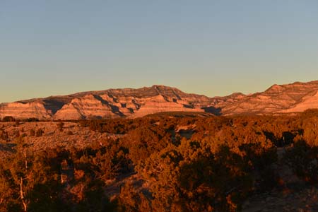 |
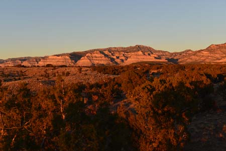 |
| Sunset |
Arches National Park
While arriving in the latef afternoon at
Arches National Park,
second visit, I discovered at Visitor
Center weather forecasting for the end of
the week, disastrous. A true weather on
November 11th, Veterans Day. I
quickly revisited, on themove towards the
campground, Windows and Delicate Arch from
Lower view point. The night was very
windy.
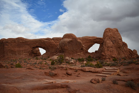
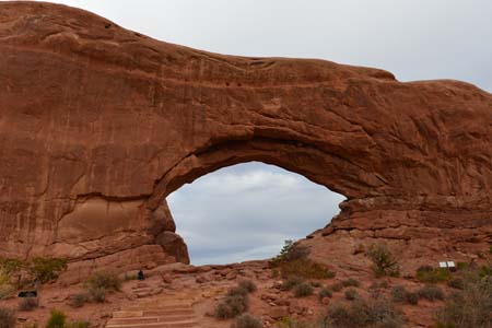 |
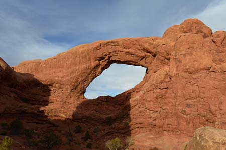 |
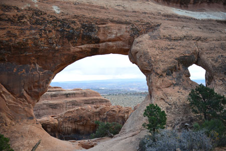
| North Window |
South Window |
 |
 |
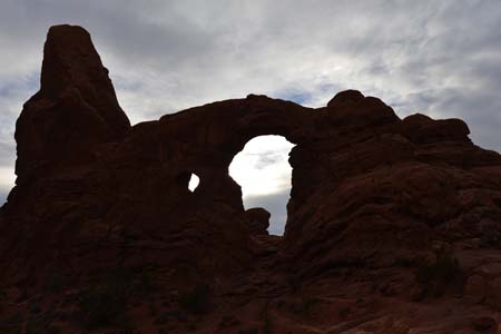
| Turret Arch |
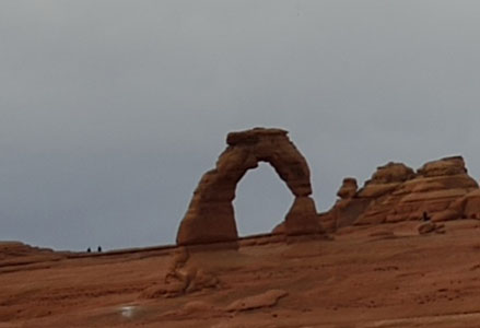
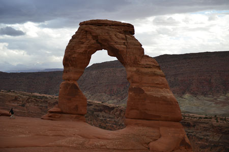
Delicate Arch |
I wanted to make again the walks on April
14th, 2011, follow the hyperlink above.
Alas I noted that the swiftness of my legs
was not with go, osteoarthritis had not
only progressed but it had also reached
hips and wrists. As Pierre Dac says in the
Marrowbone, "With the age stiffnesses
move". Admittedly the weather was rainy
and maybe with snow. However thus I
traversed not the Primitive Trail at
Devils Garden and I was not going to see
behind Delicate Arch. Nevertheless I took
pleasure to walk, more slowly. There were
some beautiful breaks between two
downpours to take pictures. While walking
in showers, I remembered an excursion in
Dolpo, Nepal. It was years ago!
 |
| Sunrise at 8 a.m. |
 |
 |
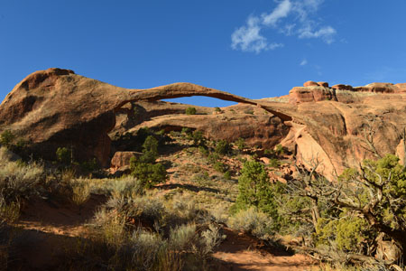
| Landscape Arch |
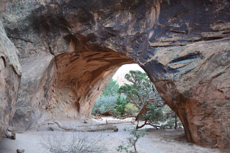
Partition Arch |
 |
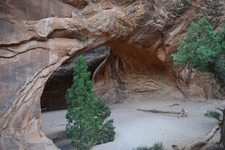 |
| Navajo Arch |
 |
| Landscape at 10 a.m. |
 |
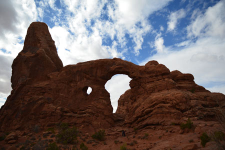 |
| North & South Windows |
Turret Arch |
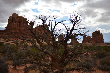 |
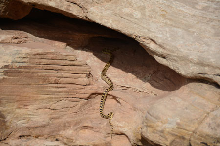 |
| Tree in sand |
Snake! |
 |
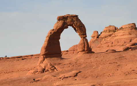 |
| Delicate Arch from upper viewpoint at 3 p.m. |
Delicate Arch from lower viewpoint at 4.30 p.m. |
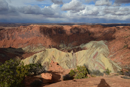
Canyonlands National Park
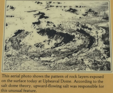
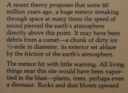
Weather forecasting was always also bad. I
made a short half-day stop in Canyonlands
NP where I had taken walks on April 13th,
2011. The sun briefly appeared around 2
p.m. to light Upheaval Dome then the sky
became again sinks and snow started to
fall at 3 p.m. O'Clock. I spent the night
at Willow Flat Campground. For the weekend
of the Veterans Day, the entry in the park
was free but not the campground.
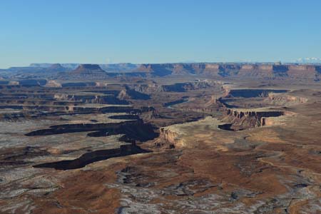
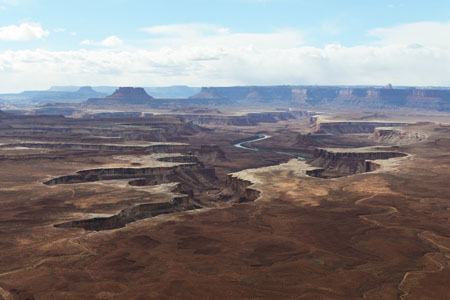 |
| Green River overlook |
 |
 |
| Upheaval Dome |
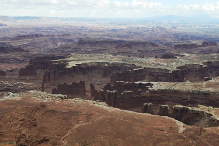 |
| Grand View Point |
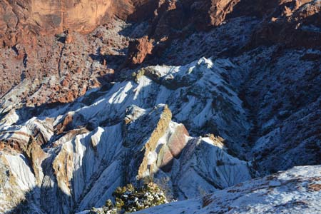
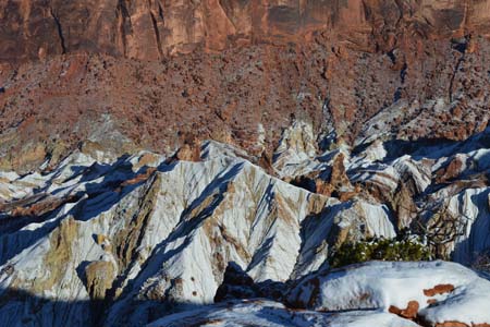
On Sunday morning the landscape was whiter
than white… As of 8 a.m. I went on foot to
admire Green River in low-angled light.
Then I revisited the sites seen the day
before under a slightly buckled morning
sun. I left Canyonlands NP around 11 a.m.
to lunch in Moab and to read my e-mailbox
before heading on Hwy #191.
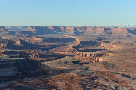 |
 |
| Green River at 8 a.m. |
Green River at 9.30 a.m. |
 |
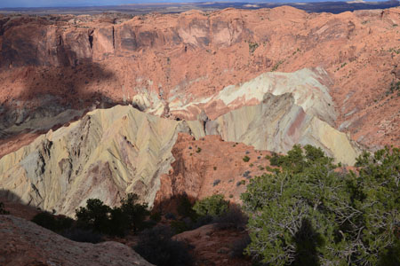
 |
| Upheaval Dome at 9
a.m. |
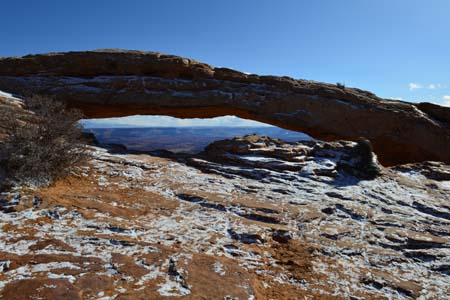 |
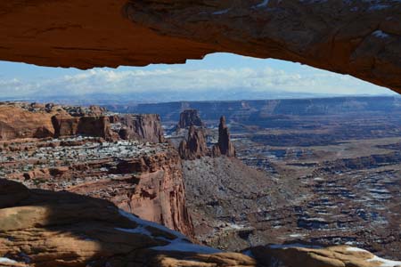 |
| Mesa Arch at 10.30
a.m. |
Monticello
I arrived at Monticello around 4 p.m. to
bivouac in front of Visitor Center while
profiting from Wi-Fi connection. At an
altitude of 2200 meters the night promised
to be cold.